September Outlook: Summer isn’t done with Canada just yet
The unofficial start of fall may begin on a warmer-than-normal note for much of Canada
Lovers of autumn rejoice as September is finally here. While all of Canada has already seen a taste of early fall, summer definitely isn’t over just yet. We still have many days of warm late-summer weather to look forward to in the month ahead.
It’s important to remember that September is a month of change. “Normal” temperatures steadily fall through the month, so a warmer pattern during the latter half of September doesn’t usually feel like the middle of summer.
Here’s a look at what you can expect in your part of Canada during our September ahead.
DON'T MISS: Rare desert rains may have stifled Atlantic hurricanes—for now
A gradual shift throughout the month
September is on track to start with a split between the West and East.
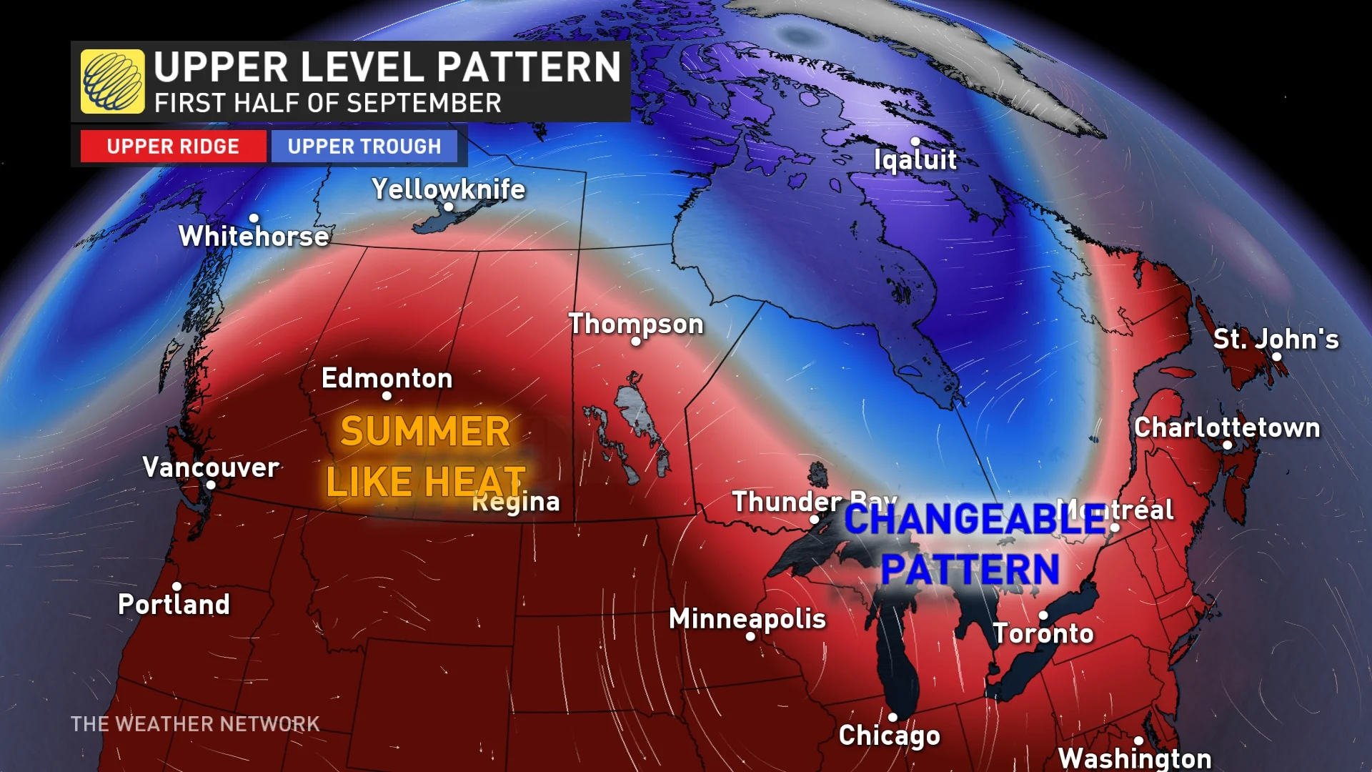
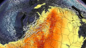
The focus of warm weather (and even hot weather at times) will fall across Western Canada, especially on the western Prairies where conditions will adopt a midsummer feel at times.
Folks back east can expect a more changeable pattern to start the month, which is typical of the fall season. Ontario, Quebec, and the Atlantic provinces will still see some warmer days, but we’ll also see some cooler days sneak into the pattern.

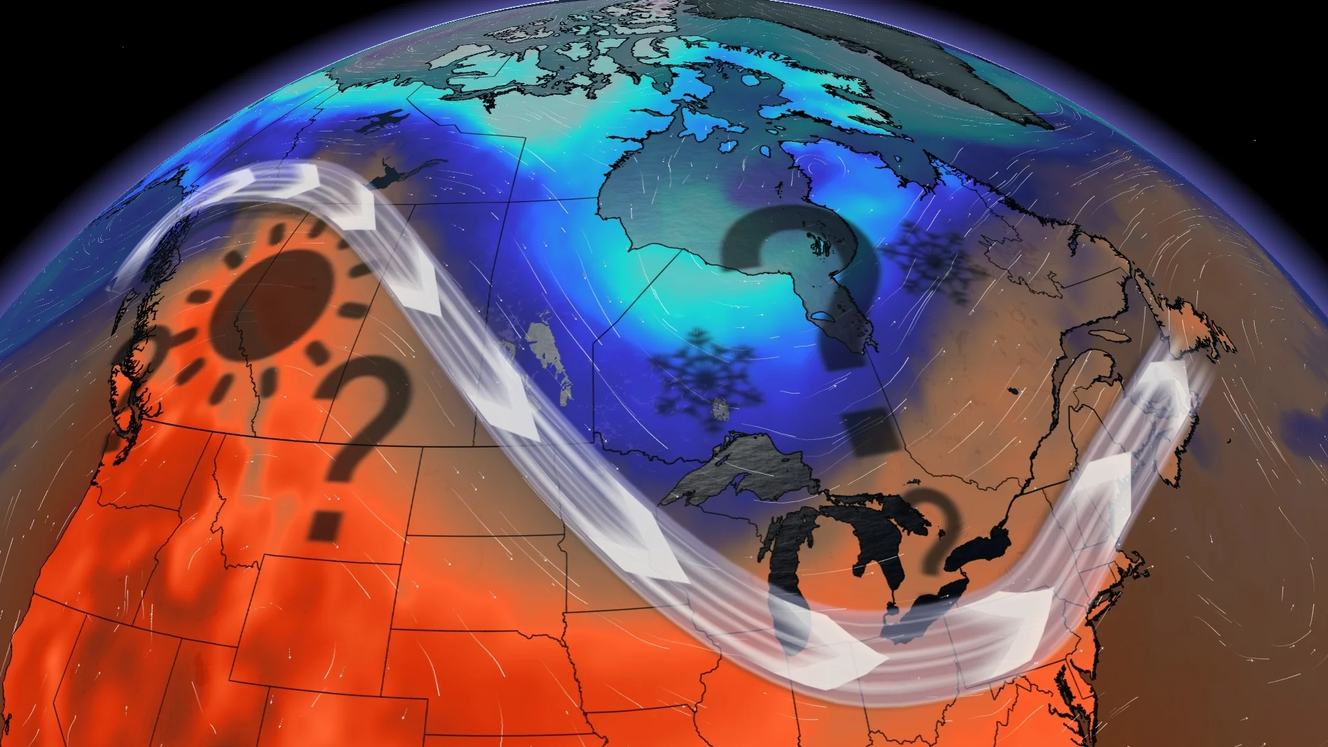
However, things will start to change around the middle of the month.
We expect a gradual shift in the pattern during mid- to late-September that’ll push the focus of the warmer weather farther east. This change will allow periods of late-summer-like conditions to spread from the Great Lakes to Atlantic Canada during the second half of September and into early October.
The warmth shifting east later this month will also bring cooler weather at times to British Columbia and possibly even the western Prairies.
RELATED: The science behind the Equinox
Overall, we expect that most of Canada will see warmer-than-normal or near-normal temperatures by the time the books close on September.
While this pattern geographically covers most of Canada, some of the largest cities—including Toronto, Vancouver, and Victoria—are expected to see more changeable conditions that could result in temperatures around normal for the month.
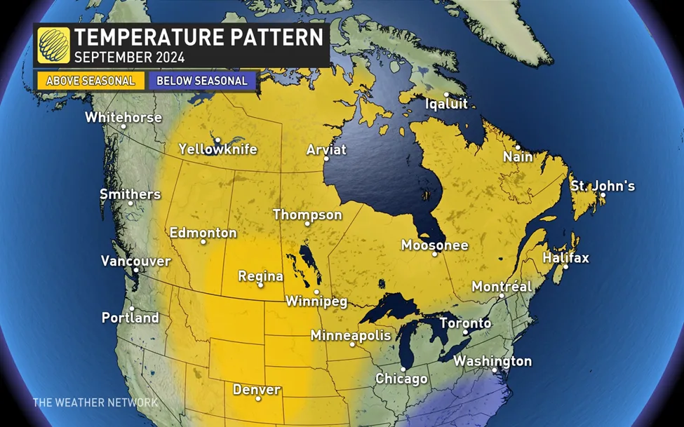
Montreal and Ottawa will be right on the line between seasonable and above-seasonal temperatures; the key to which way these cities tip will depend on how quickly the pattern shifts around the middle of the month.
Precipitation is tricky due to the tropics
Drier weather should accompany the warmer temperatures as they spread across the country throughout September. As such, we’re expecting near-normal or below-seasonal precipitation across most of Canada this month.
This change is good news for portions of southern Ontario and southern Quebec after an exceptionally wet summer. This was far and away the wettest summer ever recorded in Toronto.
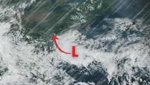
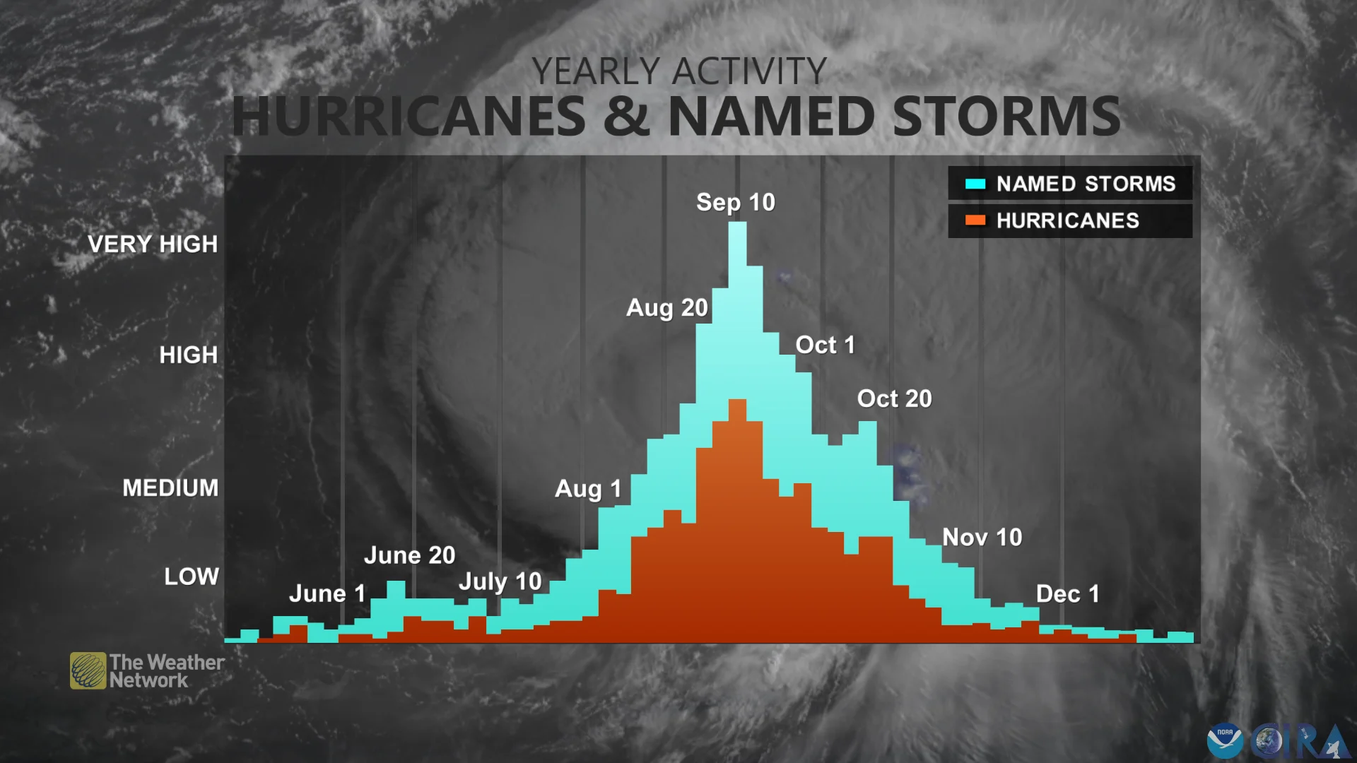
However, the wild card that can bust the precipitation forecast anywhere from southern Ontario to Atlantic Canada is the risk for the remnants of tropical storms and hurricanes.
STAY SAFE: What you need in your hurricane preparedness kit
It’s not possible to forecast the track of a tropical system a few weeks in advance. But the remnants of Beryl and Debby earlier this summer demonstrated that it’s possible to see a month’s worth of rain from a single tropical system.
While the tropics were unusually quiet throughout much of August, September is the climatological peak of hurricane season. It’s likely that the tropics will become rather active again as we progress through the month.
Farther west, forecasters see the potential for a more unsettled pattern to return to southern B.C. and possibly into southern Alberta during the second half of September. This could result in near-normal and possibly above-normal precipitation totals for the month.