Budding storm threatens vacation spots with downpours, high winds
It’ll be a rough week at the beach for some as a storm develops in the western Atlantic
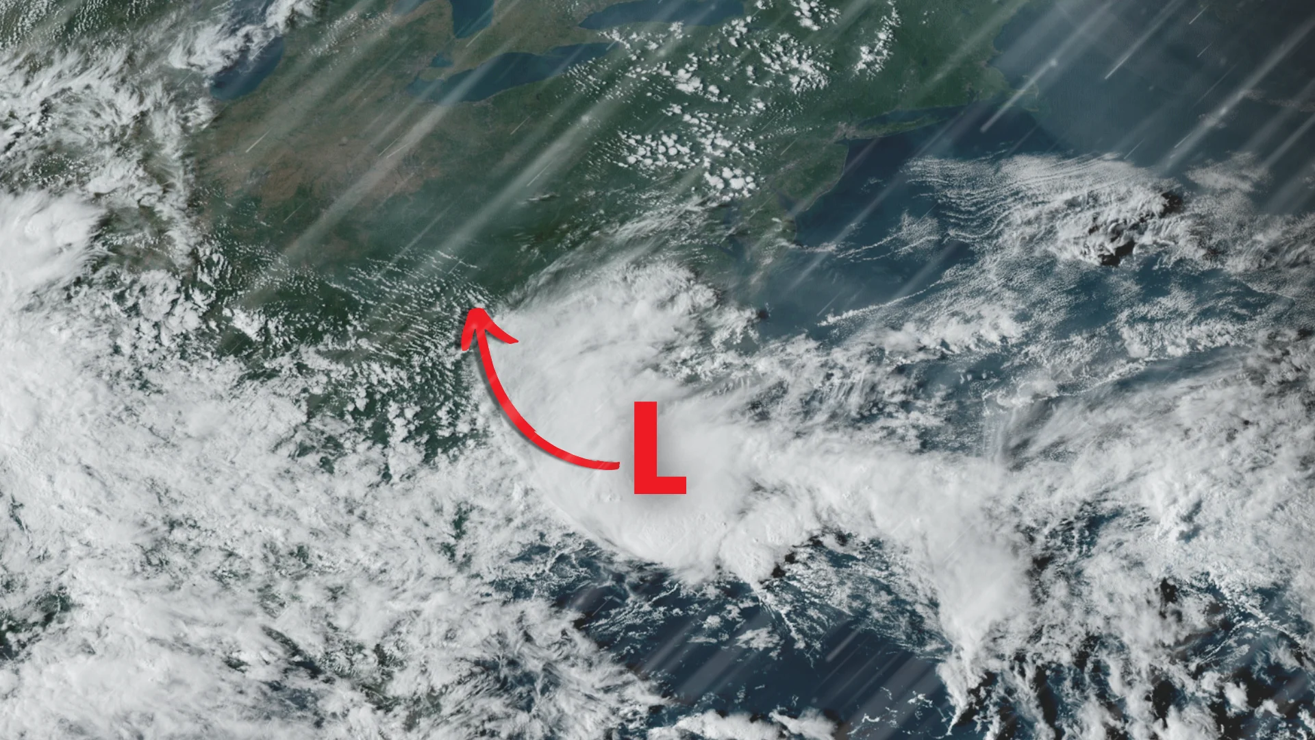
Forecasters are watching a developing tropical storm over the western Atlantic Ocean that could bring driving rains and gusty winds to some popular vacation destinations along the U.S. East Coast through the first half of the week.
DON’T MISS: After a historic start, when will hurricane season ramp up again?

The U.S. National Hurricane Center (NHC) issued tropical storm warnings for coastal portions of North Carolina and South Carolina as the disturbance gets its act together over the region’s warm waters.
Meteorologists expect the system to grow into Tropical Storm Helene by Monday morning, shortly before making landfall south of Myrtle Beach, S.C. The system will then weaken as it pushes inland over the Carolinas through Wednesday.
Tropical storm warnings cover portions of North Carolina’s Outer Banks, as well as the cities of Wilmington, N.C.; Myrtle Beach, S.C.; and Charleston, S.C.
Areas within the tropical storm warning could see sustained winds of 70-90 km/h through Monday evening, with higher gusts at times.

MUST SEE: Conditions favourable for La Niña to develop through this winter
While winds could lead to scattered tree damage and power outages, heavy rainfall is far and away the greatest threat with this system. Flash flood watches are in effect along the storm’s predicted path as 100-200+ mm of rain could fall through the first half of the week.
Heavy rain will extend far away from the centre of the storm, possibly reaching as far north as the Washington, D.C., metro area. These heavy rains will cover many of the highways that Canadians regularly use while travelling through the eastern U.S., including Interstate 95, Interstate 85, Interstate 81, and U.S. 29.
As with any landfalling tropical system, a low risk for tornadoes will follow the system inland. This threat is most likely throughout eastern sections of North Carolina.

It's still an open question whether or not this system's moisture will be able to make it into southern Ontario. A strong ridge of high pressure parked over Eastern Canada will try to keep the moisture south. However, it's possible that some shower activity might scoot north of the border later this week.
Stay with The Weather Network for all the latest updates throughout hurricane season.