Moosonee warmer than Los Angeles as Canada feels late-summer heat
It’s unseasonably warm and unusually dry across parts of Eastern Canada as a powerful summerlike ridge of high pressure parks over the region
It’s not every day that the shores of Hudson Bay are warmer than the palm-lined streets of Los Angeles.
But that’s the pattern we’re dealing with as a powerful ridge of high pressure dominates conditions over the eastern half of Canada this weekend.
Temperatures in far northern Ontario are coming in more than 10 degrees above seasonal for the middle of September, bringing a spell of midsummer-like heat that wouldn’t be out of place in vacation destinations much farther to the south.
Visit our Complete Guide to Fall 2024 for an in-depth look at the Fall Forecast, tips to plan for it and much more!

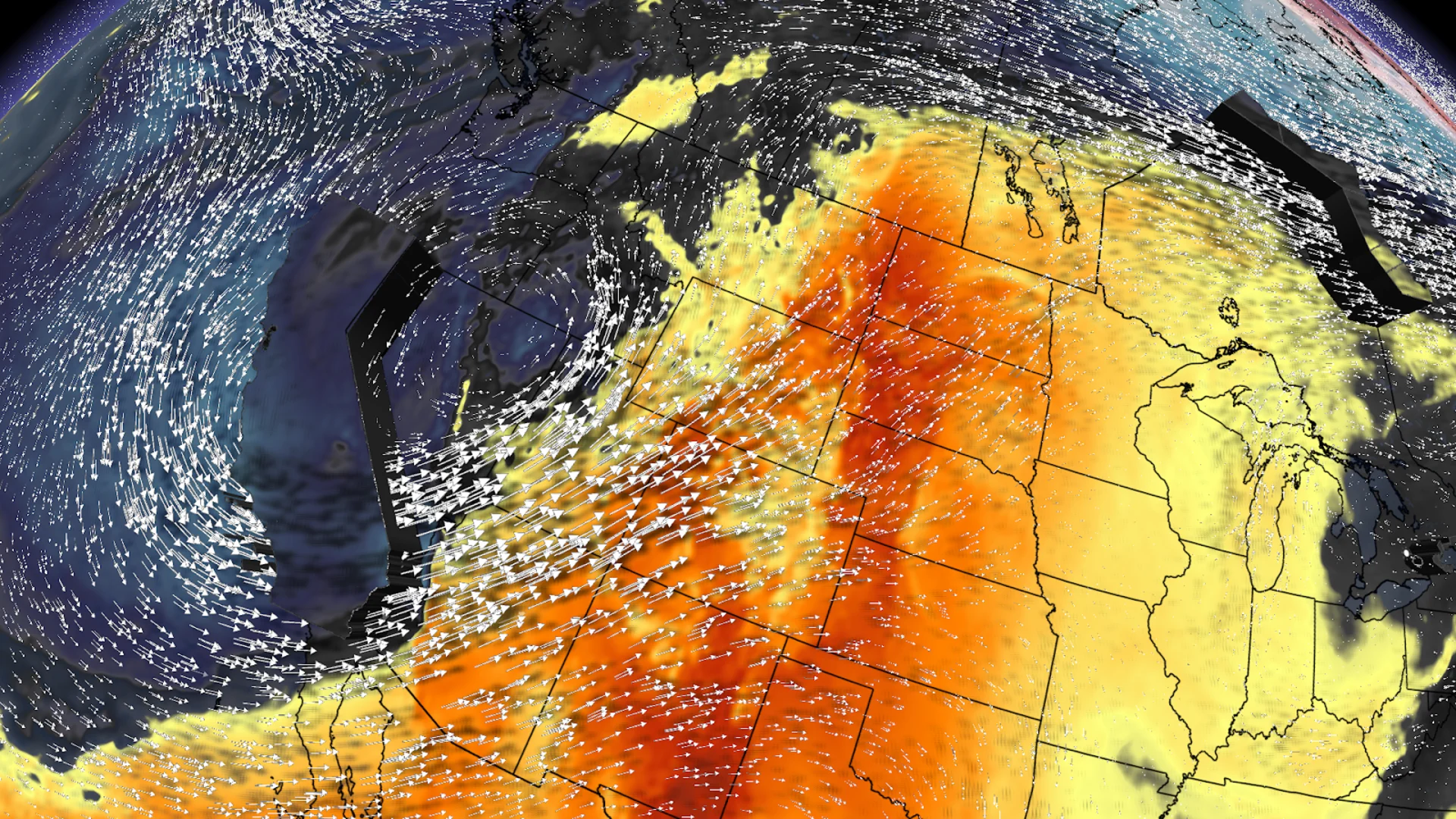
A weather pattern known as a Rex block is responsible for the topsy-turvy conditions we’re seeing across the continent this weekend.
A Rex block occurs when a ridge of high pressure gets stuck north of a centre of low pressure, essentially locking the pattern in place for days on end.

Folks stuck beneath the low see cooler and unsettled conditions for the duration of the block, while communities basking under the ridge of high pressure see above-seasonal temperatures and scant precipitation.
That upper-level low is parked over the western half of the United States this weekend, and the heart of the ridge is spread over Ontario. While folks in the western U.S. see below-seasonal temperatures and unsettled weather, the ridge is bringing much of Canada some unseasonably warm conditions and clear skies.
Nowhere is that unusual heat more intense than across far northern sections of Ontario.
DON’T MISS: It’s not your imagination—here’s why fall is the foggiest season

Saturday’s daytime high in Fort Severn reached 29.6°C—which is 20 degrees above seasonal for this time of year. Moosonee will remain in the middle to upper 20s over the next seven days as a result of this resilient ridge stalled over Eastern Canada.
This warmth over northern Ontario, northern Quebec, and up into Nunavut stands in stark contrast to what folks are seeing south of the border. Moosonee’s daytime high will register 5 degrees warmer than Los Angeles’ on Monday.
That blocking pattern will also provide quite the rain void over southern Ontario for the next week and beyond. We’re likely going to see the year’s longest stretch of dry weather in Toronto, where we might go 11 full days without a drop of rain.
The city’s current dry streak was a 6-day spell back in early February.