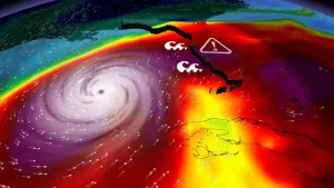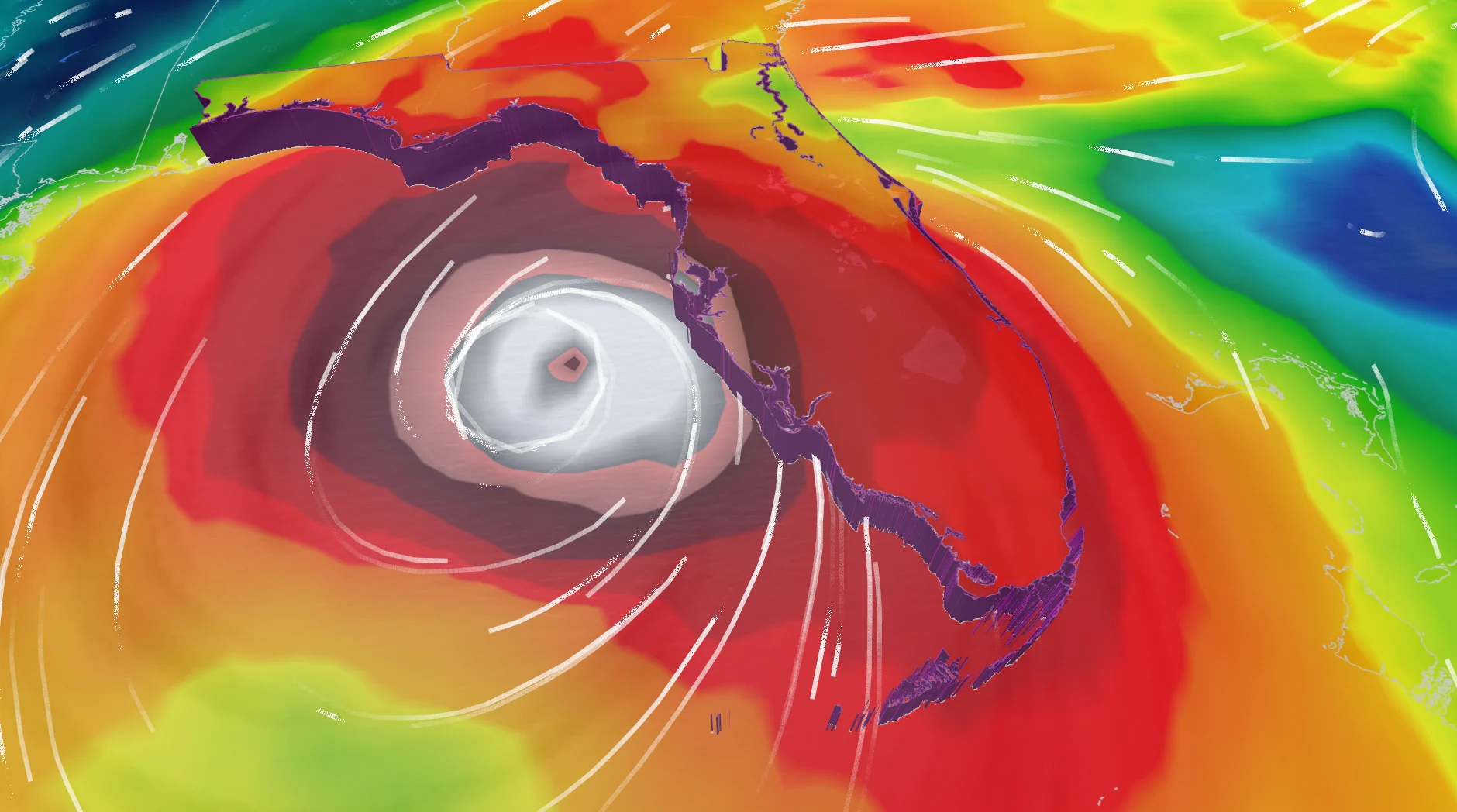
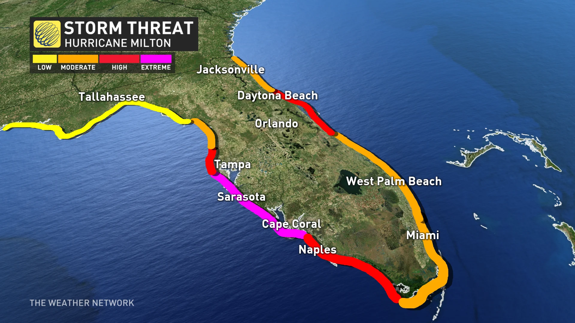
Nightmare scenario unfolding for Tampa with Milton's potential hurricane track

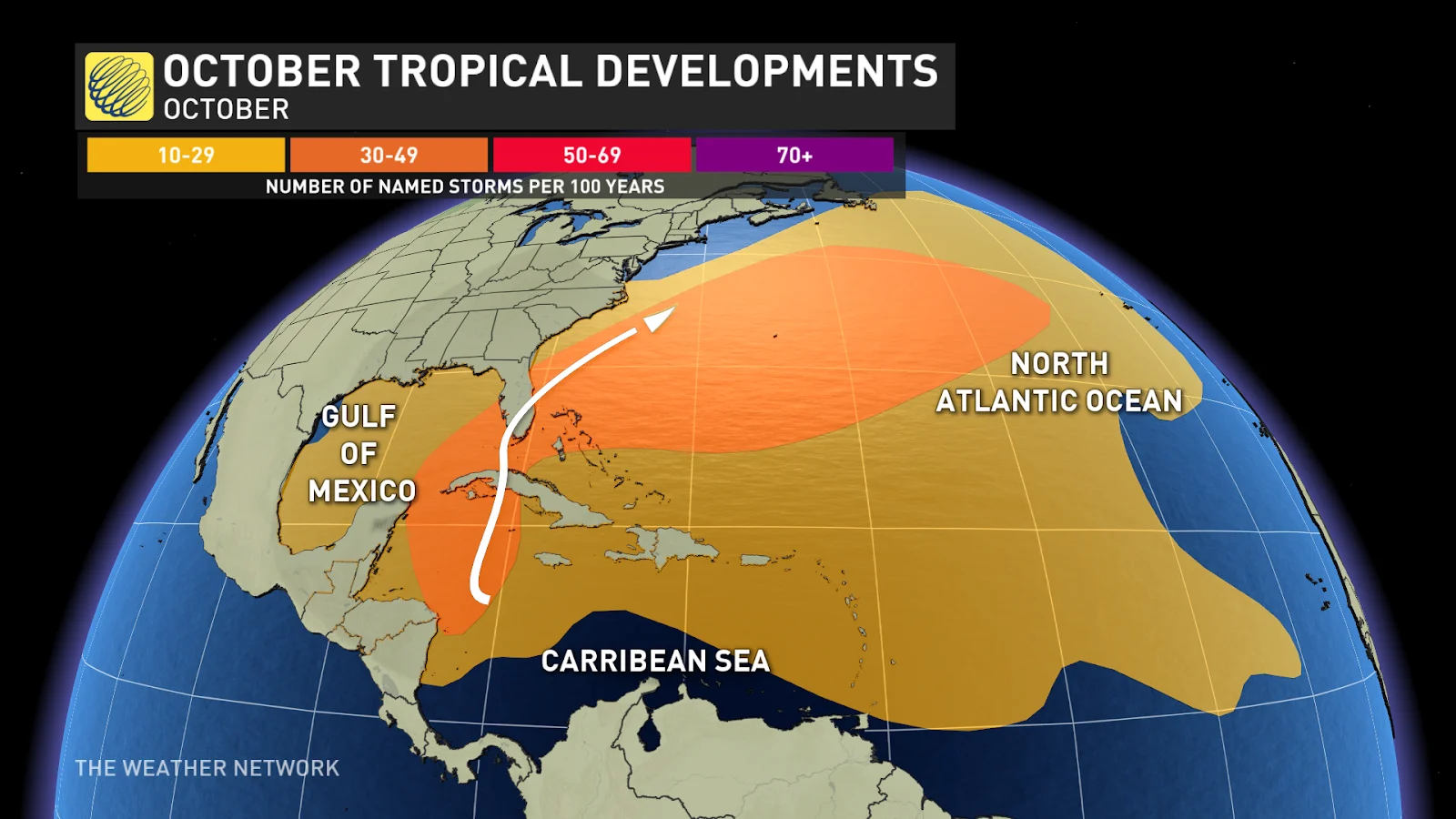
A quick check of past track data highlights how unusual it is for Milton to develop in the western Gulf of Mexico and landfall in western Florida. There are only two other instances of that scenario occurring.
Don’t focus on the exact track.
You’ve heard that phrase numerous times from meteorologists and emergency officials, but this specific track with Milton is in rarefied territory. Find out how long it’s been since we’ve seen a hurricane carve such an insidious track toward Florida.
The prevailing hurricane tracks in October are storms that develop from the Caribbean Sea and move towards Cuba and the southern tip of Florida—from the south, not from the west.
RELATED: Florida on notice as threat from strengthening Milton continues to grow
An unusual track
A quick check of past track data highlights how unusual it is for a storm to develop in the western Gulf of Mexico and make landfall in western Florida. There’s only two: a pair of unnamed storms in 1867 and 1888.

The origin of Milton and its current trajectory are puzzling, but what about any major hurricane directly impacting Tampa?
There’s nothing in the database in recent memory.
The last major hurricane to strike the area occurred in 1921 with a track just north of the Tampa Bay area, a worst-case in terms of storm surge. An unnamed storm passed south of Sarasota in 1944, but there’s no direct proxy for the forecast Milton is painting.
The cause and lingering uncertainty
The upper-level winds steer hurricanes along typical steering flows and familiar paths which change depending on which part of hurricane season it is.
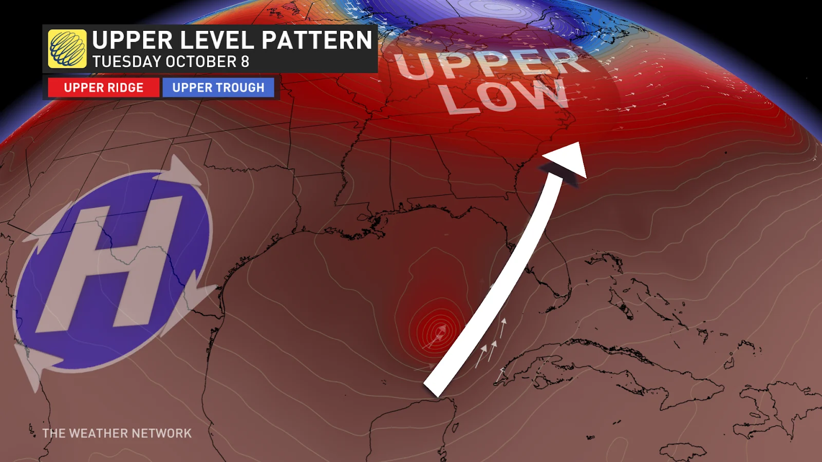
The current upper flow is dictated by a strong high over Mexico and a general westerly flow across the Gulf of Mexico. A stationary trough will be stalled across Florida early this week, providing a predecessor heavy rainfall event. A weak mid-level trough will steer Hurricane Milton towards the northeast, tugging the hurricane across central Florida on Wednesday.
72 hours before a potential landfall, historical track error is between 100-150 kilometres. This is the approximate distance between Tampa and Port Charlotte. A 150-kilometre track fluctuation is the difference between a 10 billion dollar storm and a 100 billion dollar storm.