Localized flooding concerns arise in Ontario as soaking rains linger
The dark and damp weather will continue across southern Ontario on Wednesday, with this week's rain ending the impressive streak of sunshine and dry weather that has spanned much of September so far.
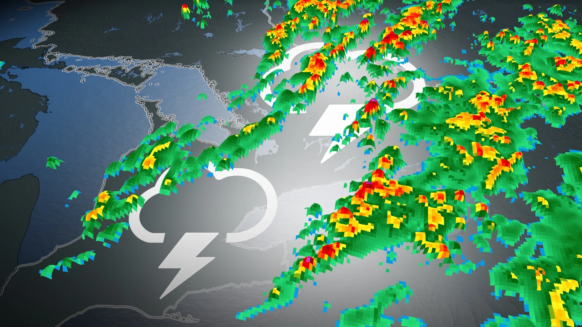
Another round of rain makes for a soggier Wednesday across southern Ontario, with eyes on some possible tropical interruptions to the weekend forecast.
These back-to-back rain days will bring a widespread 20-40 mm across the region by Wednesday morning, with some areas in line to see closer to 50 mm. This has prompted a rainfall warning in some areas, with the risk for flash floods and water pooling in areas that see the heavier downpours.
RELATED: PHOTOS: Funnel cloud spotted over Brantford, Ont. on Saturday
Forecasters will also be closely watching the remnants of a tropical system, which is expected to make landfall along the Gulf coast as a hurricane on Thursday. Will this interrupt your weekend plans in Ontario?
Wednesday:
An active storm track is helping to guide several low-pressure systems from the U.S. through Ontario this week.
Heavy showers and the risk of thunderstorms continue throughout the Tuesday overnight hours, producing rainfall amounts over 40 mm locally. A similar pattern brought locally 50 mm of rain to the Greater Toronto Area (GTA) early Monday.

A rainfall warning is in effect, with the risk for localized flooding in low-lying areas.
"Heavy downpours can cause flash floods and water pooling on roads," says Environment and Climate Change Canada (ECCC) in the warning.
An approaching cold front late Wednesday will trigger some more scattered thunderstorms, with some more shower activity along the warm front draped across eastern Ontario.
By the time all is said and done, local rainfall amounts up to 50 mm are possible through Wednesday, with most locations recording between 20-40 mm.

Instability will be limited by cloud cover and a late-September sun, so storms will likely be primarily non-severe in nature.
Thursday and Friday will be mostly sunny and warm, with temperatures hovering in the low 20s.
RELATED: Ontario welcomes fall with more summertime warmth, but will this last?
The unsettled weather pushes into Quebec by Thursday afternoon, and then it’s high pressure versus the remnants of Helene. The high pressure is expected to dominate this matchup, keeping the moisture south of Lake Erie and Lake Ontario.
Eyes on a potential tropical disruption this weekend
A mix of sun and clouds is expected for this weekend, with warmer than normal temperatures, once again. The one slight disruption to a potentially spectacular fall weekend would be the remnants of a tropical system that's expected to make landfall along the Gulf coast late this week.

RELATED: U.S. concerns grow over soon-to-be Helene as it eyes Florida Panhandle
At this point, we do not expect anything more than some high clouds with showers staying south of the border, however, there is still some uncertainty as the storm develops. If the remnants track farther to the north, there could be scattered showers throughout parts of the weekend.
There’s some uncertainty in the forecast, so you’re encouraged to check back over the next several days as Helene roars ashore in Florida on Thursday.
High confidence temperatures will continue to float above normal, and even well above normal across northern Ontario to finish September off.
Temperatures are likely to track within a couple degrees of seasonal within the first week of October across southern Ontario.
Stay with The Weather Network for all the latest on your forecast across the region.