Closely watching as Helene moves, but here's why Canada will likely be spared
All eyes are on Helene as it makes its way to the Florida Panhandle this week, with Canada watching closely for the remnants of the powerful tropical system
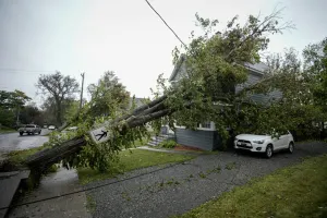
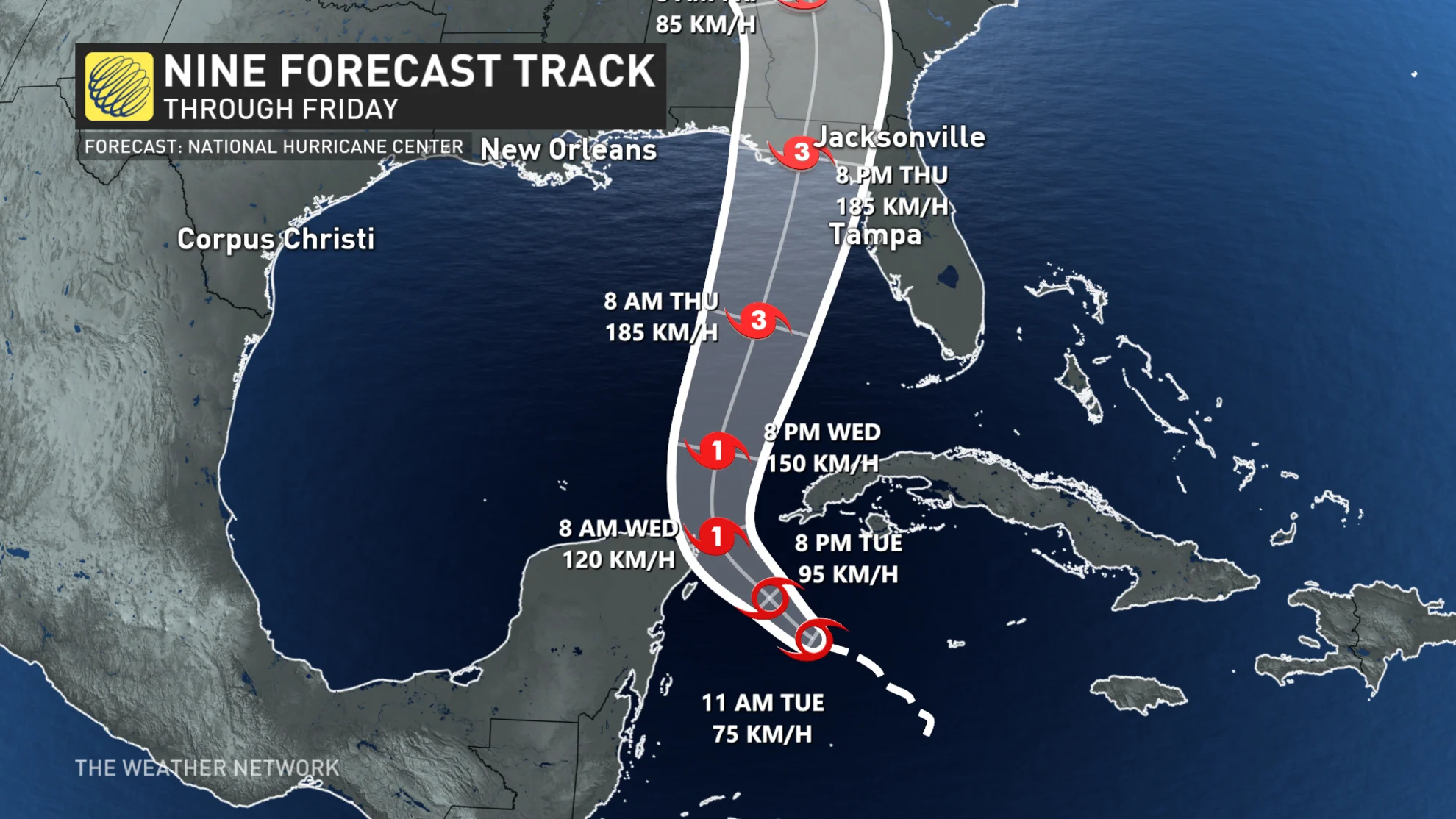
The eighth named storm of the Atlantic Hurricane season has formed, and parts of Florida are bracing for significant impacts later this week. Helene is forecast to strengthen to a major hurricane, making it the first of the season to make landfall. Landfall is expected along the Florida Panhandle, anywhere from Tampa to Tallahassee, Fla.
DON'T MISS: Tropical Storm Helene forms, hurricane watches in effect for Florida
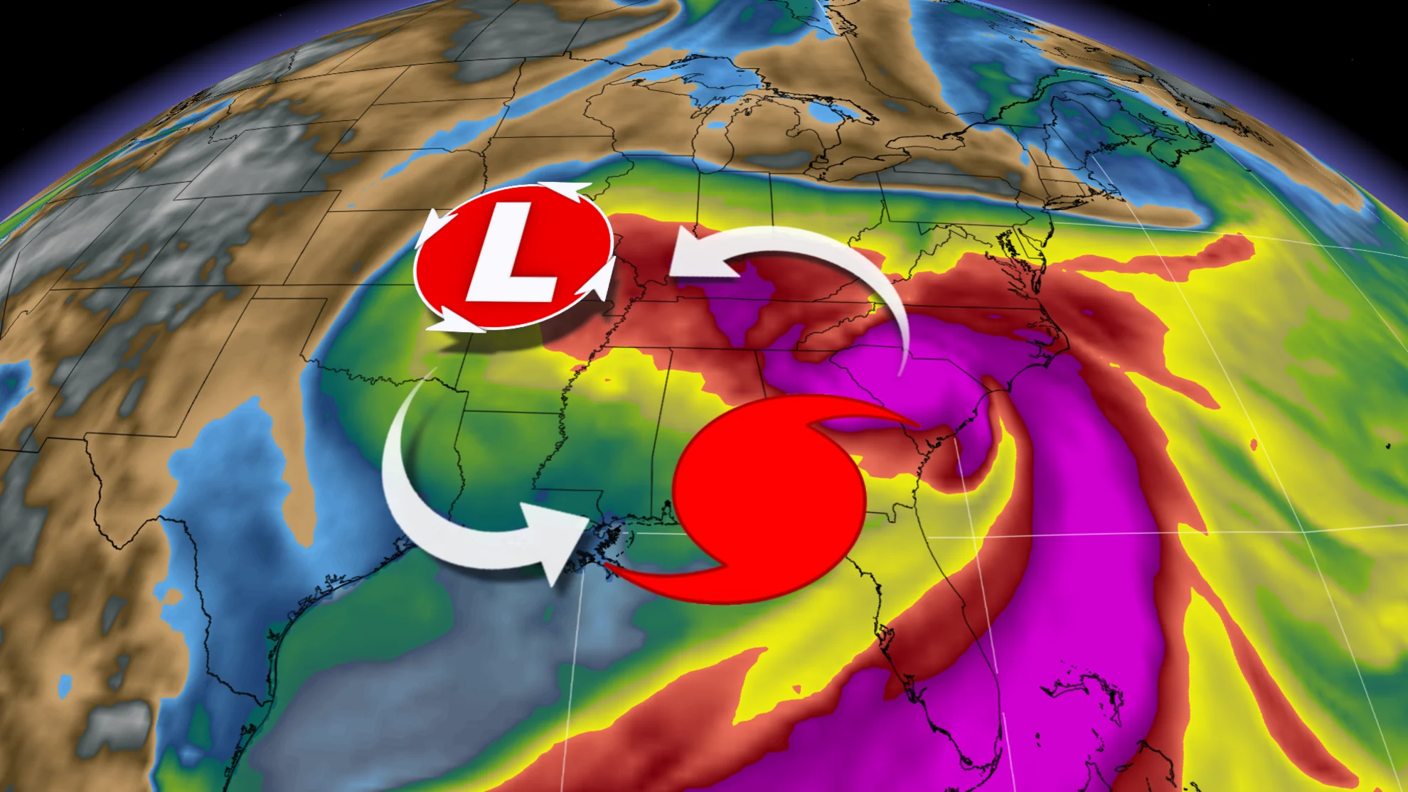
As Helene moves quickly and swirls uncomfortably close to home, it's only natural for Canadians to worry about potential impact on this side of the border. But this time, it looks like Eastern Canada will likely be spared, thanks in part to the Fujiwhara effect.
When hurricanes make landfall they begin to rapidly weaken due to the friction and lack of moisture available. As they fall apart, they leave remnant moisture and energy behind. Typically, that moisture tracks to the northeast, which usually brings some form of impact to Eastern Canada.
Beryl, for example, brought flooding rains to parts of southern Quebec this year.
WATCH: Looking ahead to the impacts of Tropical Storm Helene
Fortunately for Eastern Canada, Helene is expected to stay south of the border, with minimal impacts likely. Some cloud cover and showers could reach as far north as the shores of Lake Ontario and Lake Erie this weekend, but that's about it in terms of disruptive weather.
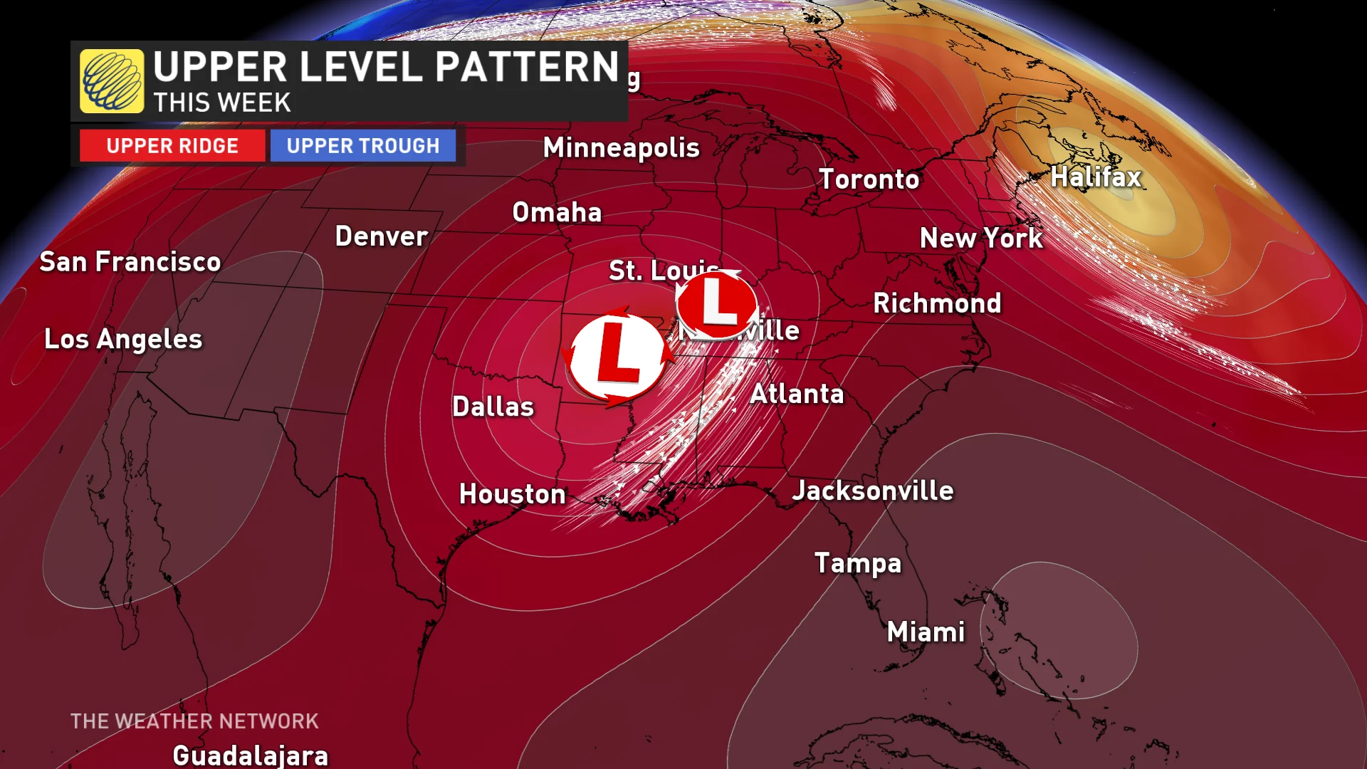
This isn't typical of tropical tracks, however. This time, a known phenomenon called the Fujiwhara effect, will help to keep the storm westward and south of Canada.
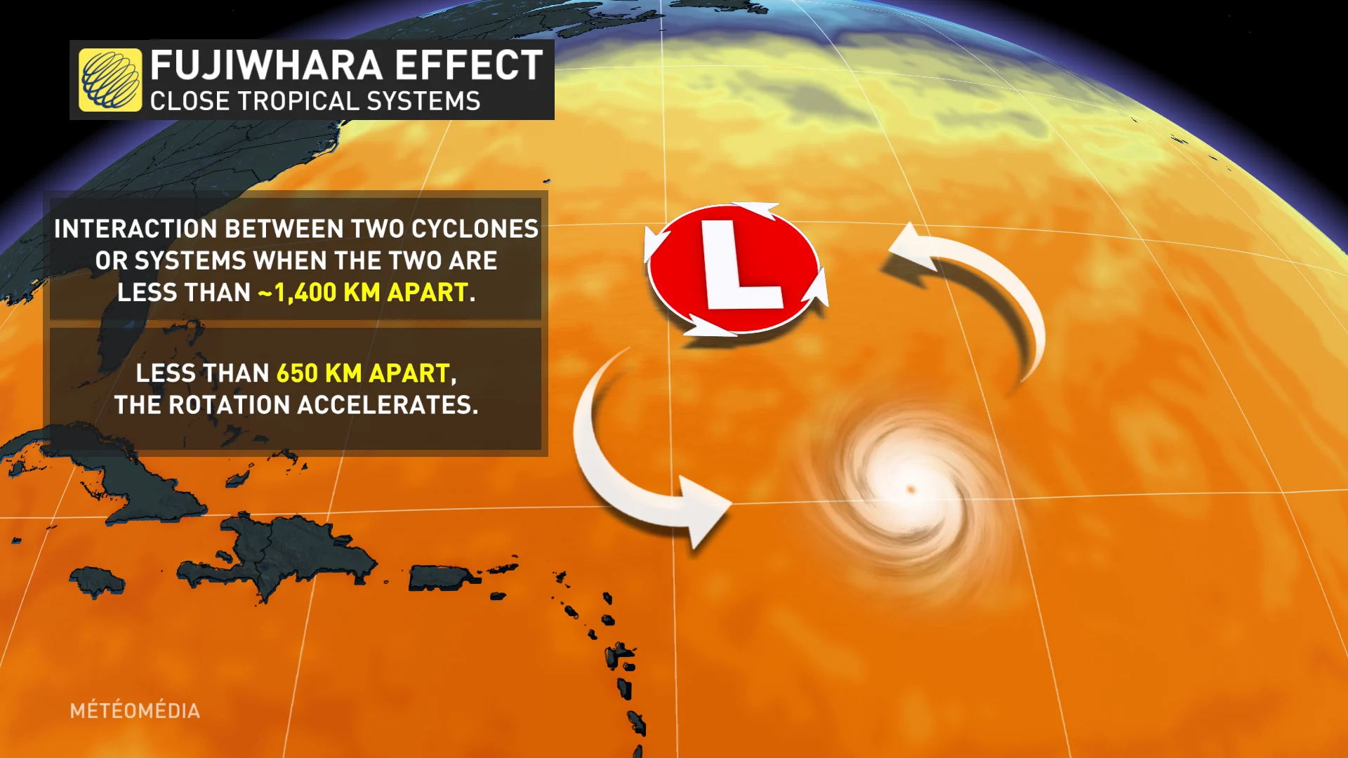
Fujiwhara effect
The Fujiwhara effect involves two interacting low pressure systems. In fact, as they approach each other, they revolve around one another. Sometimes, one low pressure system will also absorb the other.
In Helene's case, the atmospheric trough south of the border would prevent the remnants of the storm from continuing on to Eastern Canada. Instead, they are likely to turn westward before completing their life cycle, with the upper low absorbing Helene into it.
There are still some computer models that pull the moisture further north into Canada, so it'll be something to watch and see if the Fujiwhara effect verifies.
Remember though, despite passing the peak of hurricane season on Sept. 10, we're still in the thick of the season through the middle of October, a period during which some of history's most intense hurricanes have thrived and roared ashore. The Atlantic hurricane season officially ends on November 30.