Western Canada sees wild weather this week thanks to a potent cyclone

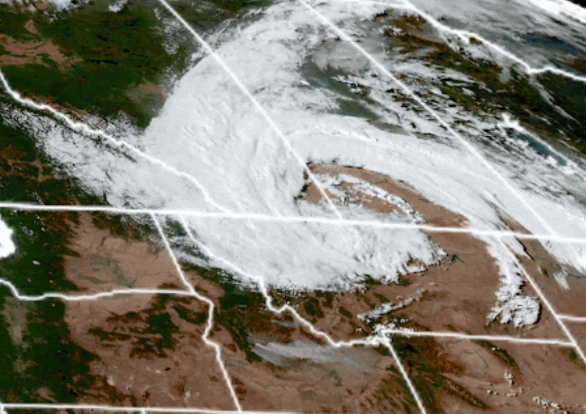
What was responsible for the wacky weather in the West this week? A massive, mid-latitude cyclone or low-pressure system that swept across Western Canada Tuesday into Wednesday.
A good portion of Western Canada experienced a wild roller-coaster ride of weather this week, from severe storms and heavy rainfall to high-elevation snow and a sharp temperature drop.
The culprit? A gigantic, mid-latitude cyclone or low-pressure system that swept across Western Canada Tuesday into Wednesday.
DON'T MISS: Changeable mix of summer and fall will define Canada's Labour Day weekend
It brought a diverse range of conditions including heavy rain, snow and a drastic temperature drop.
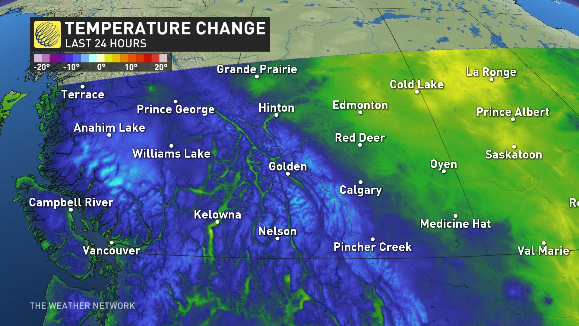
In Calgary, Alta., the daytime high on Tuesday was 25.1°C while its temperature on Wednesday barely reached 9.5°C.
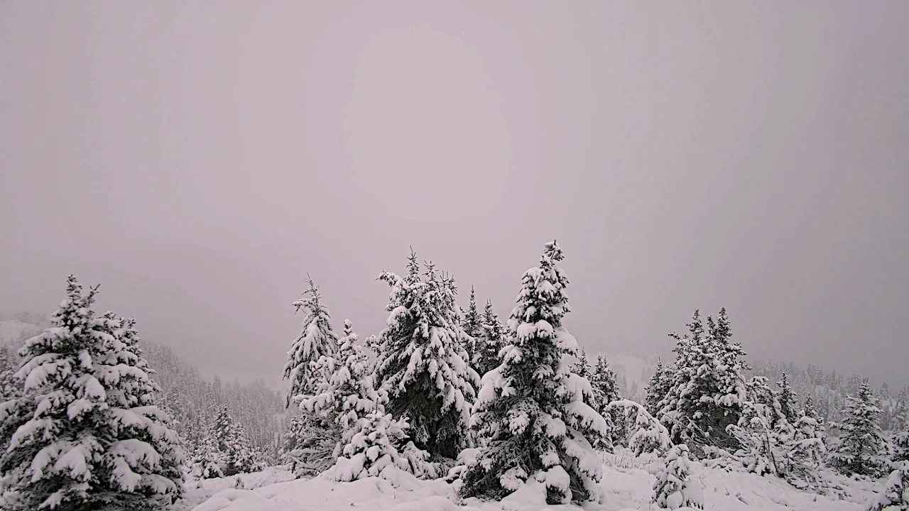
Meanwhile, snow fell for regions sitting above 2000 metres, excessive rain fell from Metro Vancouver, B.C., to Cold Lake, Alta.
Rock Isle Lake webcam. (Sunshine Village Ski and Snowboard Resort)
It brought blustery winds, too, with some places like Kindersley, Sask., recording 80 km/h gusts.
The cyclone itself is a thing of beauty –– the way it swirls and funnels in colder, Arctic air from the north down towards regions like the Rockies, and then pulling that cold air eastward with it.
As it peels cold air down the foothills, it encompasses most of Alberta, leaving B.C. cold in its wake.
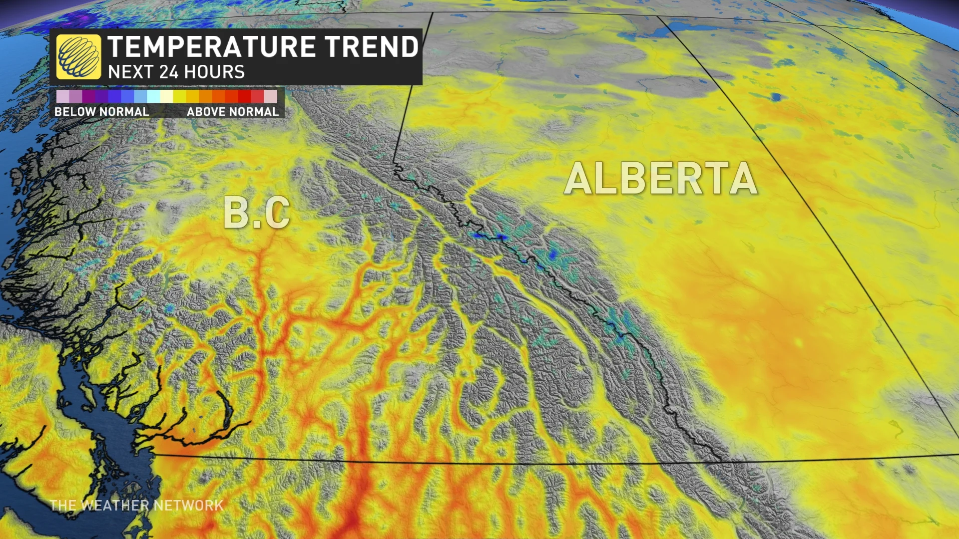
Lucky for Western Canada, it was very short-lived.
A ridge will move in following the cyclone's departure, elevating temperatures back to seasonal and beyond.
Most cities dropped to single-digit overnight lows Tuesday night throughout B.C.’s Interior and Rockies.
Thumbnail courtesy of CIRA/RAMMB/NOAA.