Welcome to the jungle, Ontario: On pace for a record, rainy summer?

Ontario is pushing towards its wettest summer on record, with many locations already surpassing their average total of seasonal rainfall
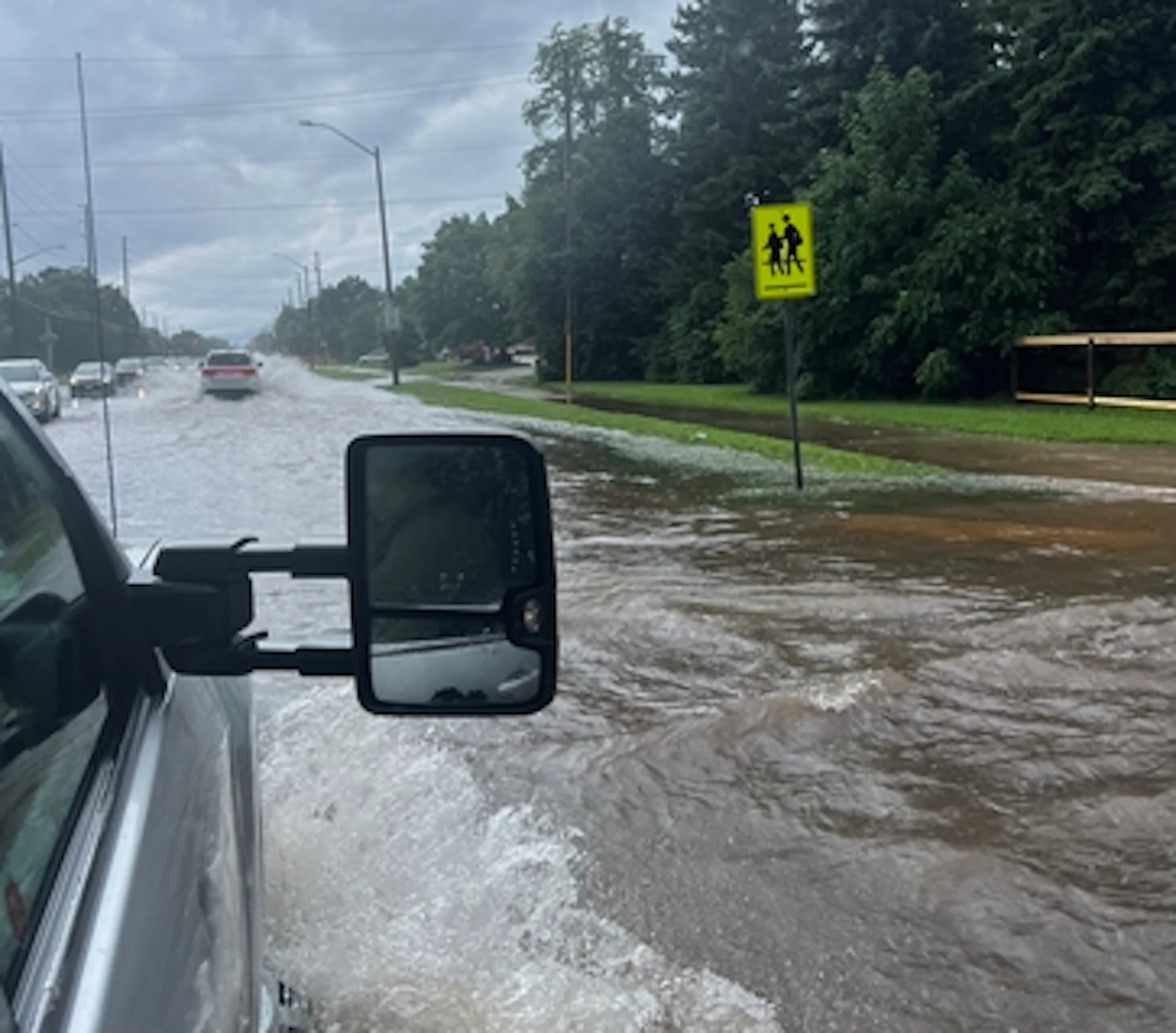
With substantial flooding reported in multiple locations in southern Ontario this week, does that mean we're shaping up to see record rainfall in the region this summer?
Before that can be answered, this week's deluge can be attributed to, in large part, the upper-level winds, among other culprits. They have helped steer a significant moisture anomaly towards southern Ontario.
RELATED: 'Training' thunderstorms cause flash floods in Ontario, but what are they?
The significant moisture anomaly is what has led to heavy, flooding rain in multiple Ontario communities.
Significant flooding occurred in London on July 15. A weather balloon in Detroit, Mich., sampled the atmosphere and found a whopping 186 per cent of normal moisture for this time of year.

When forecasters at The Weather Network assess atmospheric water content, a value above 40 mm generally raises eyebrows for the risk of flooding.
This year, we have seen several days with more than 50 mm of atmospheric moisture content.
Many convective systems have been steamrolling across the Upper Midwest of the U.S., with this storm track known as the "ring of fire."
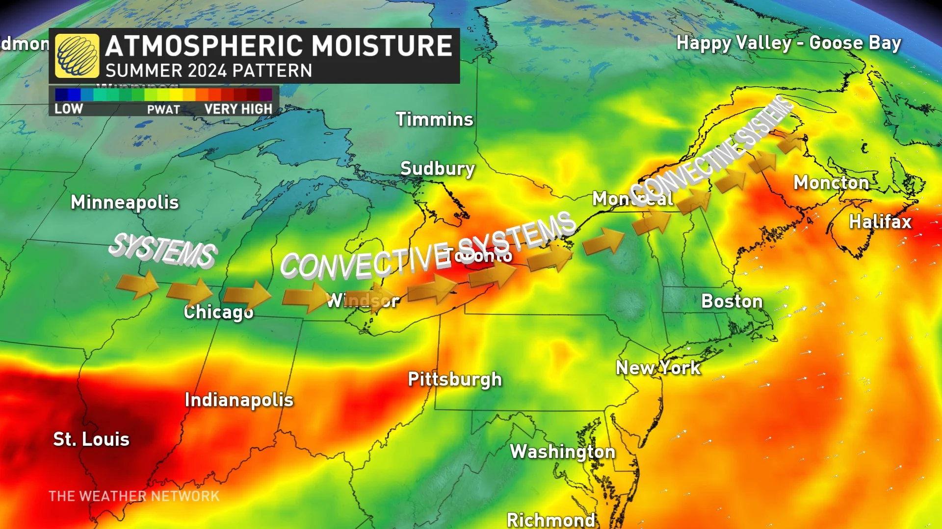
Although these clusters of storms tend to weaken as they approach southern Ontario, the moisture content they contain has added fuel to the afternoon thunderstorm cycle. As the remnant moisture tracks across the region during the afternoon hours, this excess moisture fuels the development of thunderstorms capable of torrential rainfall, causing localized flooding.
The Great Lakes create their small-scale boundaries, so that’s why there has been significantly more rainfall north of lakes Erie and Ontario. It’s near these boundaries where thunderstorm development is most likely.
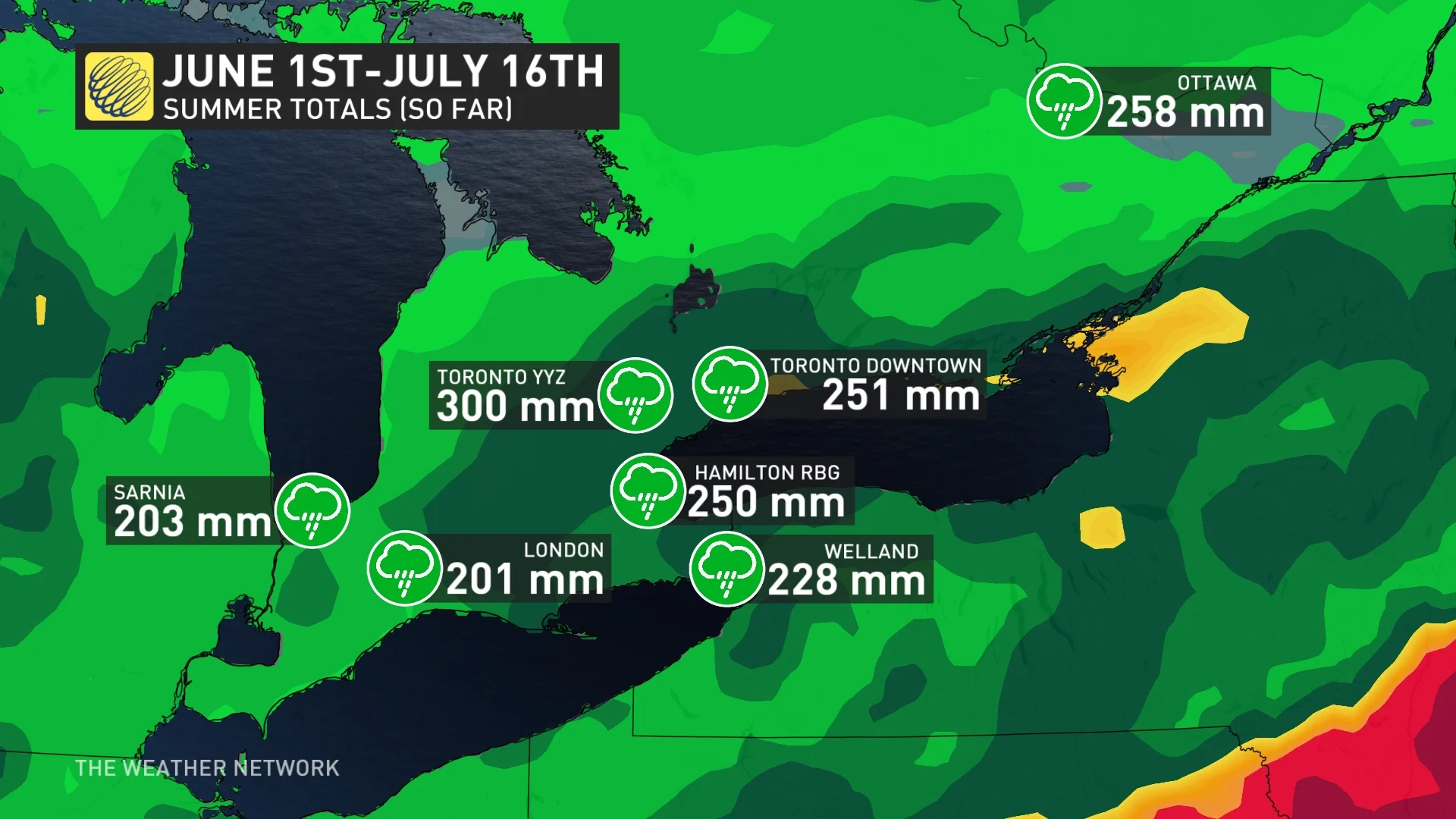
Check out these totals over the past 46 days. Yes, just halfway through the summer, we’ve already accumulated an above-average summer rainfall for London and Hamilton, Ont.
We also can’t forget the remnants from Hurricane Beryl that swept up from the state of Texas, bringing some hefty, single-day rainfall totals of over 50 mm across several communities.
The frequency and severity of flooding events, such as what occurred in communities such as London, Burlington and Toronto this week, are expected to rise as a result of climate change.
Long range
It appears we’re entering the driest stretch of summer across southern Ontario by Wednesday. Some regions may string together more than four dry days in a row, something Toronto hasn’t attained since before June 1.
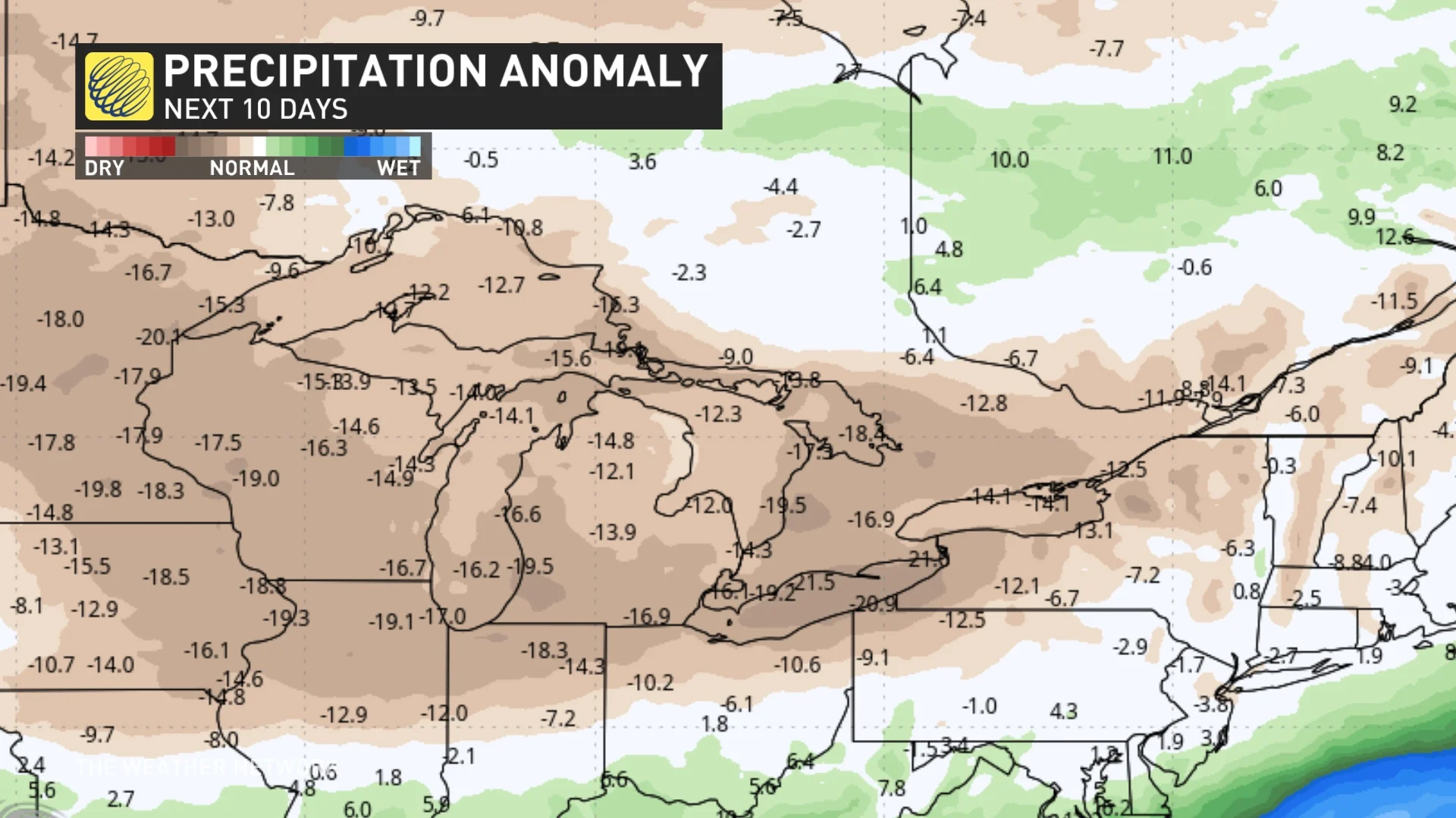
We’ll watch the storm track shift closer to southern Ontario once again later in the month, so enjoy the temporary, drier reprieve. Of course, we’ll have to keep a close eye on thunderstorm initiation along lake breezes and convective storms rolling in from the northwest, but fairer weather is on the horizon.
WATCH: Here's why you need specific insurance coverage for flooding in Canada
With files from Matt Grinter, a meteorologist at The Weather Network, and Nathan Howes, a digital reporter at The Weather Network.
Thumbnail courtesy of Madi Buttenham, taken in Burlington, Ont.