Two bomb cyclones in one week: How B.C.’s major storms compare
B.C.'s had to deal with two bomb cyclones in one week. How do the two storms stack up against one another?
No rest for the weary on the West Coast as two back-to-back bomb cyclones swing through the region within just a few days of one another.
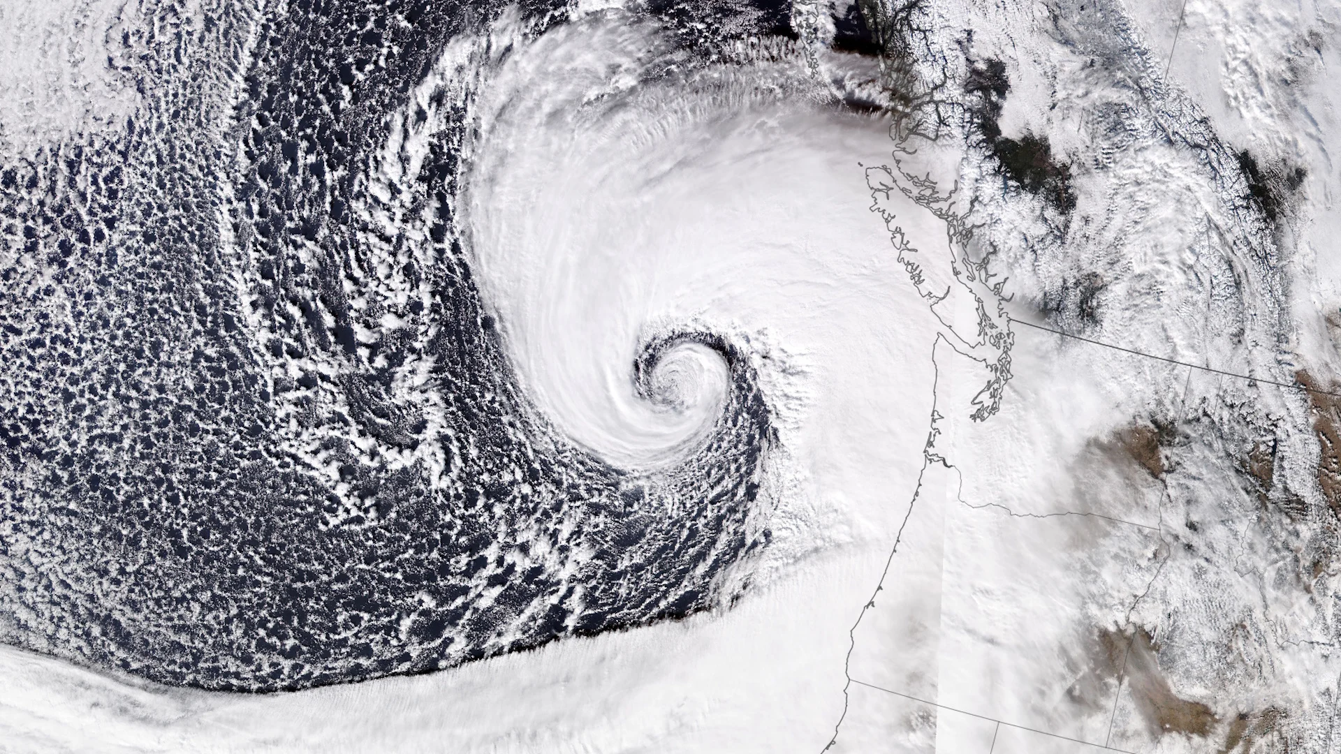
Our monstrous mid-week storm was one to remember, bombing out in style about 700 kilometres off the coast. Another bomb cyclone is hot on its heels, threatening a renewed round of gusty winds and heavy precipitation across B.C. to end the week.
But how do the two storms compare?
DON’T MISS: How a monster is born: Discover the fuse that lights a bomb cyclone
Similar sources of ignition, and similar tracks
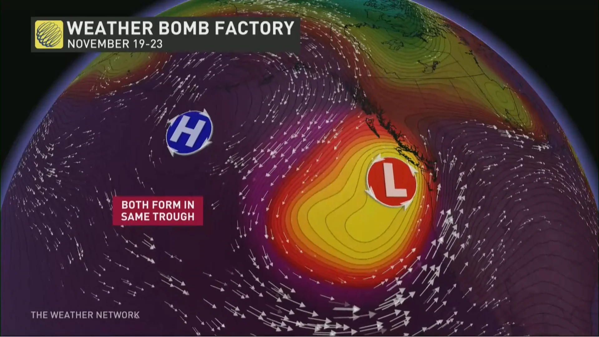
Both storms found strength within the same general setup over the northern Pacific Ocean. A large upper-level ridge soaring over Alaska helped intensify a strong trough in the jet stream swooping into Canada’s West Coast.

This same pattern has largely remained in place for the past couple of days, sparking both the mid-week bomb cyclone and the second low that’s expected to affect B.C. through the end of the week.

As a result of this familiar setup, both storms will have formed offshore Vancouver Island, and they’ll both weaken and backtrack south toward Oregon in the days after they achieve peak intensity.
Aside from strength, the only difference between the two storms is that our late-week bomb cyclone will form closer to land, allowing precipitation to push farther inland.
One storm is far more intense than the other
Let’s talk about that strength. Powerful winds aloft fan out as they twist and turn through an active pattern, creating a void high in the atmosphere that air has to rush upward from the surface to fill.
RELATED: ‘Weather bombs’ are explosive storms that create ferocious conditions
This process creates a centre of low pressure near the ground. The faster we see air rush upward from the surface, the faster and deeper our low-pressure system will intensify.

We saw this process play out in spades on Tuesday when our monstrous mid-week storm intensified by 55 mb in just a couple of hours. A storm’s air pressure has to drop by about 24 mb in 24 hours to qualify as a bomb cyclone.
The bomb cyclone that wrapped up off the B.C. coast on Tuesday achieved a minimum central pressure as low as 943 mb, which is a downright impressive intensity for this kind of storm in this part of the world.
Our second bomb cyclone will encounter less favourable dynamics, which won’t allow it to grow quite as intense as the storm we saw earlier this week. It’s still expected to just meet the criteria for a bomb cyclone, however, and folks can expect another spell of gusty winds and heavy precipitation across B.C. as it brushes closer to Vancouver Island to begin the weekend.
WATCH: What, exactly, is a bomb cyclone?
Header image courtesy of NASA Earth Observatory.


