How weather and landscape set the stage for Toronto's latest flood

With another major flooding occurrence in Toronto, Ont., on Tuesday, what were the factors that aligned for the latest event? The Weather Network breaks them down
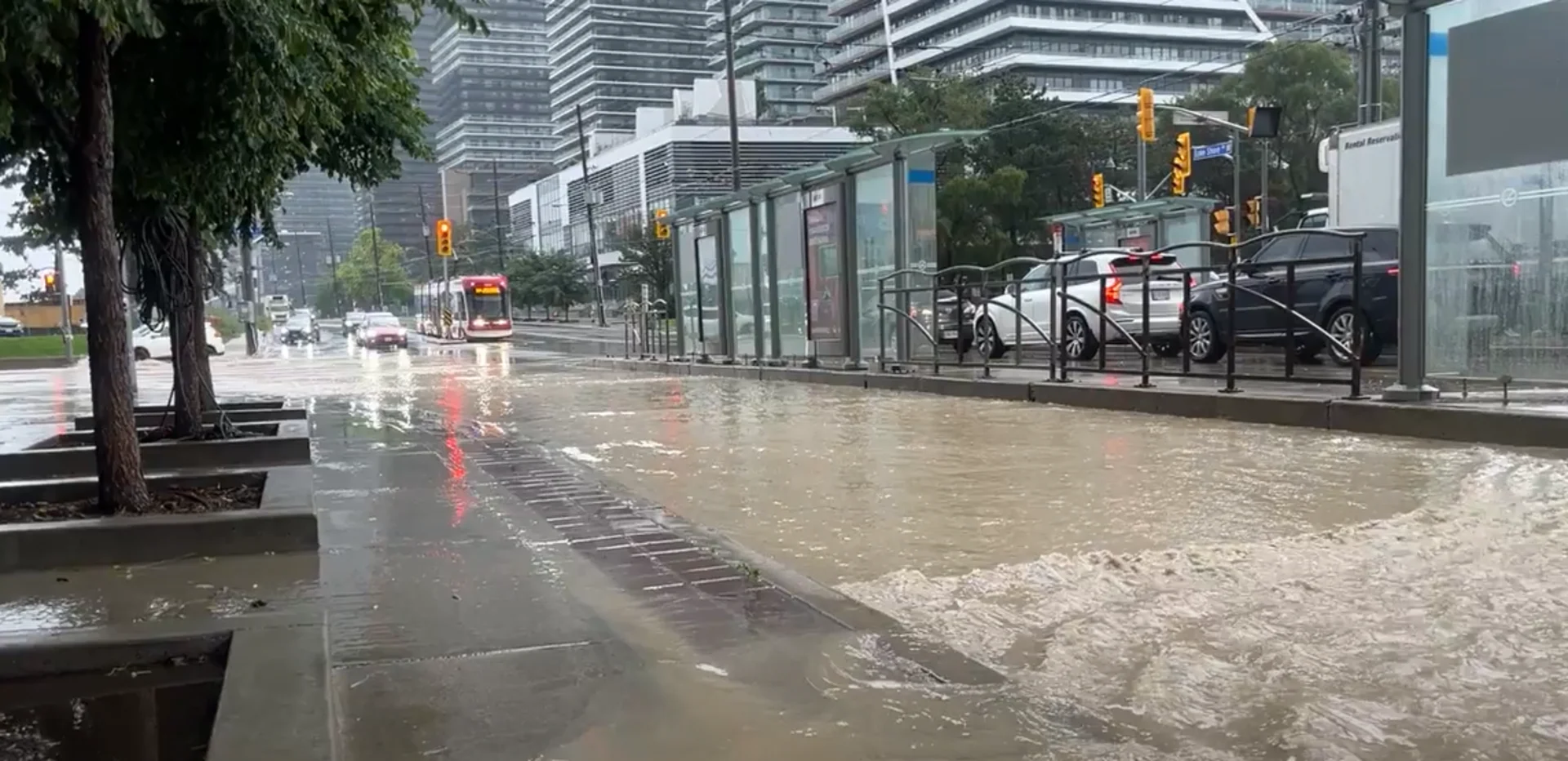
Tuesday's flooding in Toronto, Ont., was rather severe, but it's too early to say if it will approach or exceed the magnitude of its infamous event in 2013.
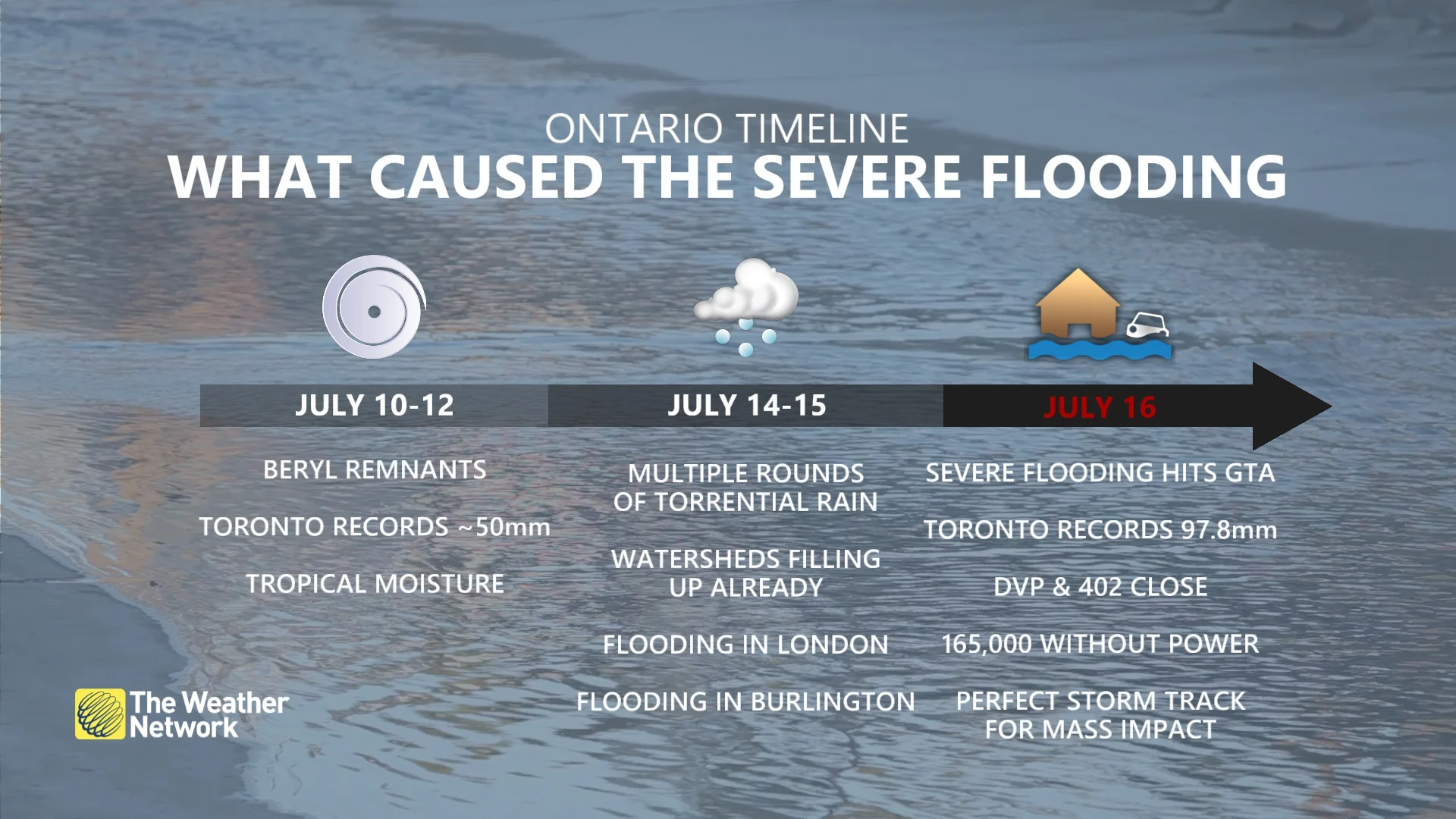
On the morning of July 16, Pearson International Airport picked up a whopping 97.8 mm of rain –– more than a month's worth. The 1991-2020 climate normals for July rainfall in Toronto is 74 mm.
RELATED: Welcome to the jungle, Ontario: On pace for a record, rainy summer?
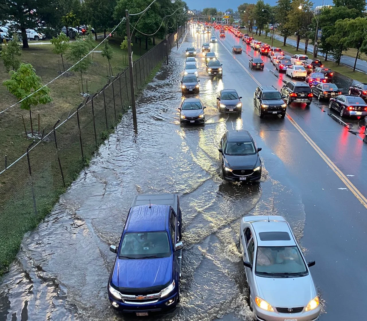
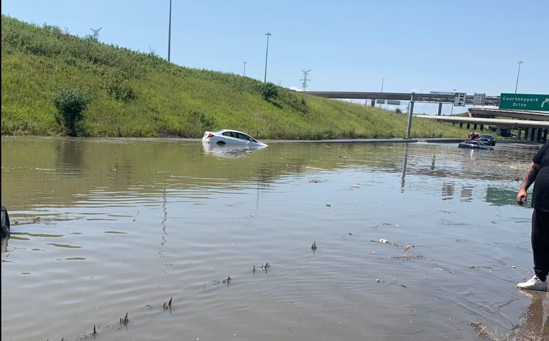
The flooding impacts in the city and surrounding communities were widespread and considerable. Numerous rivers were breached, with the Don Valley and Humber waterways pushed to very high levels, transit locales such as Union Station were flooded, resulting in closures and delays, and roads became impassable and were shut down.
As well, the extreme rain and flooding prompted closures on the 400-series highways. On top of that, at one point during the storm, there were more than 165,000 Toronto Hydro customers without power.
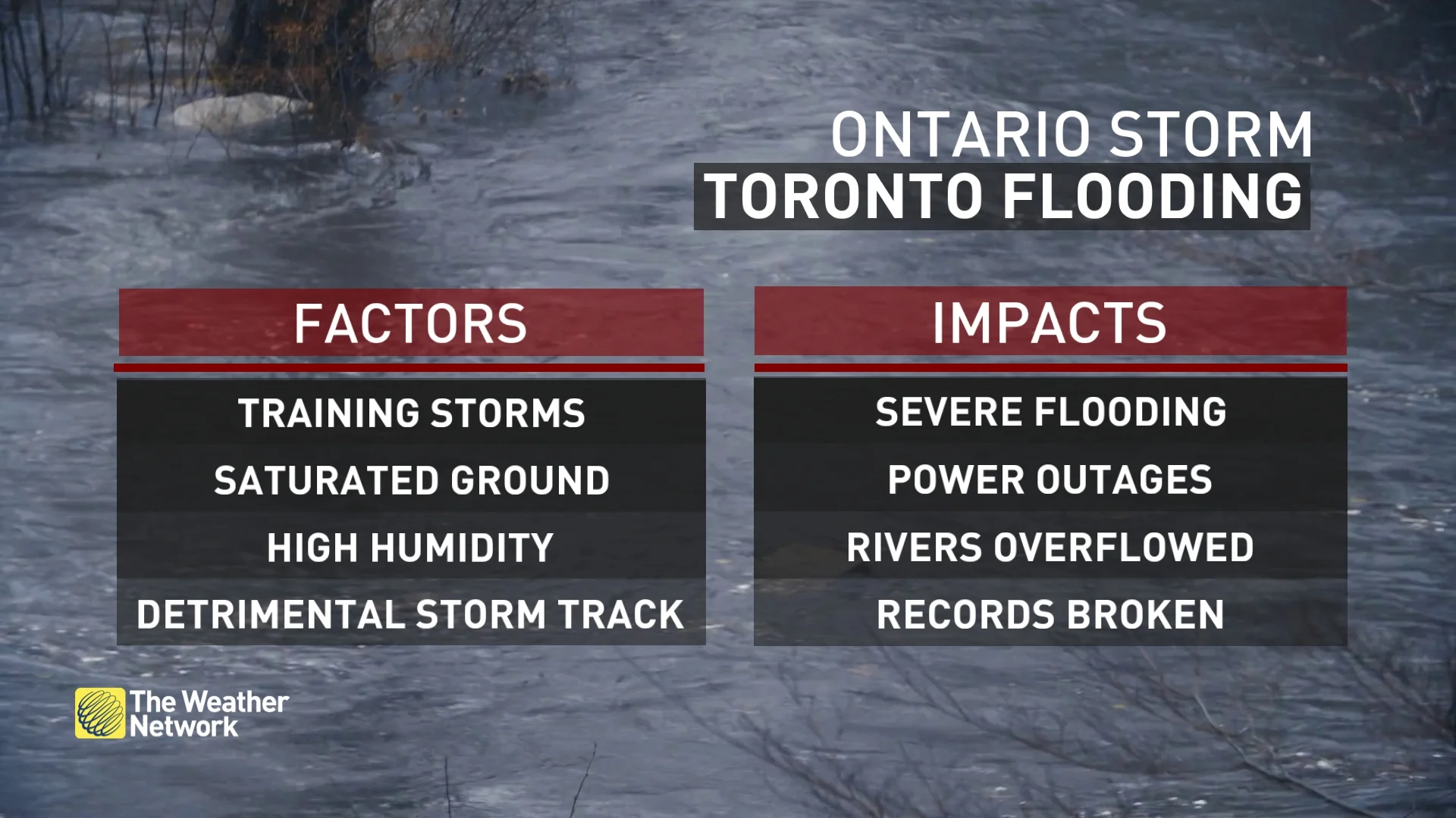
Key ingredients came together for Toronto's July 16 flood
Ontario's summer has already been wet, and it is likely to take a run at one of its wettest on record.
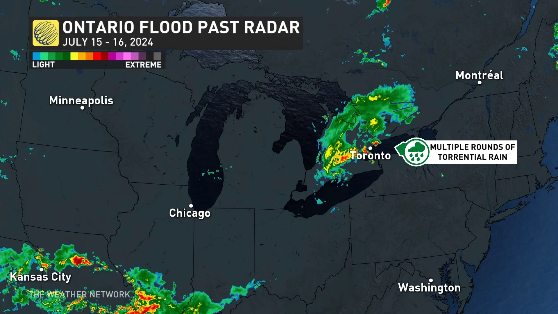
Much of what happened on Tuesday can be attributed to, in large part, the upper-level winds, helping to steer a significant moisture anomaly, via a convective system, towards southern Ontario.
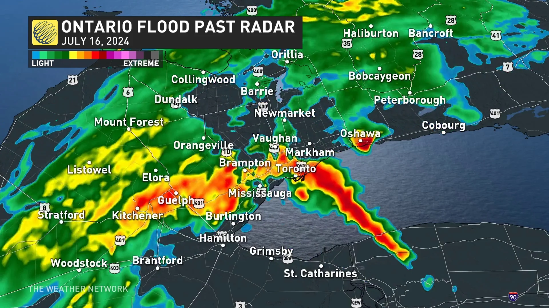
July 16 Baron radar image of precipitation for southern Ontario. (The Weather Network)
The significant moisture anomaly is what led to heavy, flooding rain in multiple Ontario communities this week, not just in Toronto on July 16.
The event started in the U.S. as a line of severe storms came tracking towards the Great Lakes region, with the convective system continuing through southern Ontario in the early-morning hours on Tuesday.
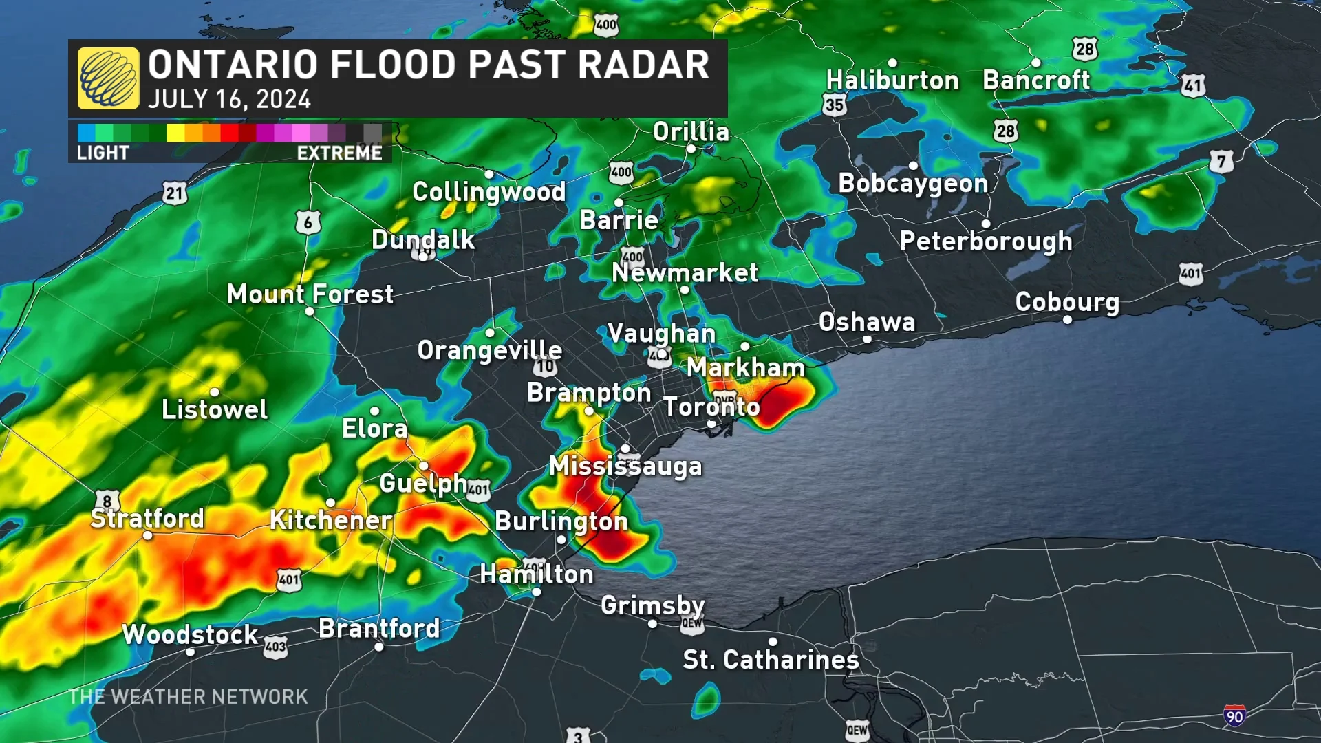
Two rounds of torrential rainfall occurred Tuesday morning, followed by wraparound, training storms with additional, heavy precipitation.
In essence, the perfect storm path aligned to cross the high-population centres of London, Burlington, Mississauga, Brampton and Toronto.
July 16 Baron radar image of precipitation for southern Ontario. (The Weather Network)
The amount of precipitable water, often abbreviated as PWAT, was extremely high and mimicked tropical moisture. PWAT is the amount of water vapour confined in a column of air if it was to be condensed and collected. It allows for torrential rain.
And, with an already saturated ground from recent rainfall events, including the remnants of Hurricane Beryl, there wasn't going to be much help provided to absorb the excess precipitation. Rivers and watersheds were already filling up in the days prior to Tuesday's event.
July 16 Baron radar image of precipitation for southern Ontario. (The Weather Network)
Toronto lacks enough natural buffers to absorb rainfall
Climate change does play a role in contributing to an increase in the number of extreme weather events, there are other factors to consider for Tuesday's excessive rainfall and flooding.
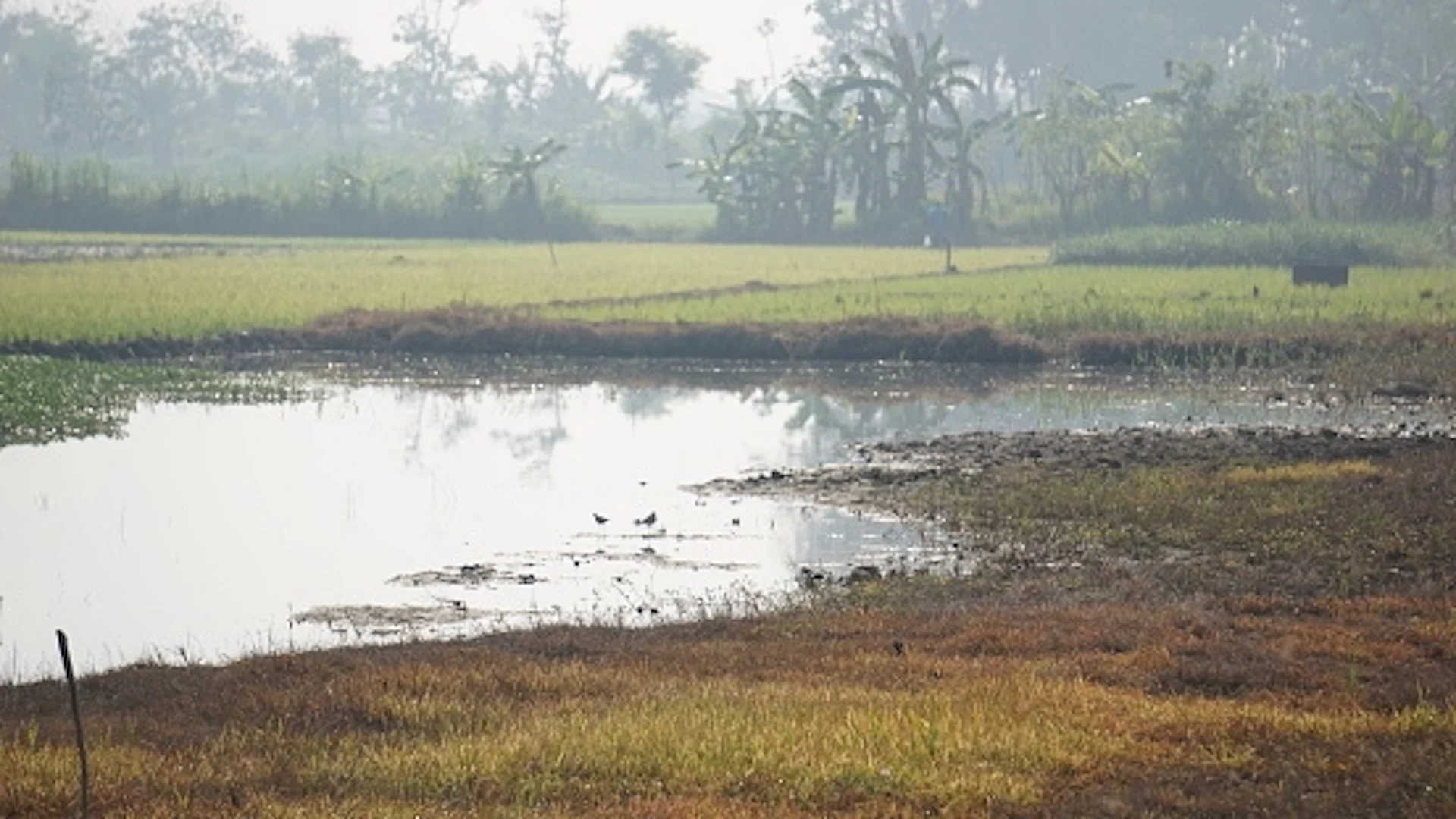
Toronto has undergone decades of urbanization, removing natural infrastructure such as wetlands, grasslands and forested areas, which all work as sponges to absorb rainfall and mitigate flooding effects.

(Getty Images)
But, the city has replaced much of those with concrete roadways, driveways and buildings, among others.
In a 2023 interview with The Weather Network, Jeremy Hogan, the Nature Conservancy of Canada's (NCC) director of prairie grassland conservation, said only 18 per cent of Canada's original grasslands remain.
Natural landscape such as grasslands can trap and filter water resources, mitigating floods and droughts in the process.

(Getty Images/Autumn Sky Photography/962974532-170667)
Without natural barriers such as grasslands, we would lose a lot of the "buffering" the grasslands do to help mitigate climate change effects, Hogan said, allowing for more flooding because the water would flow without being stored.
Also, grasslands, forests and deep peatlands can also absorb vast amounts of greenhouse gas emissions and store carbon, acting as a sink to counter the effects of climate change.
SEE ALSO: Action needed as Canada loses nearly 300 football fields of grasslands daily_
(Getty Images/Taufan Kharis/1788933366-170667a)
Each day, Canada loses 272 pro-sized football fields of grasslands due to human activity. Over the course of a year, it's 60,000 hectares (600 square kilometres) -- the equivalent to 100,000 football fields, according to NCC.
On top of that, Toronto's aging infrastructure is in need of serious upgrades –– an issue that also exacerbates the flooding risk, even in seemingly less extreme rainfall events.
However, in a media scrum on Tuesday, Toronto Mayor Olivia Chow stated the city has found $2 billion in the budget after the provincial government "uploaded" the cost of the DVP and the Gardiner Expressway repairs, and will be allocated to fixing Toronto's aging transit system and roads, CBC News reported.
However, Toronto's infrastructure is still lagging, with Chow noting it is $26 billion and more than 10 years behind in repairs.
What is needed to be better prepared for flooding?
In May 2023, the federal government unveiled the country's first national-level disaster risk assessment, highlighting the catastrophe threats facing Canada and the current measures and resources in its emergency management systems to address them. The inaugural report addressed multiple hazards including floods.
Among the flood highlights from the report included:
The risks from flood events will increase over time due to the impacts of climate change on weather patterns and the increasing number of people living in urban areas
The threat profile identified the following gaps in Canada's flood resilience including co-ordination among governments to manage flood risk; lack of flood risk information that impacts the management of evacuations; low awareness among Canadians of their personal flood risk; and a lack of sustained investment in a national flood insurance arrangement and in countrywide infrastructure measures for prevention, like planting trees to prevent erosion
(Ontario Provincial Police Highway Safety Division/@OPP_HSD/X)
And, for homeowners, the best way to address flooding is prepare, prevent and protect, according to The Co-operators.
Canadians can find their risk area and preventative measures, here.
WATCH: Flooding rain shuts down major roads and transit in Toronto
With files from Rachel Modestino and Tyler Hamilton, meteorologists at The Weather Network.
Follow Nathan Howes on X, formerly known as Twitter.