How Hurricane Milton’s destructive surge mostly spared Tampa Bay

The hurricane caused widespread damage even though the worst-case scenario for storm surge didn’t pan out for Tampa Bay
Hurricane Milton struck Florida on Wednesday evening as a major Category 3 storm with sustained winds of 205 km/h. The storm roared across the state with damaging winds, flooding rains, and a historic tornado outbreak that killed at least ten people.
Folks across hard-hit Tampa woke up to widespread wind damage and millions of power outages throughout the region. But while some communities face the prospect of a long recovery, the worst-case scenarios didn’t pan out as feared.
Here’s a look at how Milton’s track across Florida stacked up against the conditions forecasters worried would come to pass.
PHOTOS: Fearsome Hurricane Milton leaves trail of damage after Florida landfall
Milton made landfall as a different beast
Steamy waters in the southern Gulf of Mexico supported a monster in Hurricane Milton. The storm will live in the history books as the fifth-strongest hurricane ever observed in the Atlantic basin in terms of minimum central air pressure.
Thankfully, the environment couldn’t support that scale-topping Category 5 hurricane for long.

A strengthening jet stream picked Milton out of the southern Gulf of Mexico and made it accelerate toward Florida’s western coast. Strong wind shear and cooler waters chipped away at the hurricane’s internal structure, forcing its winds to weaken as it approached land.
While this setup forced Milton to weaken, it also caused the hurricane to greatly expand its wind field. This enlarged footprint exposed more of Florida to the storm’s wind, rain, and surge.
Some dry air also got wrapped into the core of the system as it approached the Tampa Bay region, causing the storm to become lopsided with most of its heavy rain and strong winds on the northern half of the storm.
This slightly weaker and asymmetrical hurricane may have saved Tampa from disaster on Wednesday.
WATCH: Milton brings tornadoes, damaging winds to Florida
Tampa was spared the worst storm surge
Ask any meteorologist in Florida what keeps them awake at night, and a major hurricane hitting Tampa Bay would pretty much sit at the top of the list.
Florida’s western coast is highly susceptible to a major storm surge, which is seawater pushed inland by a storm’s powerful winds.
Milton’s slightly lower winds, lopsided structure, and a path a few dozen kilometres to the south made all the difference in sparing Tampa the storm surge forecasters feared might push into the city and its suburbs. The storm also moved faster than anticipated, which reduced the amount of time strong winds buffeted the coastline.

Tampa Bay remained in the hurricane’s northern eyewall, which meant that winds blew from the east—offshore—during the worst of the storm. Not only did these offshore winds spare the region the worst of the surge, but Tampa actually experienced an “anti-surge” as the storm made landfall. Strong winds pushed more than a metre of water out of Tampa Bay and into the Gulf of Mexico.
Even though Tampa was spared, Milton did produce a damaging storm surge. The U.S. National Hurricane Center (NHC) reported Thursday that 5-10 feet (1.5-3.0 metres) of storm surge pushed into the coast south of where the hurricane made landfall.
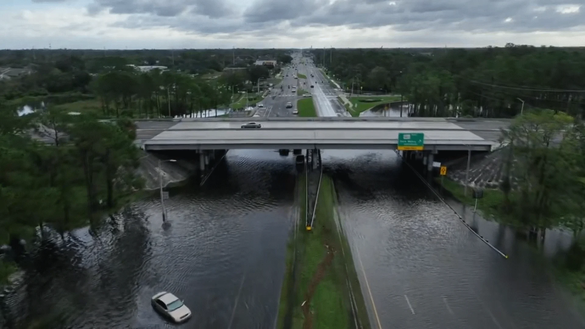
Milton produced violent tornadoes, flash flooding
Milton’s biggest legacy will likely turn out to be the storm’s flooding rains and a violent tornado outbreak.
Prolific rains within the northern half of the storm produced 200-400 mm of rain in just a day’s time. St. Petersburg Airport recorded 479 mm of rain between Oct. 8 and Oct. 10, while nearby Tampa Airport saw 298 mm of rain. Farther inland, Orlando picked up 174 mm of precipitation, while Daytona Beach on the state’s east coast saw 232 mm as the storm swung through.
This much rain in such a short period of time caused major flooding throughout the region. Creeks and rivers around Tampa and Orlando are expected to see all-time record high crests as the excess rainwater runs off over the next few days.

PHOTOS: Major tornado outbreak as Hurricane Milton hits Florida
The outer bands of landfalling tropical systems tend to produce tornadoes as they encounter extreme wind shear in the lower levels of the atmosphere. This scenario panned out in Florida on Wednesday as a historic tornado outbreak unfolded across the state.
Several people were killed when more than a dozen tornadoes touched down throughout southern and central Florida. Some of the tornadoes were particularly large and violent, reminiscent of the twisters you’d see during the spring in Tornado Alley. Meteorologists will survey the damage from these tornadoes in the coming days.
Header image courtesy of the Hillsborough County Sheriff's Office.