What we know so far about potential Ernesto impacts to Canada
With Hurricane Ernesto now churning away from Puerto Rico, forecasters are keeping an eye on its future path in the Atlantic, including potential impacts to Canada's East Coast.
With Hurricane Ernesto now pulling away from Puerto Rico after considerable impacts. Ernesto is forecast to track towards Atlantic Canada Monday into Tuesday, depending on the track the timing could change.
RELATED: Hurricane Ernesto leaves half of Puerto Rican customers without power
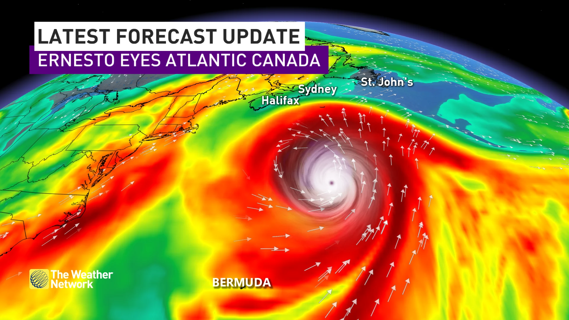
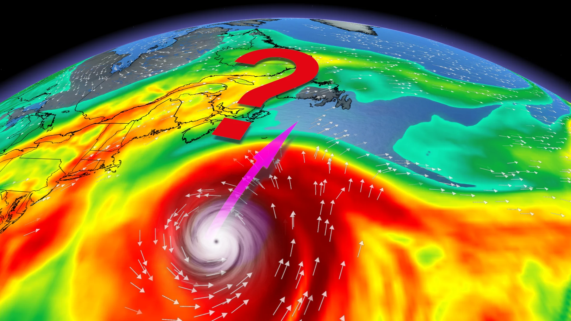
The forecast cone of Ernesto is east of Nova Scotia for Monday and is currently over eastern Newfoundland, but the cone is quite large at that point in time and a good majority of the cone is offshore.
Models have come into better agreement, meaning that they are closer together in their track which increases in confidence that Ernesto will bring some impacts to Newfoundland.
Below is what we know about Ernesto's long-range path so far.
Eyes on Canadian impacts
Currently, Ernesto is tracking northward into the Atlantic Ocean towards Bermuda and is forecast to become a major hurricane as it approaches the territory.
Forecasters are currently tracking the northward movement of the storm, with possible impacts to parts of Atlantic Canada in the long range.

One source says a dip in the jet stream will be strong enough to pull Ernesto on a more westerly path for a period of time, and that should be sufficient to cause a landfall in Atlantic Canada.
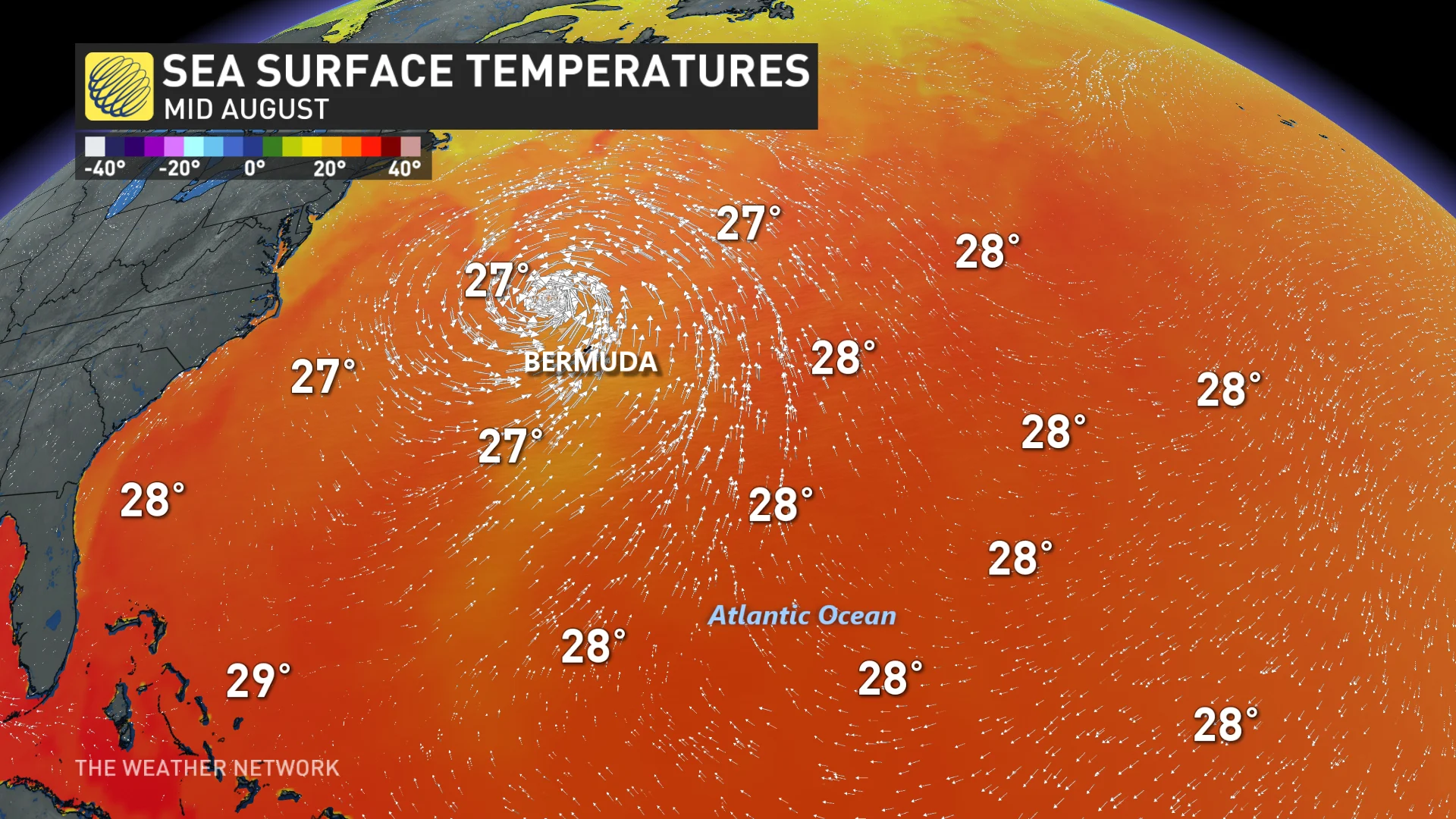
Sea surface temperatures are currently 26.5 C, the right figure needed for hurricanes to thrive, only 400 km south of Nova Scotia. That may seem like a big distance, but that region of the ocean is 2-3 C warmer than normal, so typically that 400 km distance would be greater.
Ernesto is forecast to track towards Atlantic Canada Monday into Tuesday, depending on the track the timing could change.
The forecast cone of Ernesto is east Nova Scotia for Monday and is currently over eastern Newfoundland, but the cone is quite large at that point in time, with a good majority of the cone offshore.
There is high uncertainty on where the centre of Ernesto will track and that means the impacts are uncertain, as well. Even if the track is farther out to sea, there will still be some coastal impacts due to high surf, and even some cloud cover and rain.
If the track heads towards eastern Nova Scotia and Newfoundland, then strong winds up to 90 km/h, heavy rain, and even coastal flooding could be an issue.
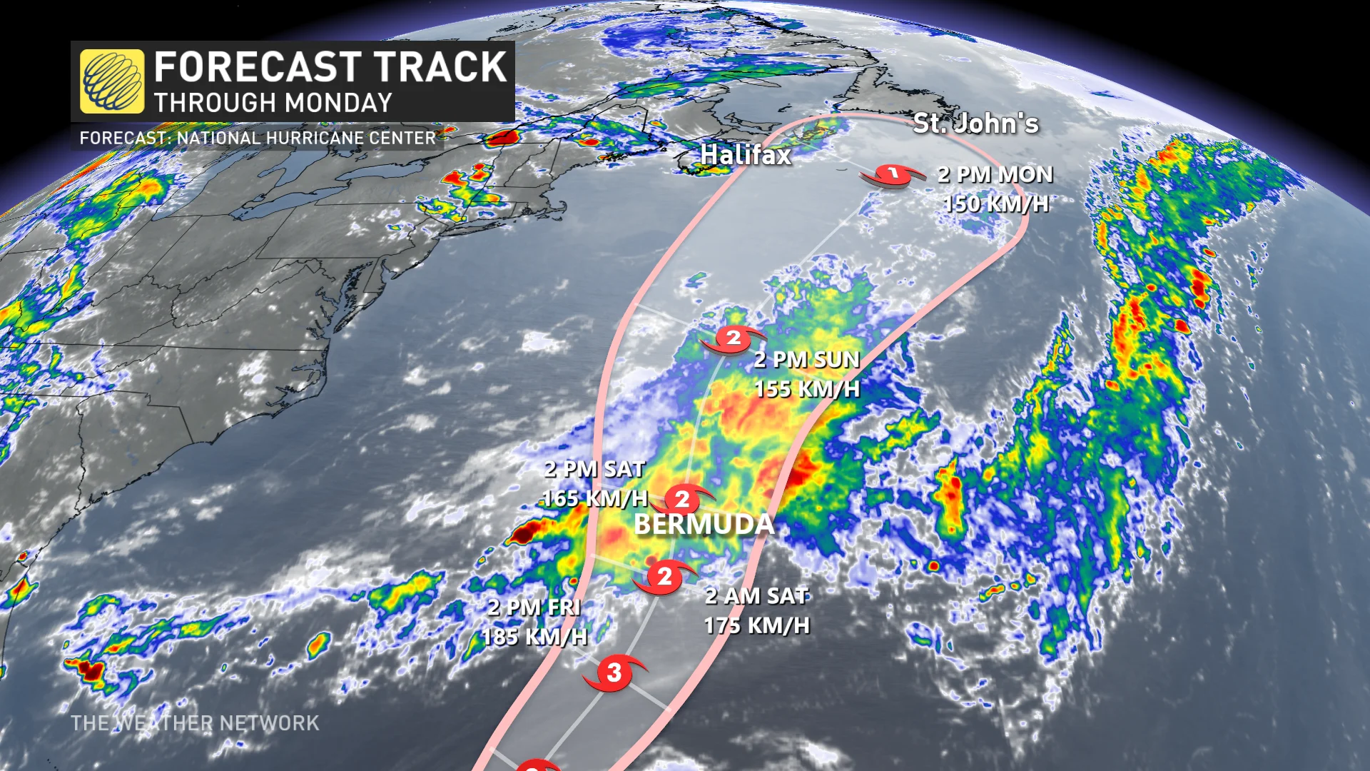
There is also some agreement with models that the centre of Ernesto will track east of Newfoundland.
Regardless, this storm will certainly be one to watch this week, so continue to back as forecast details become clearer.
Stay tuned to The Weather Network as Ernesto continues to strengthen in the Caribbean.