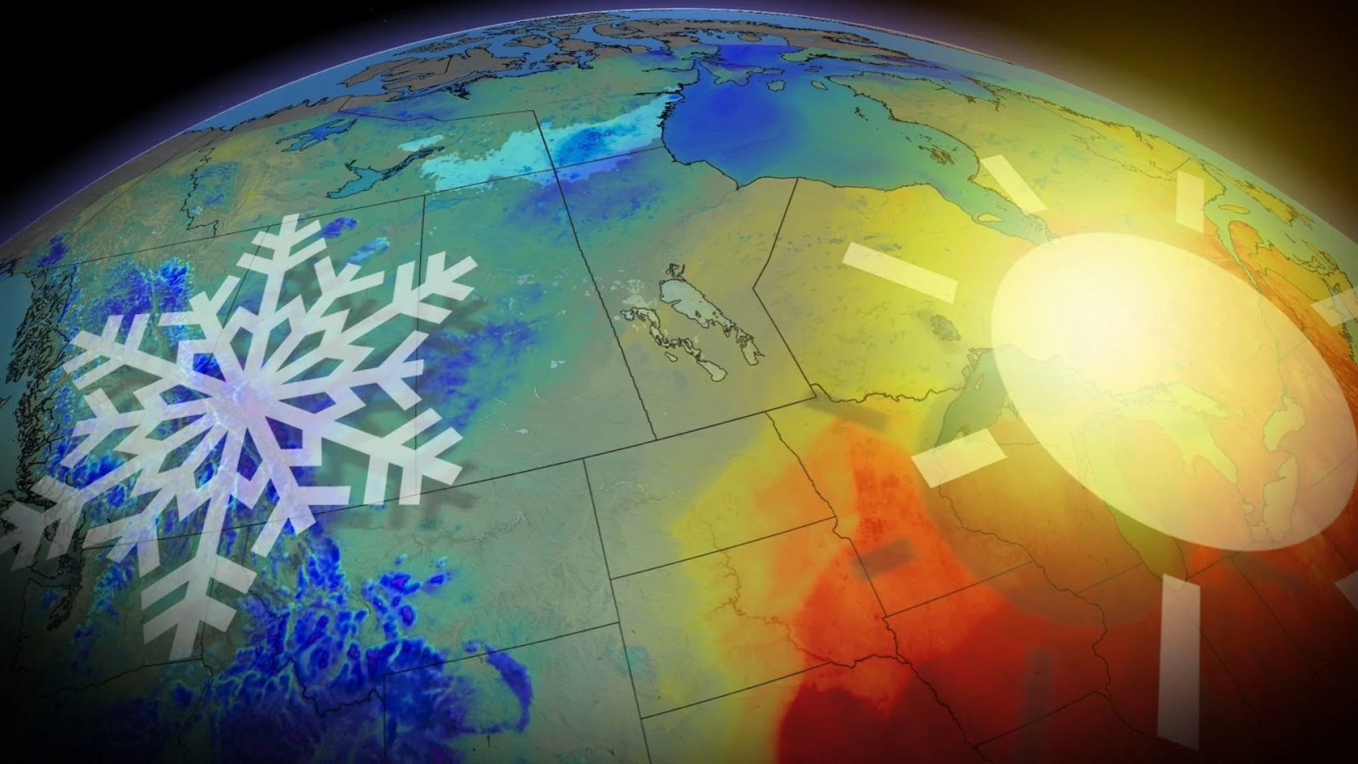
Canada is divided by steep temperature contrast this week
It's a tale of two different climates across Canada this week. Those in Western Canada will need to break out their jackets while Eastern Canada will be sweating through a dangerous heat dome
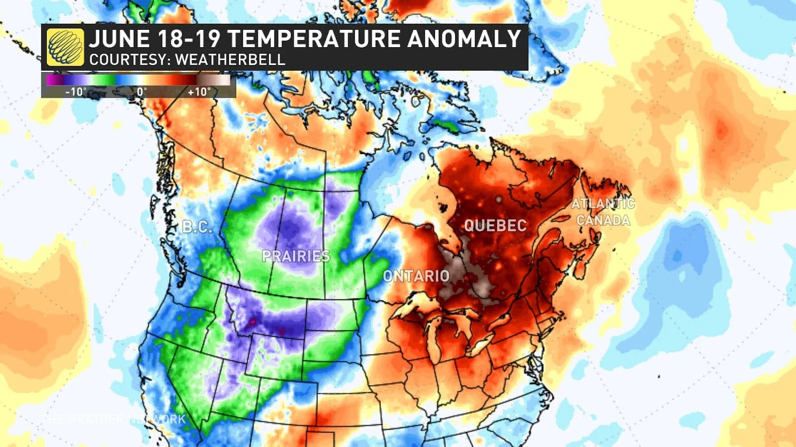
Canadians across the country will be experiencing some pretty intense temperatures differences this week. Those in the west will see temperatures plummet and the chance of snow in some places, while those in the east will see temperatures soar as a heat dome parks across the region.
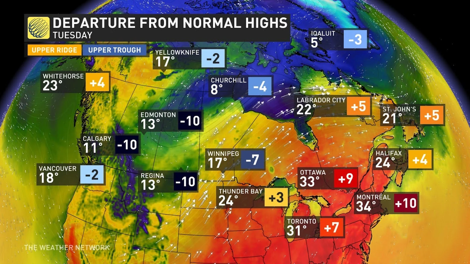
Western Canada will struggle to see double digits on Monday with some areas with the potential to see snow overnight.
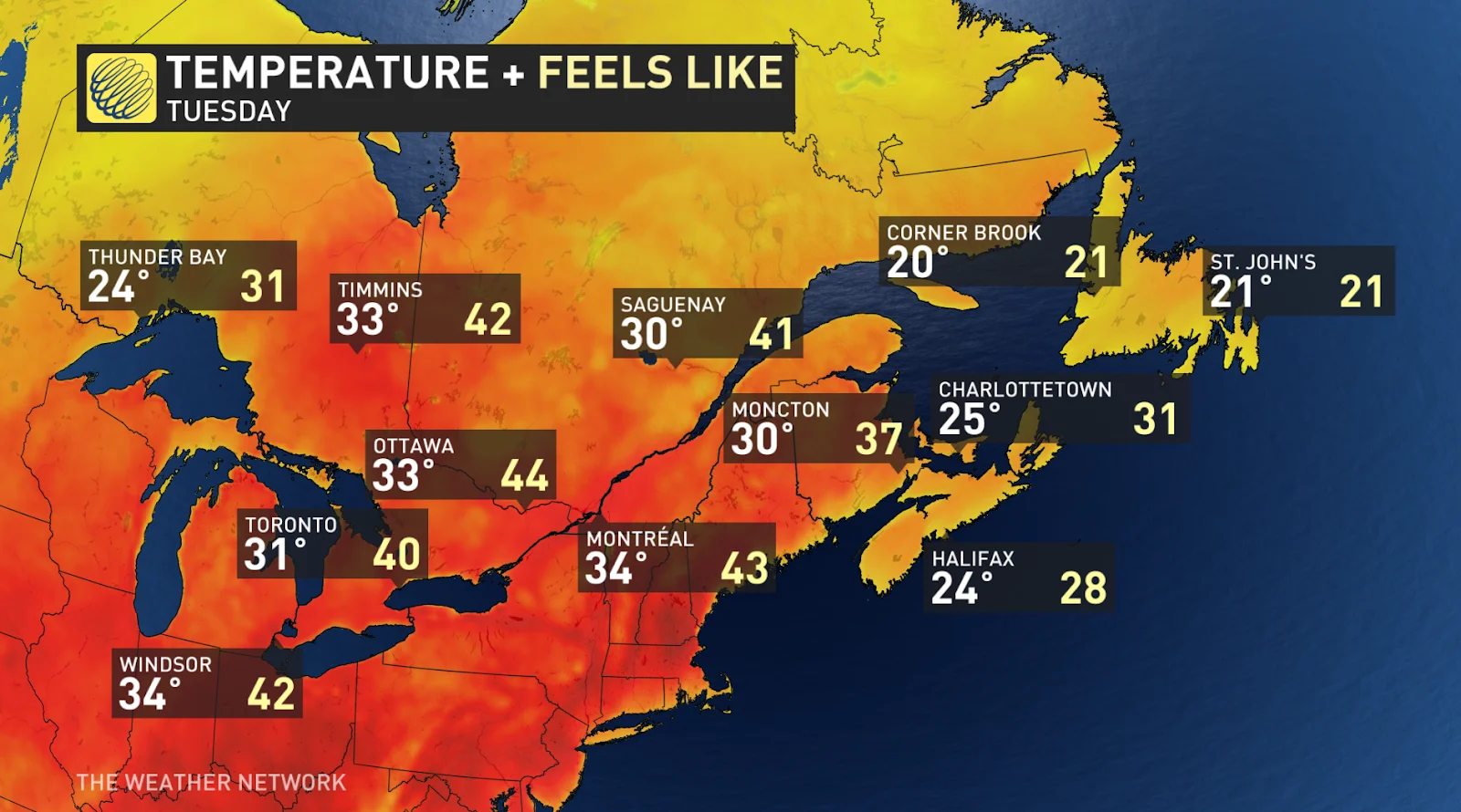
Meanwhile, temperatures will begin to climb in eastern Canada as a heat dome approaches. Southern Ontario, Quebec, and Atlantic Canada will see humidex values in the mid-to-low 40s through most of the week.
RELATED: Environment Canada says it can rapidly link high-heat events to climate change
Western Canada
The below seasonal temperatures will reach across B.C. and much of the Prairies starting early Monday.
A massive cold front moving down from the Arctic is the culprit bringing the colder temperatures into the region, also bringing the threat of snow to those in higher elevations.
Temperatures overnight will be even colder, those in Canmore, Alta., will see overnight lows of -7°C early Tuesday morning.
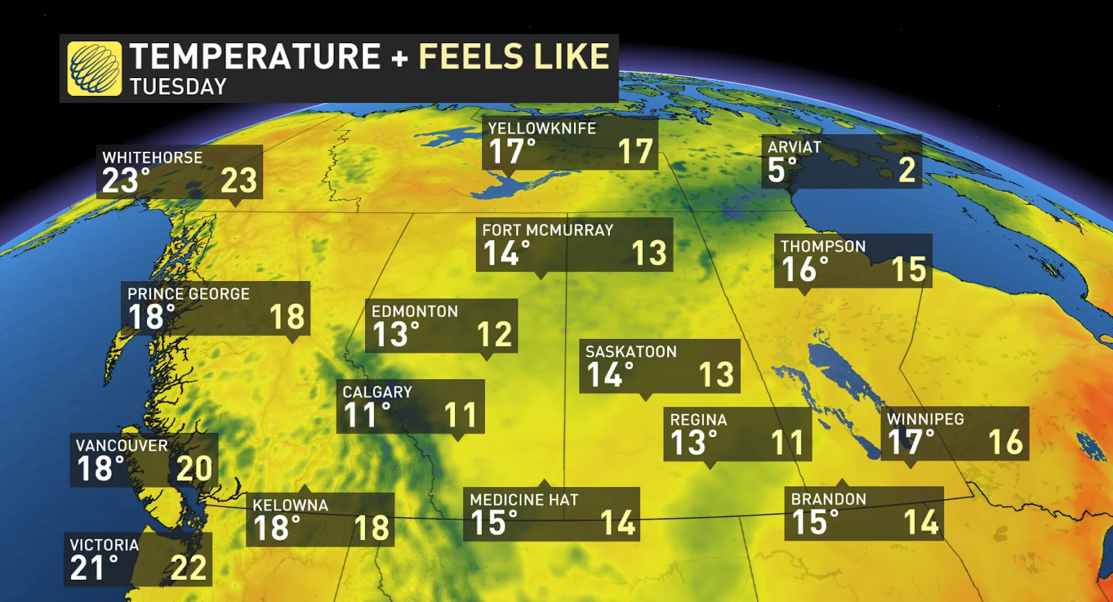
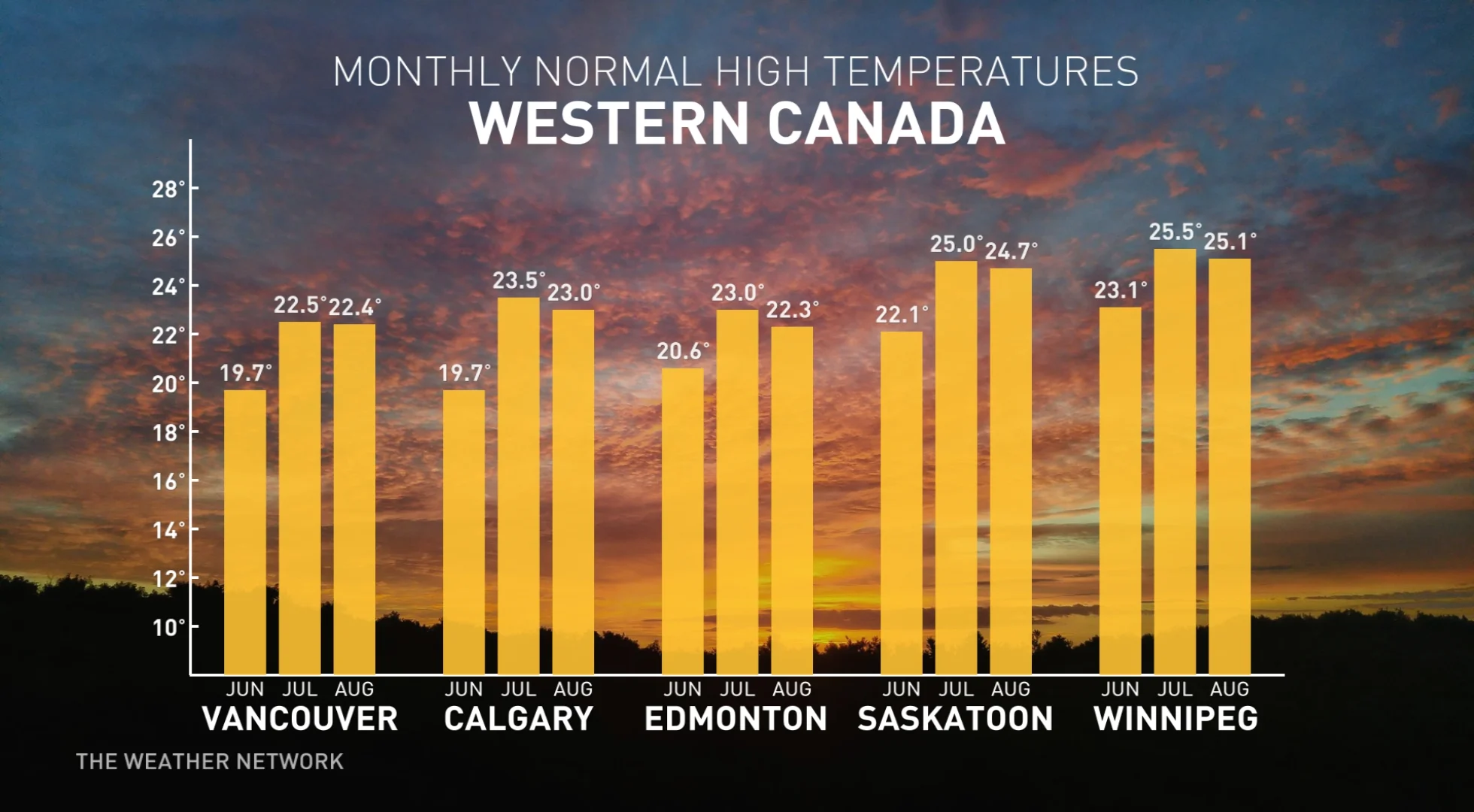
Temperatures will continue to be below seasonal throughout much of the week. Calgary and Edmonton will see temperatures 20 degrees below seasonal on Wednesday.
Temperatures in the west will begin to level out by the end of the week, bringing everyone in the region back up to seasonal temperatures.
Eastern Canada
While those in western Canada will be experiencing some freezing temperatures this week, those in eastern Canada will be sweltering, leaving those in vulnerable populations at risk for heat related illnesses.
SEE ALSO: Why extreme heat is one of the world’s deadliest weather disasters
Record-breaking humidex values will sweep across the region, bringing temperatures in the low-to-mid 30s range for much of southern Ontario, Quebec, and Atlantic Canada. The real danger will be the high humidex values. Toronto, Montreal, and Ottawa are looking at humidex values in the low-to-mid 40s for much of the week.
Little relief will be felt at night as temperatures will only dip slightly to the mid 20s. Those in vulnerable populations, including the elderly, those without access to air conditioning, young children are all at increased risk in the excessive heat so be sure to be weather aware this week.
Remember to drink plenty of water. Avoid strenuous work outdoors.
The heat and humidity will also fuel daily thunderstorm risks, so people will need to be weather-aware.
The heat in the east will likely break next week, bringing the region back to more comfortable seasonal temperatures.
Stay tuned to The Weather Network for more forecast updates across Canada


