A ‘weak’ La Niña is likely as Canada heads into this winter

Experts monitoring the Pacific still see signs that La Niña will develop over the next couple of months
La Niña is still expected to develop as we head into the upcoming winter months, experts announced this week, building on months of predictions that we’ll soon dive into this chilly pattern in the Pacific Ocean.
The phenomenon is favoured to develop through November, the U.S. Climate Prediction Center (CPC) said, with La Niña conditions expected to persist through early next year.
This budding La Niña could have some effects on Canada’s weather in the season ahead.
DON’T MISS: Will winter redeem its reputation? A sneak peek at winter 2024-25
La Niña expected to develop soon
Conditions across the Pacific Ocean are ENSO-Neutral right now.
Neutral conditions mean that water temperatures throughout a critical region of the Pacific Ocean are hovering close to normal for this time of year. ENSO-Neutral doesn’t have much of an effect on weather conditions around the world.
However, sea surface temperatures in that region have fallen below seasonal in recent months, and forecasters expect there’s a 60 percent chance that we’ll dip into a La Niña by November.

Get all the latest information and facts about El Niño and La Niña at The Weather Network’s hub page!
La Niña occurs when sea surface temperatures around the equator in the eastern Pacific Ocean run at least 0.5°C colder than normal for several consecutive months.
This developing La Niña would likely be weak and short-lived, only lasting through the end of winter before we return to neutral conditions in time for next spring.
Potential effects this winter
The chilly waters of a La Niña have a noticeable impact on the atmosphere that sparks ripple effects we can feel here in Canada.
What kind of changes could we see during a La Niña winter?
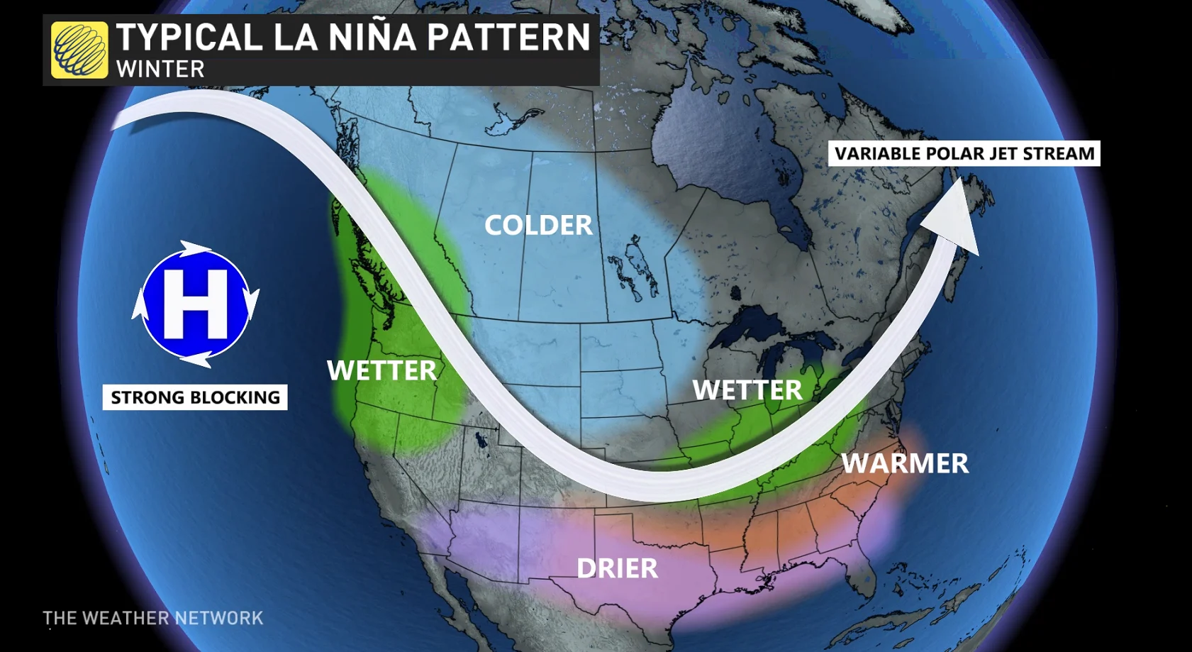
Typically, a formidable event would bring below-seasonal temperatures to the western half of Canada, with an active storm track parked over the Great Lakes and Atlantic provinces. These effects are dulled during weak La Niña events.
Predicting the onset of El Niño and La Niña can be a difficult feat. These patterns are driven by large-scale wind circulations and air pressure patterns across the Pacific Ocean. Small changes can have a big impact on water temperatures in the eastern portion of the ocean basin.