Unwavering heat creates ideal wildfire environment in B.C.
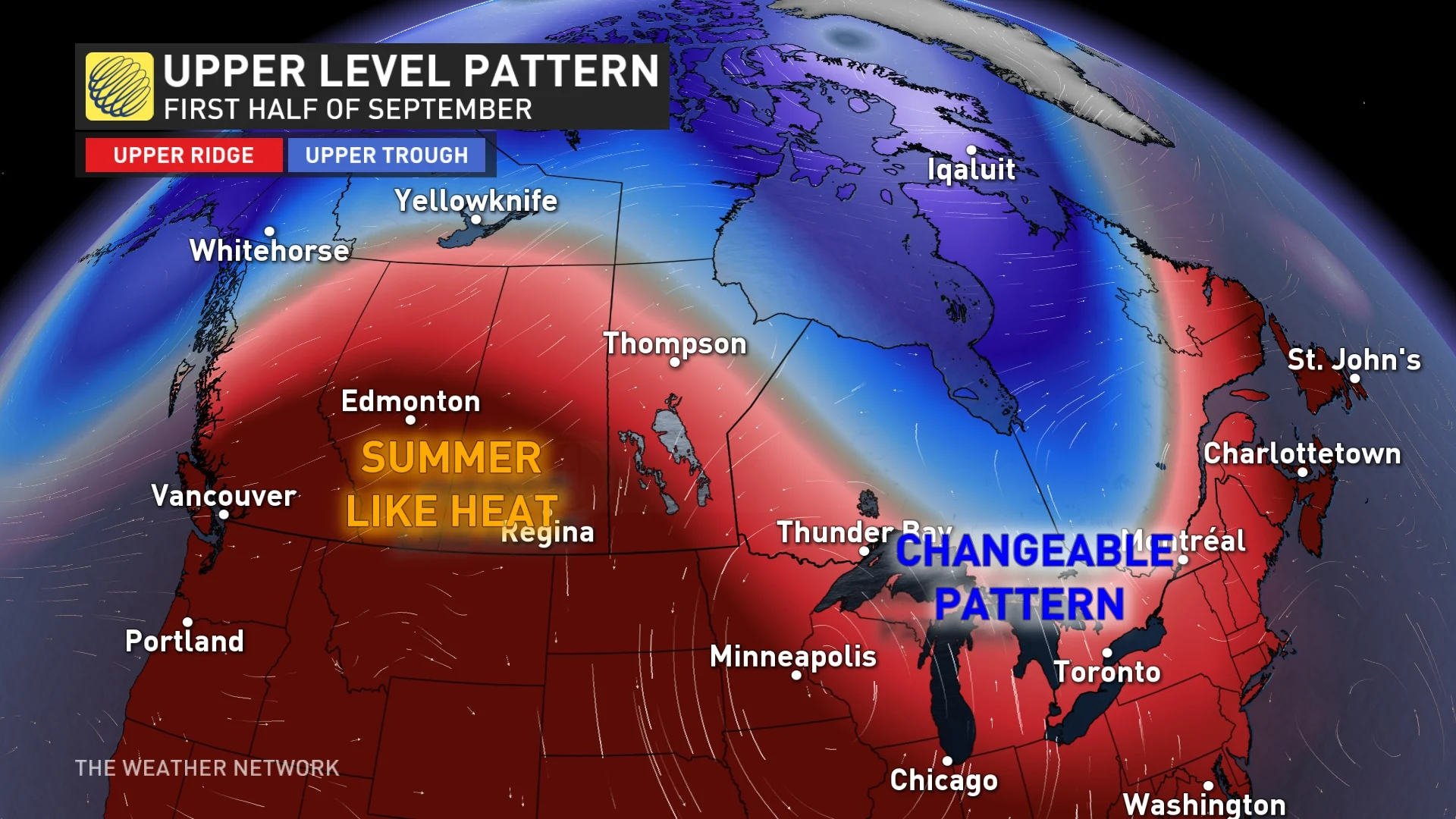
A mighty ridge of high pressure continues to be anchored over the southern half of B.C. this week, keeping the Interior hot and bringing the heat back to the coast –– leading to an elevated risk of wildfires
A surge of heat over southern British Columbia will continue to keep the fire danger high this week.
We’re likely facing the warmest start to September on record for several locations of southern B.C, reminiscent of September 2022.
DON’T MISS: September Outlook: Summer isn’t done with Canada just yet
The stationary heat is also raising the risk of wildfires in the province, with 32 blazes considered out of control as of Sept. 3.
Seasonal temperatures vary in early September across B.C., with average highs generally near 20°C along the immediate coastline with normal highs coming in around 25°C throughout the southern Interior.
Wednesday and Thursday: Hot weather returns to the coast
We’ve already seen more than 1,500 fires across B.C. this season, collectively responsible for burning more than one million hectares of land. Nearly three-quarters (73 per cent) of those fires were started by lightning, above the long-term average of 58 per cent.

As it stands, the number of lightning-caused wildfires is the highest since at least the 2008 wildfire season. As of Sept. 3, 32 wildfires remain out of control with 217 active blazes.
Hot weather will push back into the South Coast by Wednesday and Thursday, with temperatures cresting above the 30°C mark across the inland sections.
With high dew points, it will feel muggy across the Lower Mainland, especially inland in the Fraser Valley as a southerly flow develops.
The warmest humidex record is 40 for Abbotsford in September, and it will feel like the upper 30s by Thursday, making it uncomfortable for some.

The South Coast looks to remain dry until next week, when a trough is set to move closer to the coast, increasing the risk of showers. No significant rainfall is forecast through the southern Interior for the next 10 days.
This is noteworthy heat this late in the season.
The first 10 days of September may remain at or above 30°C for communities like Osoyoos, reminiscent of the pattern we saw across the region back in September 2022.
Stay with The Weather Network for the latest on conditions across B.C.