Unwavering heat continues to fuel major wildfires across British Columbia
Hundreds of fires are burning across B.C. as a heat wave continues across the province
Wildfire season is growing more dangerous by the hour as an unrelenting heat wave remains locked in place over Western Canada.
More than 320 active blazes were burning throughout the province as of Sunday morning.
Extremely dangerous fire conditions will persist for the next couple of days as high heat, dry air, and occasional bouts of thunderstorms develop across the region.
Hazardous air quality and high heat will also threaten the health and well-being of vulnerable people across B.C.
Stay with The Weather Network’s wildfire hub for the latest on fires across B.C. and around Canada
Hundreds of fires burning across B.C.
The B.C. Wildfire Service reported 324 active wildfires across British Columbia as of early Sunday morning, with 27 of those fires starting within the past day. Officials are battling several wildfires of note across the province.

DON’T MISS: Out of control, held, out — What the stages of wildfire mean
More than half of the fires were considered out of control, with about one-third of the active blazes considered under control by the B.C. Wildfire Service.
Officials reported that three of the incidents were considered wildfires of note as of Sunday morning.
Two of those fires, Aylwin Creek and Komonko Creek, are burning along the eastern shores of Slocan Lake north of Nelson.

Crews are also working to get a handle on the Shetland Creek fire, which has burned nearly 15,000 hectares of land west of Kamloops.
Air quality will remain extremely poor and downright dangerous for communities near ongoing wildfires. Widespread smoke across B.C. will make for periods of hazardous air quality for the region, including for portions of the Lower Mainland at times.
WATCH: Rapid wildfire growth threatens British Columbia
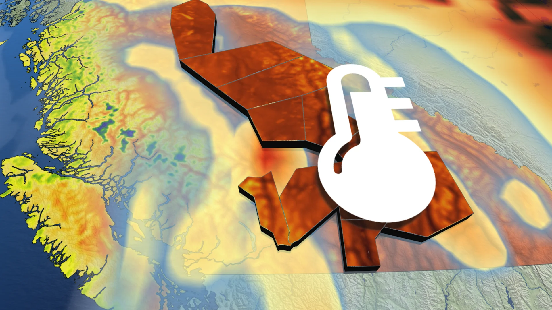
Heat warnings persist
Our current pattern is a stark change from the below-average temperatures and low fire danger ratings that lasted through June and into the Canada Day long weekend.
Temperatures will remain in dangerous territory for many communities as a significant ridge of high pressure remains firmly in place over Western Canada.
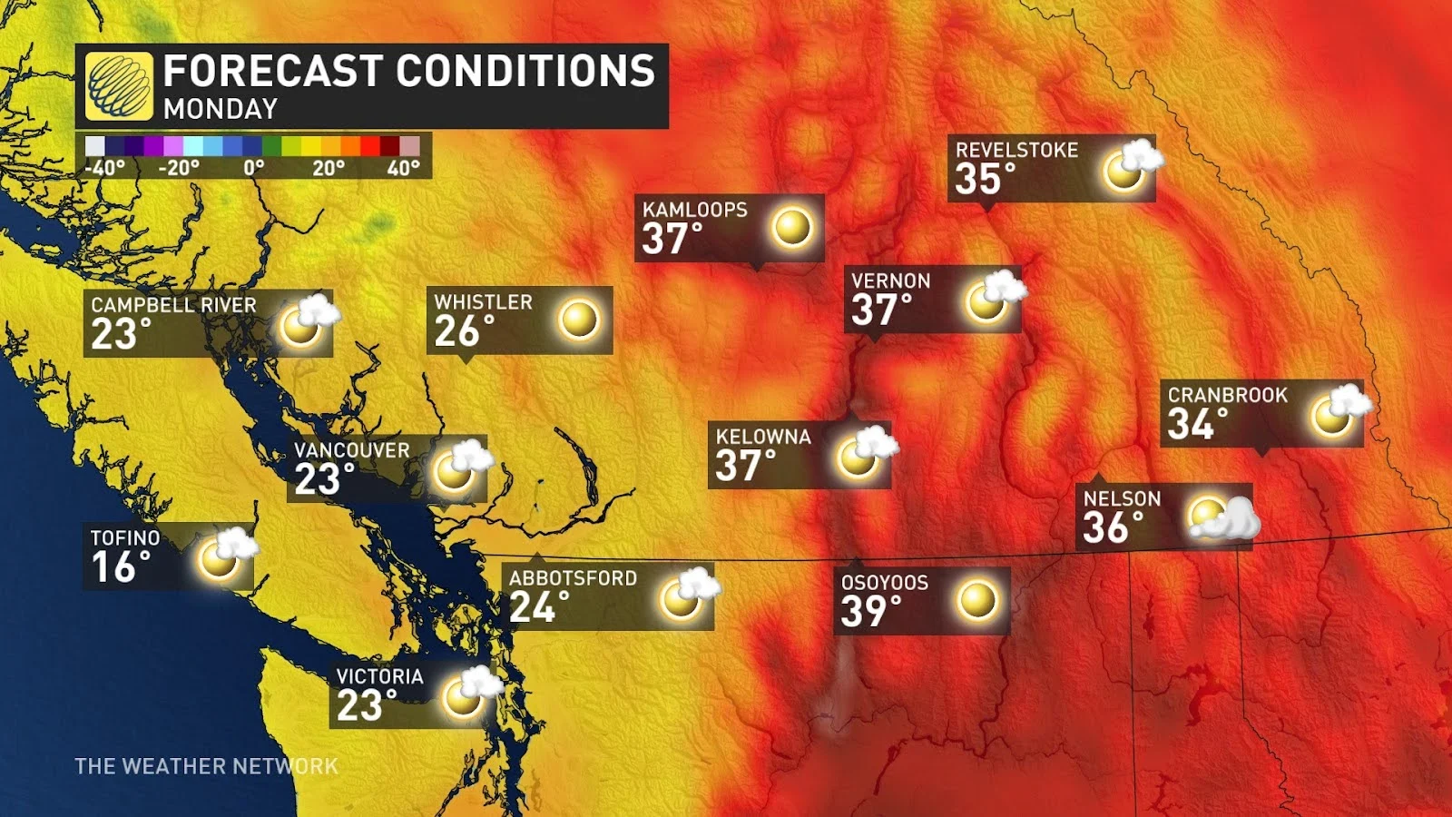
This spell of heat will send temperatures throughout the B.C. Interior soaring into the lower 40s for some communities into the beginning of the week.
RELATED: Wildfires rage across Western Canada, smoke pollution sweeps into Ontario, U.S.
Widespread heat warnings remain in effect for this spell of dangerously hot temperatures.
“Environment Canada and local Medical Health Officers expect an increase in health and safety risks from heat and are advising the public to take precautions,” Environment and Climate Change Canada said in its heat warning. “Check on family, friends and neighbours, who are at higher risk, particularly if they live alone, to make sure they have a cool space.”
How bad is this heat wave? Lytton and Osoyoos have both smashed their record for the longest stretch of 35+ degree days ever observed.

Both communities are on track to rack up 18 consecutive days at or above the 35-degree mark by this week, a feat unmatched even by the infamous 2021 heat dome event.
We won’t begin to see relief until later in the week when the ridge of high pressure slides east across the Prairies. Temperatures in the Interior will begin to fall by Wednesday, finally putting an end to this remarkable heat wave that’s roasted the region.
Despite the falling temperatures, smoke and wildfires will remain a concern with little to no rain in the forecast for the remainder of July.
Stay with The Weather Network for all the latest on conditions across British Columbia.