U.S. heat dome drives extreme and rare weather from Mexico to Canada
From Mexico to the southern Prairies, a U.S. heat dome will drive some extreme and rare weather as we head into next week
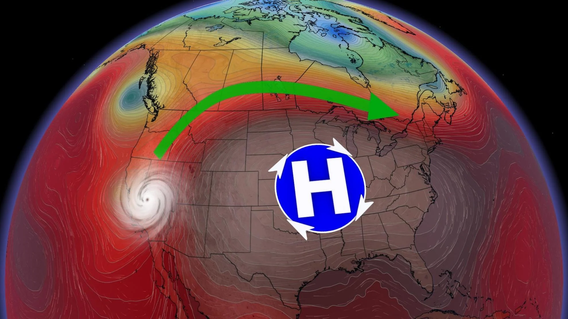
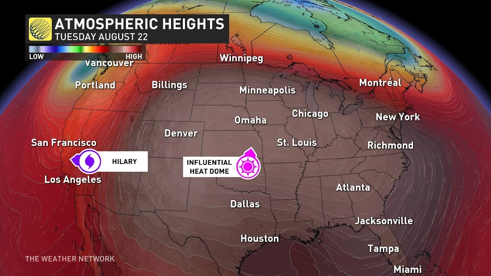
A heat dome is developing in the Southern U.S and will be a driver of weather across all of North America this weekend and into next week.
DON'T MISS: Talking about the warmth? Add heat dome to your vocabulary, here's why
In the eastern Pacific tropics, Hurricane Hilary has developed and is expected to quickly become a major hurricane as we head into the weekend.

What is most unusual is the track of the storm to the west of the Baja Peninsula, with a significant impact expected on southern California. That's all thanks to the steering force of the heat dome.
The last tropical system to move through California was Nora back in 1997. Although Hilary is forecast to become post-tropical as it moves over the region, it is still expected to bring torrential rain to the area. Flash flooding, locally significant, will be possible.
"Heavy rainfall in association with Hilary is expected to impact the Southwestern United States from Friday through early next week, peaking on Sunday and Monday," the U.S. National Hurricane Center said in a statement Thursday morning.
RELATED: NOAA now projects 'above-normal' Atlantic hurricane season in update

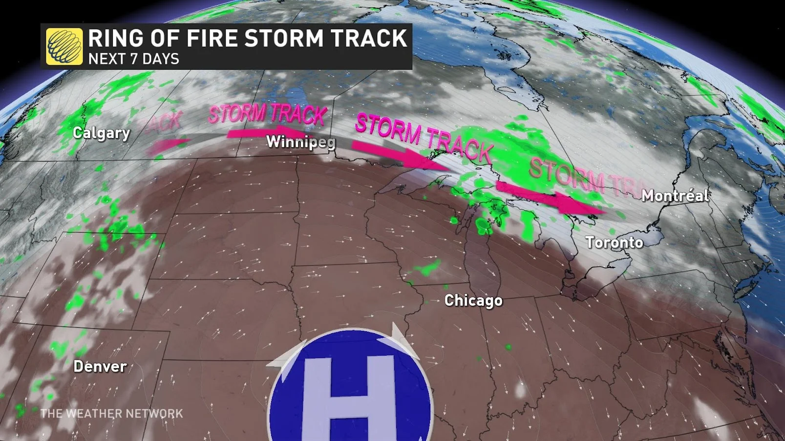
As the heat dome continues into next week, this will also help push the moisture from Hilary into B.C. and the southern Prairies, potentially enhancing rainfall totals for early to mid next week.
"Along with that moisture and being on the northern edge of the heat dome -- an area called the ring of fire -- this will help to create unsettled conditions for the southern Prairies and into the Great Lakes as well for next week," says Matt Grinter, a meteorologist at The Weather Network.

Watch the video above for more on these weather stories unfolding over the next week.


