Tropical storm warnings issued as growing system nears Florida
The storm will bring gusty winds and heavy rain to the southeastern U.S. into early next week
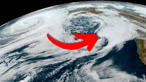
A rough weekend is in store for the Sunshine State as a developing tropical storm tracks toward the region.
Forecasters expect a vigorous tropical disturbance over the Greater Antilles to grow into Tropical Storm Debby by Saturday.
Tropical storm watches and warnings are in effect for portions of the Florida coast in anticipation of foul conditions reaching land within the next 36 hours.
Vacationers are advised to keep a close watch on forecasts over the coming days. Prepare a hurricane kit and stay alert as this system progresses.
Keep up with all the latest news and information this season at The Weather Network’s hurricanes hub page!
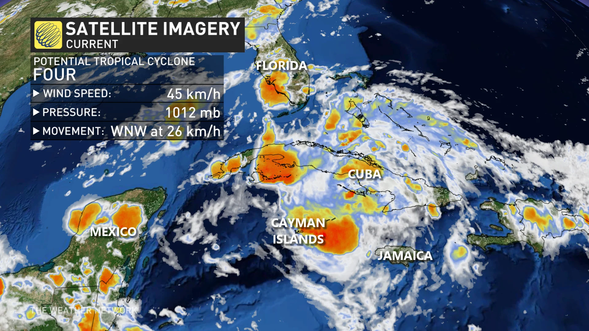
We’ve been monitoring a strong tropical disturbance in the Atlantic for the past couple of days. The system is entering a more favourable environment and it’s likely to develop into Tropical Storm Debby near the eastern Gulf of Mexico sometime on Saturday.
The U.S. National Hurricane Center (NHC) warned on Friday that tropical storm conditions were likely to reach the southwestern shores of Florida by Saturday night or Sunday.
A tropical storm warning is in effect for portions of the region, including the communities of Ft. Myers, Cape Coral, Naples, and Marco Island.
Tropical storm watches cover much of western Florida, stretching from the Florida Keys northward through the Tampa metropolitan area. This watch includes Key West, Sarasota, St. Petersburg, and Tampa proper.
DON’T MISS: Why focusing on a hurricane’s category is downright dangerous
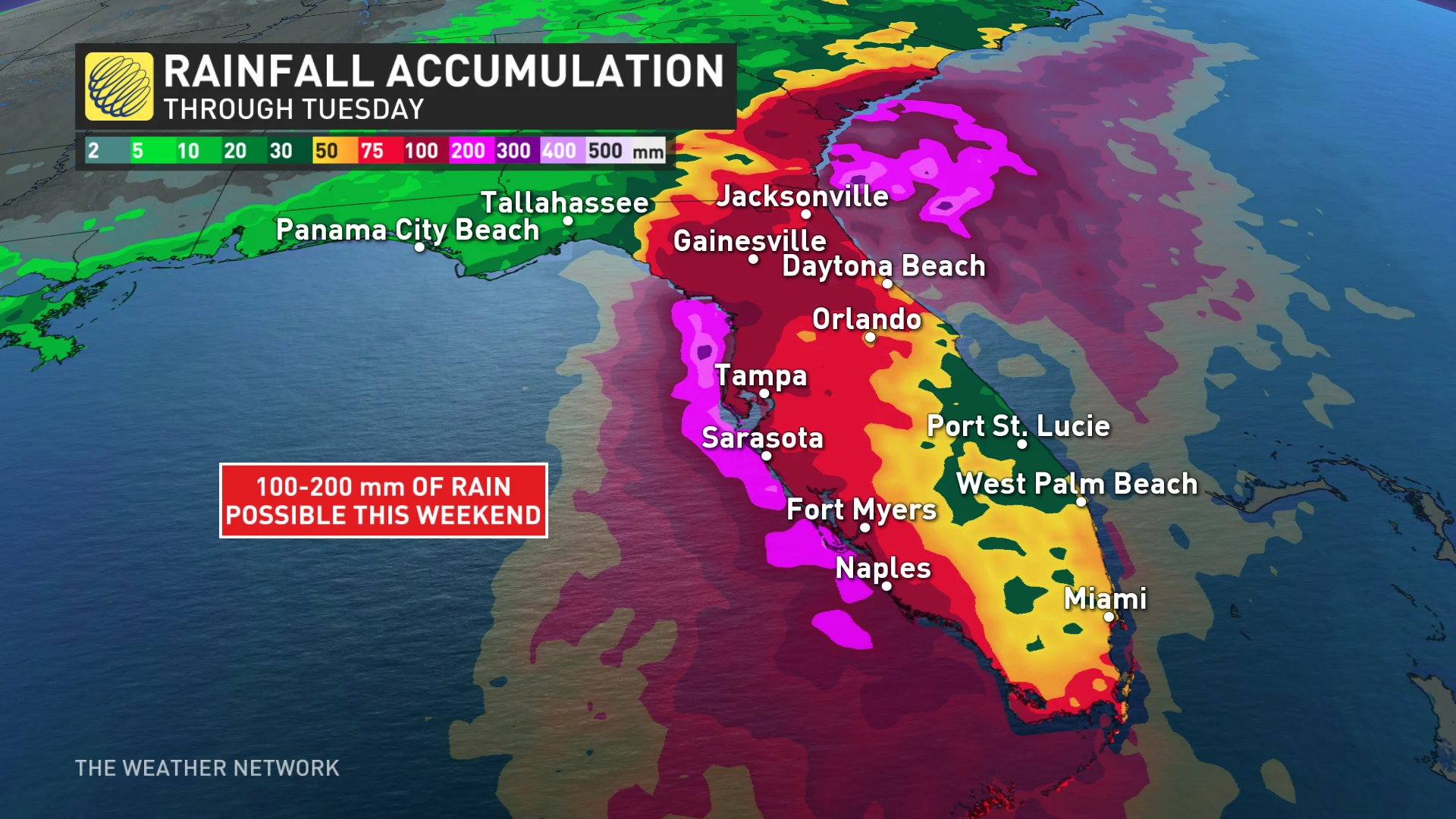
Regardless of this system’s potential development, flooding rains are possible throughout Florida as the disturbance moves into the region. Flash flooding from heavy rainfall is far and away the greatest threat with any landfalling storm—even one that doesn’t have a name.
Additionally, folks throughout Florida can expect coastal flooding from up to one metre of storm surge, a risk for tornadoes, rough surf, and rip currents as a result of this storm.
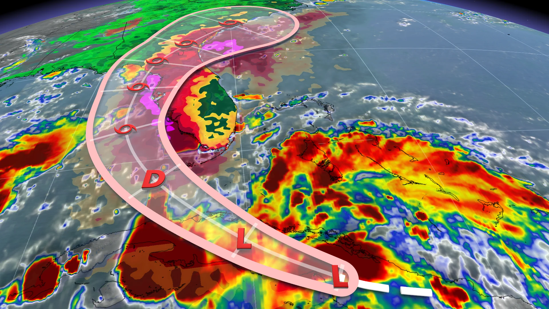
The potential tropical storm’s track will likely take the system across the Florida Peninsula through the weekend before crossing into the western Atlantic by Monday morning.
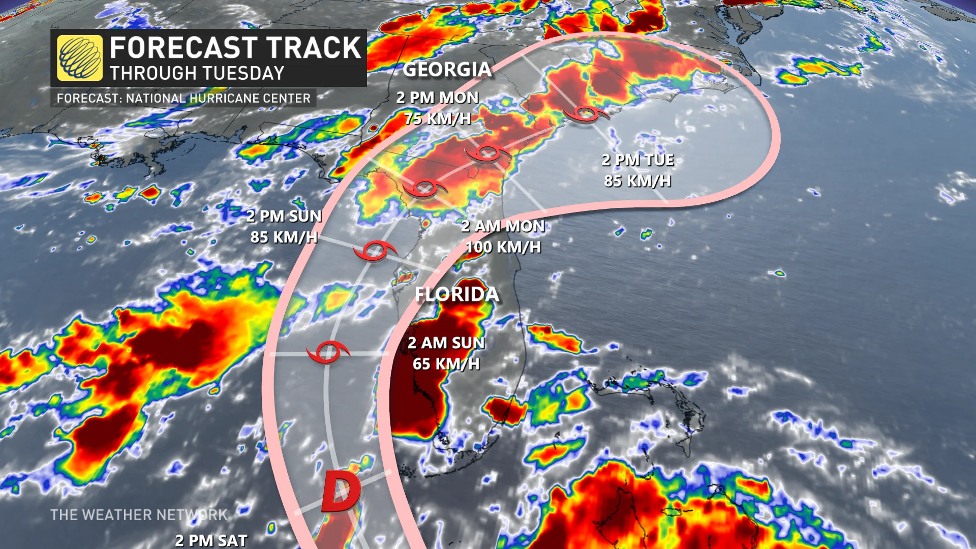
Debby will enter a complex environment that’ll make its future track and intensity a bit more uncertain. Two strong ridges of high pressure—one over the western Atlantic, another over the southern U.S.—will each push and pull on the storm.
As a result of that complexity, computer models are having trouble resolving what the storm may do once it exits the Florida coast and begins tracking along the coast of the southeastern U.S.
Anyone visiting popular vacation destinations along the Atlantic coast, including the cities of Savannah, Charleston, Myrtle Beach, and Wilmington, should keep a very close eye on this storm and prepare to act if watches or warnings are issued for the region.
It’s still too soon to say what, if any, impacts this system could have on Atlantic Canada late next week. Stay tuned and keep checking back for details throughout the weekend.