Tropical Storm Ernesto forms in the Atlantic, closely eyeing Canadian impact
Ernesto has officially become the fifth tropical storm of the Atlantic season, and it is expected to strengthen into a hurricane this week. Will there be impacts to Atlantic Canada? Here's what we're watching
Following the impact from tropical storm Debby across the Eastern Seaboard earlier this month, Ernesto will strengthen in the Atlantic Ocean, likely developing into the third hurricane of the 2024 hurricane season by the end of the week.
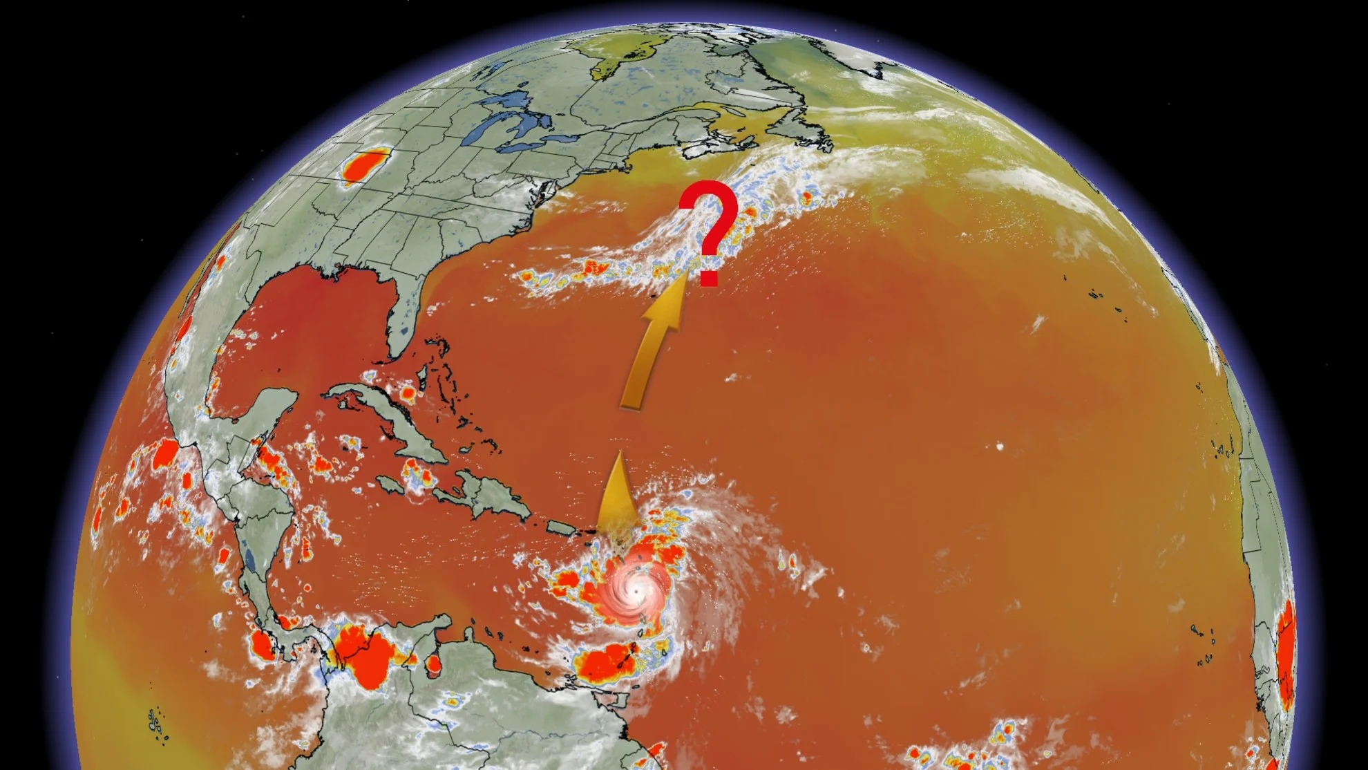
Ernesto developed as a tropical storm on Monday and will continue to organize and strengthen as it passes by the Lesser Antilles on Tuesday and Wednesday. On the forecast track, Ernesto is expected to move across portions of the Leeward Islands, and near or over the U.S. and British Virgin Islands and Puerto Rico by Tuesday evening. After passing Puerto Rico and the Virgin Islands, Ernesto is forecast to turn northward over the western Atlantic.

Maximum sustained winds near 65 km/h were reported Tuesday morning.
Gradual strengthening is expected over the next few days, and Ernesto could reach hurricane status over the waters north of the Greater Antilles by Thursday.
SEE ALSO: Six ways the weather can scar, shift, and snap the Earth itself
According to the U.S. National Hurricane Center (NHC), Ernesto is expected to produce total rain accumulations of 100-150 mm over portions of the Leeward and Virgin Islands. For Puerto Rico, 75-150 mm of rainfall is expected, with maximum amounts of 250 mm possible.
Large and destructive waves generated by Ernesto are forecast to affect portions of the Leeward Islands.
"These swells are likely to cause life-threatening surf and rip current conditions," warns the NHC.
Eyes on Canadian impacts
Forecasters are currently tracking the northward movement of the storm, with possible impacts to parts of Atlantic Canada in the long range.
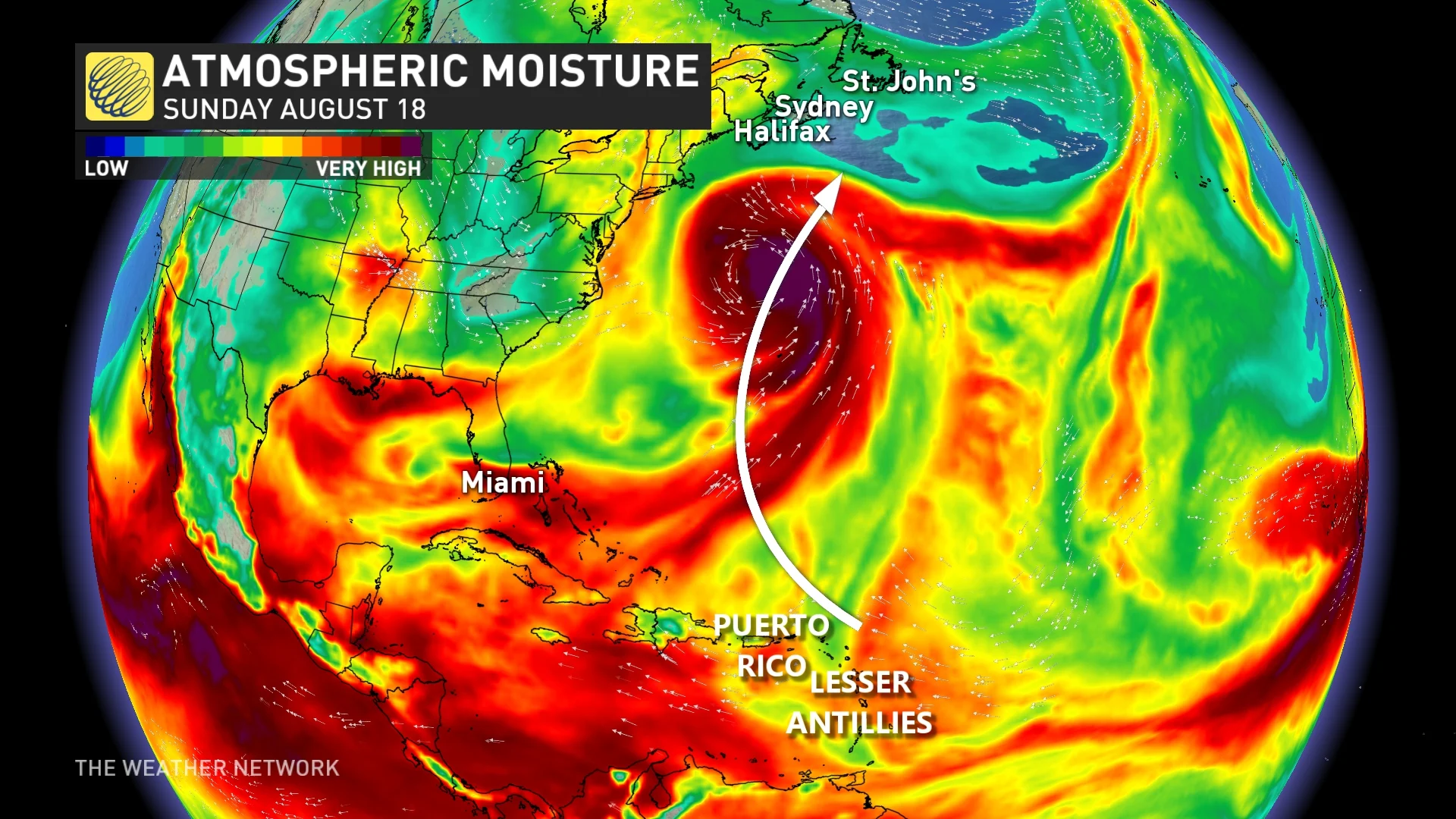
While it's still far too early to say, some long range models do suggest that Ernesto could pass near enough to the Canadian East Coast to bring heavy rainfall early to mid next week. Most models do have the storm recurving out to sea before reaching Atlantic Canada.
Regardless, this storm will certainly be one to watch this week, so continue to back as forecast details become clearer.
Stay tuned to The Weather Network as Ernesto continues to strengthen in the Caribbean.