Toronto, Ottawa, unlikely to hit 30°C at all this August

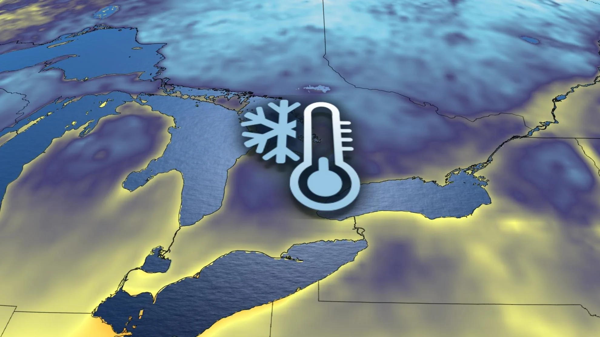
There will be a lack of late summer heat across most of Central Canada for the remainder of August, with major cities like Toronto, Ottawa and Montreal unlikely to reach 30°C at all this month. Quite the formidable feat!
The same heat dome broiling much of the United States and steering Hilary’s historic rains in Southern California will help bring a spell of unseasonably cool weather to parts of Ontario later this week. Some moisture from the remnants of Hilary will also see rain showers spread across parts of the region through the mid-week mark.
See also: Historic storm meets historic fires, but B.C. flames will not be quenched
It’s been more of a humid summer than hot for much of Ontario so far this season.
Look no further than the fact that several major cities have failed to hit 30°C so far this month—and they’ll likely make it to September without hitting the mark, either.
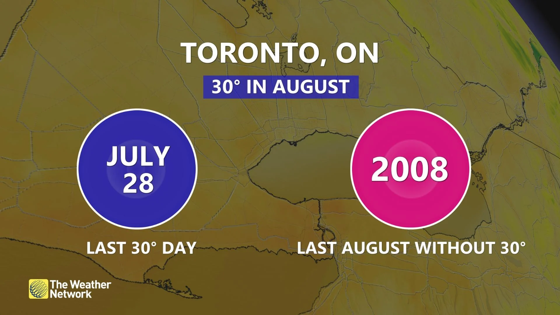
Both Toronto and Ottawa are likely to get through the entire month of August without a 30-degree reading. For Toronto, that will be a first since 2008.
The warmest temperature measured so far this month in downtown Hamilton was 28.9°C, which is on track to be the lowest high temperature ever recorded there during the month of August, with records stretching all the way back to 1866.
Ottawa International Airport will likely make it through the month with warmest reading coming in at just 28.3°C, which would be a record for the lowest high temperature there, as well.
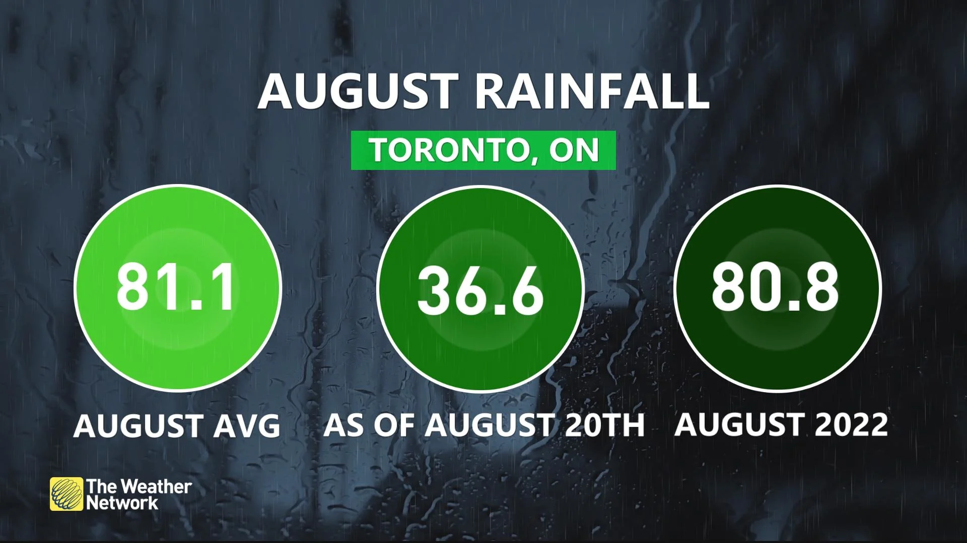
Even with the cooler temperatures, the heightened humidity fuelled heavy rains across parts of Ontario this summer, especially toward the National Capital Region. We’ve finally pumped the brakes on the deluges, and Toronto is on track to see below-normal precipitation this August.
DON'T MISS: Why does your long-range forecast change so often?
A look ahead in the forecast shows the taste of fall coming our direction later in the weekend.

We’ll see a potent upper-level trough kick down from Hudson Bay and swoop into Ontario, settling into the region with the help of the long-duration heat dome parked over the United States. There are signs that the trough will remain in place through the end of August.
Warm and humid weather should reach into the Greater Toronto Area (GTA) by Friday, though temperatures will be closer to seasonal for eastern Ontario and southern Quebec.
Cooler and less humid weather will span the region through the later half of the weekend, with temperatures on the cool side of seasonal. Daytime highs will likely struggle to climb much above the lower 20s on the coolest days to come, with overnight lows dipping into the single digits in rural sections of southern and eastern Ontario.
There is some indication, however, for a warmer pattern to develop during early September, so it's not time to write off the summer season just yet.
Stay with The Weather Network for the latest on conditions across Ontario.