Three big snow events close out November across Canada
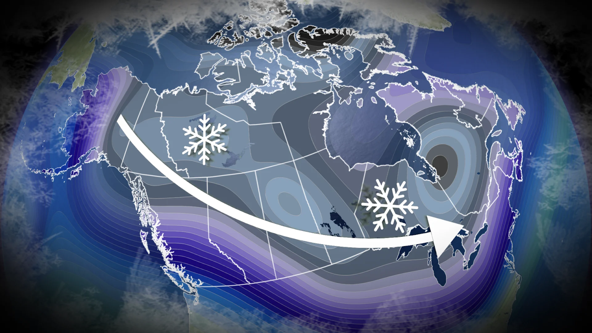
An active and cold pattern has settled in from coast-to-coast across Canada. Many Canadians will see big snow events through these final days of November, ending the month with a bang
Autumn across Canada seemed to be on a delay this year, sparking concern for the upcoming winter’s timeline. But, as we enter the final days of November, winter weather has already started to grip Canadians across the country.
Last week, three low-pressure systems targeted the country, bringing a damaging bomb cyclone to British Columbia, a snowstorm to the Prairies, and a messy winter mix to Atlantic Canada.
Now, a similar scenario is about to play out this weekend, with three more low-pressure systems bringing a burst of winter weather to Canadians from coast-to-coast.
If you’ve been waiting for a signal of winter to put on your winter tires, this may be it.
DON'T MISS: The deadliest risk Canadians take each winter
Parts of Atlantic Canada get their first hefty dose of winter weather
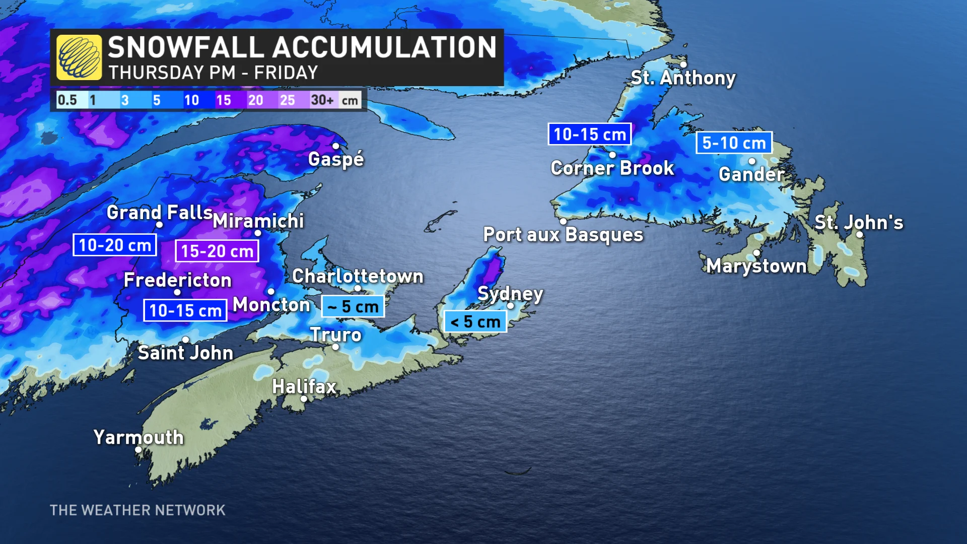
A Colorado low tracking along the New England coastline will make its way up the Bay of Fundy and into the Gulf of St. Lawrence by Friday.

The intensifying low will bring 10-20 cm of wet snow across New Brunswick and 5-10+ cm to Newfoundland through Friday, paired with gusty coastal winds.
Environment and Climate Change Canada (ECCC) issued a widespread snowfall warning across New Brunswick on Thursday morning. Les Suêtes wind warnings were also issued along the northwestern coast of Cape Breton.
SEE ALSO: How to make your own windshield washer fluid using simple ingredients
Snow squall warnings issued around the Great Lakes
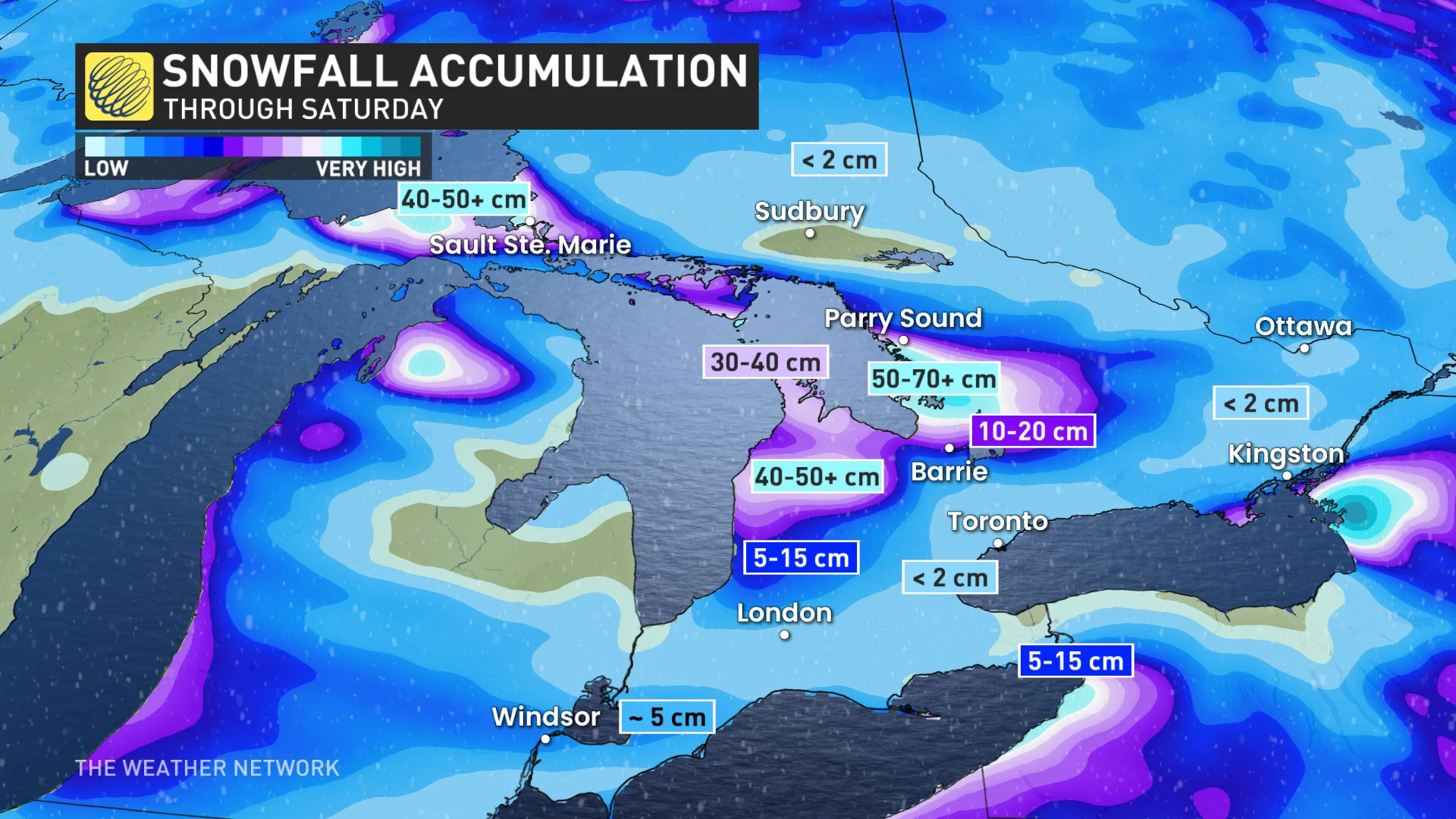
A blast of cold polar air will fuel significant lake-effect snow across Ontario's Great Lakes. Streamlined winds will also generate persistent snowsqualls along the snowbelts and around Sault Ste. Marie.

SEE ALSO: Get winter-ready: How to prepare your vehicle for the cold weather ahead
Snow squall warnings and watches have been issued for these regions, with ECCC warning drivers to expect possible road closures, especially in areas affected by multiple snow squall bands.
A shift in winds could also bring a few snowflakes to the Greater Toronto Area, which would be the first flakes of the season for the region; however, it remains highly uncertain as to whether that will play out.
WATCH: Snow squalls are back in Ontario, tips for driving in this dangerous weather
Western Canada sees a bout of classic winter weather
After multiple damaging fall storms impacted the B.C.’s coast this month, the province will be seeing a setup more indicative of winter to end the month.
Temperatures will plunge and persistent snow will pour across the north coast of B.C. and the northern Rockies this weekend. The Alpines may see over 50 cm of snow, with 10-20 cm affecting the Yellowhead highway, including Prince George.
We could see temperatures in the north dip into the minus 30s.
The central coast of B.C. will be receiving a deluge of heavy rains in lieu of the snow as temperatures gradually shift towards seasonal heading southward.
Snowfall will escape into Alberta too, affecting Grande Prairie and Edmonton on-and-off throughout the weekend.
Since temperatures are already so cold on the Prairies thanks to an Arctic cold snap, the snowfall will be fluffy but will blow around easily and accumulate much more than the snow in Eastern Canada will.
A region of high pressure south of the border will spare southern regions of Western Canada from this wintry blast, but the relief may not last long as we look ahead to a parade of clippers shaping up to impact the Prairies for the first half of December.
