Snowy, windy system to make for difficult, wintry travel in Atlantic Canada
A low-pressure system tracking through the U.S. Northeast will move into Atlantic Canada soon, bringing impactful snow to some cities.
The unsettled pattern will continue across much of Atlantic Canada this week, keeping the region stuck in a stubborn and gloomy cycle.
This comes after parts of the East Coast saw minimal precipitation in much of this fall, resulting in lower-than-normal water levels in Lake Major.

RELATED: Parts of Atlantic Canada actually in need of the weekend rain
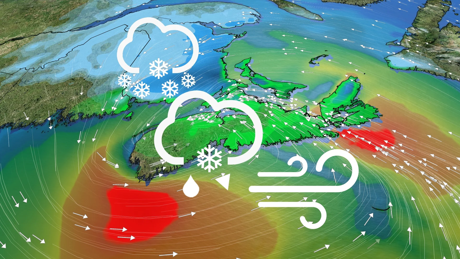
The next scenario will come from a forthcoming Colorado low, which is expected to become a messy storm as it intensifies and tracks into Atlantic Canada late Thursday. Some areas can expect a decent amount of snow and/or wind, so expect some potential travel troubles and leave extra time if you're headed anywhere.
This week:
A low-pressure system tracking through the U.S. Northeast will move into Atlantic Canada, bringing some accumulating snow to the region.

DON'T MISS: Canada's 2025 Winter Forecast
The low will track in late Thursday with some rain initially, but during the overnight hours and into Friday morning, a good chunk of the Maritimes will see transition to snow.
Southwestern Nova Scotia and the southern shores look to just see rain for the system.
With the low set to track over the middle of Nova Scotia, the winter weather story will be confined to New Brunswick and P.E.I.
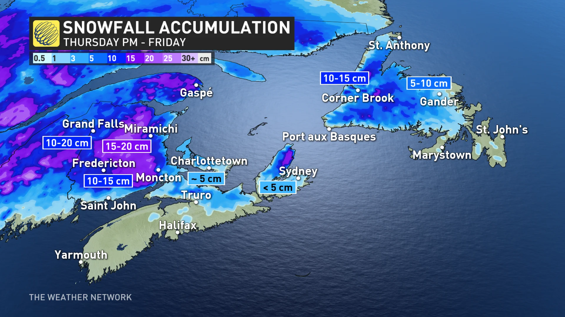
A northeasterly wind off the Gulf of St. Lawrence will take a chunk out of accumulations for P.E.I. and eastern New Brunswick shores, with less than 5 and 10 cm expected, respectively. Higher amounts will be inland in New Brunswick, where 10-20 cm is possible in some locales.
Cold air and high precipitation rates should be sufficient to keep the snowfall for the majority of the time for the Highway 2 corridor including Moncton, Fredericton, Woodstock and Grand Falls, N.B.
Rain is expected for the Avalon Peninsula, a mix for central areas, and snow is anticipated for western N.L, although not as much moisture will make it to the island.

From Thursday night until Friday morning, there will be 70-90 km/h periodic wind gusts along the shorelines of the Maritime provinces.
Strongest gusts will be saved for the southern shore of Newfoundland, with winds reaching 80-100 km/h from the southern Avalon Peninsula to Port aux Basques, N.L.
A colder pattern will develop across the region during early December, and persist well into the second week of the month.
WATCH: Moncton, N.B., under a snowfall warning
Stay with The Weather Network for all the latest on conditions across Atlantic Canada.


