Wildfire threat remains high as temperatures begin to dip in B.C.
Extremely dangerous fire conditions will persist in B.C. this week, despite slight relief in extreme temperatures.
Hundreds of wildfires are burning across B.C. as a potent heat wave continues across the province, but the hot temperatures will begin to ease soon.
Evacuation orders and alerts continue for many residents in wildfire- stricken B.C. as hot and dry conditions exacerbate the danger and battle efforts.
Stay with The Weather Network’s wildfire hub for the latest on fires across B.C. and around Canada
Hazardous air quality and high heat will also continue to threaten the health and well-being of vulnerable people across B.C.
Hundreds of fires burning across B.C., air quality remains poor for some
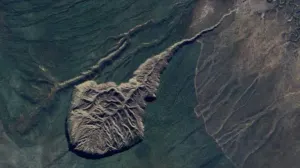
The B.C. Wildfire Service reported 354 active wildfires across British Columbia as of Monday evening, with 71 of those fires starting within the past 24 hours. Officials are battling several wildfires of note across the province.
Sunday yielded 20,000 lightning strikes across B.C., with Monday’s storms delivering thousands more, initiating more wildfire activity. The good news is that lower lightning activity is forecast across the province on Tuesday.
Dangerous fire conditions will continue into Tuesday with low relative humidity, gusty winds and warm temperatures continuing.
DON’T MISS: Out of control, held, out — What the stages of wildfire mean
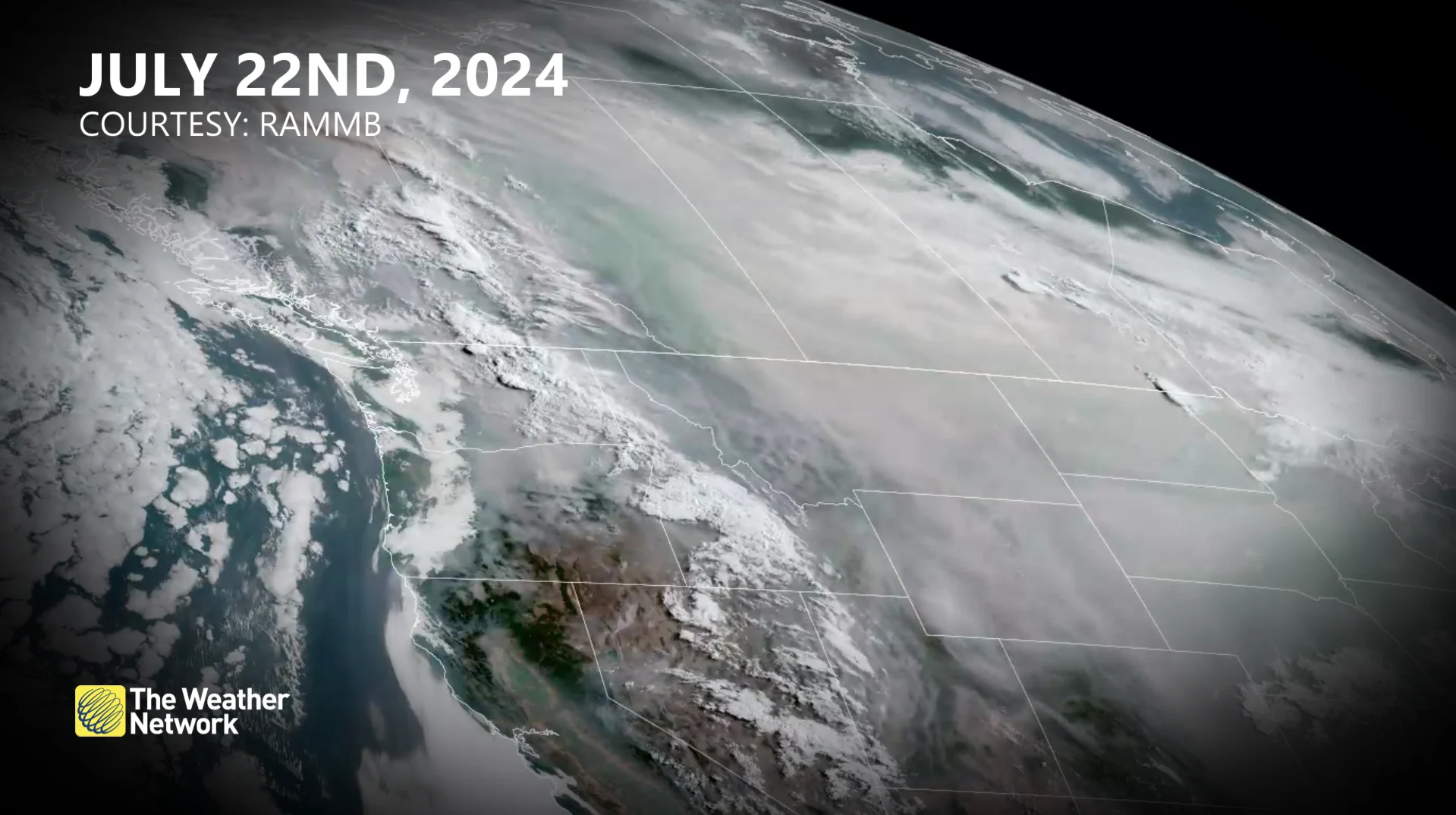
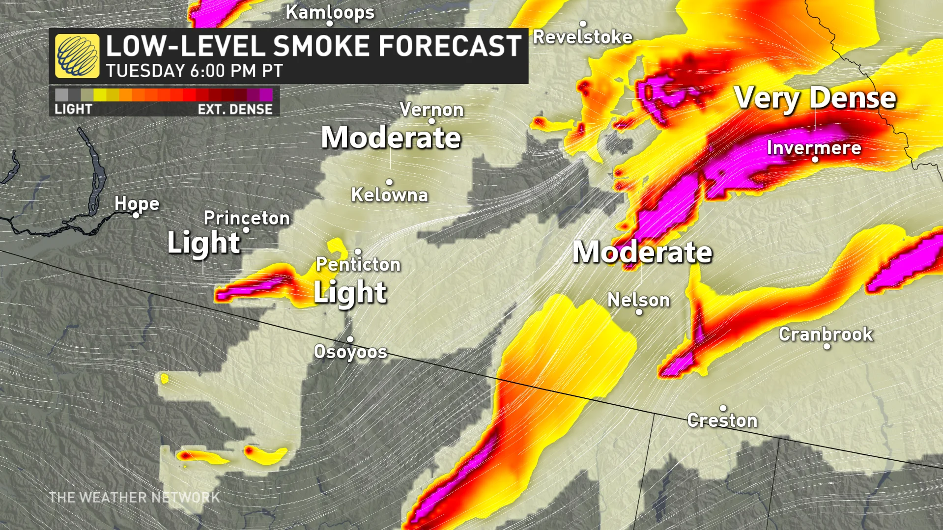
Air quality will remain extremely poor and downright dangerous for communities near ongoing wildfires. Widespread smoke across B.C. will make for periods of hazardous air quality for the region, including for portions of the Lower Mainland at times.
A westerly wind shift should improve air quality across the Okanagan Valley and the Thompson-Nicola Regional District, but regions downstream of fires in southeastern B.C. can still expect locally poor air quality.
WATCH: Rapid wildfire growth threatens British Columbia
Heat warnings persist, but temperatures begin to moderate
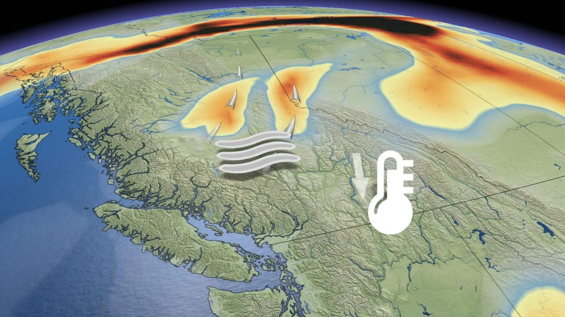
Temperatures will remain in dangerous territory for many communities this week as a significant ridge of high pressure remains firmly in place over Western Canada.
SEE ALSO: Best practices to keep yourself safe from wildfire smoke
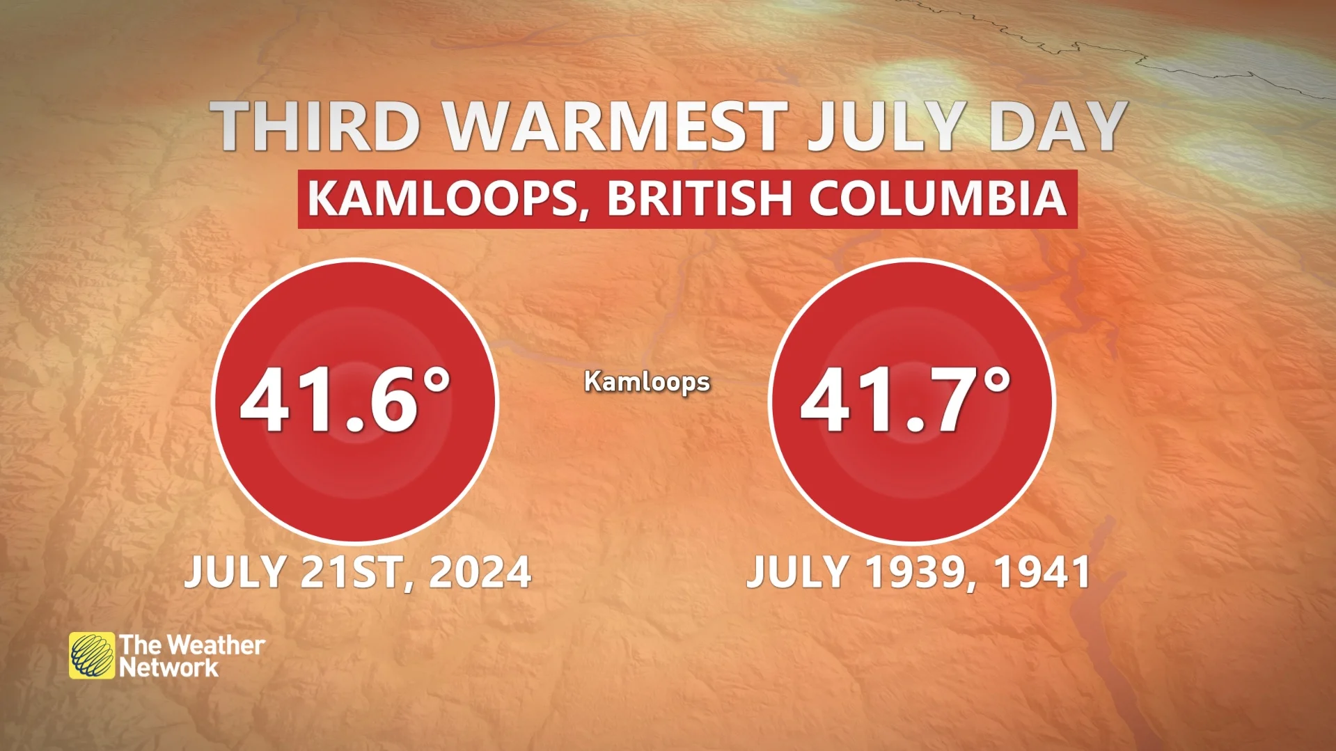
This spell of heat has sent temperatures throughout the B.C. Interior soaring into the lower 40s for some communities including in Kamloops.
RELATED: Wildfires rage across Western Canada, smoke pollution sweeps into Ontario, U.S.
Widespread heat warnings remain in effect for this bout of dangerously hot temperatures.
“Check on family, friends and neighbours, who are at higher risk, particularly if they live alone, to make sure they have a cool space," Environment and Climate Change Canada said in its heat warning.

Osoyoos recorded its 18th day in a row above 35°C, a likely all-time record for a Canadian city.
Residents in the Interior will feel slight relief from the 40-degree heat on Tuesday as a Pacific trough will usher in cooler air, dropping Tuesday's highs to the low 30s.
We won’t begin to see significant relief until later in the week when the ridge of high pressure slides east across the Prairies. Temperatures in the Interior will begin to fall by Wednesday, finally putting an end to this remarkable heat wave that’s roasted the region.
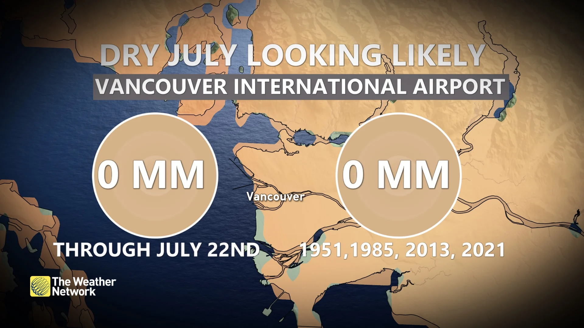
Vancouver International Airport is still waiting for rainfall this July, with 0 mm recorded through the first few weeks of the month. The city's best chance at seeing any rainfall this month will be on Thursday, with a 40 per cent probability of precipitation.
Rainfall warnings issued in parts of northern B.C.
For parts of northern B.C., some rain relief is on the way.
An upper-level low will swing onto the coast bringing some widespread rain through the midweek. Some rain is also expected along the central coast on Tuesday, and will continue to spread inland. Unfortunately, the southern Interior will likely see little rainfall accumulation.
Rainfall warnings have been issued for parts of B.C.'s far north, including Cassiar Mountains and Dease Lake.

While the rain will be much-needed throughout these burned areas, heavy rainfall could lead to a risk for flooding in the area -- a phenomenon known to happen when soil is heated so much that it can no longer absorb water.
Additionally, the north will also see a thunderstorm risk on Tuesday, which poses the threat of lightning striking up more fires.
Despite the falling temperatures and rain, smoke and wildfires will remain a concern with little to no rain in the forecast for the remainder of July.
Stay with The Weather Network for all the latest on conditions across British Columbia.