Long weekend plans in jeopardy for some Canadians amid storm potential
Many folks across Canada looking for a midsummer getaway may run into stormy skies this long holiday weekend
The August holiday weekend has arrived, giving folks an opportunity to relax and travel before the summer slowly winds down.
It’s been a stormy couple of weeks across the country, with disturbances sweeping from coast to coast with persistent waves of storms.
What can we expect this weekend? Most folks will dodge the worst conditions, but forecasters are keeping their eye on a few areas that could see rough weather in the days ahead.
DON'T MISS: Humans have already used more resources than the world can restore this year
Muggy air, storm risk in the East
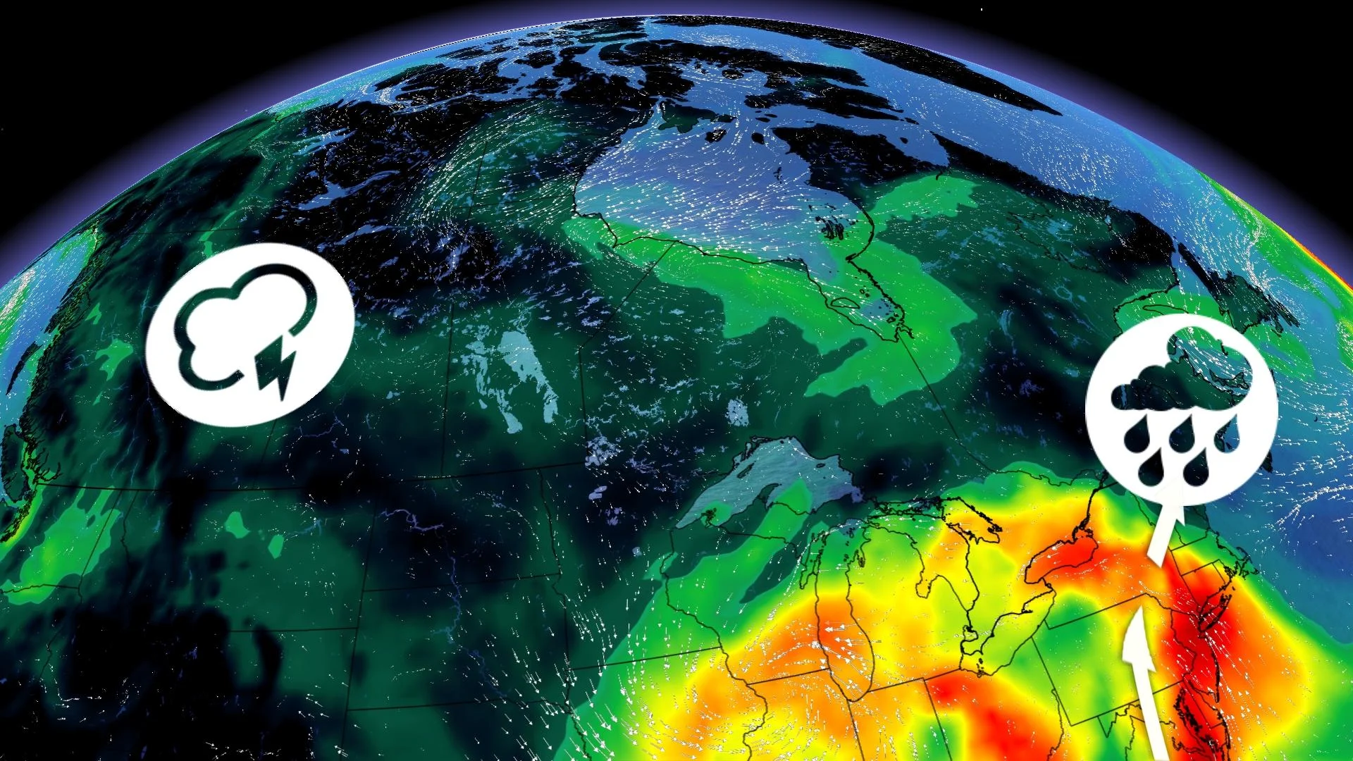
The eastern half of the country will face several opportunities for thunderstorms over the next couple of days, culminating in the potential for severe weather around the Great Lakes on Monday.

Our first storm risk arrives in Quebec and the Maritimes during the day Saturday. The same low-pressure system that brought very large hail to parts of Ontario on Thursday is still moseying through the region as we kick off the weekend.
We’ll see warm and muggy conditions spread over much of Eastern Canada on Saturday, which will fuel a risk for thunderstorms throughout eastern Quebec, all of New Brunswick, most of Prince Edward Island, and across Nova Scotia along and west of Highway 102.
A few of the storms that bubble up on Saturday could produce strong wind gusts, small hail, and heavy rainfall. Localize flooding is also a potential hazard in parts of Nova Scotia.
The weekend’s gloomiest weather is likely to fall across Newfoundland, where a chance of showers on Sunday and Monday will accompany temperatures falling 5 to 10 degrees below seasonal for early August.
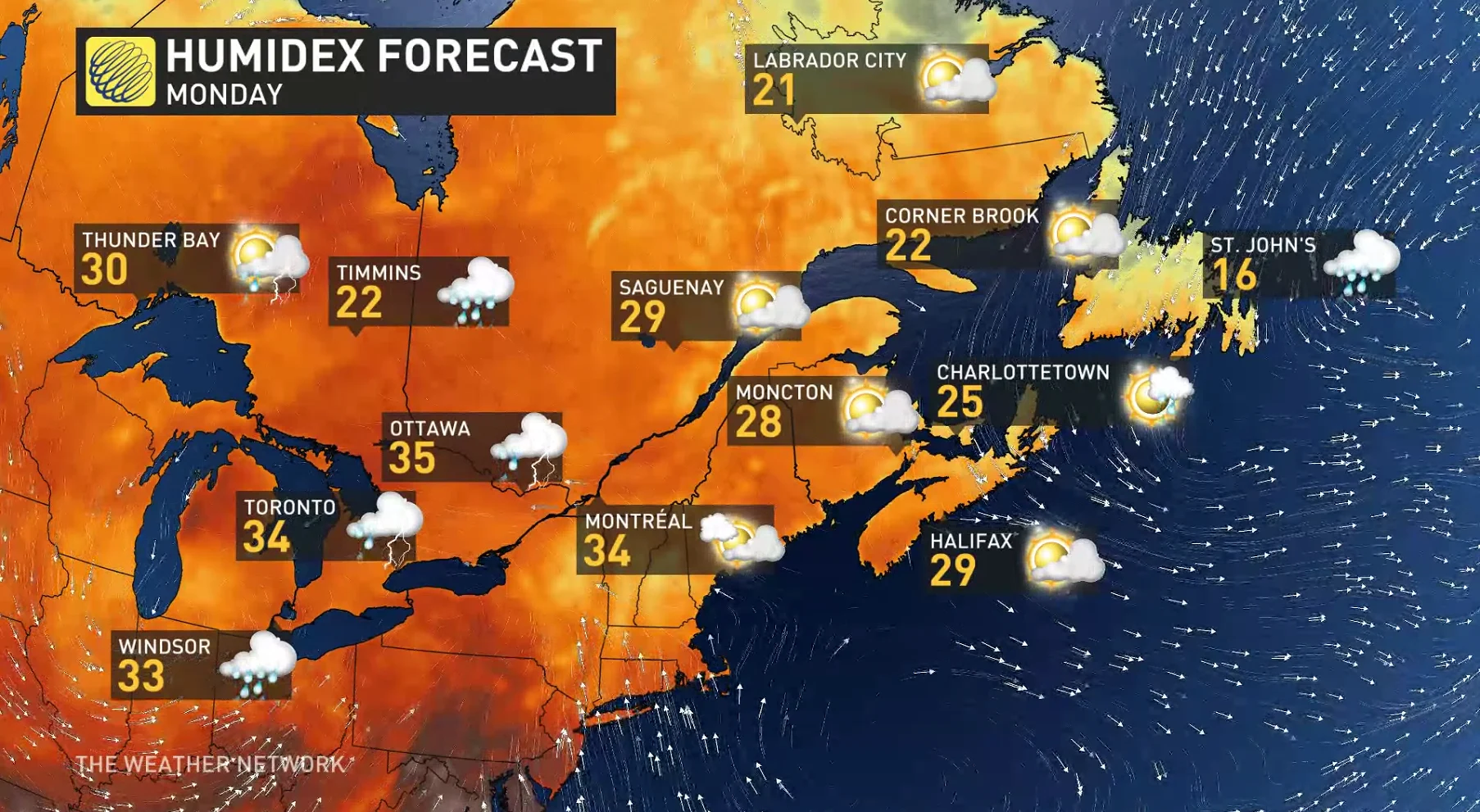
All eyes turn toward the Great Lakes by Monday.
Winds blowing from south of the border will shuttle warm and humid air into Ontario and Quebec on Monday. It’s going to feel pretty sticky for anyone hoping to spend some time outside, with humidex values climbing into the mid-30s in southern Ontario.
A sharp upper-level trough will swing into the eastern Great Lakes to start the week. This lift, combined with the instability of that muggy air parked over the region, could spark the risk for severe weather during the day on Monday.
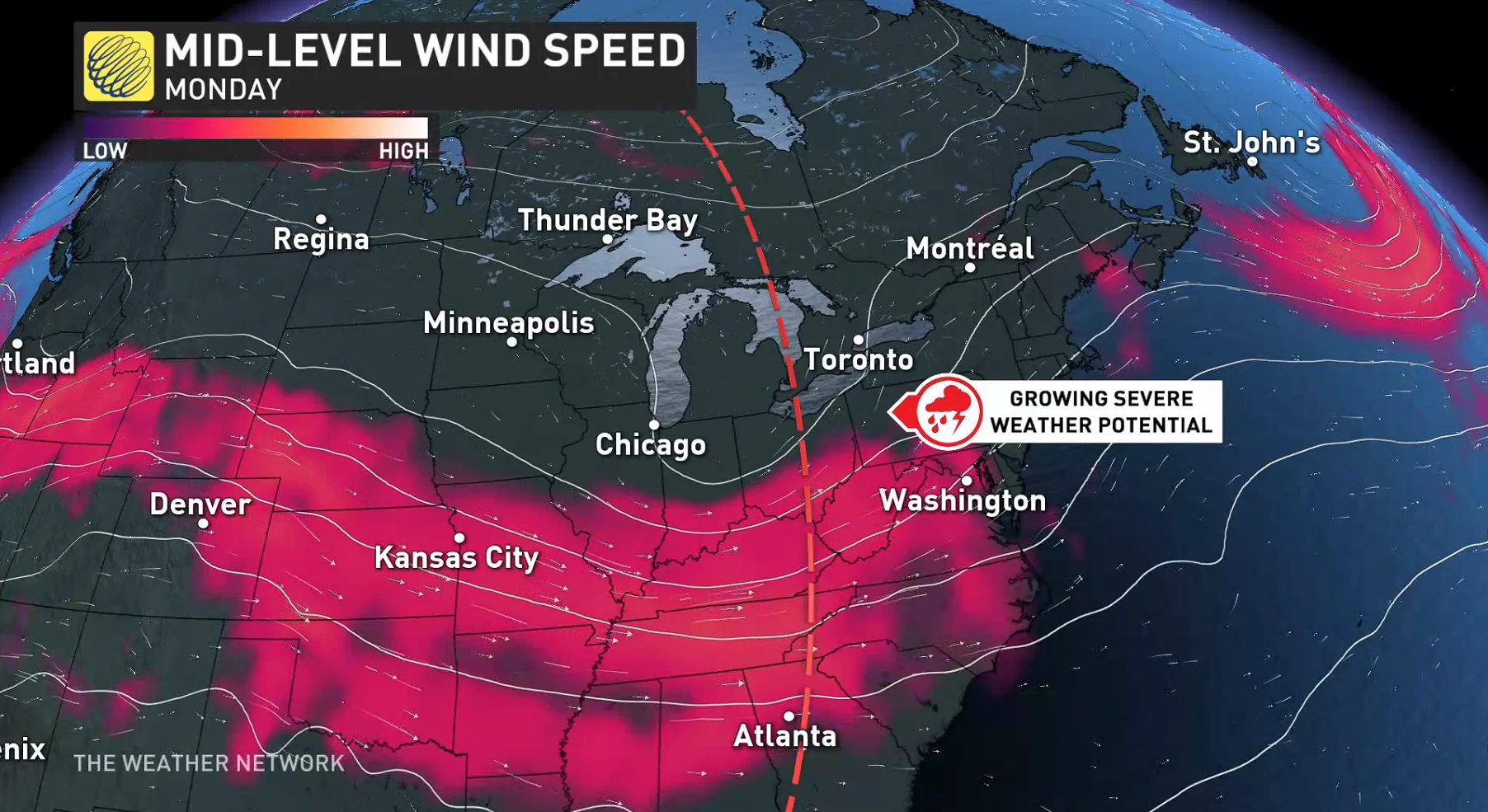
It’s far too early for specifics on the precise timing, type, or location of any severe storms, but forecasters see the hallmark ingredients for strong storms with a setup like this.
Folks who are camping and spending time at cottages should have a severe weather plan in mind, knowing where to go and what to do if severe weather threatens your location. Have a way to get severe weather warnings the moment they’re issued, and make sure you keep your electronics charged in the lead-up to Monday’s storm potential.
WATCH: Three things to know about this weekend's weather in southern Ontario
Warm temperatures and much-needed rain chances in the West
Some good news is on the way for folks across British Columbia’s Interior hoping for a touch of much-needed precipitation.

Saturday will start off on a warm note across Western Canada, with humidex values climbing into the 30s all the way down to the B.C. coast.
A system south of the border should track close enough to B.C. that we’ll see rounds of beneficial rainfall developing across the region on Sunday and Monday, which will also provide some relief from Saturday’s warmer temperatures.

Visit The Weather Network's wildfire hub to keep up with the latest on the active wildfire season across Canada.
The rains should bring some aid to areas that need help controlling the wildfires burning across the region. Until those fires wane, on-and-off smoky conditions are likely to continue throughout the Interior—especially in valleys—especially through the evening hours each day this weekend.
Most of the Prairies will escape the active weather this long weekend. Warmer-than-normal temperatures will persist across the region, along with ample sunshine for cookouts, hikes, and everything in between.
Stay with The Weather Network for the latest conditions this long weekend.


