Severe storm threat lingers over the Prairies as many areas deal with floods
A lingering storm threat hangs over the Prairies, as a strong stateside system takes its time tracking through the region. Heavy rain will persist into Thursday, with the risk for more severe storms to bubble up
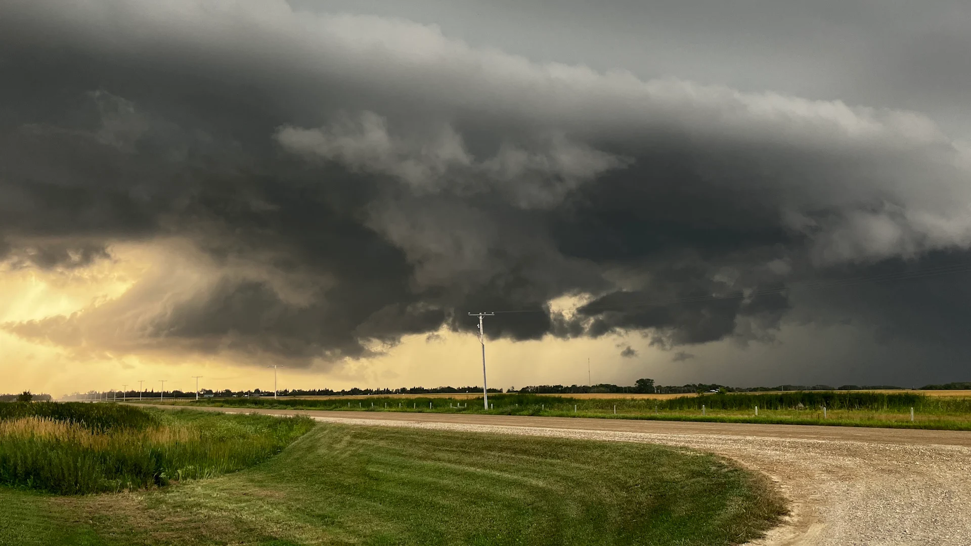
Back-to-back storm days have spanned much of the Prairies and parts of northwestern Ontario this week, with periods of flooding rain, strong winds, and even tornado warnings popping up to start the week.
Parts of southern Manitoba have already picked up more than 150 mm of rain, with the hardest-hit areas of Saskatchewan in line for significant totals into Thursday, as well. That's as a potent stateside system slowly moves its way eastward over the region.
SEE ALSO: Don’t fall victim to these seven dangerous tornado myths
As peak rainfall rates intensify on Wednesday, the deepening low will also create strong, northwesterly wind gusts across Alberta and Saskatchewan. There's the potential for more severe storms to spark up east of the centre of the low, as well, with parts of eastern Saskatchewan and southern Manitoba in line for the worst of the stormy conditions into Thursday.
It will be important to pay close attention to the latest alerts in case severe weather occurs. Have a plan in place to seek safe shelter in case severe weather threatens your home, your office, or while you’re driving.
Wednesday:
Peak rainfall rates will pick up through Wednesday afternoon, with the heaviest rain expected in southwestern Saskatchewan.
The deepening low will also create strong, northwesterly wind gusts across Alberta and Saskatchewan, with gusts up to 70 km/h possible throughout the day.

The potential for severe storms will bubble up east of the centre of the low, with the cold front extending south into the Dakotas. While the thunderstorm threat will be lingering throughout much of the day, the strongest storms will develop during the late afternoon and evening hours across eastern Saskatchewan and southern Manitoba.
Large hail and strong wind gusts are the main threats with storms that develop, with the small chance of a tornado. While it's low, it's a non-zero risk.

Visit our Complete Guide to Fall 2024 for an in depth look at the Fall Forecast, tips to plan for it and much more!
Thursday:
The low will continue to track to the northeast on Thursday, with the rain gradually easing across the Prairies. By the time all is said and done, between 50-100+ mm of rain could fall in some of the hardest-hit areas of central and southwestern Saskatchewan. Parts of southern Manitoba are already dealing with significant flood waters.

Thunderstorms will once again develop for northwestern Ontario on Thursday, with multiple rounds expected throughout the day.
Large hail, and the potential for damaging wind gusts are possible in areas that see the severe storms develop.

Flooding rains hit southern Manitoba
The heavy rain over the past couple of days has inundated parts of southeastern Manitoba, with backbuilding thunderstorms producing significant amounts. Localized flooding has been reported in many communities.
RELATED: Manitobans wade through flooded streets, basements after massive downpour
According to Environment and Climate Change Canada (ECCC), Elma, a community in the Whiteshell area of eastern Manitoba saw 205 millimetres in just a 36-hour period. Meanwhile, 155 mm of rain has been recorded in the city of Steinbach between Monday and Tuesday.
With more rain and thunderstorms in the forecast, the ground will be unable to absorb additional downpours.

Another system will track from west to east across the Prairies on Friday and into the weekend, and while it's not expected to be as strong or moisture-packed, it will still keep most of the region well watered, especially central and southern Manitoba.
A quick shot of chilly weather will spread across the region behind the weekend system, knocking temperatures below seasonal for a day or two, then trending back warmer for most of next week.
WATCH: Canada's 2024 Fall Forecast: Fewer storms and warm weather ahead
Thumbnail courtesy of Cindy Cairns/Maryfield, Saskatchewan.