Saskatchewan’s impressive late-season chill is coldest since 1966
Temperatures came in nearly 15 degrees below seasonal across Saskatchewan as a pattern more common of late winter descended on the Prairies
Saskatchewan felt a remarkable late-season chill this week as many communities saw daytime high temperatures colder than a seasonal low temperature for this time of year.
The statistics are impressive.
DON’T MISS: What is cloud seeding? How scientists hope to generate rain
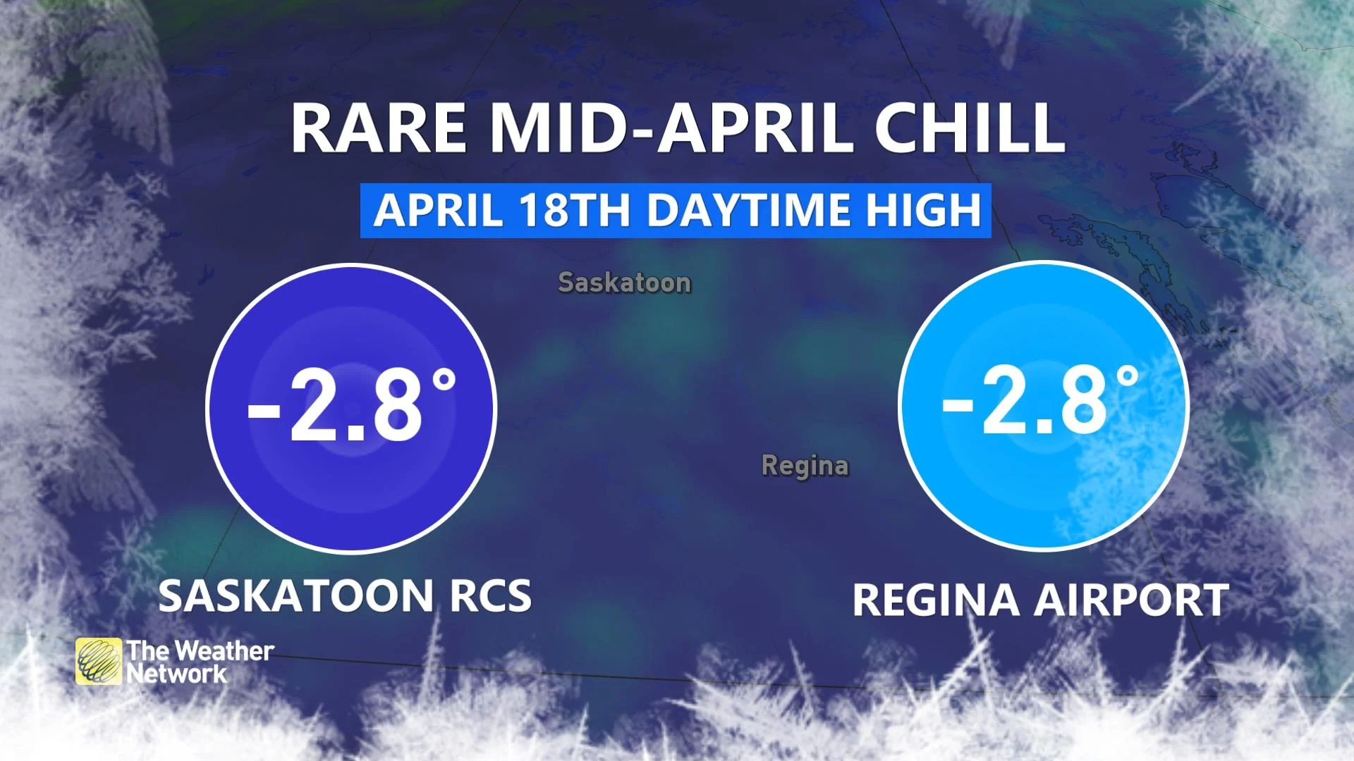
Saskatoon and Regina both notched a daytime high temperature of -2.8°C on Thursday.
For reference, folks across the southern half of Saskatchewan would expect to see a seasonal daytime high of about 12°C with an overnight low of about -2°C.
It’s tough this time of year to see daytime temperatures barely climb to the level of a normal nighttime reading.
MUST SEE: Severe storms in China unleash cherry blossom blizzard, large hail
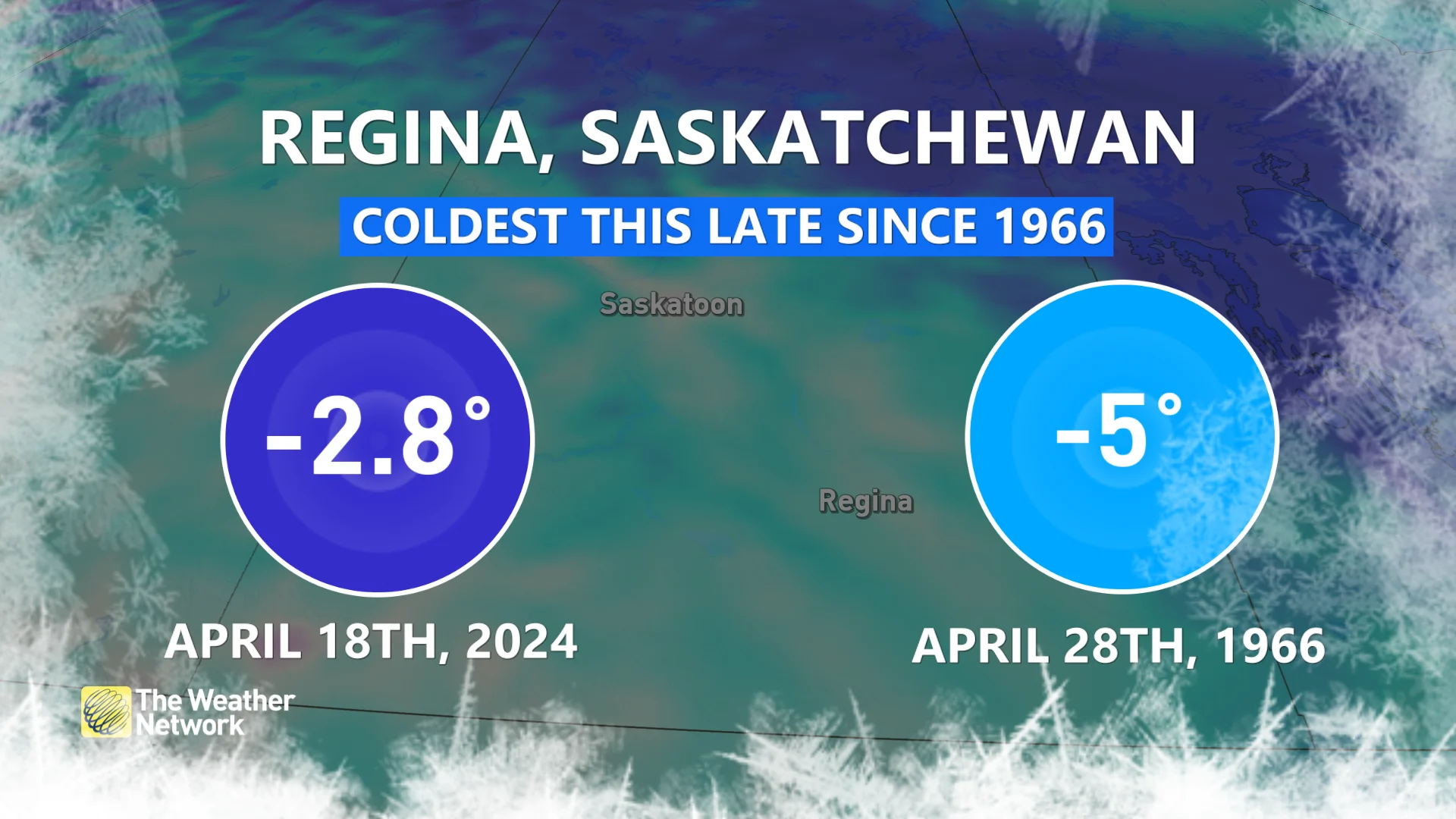
In fact, Thursday’s subfreezing high in Regina was the city's coldest temperature recorded this late in the season since a frigid late-April day back in 1966.
A ridge of high pressure parked over Western Canada helped funnel chilly air straight down from the Arctic, allowing the below-seasonal temperatures to settle over Saskatchewan to end the week.
Extremes don’t linger forever, and the cold pattern is on its way out in a hurry.
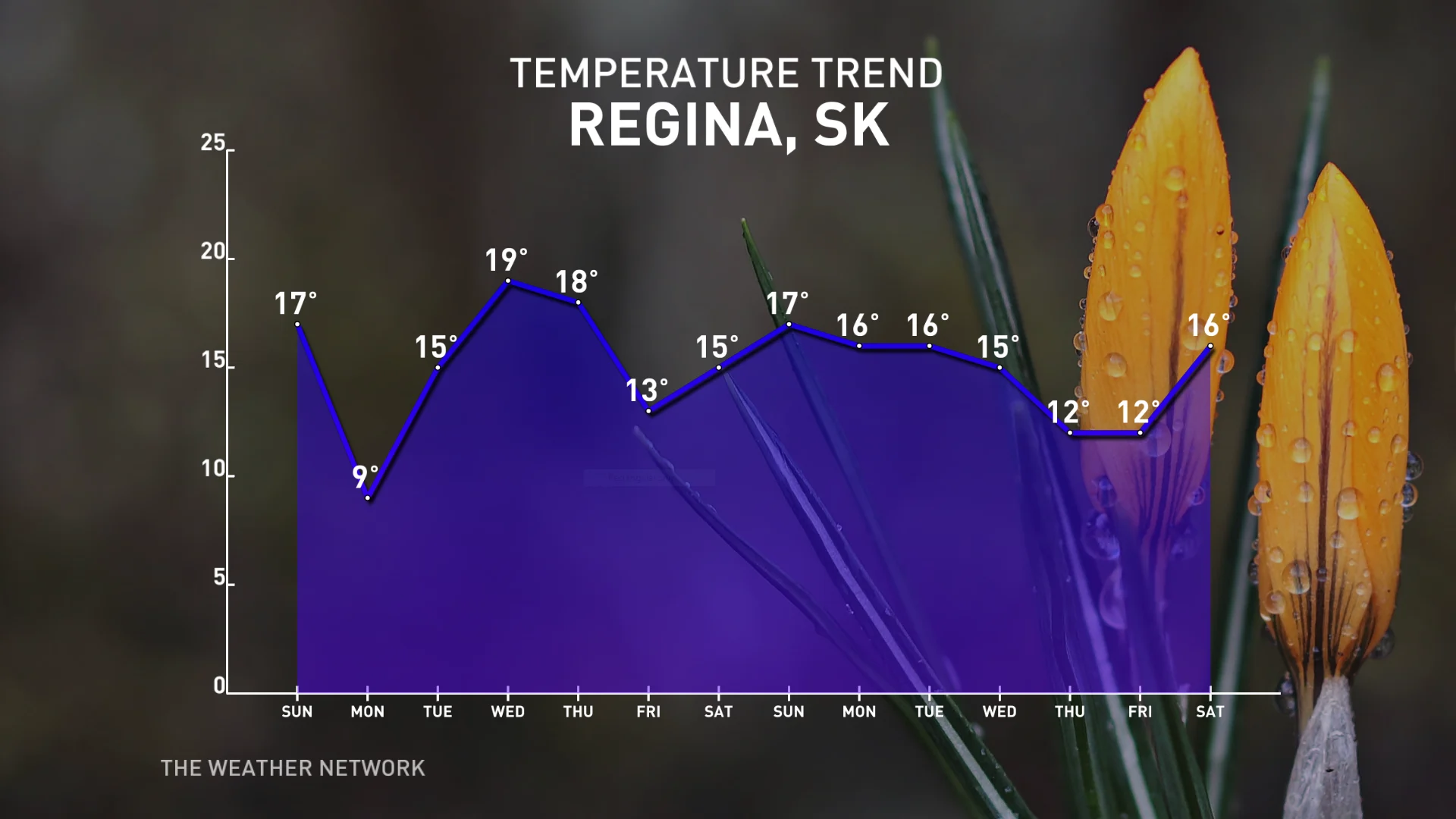
The same ridge in the jet stream that allowed the frosty temperatures to move over the central Prairies will slide south of the border this weekend. By next week, winds out of the southwest will drag warmer conditions into Saskatchewan.
Temperatures will rebound in style by Sunday as Regina expects a high of 17°C. Cooler conditions briefly arrive to start the week before bouncing firmly into the double-digits through the end of the month.
WATCH: What will the change to La Niña mean for Canada's summer?
Thumbnail courtesy of Getty Images/gretanrk/603861744-170667a.


