'Life-threatening' conditions for the Gulf Coast with Francine landfall looming
Tropical Storm Francine moves across the western Gulf of Mexico, with widespread tropical storm, hurricane, and storm surge warnings in effect
All eyes are on Tropical Storm Francine, with dangerous conditions threatening the Gulf Coast prompting evacuations ahead of expected landfall on Wednesday.
Visit The Weather Network's hurricane hub to keep up with the latest on tropical developments in Canada and around the world
A hurricane warning has been issued for the Louisiana coast from Sabine Pass eastward to Grand Isle, among many other alerts including storm surge and tropical storm watches and warnings, as well.
As of Wednesday morning, Francine swirled about 690 km southwest of Morgan City, Louisiana, with maximum sustained winds of 100 km/h.
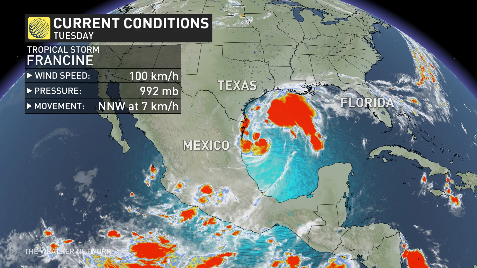
Francine strengthened to tropical storm status on Monday under the influence of very warm waters in the western Gulf, as well as low vertical wind shear.
According to the U.S. National Hurricane Center (NHC), Francine is expected to be just offshore of the coasts of northeastern Mexico and southern Texas through Tuesday afternoon, and then move across the northwestern Gulf of Mexico, making landfall in Louisiana on Wednesday.
After landfall, the centre is expected to move into Mississippi on Wednesday night or Thursday, the NHC says. Francine is expected to weaken quickly after landfall
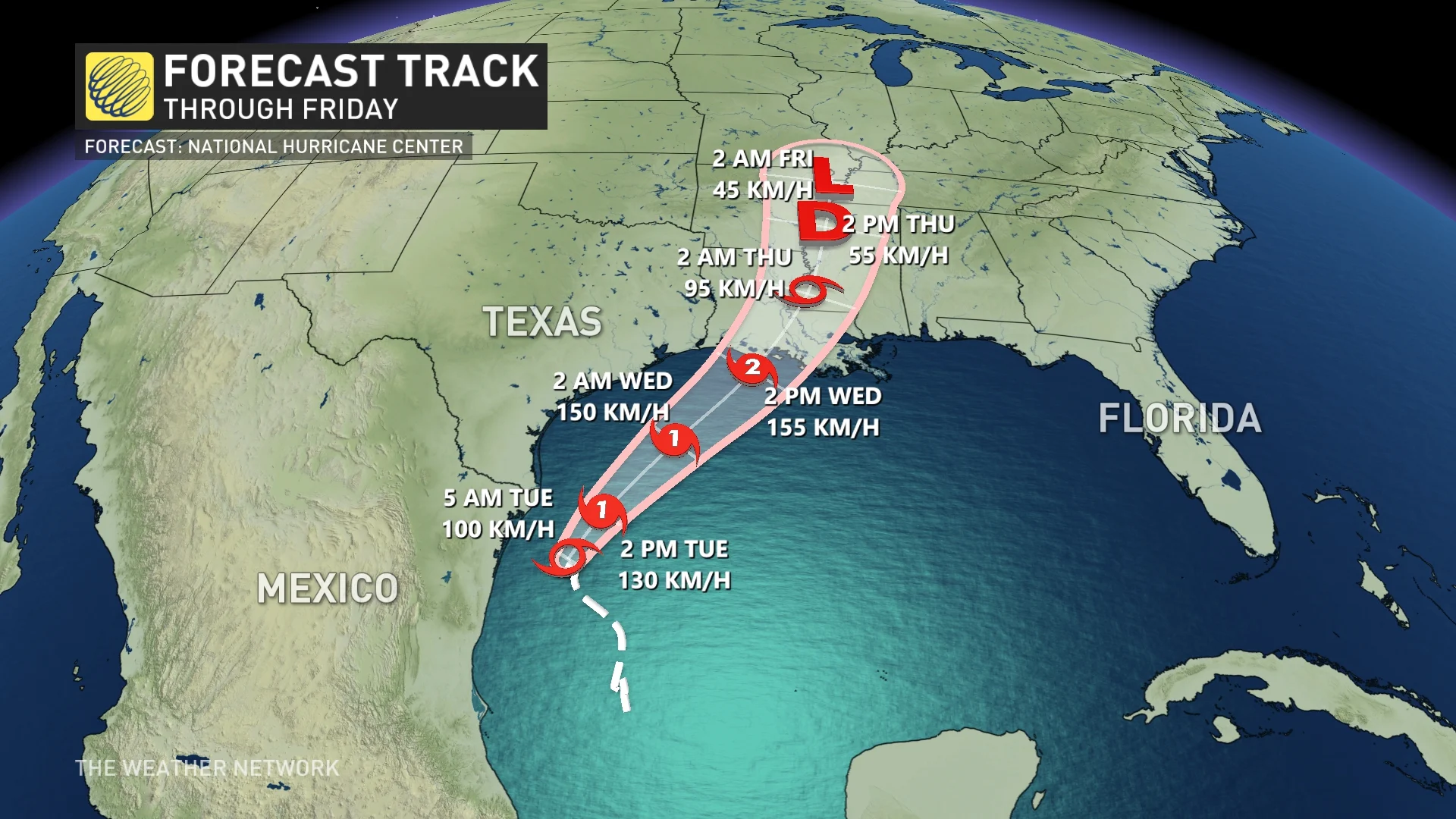
The NHC predicts Francine will likely be the fourth hurricane of the year and will become a Category 2 before landfall along the southern Louisiana border on Wednesday. Category 2 hurricane winds have a minimum threshold of 154 km/h.
SEE ALSO: ‘ACE’ is the best way to measure a hurricane season’s ferocity
Anywhere from 100-200 mm of rain, with up to 250 mm locally possible, is likely from the coast of northeast Mexico northward along portions of the southern Texas coast, the far upper Texas coast, and across southern Louisiana and southern Mississippi into Thursday morning.
"This rainfall could lead to the risk of considerable flash and urban flooding," the NHC warns.

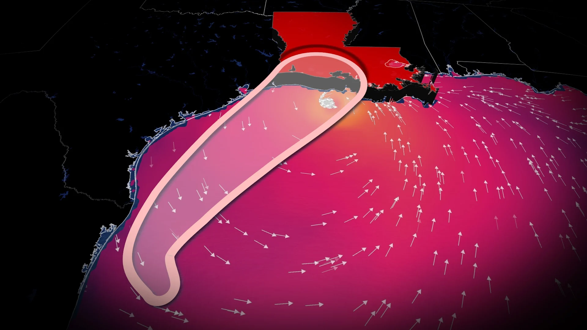
The combination of a dangerous storm surge and the tide will also cause normally dry areas near the coast to be flooded by rising waters moving inland from the shoreline, the NHC adds. That water could reach as high as three metres in some of the hardest-hit areas of Louisiana.
Swells generated by Francine are affecting portions of the coast of northeastern Mexico and southern Texas. These swells are expected to spread across the northwestern and northern Gulf of Mexico coastline during the next day or so.
"These swells are likely to cause life-threatening surf and rip current conditions," says the NHC.

Impacts to Canada are looking less likely, with a strong ridge of high pressure protecting Eastern Canada from the remnants.
There are currently two other areas in the Atlantic basin showing signs of probable development, as well, and will need to be monitored as the week wears on.