Rare October severe storm threat builds Sunday across Ontario

A round of severe thunderstorms could sweep through southern Ontario on Sunday as a cooldown pushes into the region
It’s a clash of the seasons in every sense of the term. A risk for strong to severe thunderstorms will develop across southern Ontario on Sunday as a pattern change sweeps into the region.
A strong low that has been touring Canada is finally crossing Ontario, and it’s encountering some warmer-than-normal temperatures across the south.
This may be our last widespread opportunity for thunderstorm activity this season. Behind the front arrives a cooldown that threatens to bring snow to some portions of Ontario.
It’s uncommon—but not unheard of—to have severe thunderstorms this late in the year.
DON'T MISS: Fall chill soon sweeps Ontario, and the snow chances grow
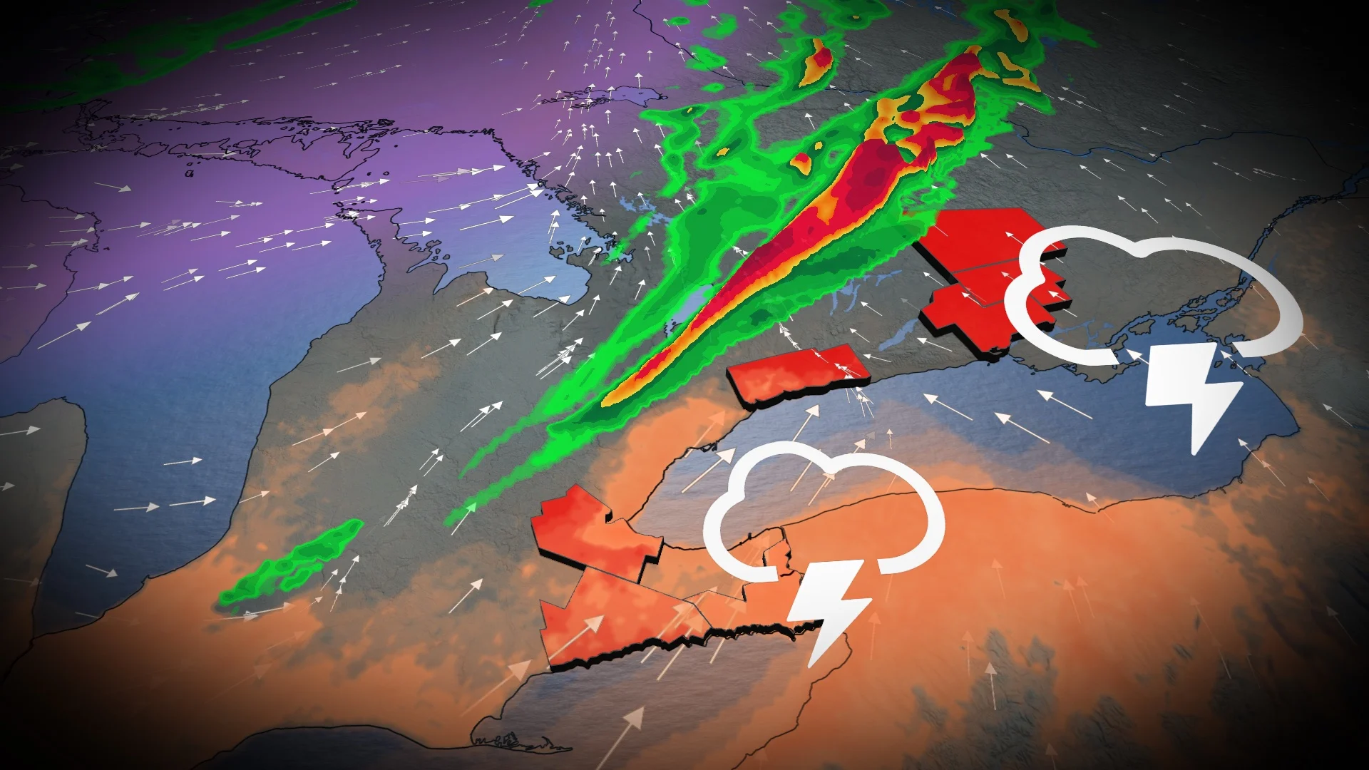
Sunday:
A cold front expected to track across southern Ontario during peak heating on Sunday will kick off a round of thunderstorms as it swings through the area.

Showers and embedded thunderstorms will kick off around Georgian Bay late Sunday morning, progressing east through the afternoon hours..
Any thunderstorms that reach severe limits could produce heavy rainfall, strong wind gusts, and large hail. Prepare for possible power outages, downed trees, and ponding on roadways beneath the heaviest storms.

Given this late-season setup, there’s some uncertainty in the development of severe thunderstorms. Clouds hampering daytime heating, as well as the timing of the front itself, will play a role in where and even if thunderstorms are able to develop. However, the kind of setup we’ll see on Sunday has been known to overperform in the past.
Gusty winds are expected to develop, potentially exceeding 80 km/h near thunderstorms and along the shorelines.
Some areas that experience sustained rainfall and storm activity could see up to 40 mm of precipitation, including portions of cottage country, Prince Edward County, Kingston, and other communities throughout eastern Ontario.
The threat will diminish Sunday evening across the Niagara Peninsula and eastern Ontario.

Conditions feel like fall—for a few days, at least
Looking ahead, a stretch of autumnal weather is likely beginning Monday and lasting through the middle of the week. Temperatures will come in a few degrees cooler than seasonal for a few days—a sharp contrast to anything we’ve seen so far this fall.
This should bring our first widespread frost or freeze for many areas, especially in rural areas north of Toronto. However, the city proper will stay above freezing.
Temperatures should rebound to near- or above-seasonal late next week and into the start of the long weekend, followed by another dose of cold weather during the long weekend itself.
A warmer pattern is expected to return for the final 10 days of October, but keep in mind that "seasonal" is relative and it drops quickly at this time of year.
Stay tuned to The Weather Network for the latest forecast updates for Ontario.