Far-reaching storm targeting Quebec puts travel and power in jeopardy

Remember to plan your travel ahead of time this holiday season in Quebec with impending, major winter storm. Road conditions will be difficult and power outages are possible.
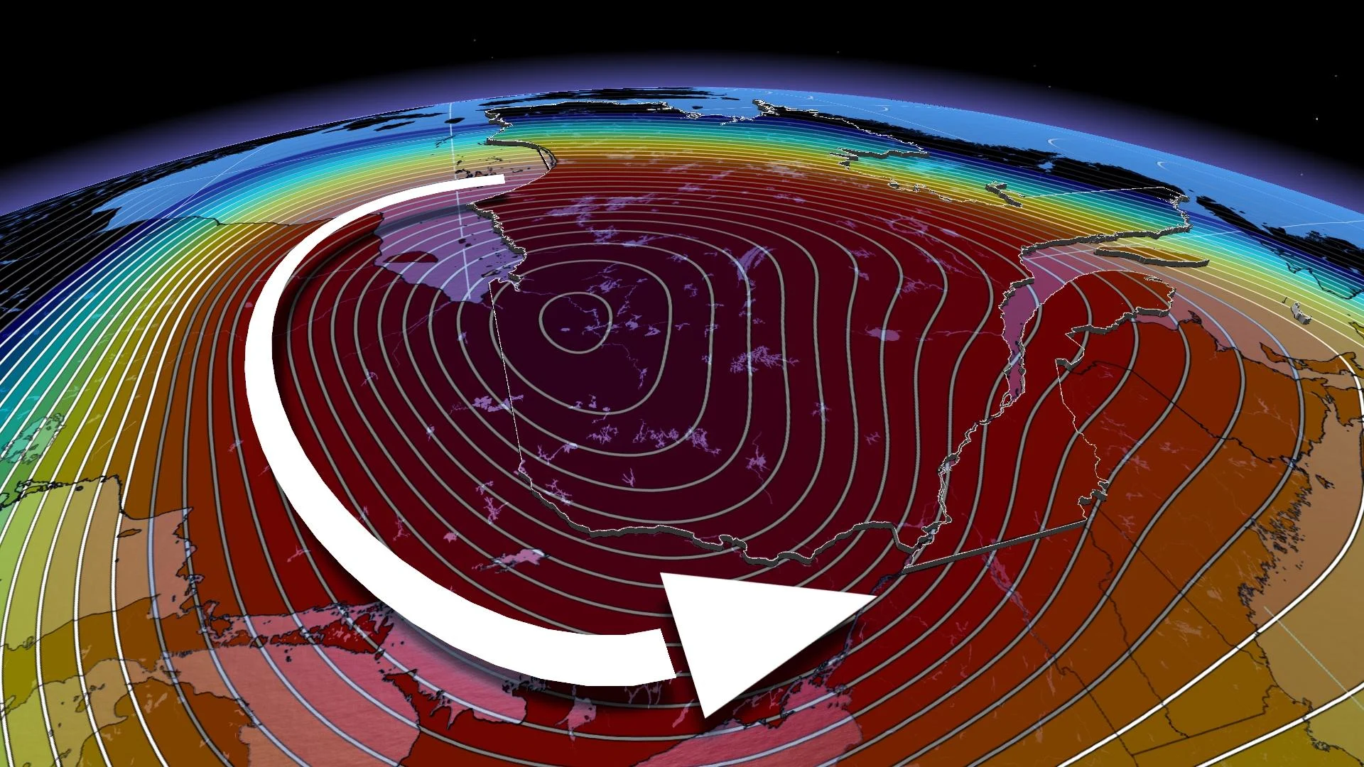
A powerful storm that will encompass 3,000 kilometres of land in North America has set Central Canada in its crosshairs for late week. Just like Ontario, Quebec will see heavy snow, rain and blustery, potentially damaging winds, along with the chance of a flash freeze and blizzard-like conditions. Plan your holiday travel accordingly, or postpone them until conditions improve.
RELATED: Holiday havoc: Vast, 3,000-km-sized storm puts travel plans in peril
Environment and Climate Change Canada (ECCC) has issued special weather statements across southern parts of the province, with precipitation-related and/or wind warnings likely to be added for some in the coming days.

Significant snowfall amounts, strong winds and blowing snow are expected over the areas to the north of the St Lawrence river, while over the areas to the south, some of the precipitation will fall as rain at times heavy.
DON'T MISS: Here's how to stock your vehicle's emergency kit, BEFORE you get stranded
Snow will arrive Thursday night and transition to rain through Friday for Montreal and other communities along the St. Lawrence.
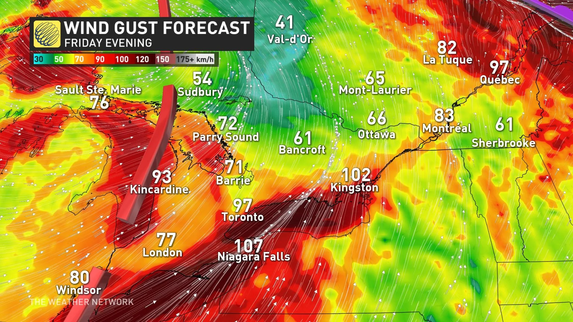
Residents should be cautious of the conditions as wet surfaces will ice over. Additionally, strong winds are forecast to intensify late Friday into Saturday when precipitation has transitioned to snow.

In terms of snowfall amounts, areas from Montreal to Quebec City could see 10-25 cm, with heavier amounts in the northern sections where as much as 20-50 cm is possible through Christmas.
Friday into the weekend will likely feature treacherous travel across the province for the holidays.
“Temperatures will climb into the mid-to-upper single digits, even double digits for parts of the Eastern Townships,” says Kelly Sonnenburg, a meteorologist at The Weather Network. “What becomes dangerous is the drastic drop in temperatures forecast for Friday evening.”
Moreover, beginning on Friday, there will be a run of high tidal amplitudes. The possibility of a storm surge will therefore have to be monitored from Quebec City to the east.
On Saturday afternoon, in the wake of the system, snow squalls will also be possible over southern parts of the province with the passage of cold air over the Great Lakes.
The arrival of this cold air will see temperatures drop below seasonal values on Sunday and early next week.
Residents are reminded to pack emergency kits in their vehicle if travel abosolutely cannot be avoided.
Check back for the latest on the forecast across Quebec.