
Rain puts a quick end to Ontario's dry spell, some in line for 50 mm by mid-week
Days of rain have put a quick end to one of Ontario's longest dry spells of the year
It was nice while it lasted. One of Ontario's longest dry stretches of the year has officially come to an end, as back-to-back disturbances bring periods of rain to start out this week.
The weather took its first turn over the weekend, and Saturday's storms even resulted in a funnel cloud sighting over the region.
Another round of rain fell Sunday night into early Monday, with heavy downpours bringing a burst of rain ahead of the morning commute. That isn’t the end of the rain for this week, either.
RELATED: PHOTOS: Funnel cloud spotted over Brantford, Ont. on Saturday
Monday:
An active storm track will help to guide several low-pressure systems from the U.S. through Ontario, beginning with systems tracking through northwestern Ontario and the northern Great Lakes on Monday.
Some pop-up showers and thunderstorms are possible in southwestern Ontario and parts of the Greater Toronto Area (GTA) through Monday, but they will be isolated.
Tuesday into Wednesday:
Showers will return to southwestern Ontario Tuesday morning, spreading across the GTA in the afternoon and evening, then eventually to eastern Ontario by the overnight hours. Thunderstorms are even possible in southwestern Ontario on Tuesday afternoon.
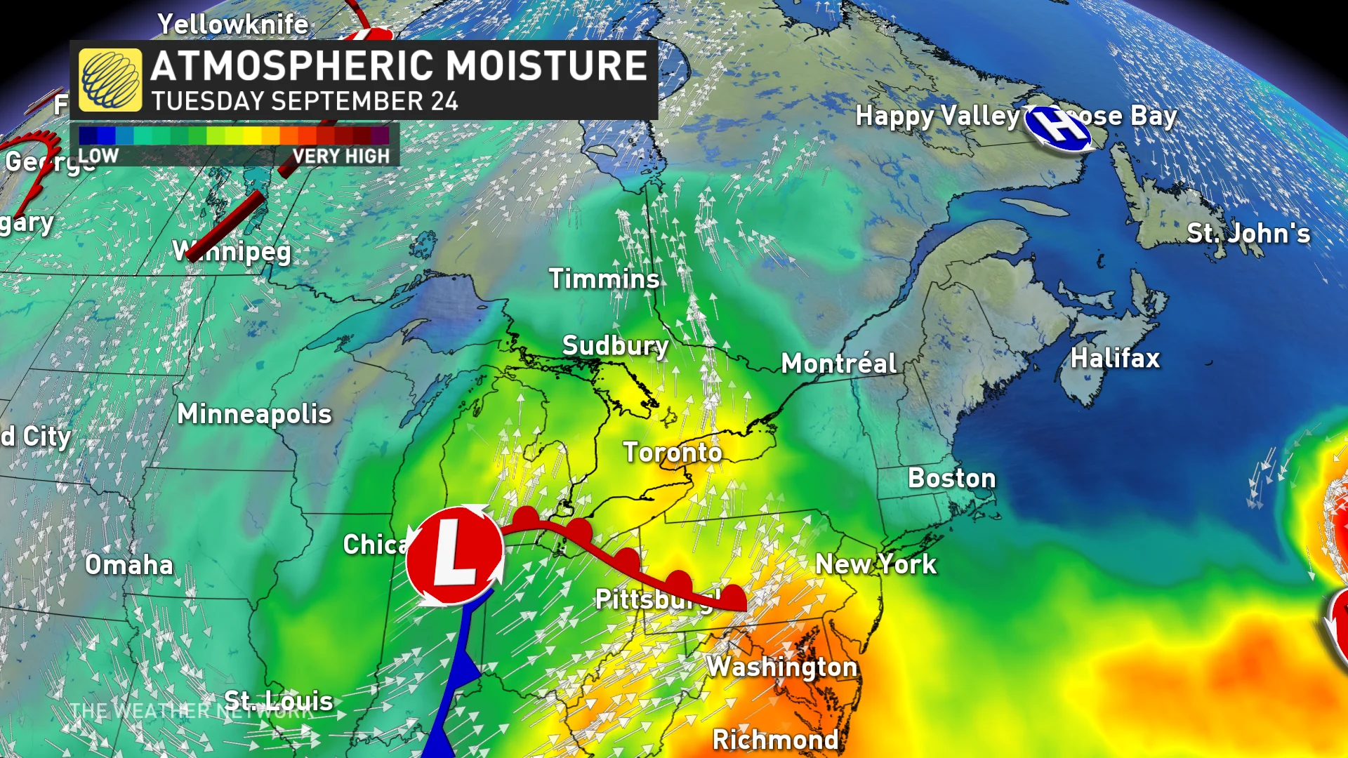
Wednesday will be another showery day across eastern Ontario.
RELATED: Ontario welcomes fall with more summertime warmth, but will this last?
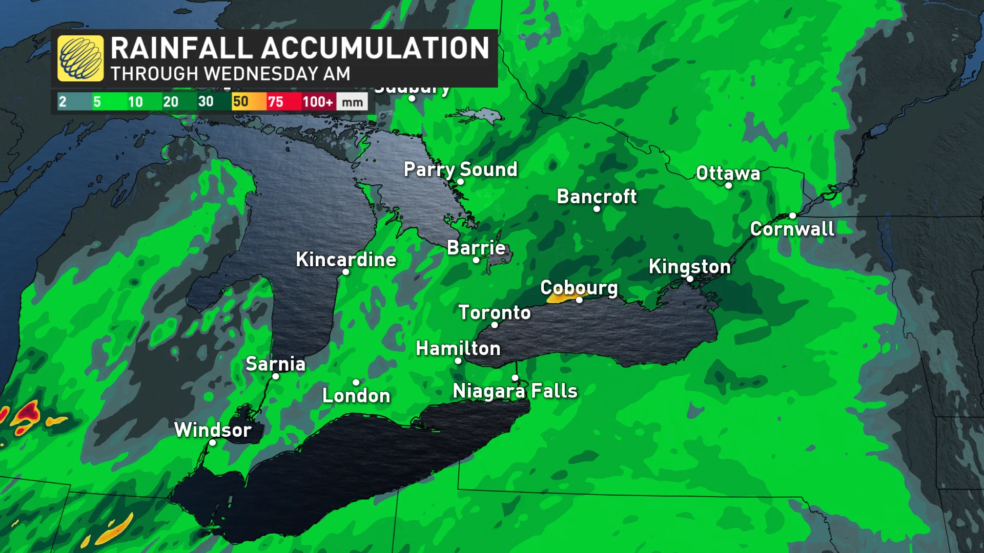
By the time all is said and done, local rainfall amounts up to 50 mm are possible through Wednesday, with most locations recording between 20-40 mm over the next few days.
Hanging onto more summertime warmth to round out September
Forecasters are confident that the remainder of September will come in above seasonal for the province, and even extremely above-seasonal for northern Ontario.
Another formidable ridge of high pressure will grow over the Great Lakes late this week, anchoring where we’ve seen ridges park themselves for much of this month.

This means temperatures will soar as much as 15 degrees above seasonal for northern communities, with anomalies running three to five degrees above seasonal for the south.
Stay with The Weather Network for all the latest on your forecast across the region.