Rafael threatens millions in the Caribbean, likely to hit Cuba as a hurricane
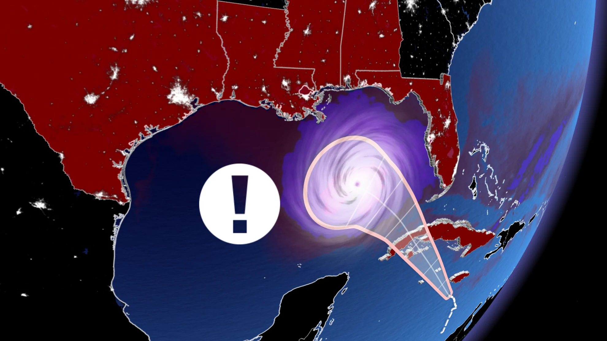
Tropical storm and hurricane warnings are in effect across the Cayman Islands, Jamaica and Cuba, as Rafael continues to strengthen ahead of a Cuba landfall on Wednesday
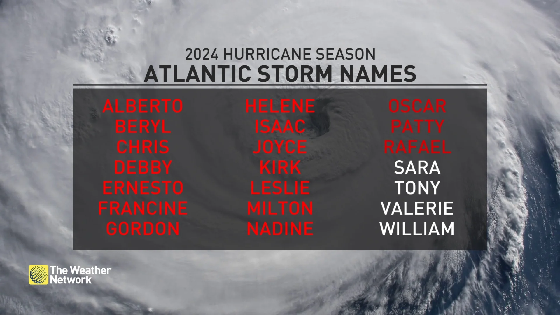
Flooding rains, gusty winds, and coastal flooding are likely to impact millions of the Caribbean islands as Tropical Storm Rafael, the 17th named storm of the Atlantic hurricane season, picks up steam through Tuesday and Wednesday.
DON'T MISS: Autumn can still produce intense hurricanes across the Atlantic
Rafael is forecast to strengthen into a hurricane late Tuesday or early Wednesday as it heads through the Western Caribbean.
A hurricane warning is in effect for the Cayman Islands, and the Cuban provinces of Pinar del Rio, Artemisa, La Habana, Mayabeque, Matanzas, and the Isle of Youth. Meanwhile, while a tropical storm warning covers Jamaica, as well as the Cuban provinces of Villa Clara, Cienfuegos, Sancti Spiritus, and Ciego de Avila.
A tropical storm warning has also been issued for the Florida Keys.

Rafael likely to hit Cuba as a hurricane
The 17th tropical storm of the year has developed in the Caribbean Sea. On the forecast track, Rafael is expected to move near western Jamaica on Tuesday, and near or over the Cayman Islands Tuesday night.
This system will encounter a generally favourable atmosphere over the western Caribbean as it moves north-northwest over the next couple of days.
"Steady to rapid intensification is forecast over the next 24 to 36 hours, and Rafael is forecast to become a hurricane in the northwestern Caribbean near the Cayman Islands with further strengthening before it makes landfall in Cuba," said the U.S. National Hurricane Center (NHC) in its Tuesday morning update.

In Cuba, it is some of the largest cities, Havana and Varadero, that could receive heavy rain and strong wind gusts. The NHC forecast indicates that the storm could hit Cuba as a Category 1-strength storm, with winds between 119-153 km/h.
Heavy rainfall will impact the Western Caribbean through early Thursday, particularly across Jamaica and the Cayman Islands into southern, and western portions of Cuba, the NHC says. Rainfall totals of 75-150 mm are expected, with isolated higher totals up to 250 mm possible across the higher terrain in Jamaica and Cuba. These significant rainfall totals could lead to areas of flash flooding and mudslides.

While exact landfall locations and impacts currently remain uncertain in the southern United States, heavy rain is likely to spread north into Florida and adjacent areas of the Southeast U.S. during the latter part of the week. A few tornadoes are also possible Wednesday over the Keys and southwestern-most Florida mainland.
Fortunately, Rafael is expected to weaken due to wind shear in the Gulf of Mexico, however, the risk of flooding and landslides should not be underestimated. Rainfall totals of 25-75 mm are expected for the Lower and Middle Florida Keys.
MUST SEE: Why focusing on a hurricane’s category is downright dangerous
The hurricane season slowed down in August, which is quite unusual. The peak of hurricane season occurs around Sept. 10. However, tropical activity resumed at the end of the season with about 10 storms named since Sept. 24. This is a record according to specialist Phillip Klotzbach.

The Atlantic hurricane season officially runs through Nov. 30, though it’s still possible for storms to form after that date. Many of the late-season storms we see develop in November form in the Caribbean and Gulf of Mexico, which can reduce the amount of time coastal residents have to prepare before these storms hit land.


