Quebec: Rain and snow linger as flooding conditions worsen
Drier weather is on its way to southern Quebec, but there's one more round of rain to deal with first.
The Galipeault Bridge connecting Montreal and Île Perrot was closed early Saturday as water levels in the region continue to rise. Montreal declared an island-wide state of emergency on Friday as the province continues to grapple with a challenging flood season.
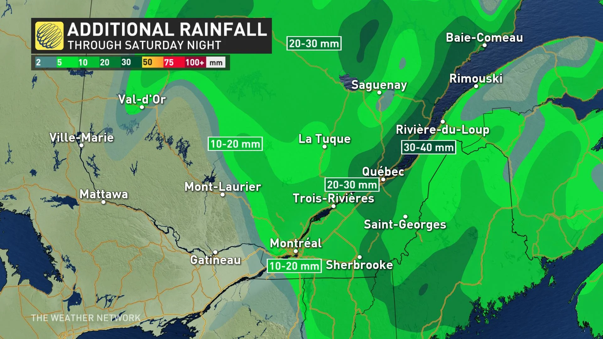
While drier weather is on the horizon for soggy southern Quebec, there's one last round of unsettled weather to deal with on Saturday before conditions improve. We track what's left of this latest round of rain, below.
SEE ALSO: Emergency flooding guide -- whom to contact if you've been impacted by flooding
WEATHER HIGHLIGHTS
Rain and snow showers taper off west to east through day
Saturday cools down to the single digits Saturday and Sunday
Stay up-to-date on the ALERTS in your area
WATCH BELOW: TRACKING WHAT'S LEFT OF RAIN AND SNOW
The low pressure system that brought heavy rain on Friday will continue to depart to the east through Saturday afternoon, with lingering rain showers and higher-elevation snow ending west to east through the day.
What's left of the rain for Saturday will be heaviest further down the St. Lawrence, toward Quebec City, which is at least some good news for those areas hardest-hit by flooding.

Unfortunately, with the ground already saturated, the rain that does fall will add to the overall runoff.
"Combined with the melting snowpack, the rain is expected to accelerate the spring freshet," warns Environment Canada.
Residents are urged to take the necessary preparations and keep an eye on the flood forecast.
DON'T MISS: Our country is warming two times faster than the rest of the planet. The Weather Network and Canada's leading experts on climate bring you 2xFaster.


