Sprawling, mighty Hurricane Kirk whipping up swells to Canadian shores
Kirk is thousands of kilometres away, but its influence will reach Canadian shores this weekend
Kirk is a record-setting hurricane swirling through the central Atlantic Ocean this week. The large and powerful storm may be thousands of kilometres away from Canada, but we’ll start to feel some of the storm’s influence here beginning this weekend.
That hurricane isn’t the only storm in town. Anyone with interests in Florida should remain alert as a new tropical depression threatens widespread flooding rains throughout the state heading into next week.
DON’T MISS: 2024 Atlantic hurricane season is officially above average with 12th named storm
Hurricane Kirk’s influence felt here in Canada
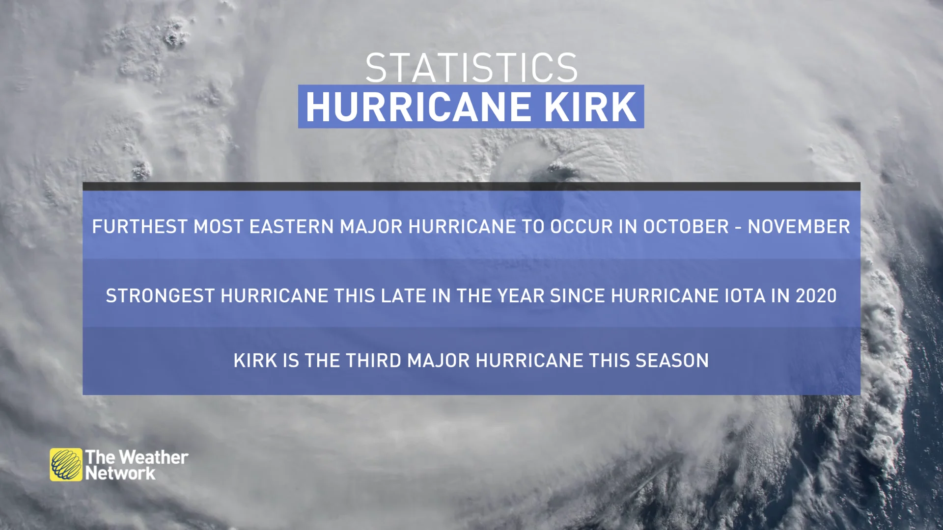
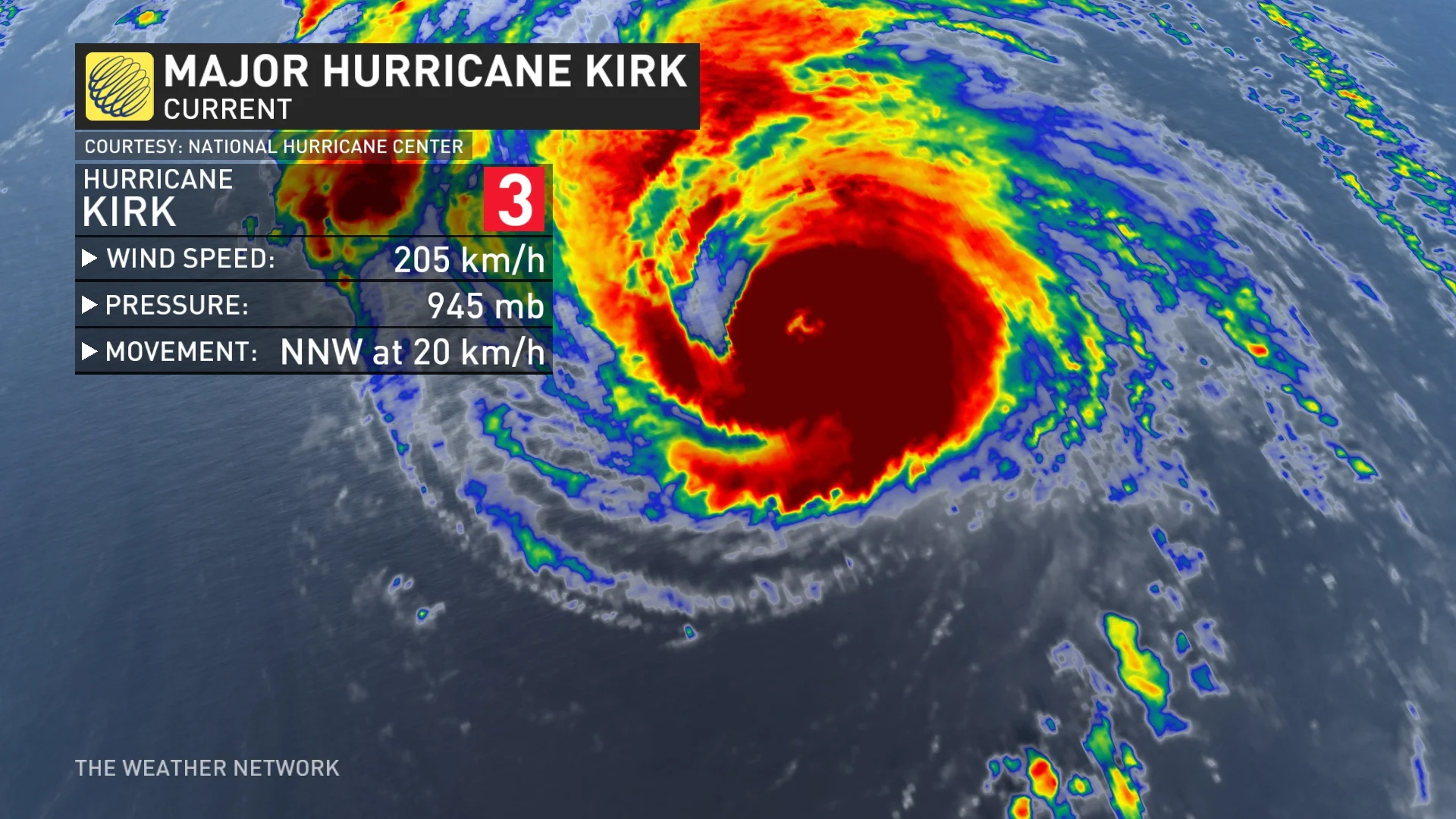
Hurricane Kirk set the record for the strongest storm we’ve ever seen so far east in the Atlantic this late in the season. Strong hurricanes in October tend to form much closer to North America. Kirk is more like a storm we’d see in late August or early September, a testament to how unusually steamy the waters are this year.
Forecasters found that the storm is currently a Category 3 hurricane as of Saturday morning, boasting winds of around 195 km/h.
STAY SAFE: Rip currents are a natural hazard along coasts – here’s how to spot them
Even on its current track, such a large and intense storm can have far-reaching effects, some of which we’ll see here in Canada beginning this weekend.
The hurricane’s large and powerful waves will radiate west through the weekend, reaching Canada Sunday into Monday. Folks heading to the beach along the East Coast should use extreme caution as high swells can pose a significant danger along the shoreline.
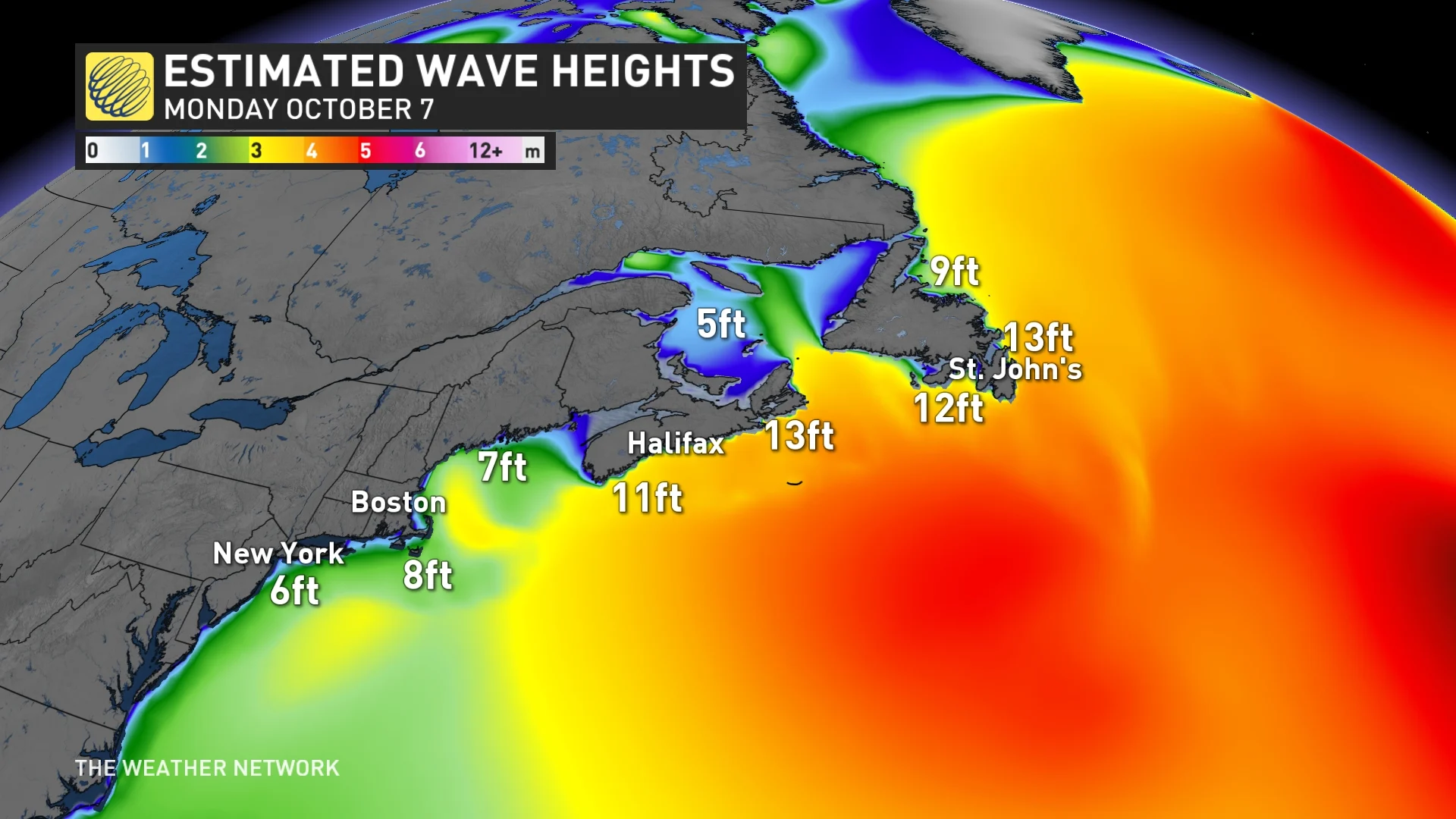
Large swells from faraway hurricanes routinely kill people in Canada and the U.S. Stay away from rocks, overhangs, and anywhere rough waves could splash up and sweep you into the ocean.
Dangerous rip currents will also be a significant hazard as these waves reach the coast.
Florida on the lookout for flooding rains as tropical depression forms
South of the border, we’re on alert for yet another heavy rain event courtesy of a tropical disturbance moving through the Gulf of Mexico.
According to the U.S. National Hurricane Center, Tropical Depression 14 formed in the southwestern Gulf of Mexico on Saturday morning. It is forecast to strengthen and bring the risk of life-threatening impacts to portions of the west coast of Florida next week.
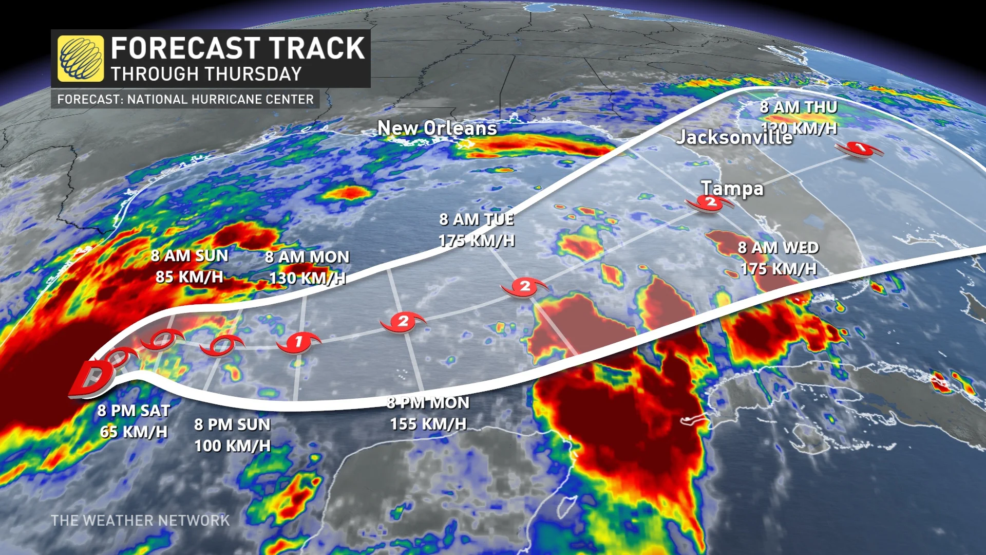
Rapid strengthening is forecast during the next few days. The depression is forecast to become a tropical storm later on Saturday, with Milton set to become its name, and a hurricane by early Monday. The system could become a major hurricane while it moves across the central and eastern Gulf of Mexico.
RELATED: Tropical systems don’t need a name to trigger devastating floods
"On the forecast track, the depression is forecast to remain over the southwestern Gulf of Mexico through Sunday night, then move across the south-central Gulf of Mexico on Monday and Tuesday, and approach the west coast of the Florida Peninsula by midweek," NHC said in the Saturday update.
Areas of heavy rainfall will also impact portions of Florida Sunday and Monday, well ahead of the tropical system, with heavy rainfall more directly related to the system expected by later Tuesday through Wednesday.
Forecasters expect 125-200 mm of rain to fall across much of the Florida Peninsula heading into next week, with locally higher totals possible. This includes Miami, Fort Myers, and the Florida Keys.
"This rainfall brings the risk of flash, urban, and areal flooding, along with minor to isolated moderate river flooding," NHC said.
We’re also continuing to watch Tropical Storm Leslie in the far eastern Atlantic Ocean. This system is expected to grow into a hurricane by this weekend, taking a similar recurving track to Hurricane Kirk that’ll keep the storm safely out to sea.
Thumbnail courtesy of NOAA.