NOAA now projects 'above-normal' Atlantic hurricane season in update
The likelihood of greater activity has risen due to record-warm sea surface temperatures, NOAA says
Despite the current lull in the Atlantic hurricane season, we shouldn't let our guards down as forecasters are still anticipating a higher number of storms than usual this year.
In an update provided on Aug. 10, the National Oceanic and Atmospheric Administration's (NOAA) Climate Prediction Center has raised its prediction for the 2023 season from a near-normal level of activity to above normal.
SEE ALSO: Atlantic hurricane season may defy the odds with above-average activity
Current ocean and atmospheric conditions, such as the record-warm Atlantic sea surface temperatures, are likely to counterbalance the effects of the ongoing El Niño, which normally limits atmospheric conditions associated with it, according to NOAA.

The likelihood of an above-normal Atlantic hurricane season has been elevated to 60 per cent, up from May's outlook that predicted a 30 per cent chance.
As a result, the probability of near-normal activity has dropped to 25 per cent, a decline from the 40 per cent chances outlined in May's outlook. The revised forecast gives the Atlantic a 15 per cent likelihood of seeing a below-normal season.
“Considering those factors, the updated outlook calls for more activity, so we urge everyone to prepare now for the continuing season," said Matthew Rosencrans, lead hurricane season forecaster with NOAA’s Climate Prediction Center, in the news release.
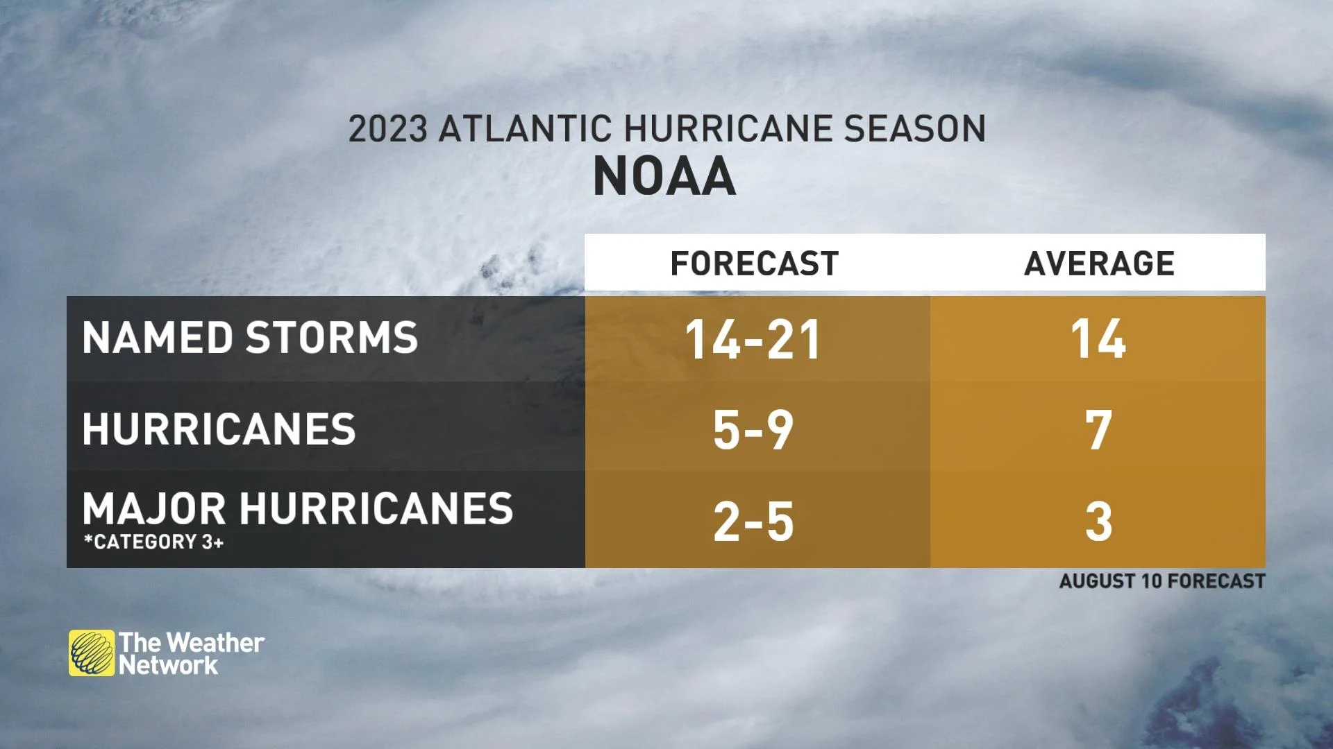
NOAA’s change to the 2023 outlook, which covers the entire six-month hurricane season that ends on Nov. 30, now calls for 14-21 named storms. Of those, six to 11 could become hurricanes. Of the number of projected hurricanes, two to five could reach major status (Category 3 or greater). NOAA says the revisions come with 70 per cent confidence. The updated ranges include storms that have already formed this season.

The Atlantic basin got off to an active start with five storms that reached at least tropical storm-strength, including one hurricane. An average hurricane season produces 14 named storms, of which, seven become hurricanes, including three that attain major status.
With the Atlantic currently experiencing El Niño conditions, there is a greater-than 95 per cent chance the event will continue through the Northern Hemisphere winter, according to the latest ENSO (El Niño-Southern Oscillation) discussion from the Climate Prediction Center.
Eyes on Gulf of Mexico
It should be noted that El Niño typically results in atmospheric conditions that help lessen tropical activity during the Atlantic hurricane season. However, because the aforementioned conditions have been slow to come to fruition, climate scientists are predicting the tropical activity-limiting impacts may not be in place for much of the remaining hurricane season, NOAA stated.

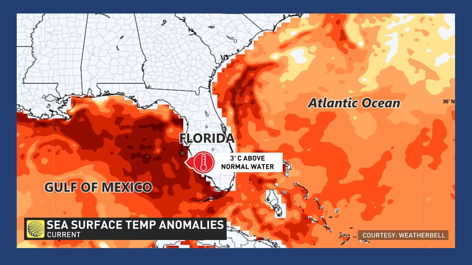
Some of the biggest sea surface temperature anomalies lurk in the Gulf of Mexico, where the high heat content of the water means the area will have to be closely watched for major hurricane activity through the remainder of the season.
With current water temperatures near 32°C in the Gulf of Mexico, under perfect atmospheric conditions without dry air and low wind shear, it would be possible to spin up a major hurricane with up to 300 km/h maximum sustained winds. Storms of that calibre include Dorian, Wilma, Gilbert and the Labour Day hurricane of 1935.
WATCH: These two hurricane names from 2022 are now officially retired
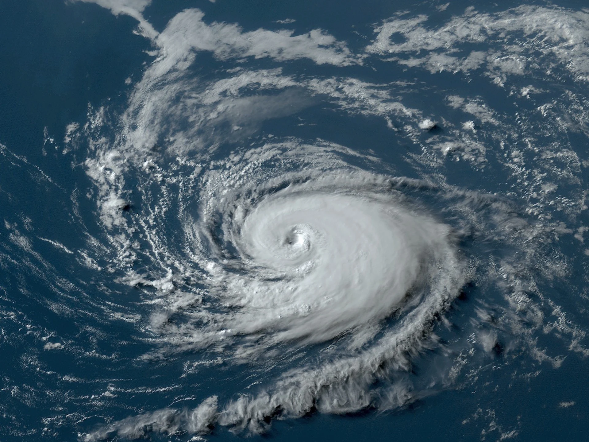
Thumbnail courtesy of NOAA. It is a GOES-16 (GOES East) visible satellite image of Hurricane Don, captured on July 22, 2023 in the Atlantic.
With files from Tyler Hamilton, a meteorologist at The Weather Network.
Follow Nathan Howes on Twitter.


