Rough overnight severe storms likely in southwest Ontario

Stay alert in southwestern Ontario for the risk for severe thunderstorms into the late evening and overnight hours Thursday
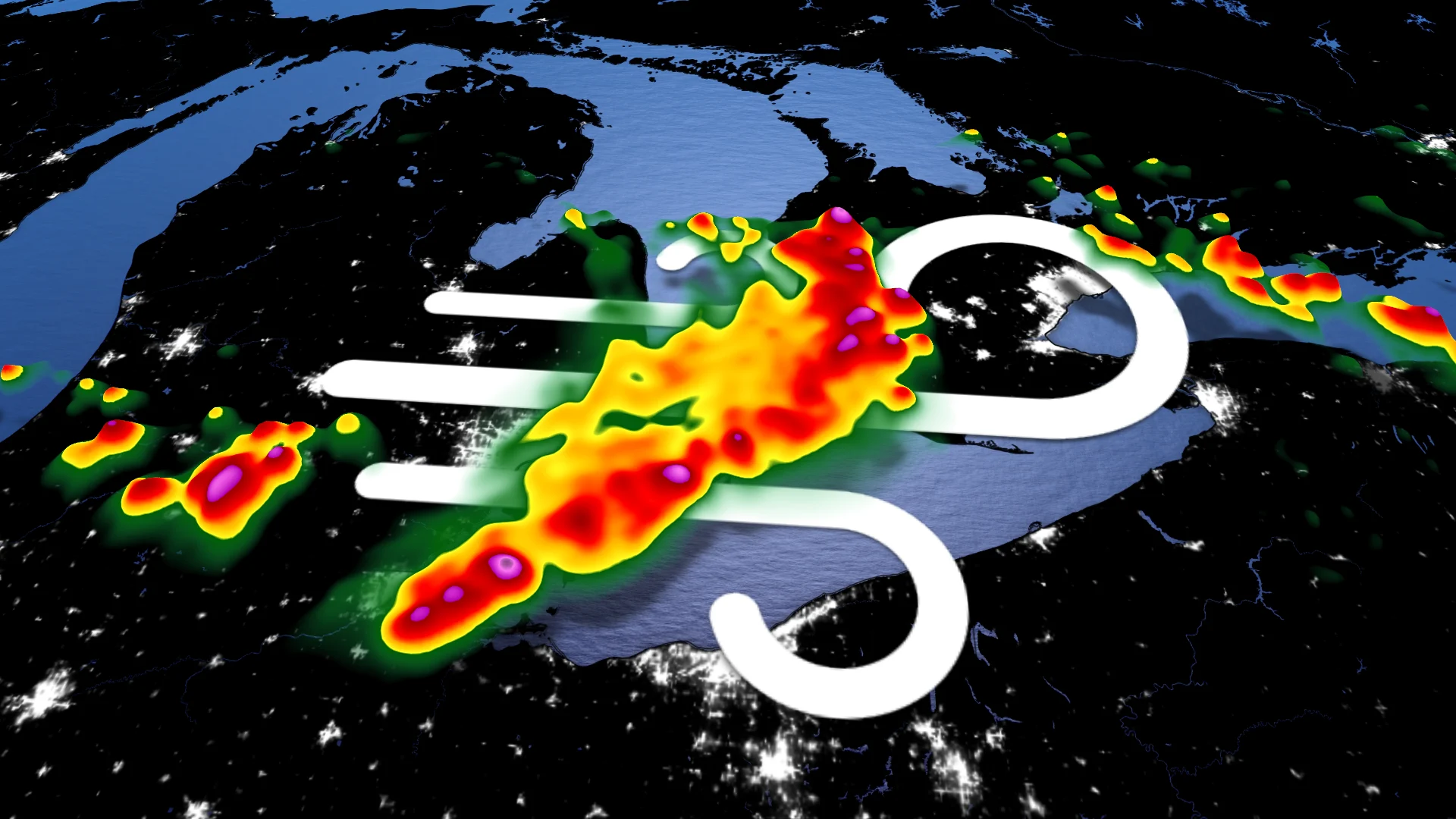
Severe thunderstorms are likely across southwestern Ontario through the late evening and overnight hours Thursday as intense storms bubble up in Michigan and push into the region.
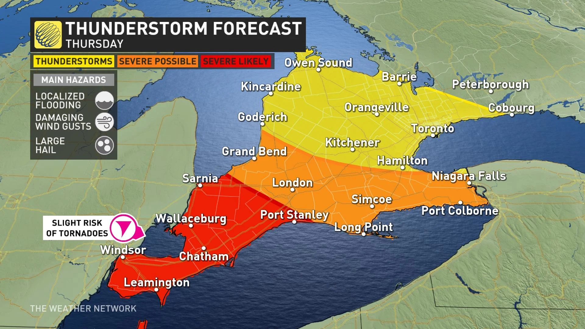
The main threat from any storms that push into the region will be strong wind gusts that could exceed 100 km/h, along with a slight risk for tornadoes in far southwestern portions of the province near the Michigan border.
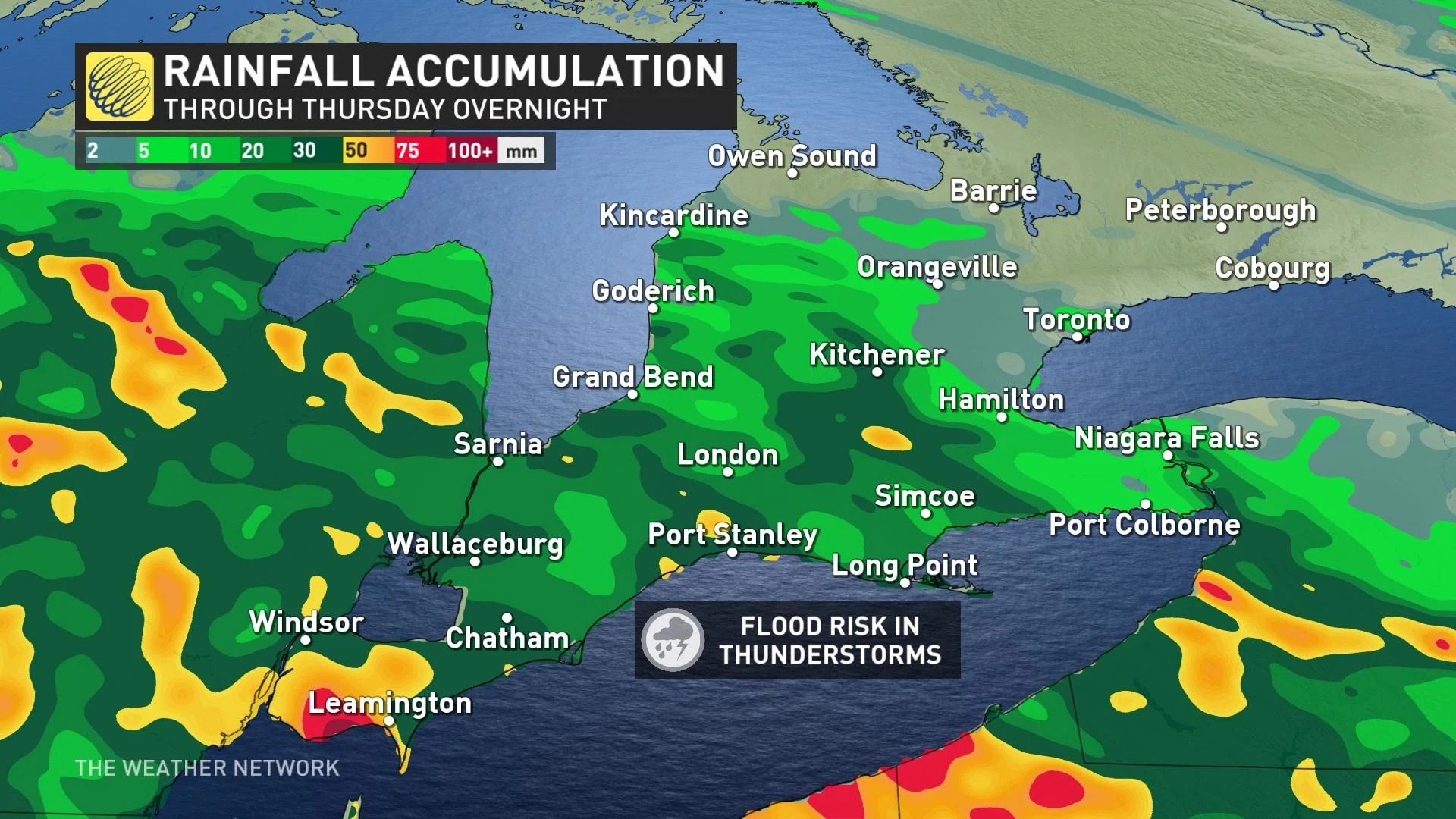
We’re on the lookout for localized flooding from Thursday night’s storms, especially across areas that saw flooding from torrential downpours on Wednesday. Those storms earlier this week dropped more than 140 mm of rain in spots. We saw Several road closures from the storms, which was called a ‘1 in 100 year’ rainfall event.
Thursday overnight
Areas: Southern Ontario
Timing: Through the late evening and overnight hours
Weather: Strong to severe thunderstorms that developed stateside on Thursday evening will push east as night settles. These storms will sweep across southwestern Ontario late in the evening and into the overnight hours.
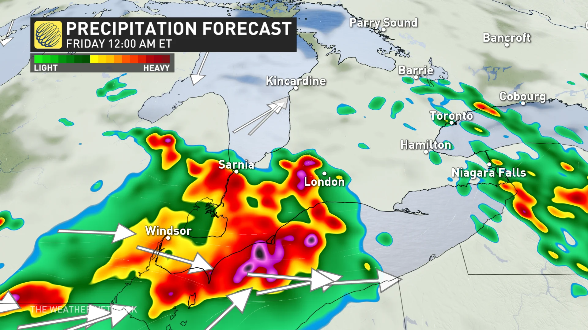
While we’ve lost some of the ideal dynamics for severe weather, severe weather remains likely southwest of London, including Windsor, Chatham, and Sarnia. The greatest threat with these storms is damaging wind gusts in excess of 100 km/h, but localized flooding and large hail are also possible.
A few of the storms early in the evening could develop rotation, leading to a slight risk for tornadoes right near the Michigan border.
Severe storms at night are dangerous as folks wind down and head to bed. Stay aware of hazardous conditions in your area, and have a way to receive severe weather alerts even when you’re asleep. Keep your phone’s volume turned up so you can hear potential alerts.
Visit The Weather Network's hurricane hub to keep up with the latest on tropical developments in Canada and around the world
Rain chances continue into the weekend
Friday will be a much drier day, though with a small chance for some isolated rain showers in some areas. That will be short-lived, however, as yet another low sets its eyes on Ontario for Saturday, likely interrupting weekend outdoor plans.
Weekend temperatures will also hover around the 20-degree mark, giving an early taste of autumn to parts of southern Ontario. While conditions become unsettled with another shot of cooler weather by the middle of next week, temperatures should rebound heading into the start of the final long weekend of summer.
Prepare
Make sure to keep up-to-date on your local forecast information and alerts. If you are outdoors in an area with a severe weather threat, make sure you have a safety plan in place in case you need to get to shelter.
If a severe thunderstorm approaches your location, remain mindful of trees or tree limbs that loom near your home. Trees falling into buildings are a significant source of injury during strong storms. Try to avoid rooms where trees may cause damage during high winds.
The greatest danger in any thunderstorm is lightning. If you can hear thunder, you’re close enough to be struck by lightning.
DON'T MISS: Watch? Warning? How we communicate severe weather in Canada
Be sure to check back for the latest weather updates across Ontario.