Severe storms, rain threaten the Prairies, tornado risk over northwestern Ont.
Get ready for another wild week on the Prairies as a slow-moving system creeps north of the border, bringing the threat for strong storms, heavy rain, and large hail. A tornado or two isn't out of the question in northwestern Ontario, either
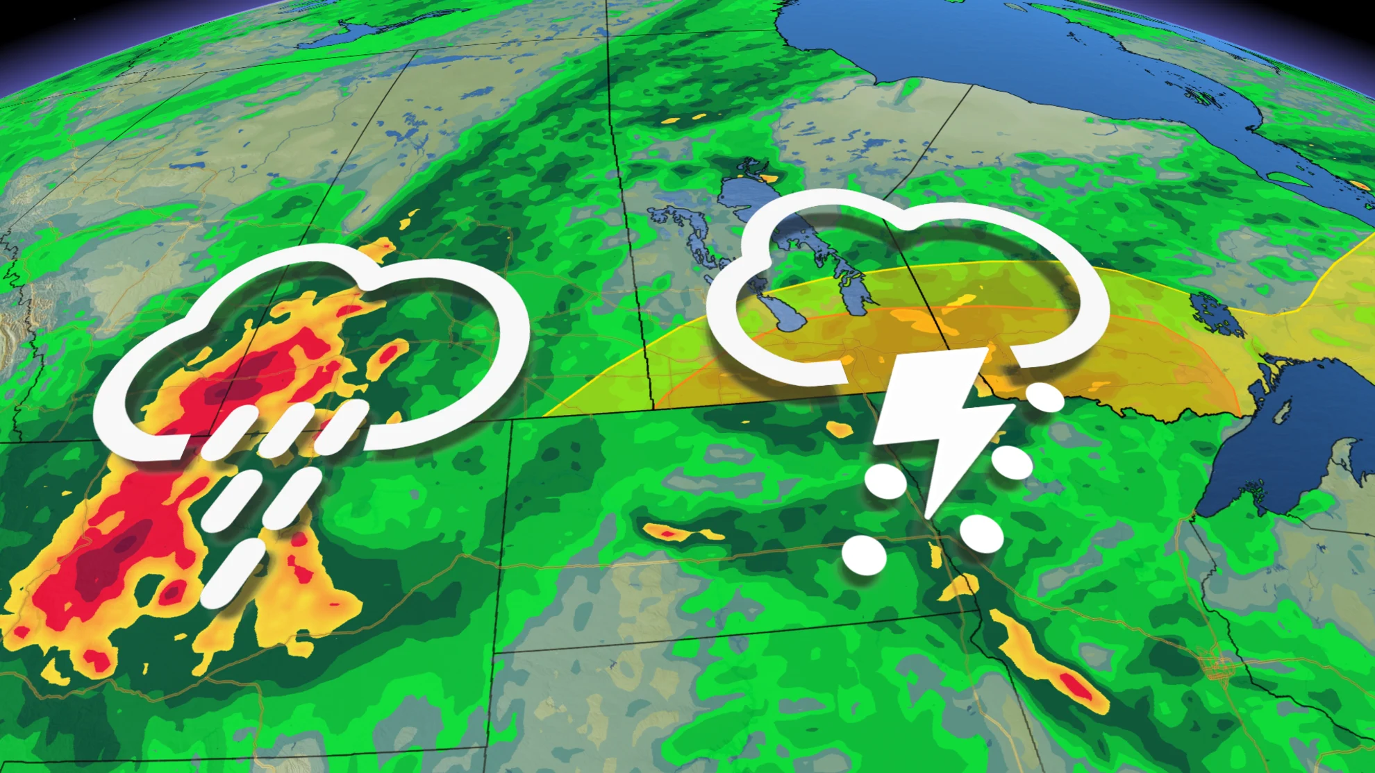
We're in for another active start to the week across the Prairies, and parts of northwestern Ontario, with multiple areas under the threat for heavy rain and strong thunderstorms. The severe set up prompted tornado watches in Ontario Monday morning.
Gusty winds, widespread heavy rainfall, large hail, and unseasonable warmth, will all accompany the storm as it treks into Canada. It will feel remarkably similar to what we experienced last week on the Prairies, with back-to-back days of unsettled conditions and the risk for severe thunderstorms.
Visit our Complete Guide to Fall 2024 for an in-depth look at the Fall Forecast, tips to plan for it and much more!
CURRENT TORNADO WATCHES (Ontario):
KENORA - NESTOR FALLS
FORT FRANCES - EMO - RAINY RIVER
Sioux Narrows - Nestor Falls - Morson
10:06 a.m. EDT - A tornado watch is in effect in northwestern Ontario amid a severe storm threat for Monday afternoon/evening. A tornado watch means that conditions are favourable for the development of tornadoes.
Conditions are favourable for the development of severe thunderstorms, which may produce tornadoes. Strong winds, large, hail, and heavy rain are also possible.
The original article with the full forecast for the Prairies and northwestern Ontario continues below.
Severe storm risk Monday into Tuesday:
A risk for severe weather will develop over portions of the southern Prairies during the day Monday and extend through the overnight hours into Tuesday morning, as well.
Thunderstorms will initially develop over North Dakota during the day Monday. These storms will push north along a warm front through the afternoon and evening hours, eventually tracking into southern Manitoba and northwestern Ontario. This threat includes the City of Winnipeg, where there's the risk for torrential rainfall, strong winds and large hail up to golf ball-size.

If the warm front from North Dakota crosses into northwestern Ontario through the afternoon, that could bring the chance of a tornado or two in northwestern Ontario.

With the cluster of the storms continuing through the overnight hours, there's the chance it could lead to some localized flooding.
WATCH: Large hail and flooding risk looms for Prairies
Risk of localized heavy rain into midweek:
Farther west, we have to watch the bulk of the low as it meanders over Saskatchewan and Alberta.
Several days of widespread heavy rainfall will accompany the storm as it moves into Canada, with the heaviest precipitation targeting areas of eastern Alberta and western Saskatchewan.
Tuesday features more scattered precipitation, but by Wednesday, more organized rainbands will pivot in from Montana, reaching peak rainfall rates by Wednesday afternoon and evening. By Thursday afternoon, the low will weaken and gradually shift east.

Some communities near the provincial border could see up to 100 mm of rain through Thursday as this storm passes through the region.
Gusty northwesterly winds will blow across Alberta and western Saskatchewan for the duration of the storm, as well. Folks can expect gusts up to 80 km/h in parts of Alberta, with gusts of 70 km/h possible in Saskatchewan.
Big temperature spread develops
Summer-like temperatures on the eastern side of the storm will send readings as much as 9°C above seasonal on Monday and Tuesday, especially in Manitoba including Winnipeg and Dauphin.

Meanwhile, cooler air filtering in on the western side of the system will keep temperatures well below seasonal across southern Alberta. Calgary and Lethbridge will struggle to climb into the mid-teens on Wednesday.