Hurricane-like vortex over Mexico a must see
A vortex swirled in the westernmost point of Mexico this week, entrancing the weather community and reminding the entire world that our atmosphere is the coolest.
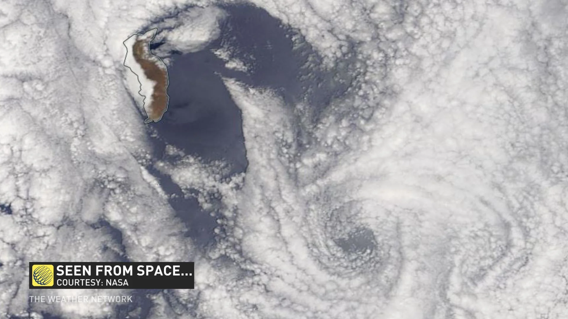
The atmosphere put on quite the show on Wednesday, spinning up mesmerizing clouds that appeared to resemble a hurricane. These von Kármán vortices, the famous spinning clouds, are an intricate dance of air parcels that all begins with a trigger, which in this case, was a small island.
SEE ALSO: Hurricane-looking vortex off California coast is a must see
On Wednesday, air innocuously slammed into Guadalupe Island, the westernmost location in Mexico, and it created a chain reaction downstream.

This cool feature in the atmosphere all began with such a subtle perturbation that interrupts an air parcels typical laminar flow. The turbulent flow continues to travel downstream, and can occasionally produce beautiful cascading swirling vortices shown on satellite.
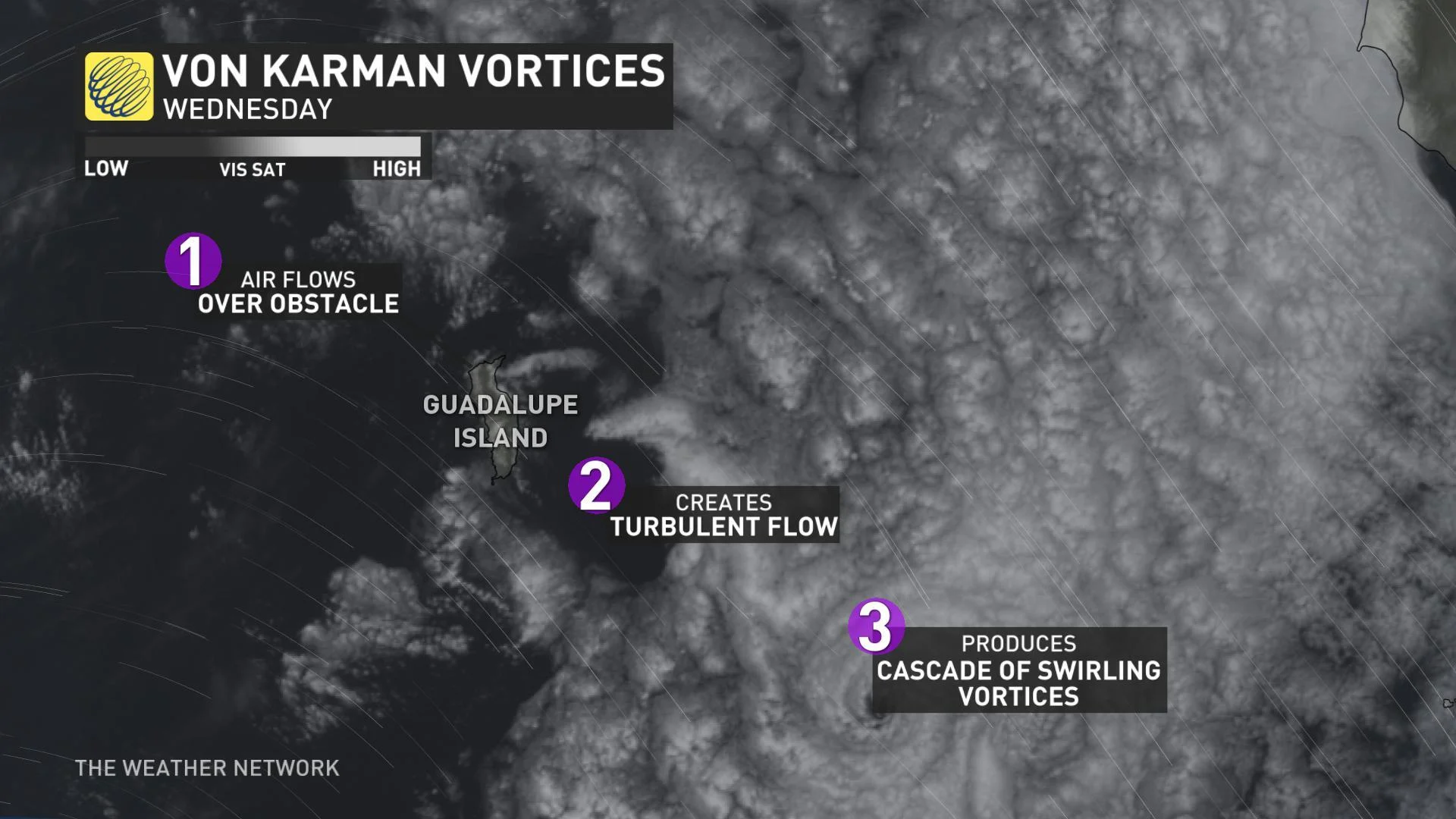
THE VORTEX EXPLAINED
With the menacing look of a hurricane you'd be tempted to think it's just a miniature version, but this beautiful atmospheric creation forms under very different conditions. A von Kármán vortex was named after Theodore von Kármán, a Hungarian-American engineer and fluid mechanics expert.
If you want the full-effect from Wednesday, watch the video below of this von Kármán vortex posted initially by Dakota Smith, a researcher at the National Center for Atmospheric Research.
While the phenomena is breathtaking to see, it's been captured before and occasionally produces a cascade of swirling vortices past obstacles. In this case, it's called von Kármán vortex streets.
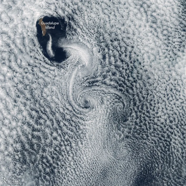
(Vortices on the lee side of Guadalupe Island in 2017. Credit: NASA)
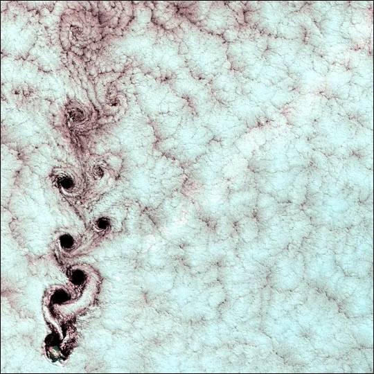
(Vortices off Alexander Selkirk Island in the southern Pacific Ocean in 1999. Credit: NASA)
With files from Weather Network meteorologists Erin Wenckstern, Tyler Hamilton.


