Deadly Helene weakens as it moves over Georgia, but strong impacts remain
Helene is now a tropical storm after making landfall as a Category 4 major hurricane in Florida late Thursday night. Helene continues to batter the South with damaging winds, flooding rains, and life-threatening storm surge
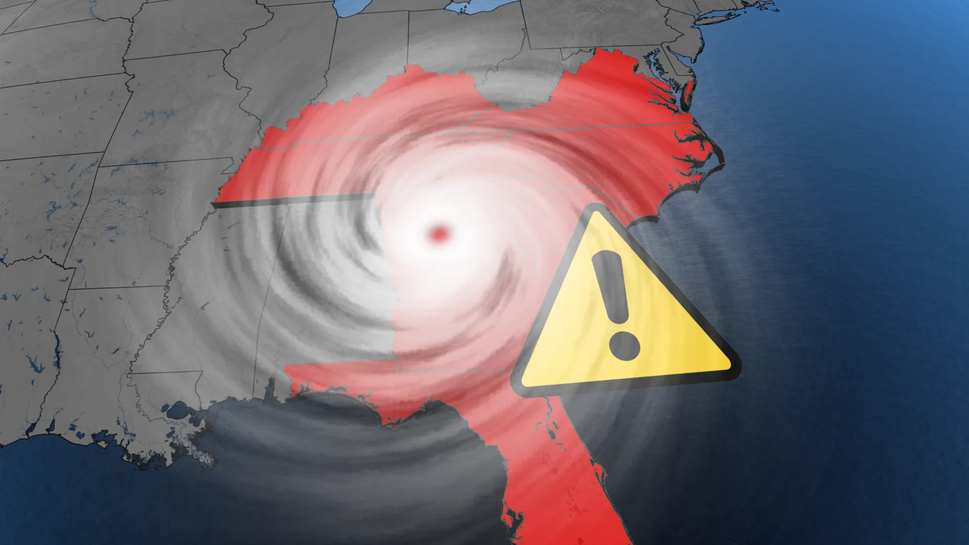
Helene weakened to a tropical storm early Friday morning, but continues on its destructive path as it moves over Georgia and the Tennessee Valley. This is one of the most powerful storms to ever hit the U.S., with fears of widespread devastation and deaths mounting in its wake.
"When we wake up tomorrow morning, the chances are there will likely have been more fatalities," said Florida Governor Ron DeSantis in one of his many hurricane updates late Thursday. DeSantis confirmed two storm-related deaths in Florida, one being a driver whose car was struck by debris.
According to The Associated Press, at least 11 people have died in Georgia. Another was reported dead in Charlotte, North Carolina, when a tree fell on a home during the storm on Friday.
MUST SEE: The Weather Network's hurricane hub for the latest updates on all tropical activity
Helene made landfall near Perry, Florida, at 11:20 p.m. EDT on Thursday as a major Category 4 hurricane with maximum sustained winds of 225 km/h. This was the strongest storm in history to make landfall in the Big Bend region since record keeping began in 1851.

Close to one million customers were without power even before Helene's arrival, with that number quickly bumping to more than four million Friday morning. Homes and businesses in Florida, Georgia, the Carolinas and other U.S. Southeast states were all left in the dark. Severe flooding, and swamped neighbourhoods have been reported in several coastal areas.
PHOTOS: Helene slams into Florida, widespread damage and impacts grow
Water sensors in Cedar Key, Fla., measured nearly 2.5 metres of storm surge shortly before landfall on Thursday. A record height of 2.8 metres was recorded for the region.
WATCH: Wild videos from Hurricane Helene as it made landfall in Florida
Tropical Storm Helene continues to bring major impacts to Southeastern U.S.
All hurricane and tropical storm warnings have been dropped along the Florida coast, as well as Georgia, with a tropical storm warning still in effect for the Savannah River northward to Little River Inlet before 12 p.m. on Friday.
As of Friday morning, the storm surge warning remained in effect for Tampa Bay, and Indian Pass to Bonita Beach, but has since been dropped.
"Water levels will continue to recede along the Florida Gulf Coast and portions of the southeast U.S. coast throughout the day," the NHC says.
Officials had called this an "unsurvivable scenario" in coastal areas, with water capable of destroying buildings and carrying cars. Several storm surge records were broken, including Tampa Bay, where heights reached 2.1 metres, beating the previous record of 1.7 metres.

Helene's maximum sustained winds were still howling at 110 km/h early Friday, but decreased to 75 km/h by 11 a.m. On its forecast track, a turn toward the north is expected, taking the centre of Helene over central and northeastern Georgia.
"After that, Helene is expected to turn northwestward and slow down over the Tennessee Valley later today and Saturday," the NHC says.

Although Helene is expected to continue weakening, likely becoming a post-tropical low by Friday night, damaging winds and flooding rains remain a major concern. Flash flood emergencies are in effect for Metro Atlanta, and much of upstate South Carolina and western North Carolina.
Helene is producing historic flooding over portions of the southeast and southern Appalachians.
Additional rain could result in catastrophic and potentially life-threatening flash flooding
Mountainous sections of the western Carolinas and northern Georgia have already seen 200-300 mm of rain over the past couple of days. This doesn’t account for the additional 100-300 mm of rain expected as the core of Helene passes over the region.
Additional heavy rain on top of what’s already fallen will "likely result in catastrophic and potentially life-threatening flash and urban flooding, along with significant and record river flooding. Numerous significant landslides are expected in steep terrain across the southern Appalachians," the NHC warns.

Tennessee's all-time rainfall record from the tropics is in jeopardy, and currently stands at 345 mm with Tropical Storm Chris in 1982.
RELATED: Hurricane Helene will halt flights causing a domino effect of delays
Airports in Tampa, Tallahassee and St. Petersburg fully suspended operations on Thursday.
WATCH: StormHunter experiences the extreme winds of Hurricane Helene
Hurricane Isaac, Tropical Storm Joyce form in the Atlantic
As one hurricane weakened, another two strengthened on Friday.
Hurricane Isaac formed in the Atlantic Friday morning, and was packing maximum sustained winds of 75 mph (120 km/h), according to the NHC.
"Additional strengthening is expected during the next day or so followed by gradual weakening by the end of this weekend," the agency said in an advisory.
No coastal watches or warnings were in effect as of Friday morning.
Tropical Storm Joyce formed over the central tropical Atlantic Ocean, as well, but like Isaac, isn't expected to do much to land. No warnings are in effect.
The storm swirled about 2130 km east of the northern Leeward Islands on Friday morning, and this general motion towards the northwest is expected to continue through Sunday, with a gradually slower forward speed. On Monday, a gradual turn to the north is forecast.
With files from Reuters