Ontario: Glorious Sunday before next round of rain

Summer does its best to end perfectly across southern Ontario ahead of the threat for widespread rain to close out the weekend
Above seasonal temperatures and widespread sunshine will stretch across southern Ontario to close out the weekend before the next rainy system moves in. Sunday won't be a perfect farewell, however, as a cold front moves in and rain and thunderstorms loom. Details and timing, below.
Visit our Complete Guide to Fall 2019 for an in-depth look at the Fall Forecast, tips to plan for it and a sneak peek at the winter ahead
WEATHER HIGHLIGHTS:
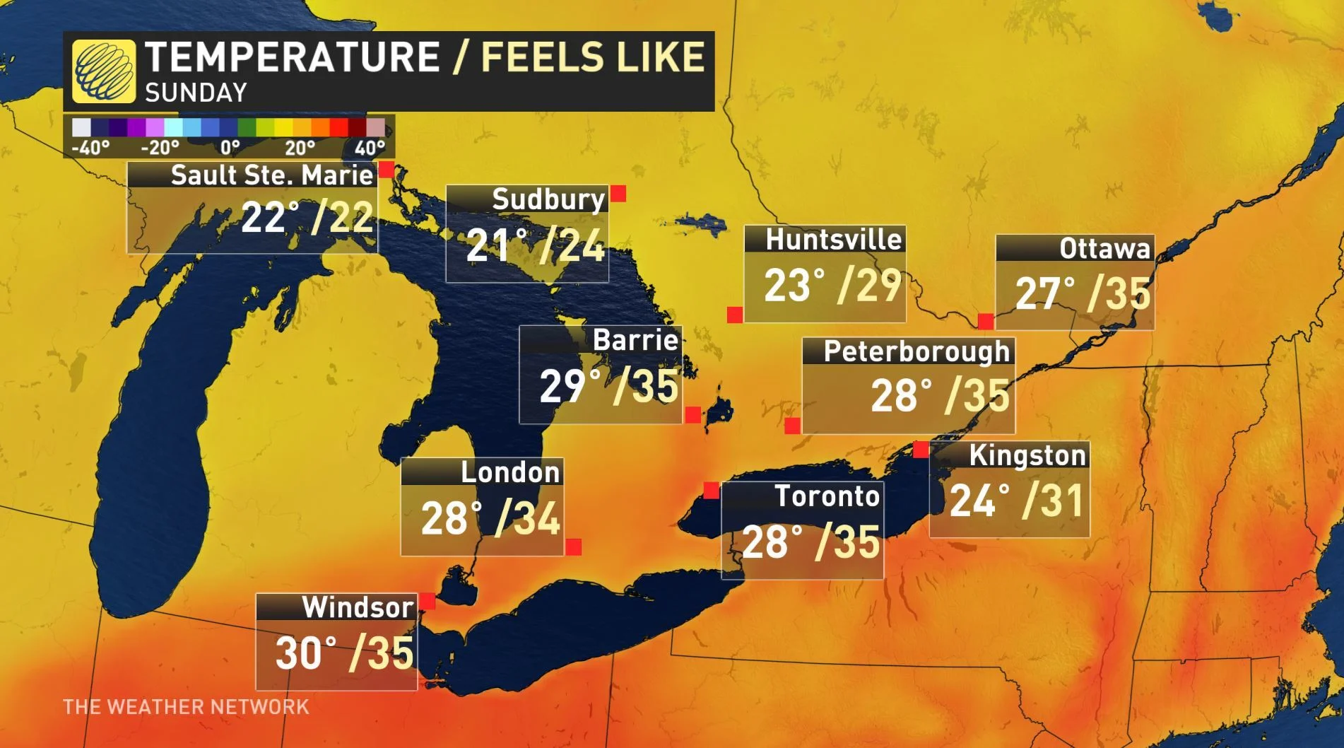
Mid-30s humidex values likely on Sunday
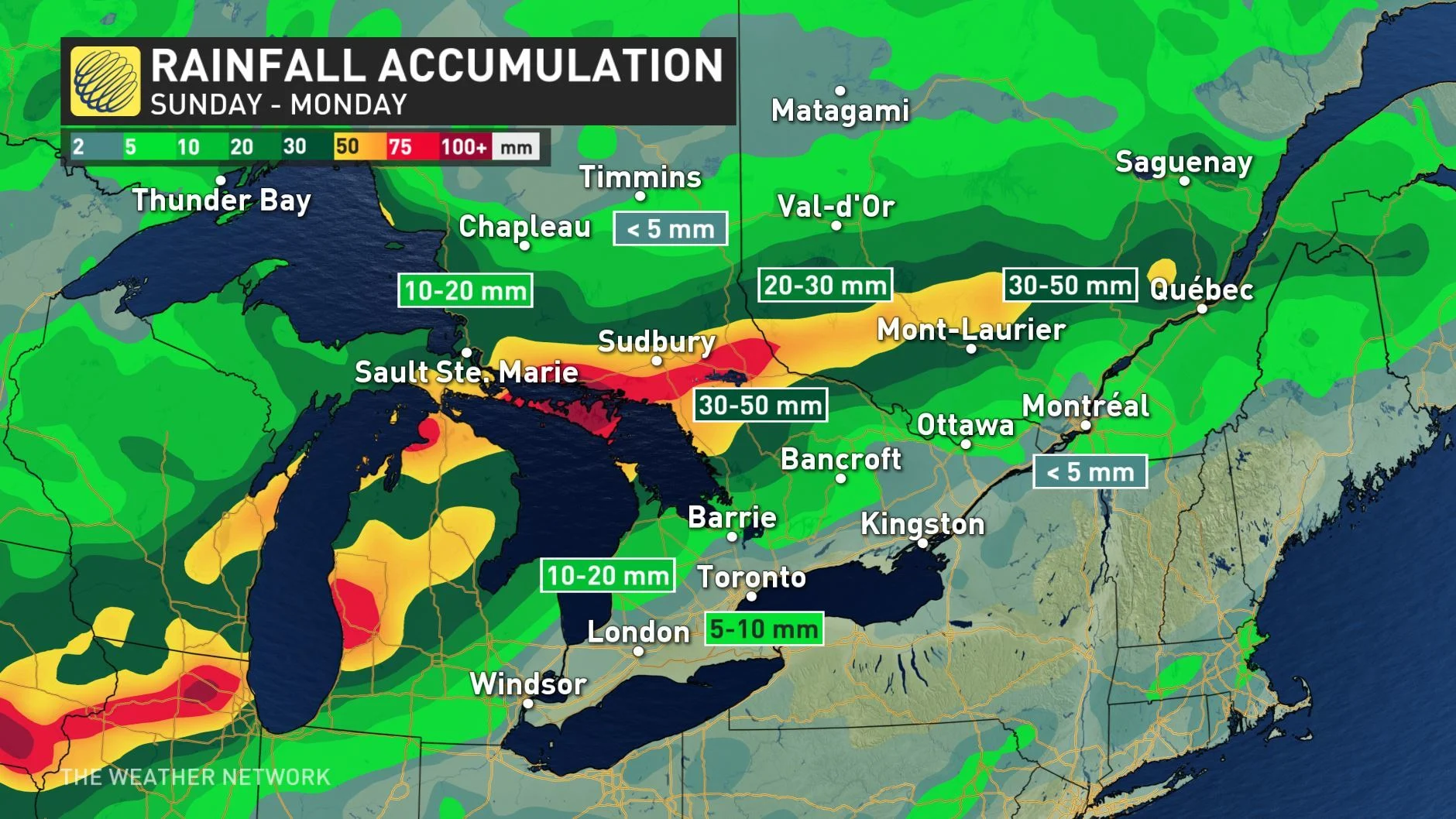
Widespread rain and thunderstorms spread into central, southern Ontario on Sunday
Cooler temperatures arrive with fall on Monday, temperatures rebound late week
HOT, HUMID FOR LAST WEEKEND OF SUMMER
The final weekend of summer will close out with peaking heat and humidity, which has been widespread over the Great Lakes region for the past few days.
The sunny skies will drive temperatures to near-record territory for some and most of the southwest will stay dry as a rainy low pressure system tracks in.

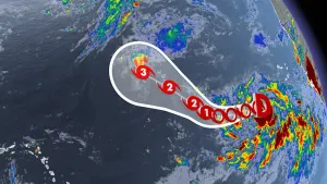
There is an increasing threat for rain showers and thunderstorms that is in part thanks to some remnant moisture from what was once tropical storm Imelda, which has brought catastrophic rain and deadly flooding to Texas.
The bulk of Sunday's rain will fall over the Nickel Belt and cottage country areas totals could reach between 50 to 70 mm by the end of the day, while most of the southwestern regions will not see the rain until Monday.
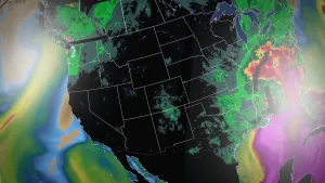
WATCH BELOW: TIMING OF RAIN ON SUNDAY
"While the actual tropical system itself has long since dissipated, a separate low pressure system developing over the U.S. will draw the ex-system's moisture in, leading to higher rainfall totals in parts of Ontario this weekend," says meteorologist Kelly Sonnenburg.
COOLER AIR ARRIVES WITH FALL ON MONDAY
Cooler, drier will sweep in behind Sunday's front, just in time for the change of seasons. While temperatures will be seasonally cooler, sunny skies will provide some consolation for those sorry to see summer end.
And late-week temperatures may add some extra comfort to those not ready to say goodbye to the warmth.
"As we head towards next weekend (and the final days of September), a warm pattern will return," says Weather Network meteorologist Dr. Doug Gillham. "By this time, our 'normal' high temperatures will be in the teens, but it looks like we will see an extended stretch of days with highs well into the 20s that will continue into the start of October."