Fall chill soon sweeps Ontario, and the snow chances grow
A big temperature pattern change is coming to parts of Ontario. Some will even see a transition from rain to snow!
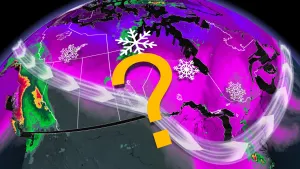
Love it or hate it -- it was only a matter of time until that 'S' word returned to the forecast.
The chances for snow in Ontario will grow as early as next week, as a noticeable fall chill sweeps the province. The first widespread frost and freeze is likely for much of the region, as well.
Visit our Complete Guide to Fall 2024 for an in depth look at the Fall Forecast, tips to plan for it and much more!
There really hasn't been much to complain about temperature-wise so far this season, with above average daytime highs giving much of the province a second summer to hang on to. October has also started on a seasonably warm note, with daytime highs still hitting in the 20s across the south over the past week.
October is always a changeable month however, and everyone will start to see significant interruptions to the warmer pattern. It's probably time to start packing those layers!
Temperatures tumble to more seasonal values next week:
After a weekend that will feature mostly spectacular fall weather, conditions will start to take a bit of a turn early next week. That's as an upper level low makes a trek across Canada, settling in over Ontario and Quebec. This system will bring a fall cooldown and dip in temperatures, as well as a widespread rain.

Rain will likely arrive across southern Ontario on Sunday, with cooler temperatures filtering in behind for Monday and beyond. Seasonal values for this time of year sit at 16°C across the south, so much of the Greater Toronto Area (GTA) will be within that seasonal mark, or slightly below, for next week.
This should bring the first widespread frost and freeze for many rural areas as overnight lows dip, especially for areas north and northeast of the GTA.
RELATED: Spectacular fall weekend, but with a catch in southern Ontario
October snow in the north
Across northern Ontario, rain begins Sunday and lingers through much of the day. As night falls, temperatures may drop below freezing, allowing for a change over to snow.

Exact amounts and locations are uncertain at this time, but there will be a snowfall chance from Timmins and areas to the north.
This won't be the first instance of snow this year either, with flakes already spotted across North Bay.

Typically, measurable snow isn't recorded for the GTA and southwest until November, but there have certainly been instances of seeing October snow across parts of southern and eastern Ontario.
In Toronto for example, the earliest snow recorded was on October 21. Meanwhile, Ottawa picked up its first flakes on October 1 in 1946. Timmins takes the cake, however, with a very early September 6 sighting back in 1986.

While we are getting into the time of year that is known for its classic fall storms, we expect that October 2024 will feature fewer storms than normal for most of the country. Although the summer temperatures are certainly fading, a consistently cold pattern isn't likely, either. During the second half of October, warmer than normal temperatures are forecast to return.
Also keep in mind that temperatures that feel chilly during early October, end up feeling relatively warm before the end of the month as the "normal" daytime high begins to quickly fall.
Be sure to check back for the latest weather updates across Ontario.