Ontario: Shifting squalls ahead of widespread snow risk Monday

Travel conditions deteriorate in local intense squalls through Saturday, with eyes on a widespread snow threat that looms for southern Ontario Monday.
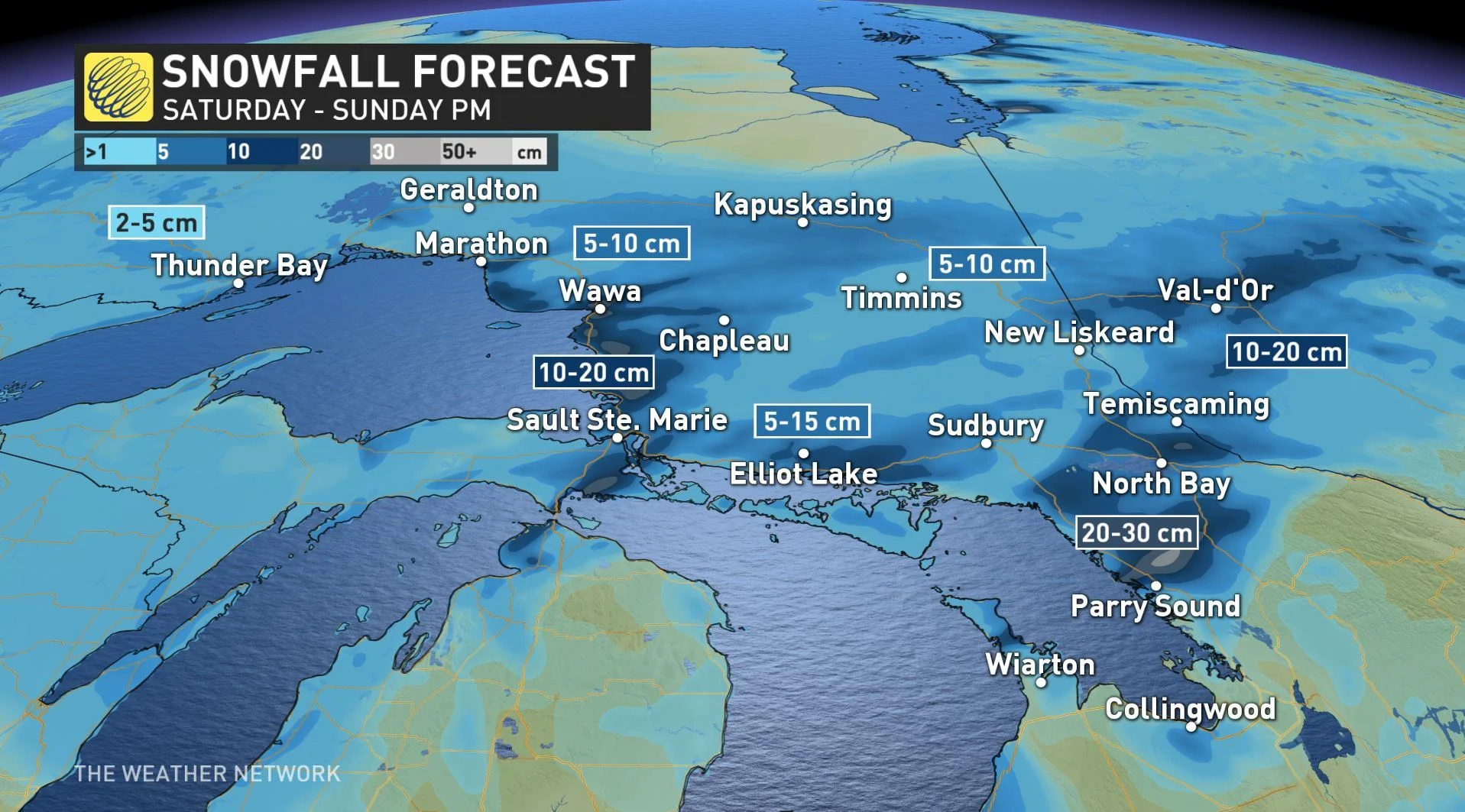
Dangerous snow squalls will continue across parts of Ontario through Saturday morning with as much as 30 cm possible under the most intense bands by Sunday morning. Though the squalls do die down by end of day Saturday, attention then turns to a potential system that could bring a more widespread snow later on Monday. More on where the travel remains the worst through the start of the weekend, plus a look at the arctic air and significant system that could snarl the start of the new workweek, below.
Time to prepare for the season ahead! The Weather Network's Winter Forecast launches Monday, November 18.
WEATHER HIGHLIGHTS:
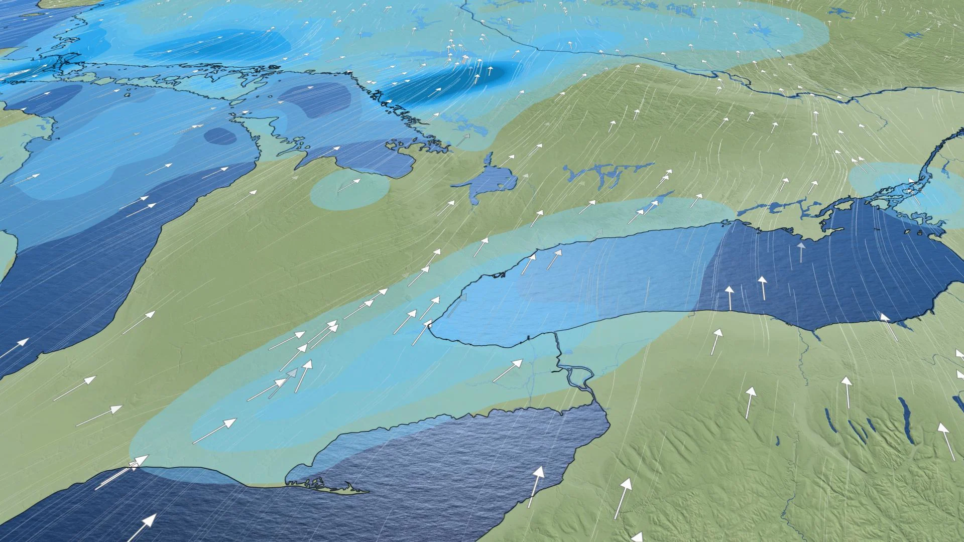
Squalls persist through the day across the Bruce Peninsula and western shores of Georgian Bay Saturday
Watching the potential development of a system along a boundary over the Great Lakes Monday
Stay up-to-date on the ALERTS in your area
Shifting winds have brought an end to most of the snow squall activity across southern Ontario. While some streamers continue to bring light snow to cottage country, much of the snow left to fall this weekend comes courtesy of a weak boundary drifting south through the Great Lakes region. The heaviest snow from this feature stands to fall north of Superior and Huron, though a few showers or flurries aren't out of the question for southern Ontario on Sunday.
While any activity the south does see on Sunday isn't likely to have much of an impact on plans, the potential storm looming for Monday is another matter entirely.
SEE ALSO: How the Great Lakes contribute to dangerous wintry weather
POTENTIAL FOR WIDESPREAD SNOW, INCLUDING THE GTA, MONDAY
A frosty couple of days will give way to a more seasonal Sunday, with daytime highs above zero and the chance of some showers throughout the day. Beyond, though, we're watching a system tracking south of the Great Lakes that has the potential to bring widespread snowfall for much of the south, including the Greater Toronto Area Monday.
Forecasters are also closely watching the increasing potential for a significant system set to develop and track along the cold front south of the U.S. border early next week. The amount of snow is track-dependant, with the potential for some 5-10 cm along the 401 corridor, but forecasters say that's not a guarantee at this point.
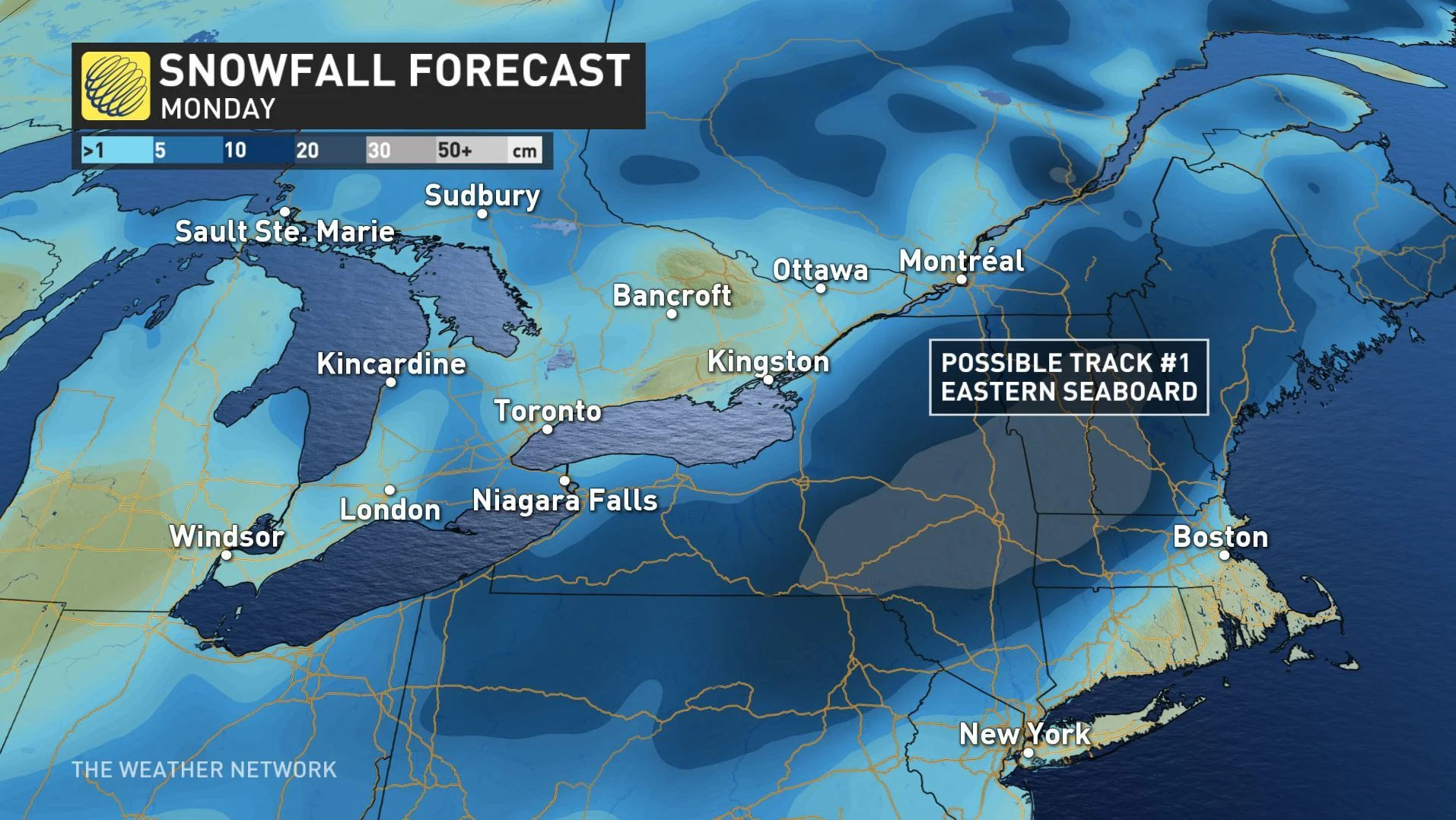
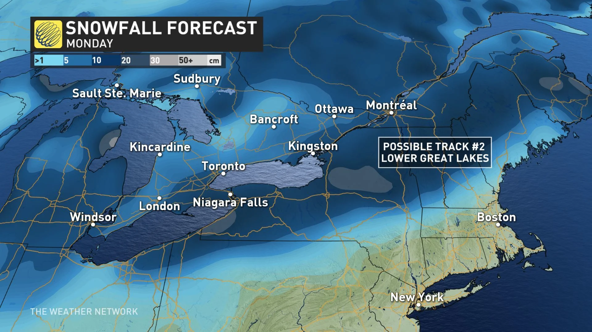
"There's low certainty on the location of the boundary on Monday when the snowfall intensifies. The latest models suggest the snow may remain south of Lake Ontario," Weather Network meteorologist Kevin MacKay says.
MUST READ: Typhoon Halong hampers any dream of a notable November warm-up
Beyond, milder temperatures retreat once again by the mid-week as Arctic air returns to the great lakes, with temperatures through Wednesday much more typical of mid-December than early November.
Once again, intense lake-effect snow squalls will severely impact travel southeast of Georgian Bay and Lake Huron, including areas near London and Collingwood.
Although the cold pattern looks to relax at times during late November, overall, the chilly weather is set to dominate right through the end of the month.
Be sure to check back through the weekend for your latest forecast updates.