
Heavy rain, flood risk as severe thunderstorms target parts of Atlantic Canada
The thunderstorm risk will continue to loom over Atlantic Canada on Thursday as the heat and unstable air mass provide fuel for the development. Intense rainfall rates could result in localized flooding
Back-to-back storm days have spanned much of Atlantic Canada this week, with hot and humid conditions fueling the instability for storms.
The risk will continue through the day on Thursday, with the threat for heavy rain, strong winds, and even small hail all on the table, once again. Severe thunderstorm watches were issued for parts of Nova Scotia and New Brunswick early in the day, warning of intense rainfall rates of 15-25 mm per hour.
"Torrential rains can cause flash flooding and waterlogging on roads," says Environment and Climate Change Canada in the watch.
PHOTOS: Another round of torrential rain hits southern Ontario
Be sure to remain weather-aware, and stay up-to-date on all of the watches and warnings in your area. Never try to drive across a flooded roadway. It’s impossible to tell how deep the water is until it’s too late.
Thursday: Threat for torrential rains with thunderstorms
A couple of frontal boundaries and lows migrating through Atlantic Canada are bringing the risk for scattered showers and thunderstorms once again on Thursday, some which could turn severe.
A severe thunderstorm watch was issued for parts of Nova Scotia and southern New Brunswick ahead of the Thursday morning commute, warning of local torrential rains and rapid rainfall rates of 15 - 25 mm per hour.
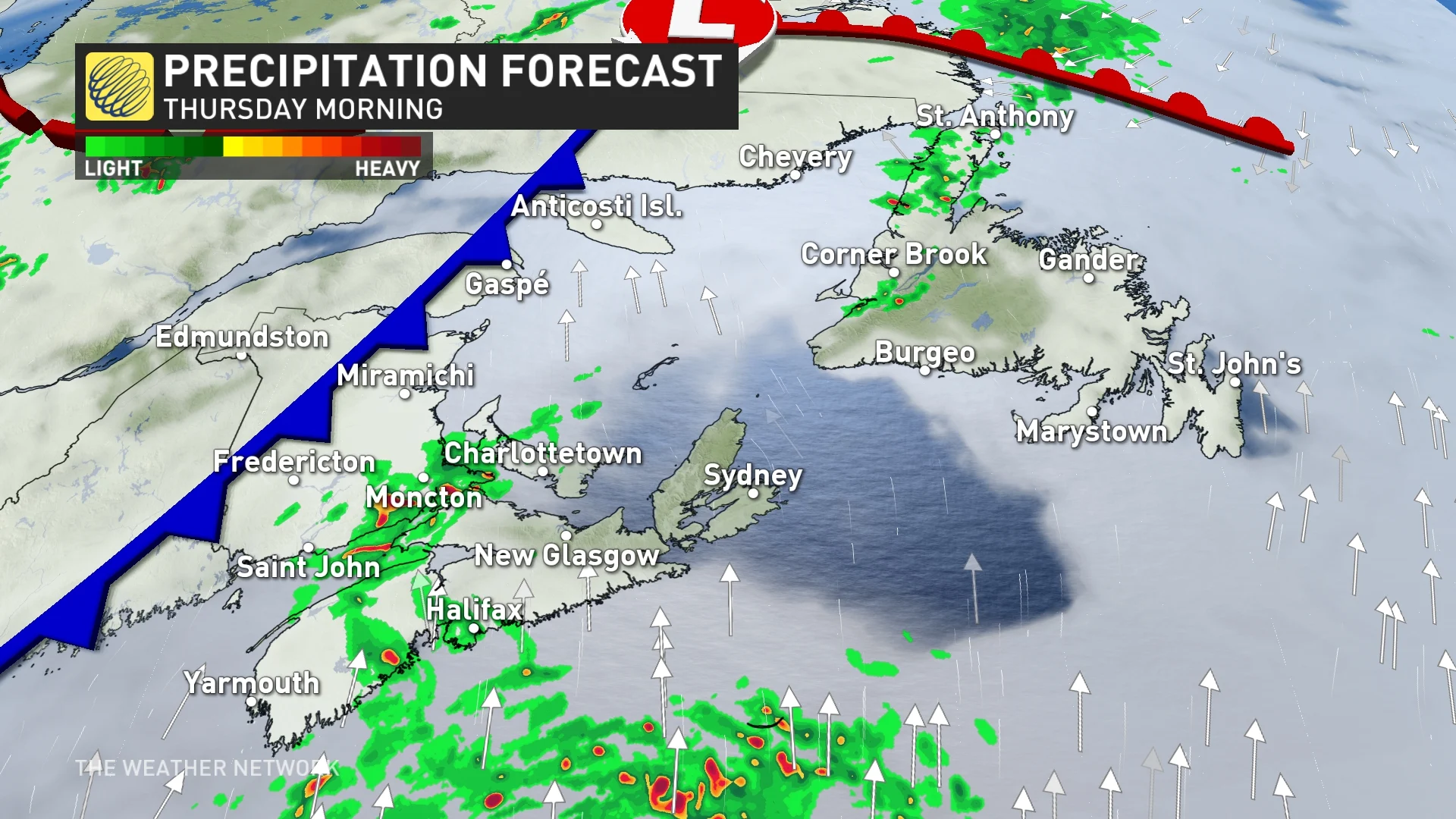
By Thursday afternoon, the cold front will trigger thunderstorms from north to south as the front passes into New Brunswick and P.E.I. in the evening.
Storms should remain sub-severe across Atlantic Canada, but the best chance of a stronger cell or two will be in northern New Brunswick, along the Quebec border.
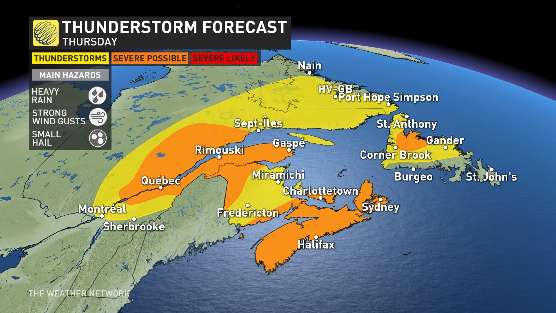
An onshore Atlantic flow into the hot and humid air mass will also trigger storms across central Nova Scotia on Thursday.
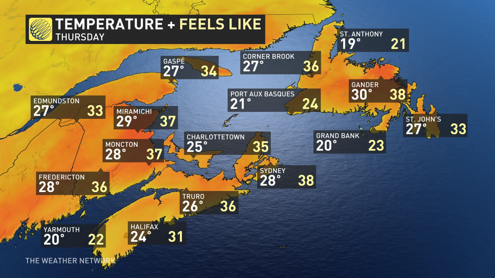
Thursday will be the hottest day for much of Newfoundland with highs in the upper 20s to lower 30s for the interior, and mid-20s for the Avalon.
Cooler weather is expected for a few days through early next week, then temperatures will trend warmer once again for the middle of and late week.
Be sure to check back for the latest weather updates across Atlantic Canada
Thumbnail courtesy of Unsplash.