Flooding, outages possible in B.C. as heavy rain, ice continue Saturday

Heavy rains could cause flooding across parts of B.C. on Saturday, while a prolonged freezing rain event will threaten significant ice for inland areas.
A wintry scene across British Columbia’s South Coast will give way to an atmospheric river heading into the start of the long holiday weekend, bringing heavy rainfall and a threat for flooding for many locations, and prolonged freezing rain event for others.
Widespread snow and freezing rain blanketed southern B.C. on Friday with accumulations that brought travel to a standstill on the roads and in the air.
Major flight cancellations plagued holiday travelers at Vancouver International Airport, and those cancellations and delays will trickle into Saturday even as the wintry precipitation gives way to rain.
WATCH: Treacherous travel throughout Vancouver as freezing rain hits streets
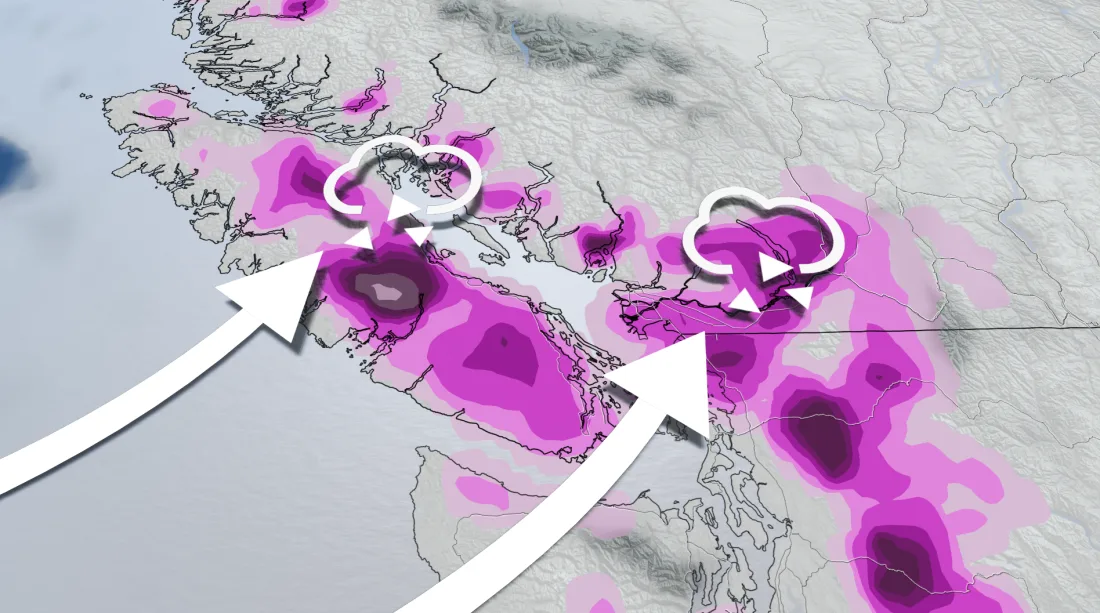
A slug of high atmospheric moisture flowing straight from Hawaii will arrive in B.C. just in time for the start of the long holiday weekend.
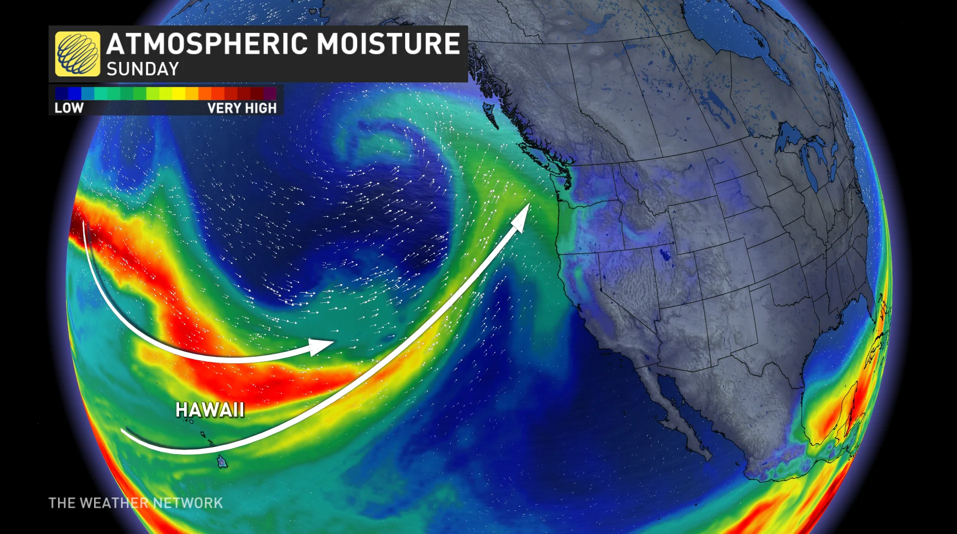
The arrival of this atmospheric river will coincide with the arrival of warmer temperatures, as well, allowing most of the region’s precipitation to switch from a wintry flavour to plain old rain as we head into Saturday.
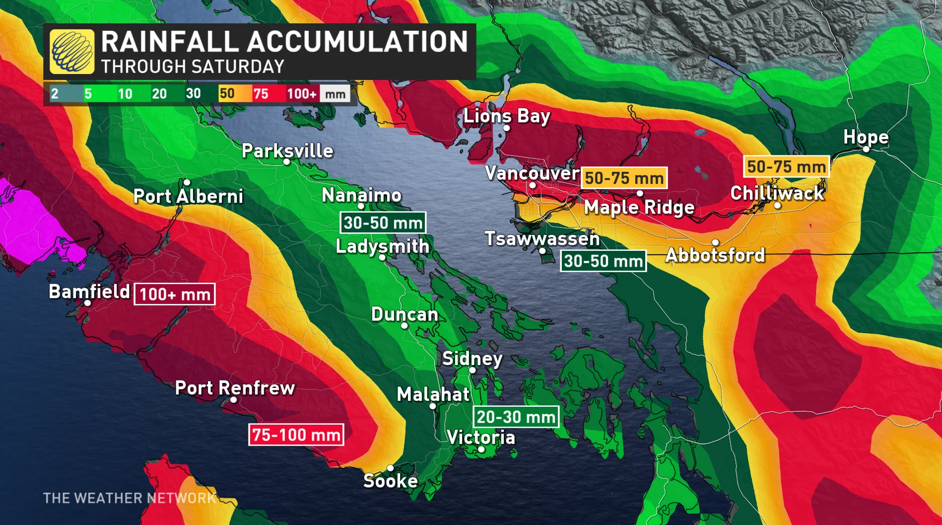
Widespread rainfall warnings are in effect ahead of this batch of heavy rain. Forecasters expect rainfall totals of 50+ mm across the region, with totals of 100+ mm predicted for western Vancouver Island and 50-75 mm possible north of the Fraser River.
Between the heavy rainfall and rising temperatures, localized flooding is possible in areas where storm drains are clogged from the recent snows.
Colder air will remain in place farther inland, however, and forecasters are concerned with the potential for significant ice accretion from prolonged freezing rain.
PHOTOS: Travel virtually impossible as B.C. digs out from snow wallop
Warm air aloft will spread over cold air lodged at the surface within the Fraser Valley, leading to a significant freezing rain event across the region heading into Saturday.
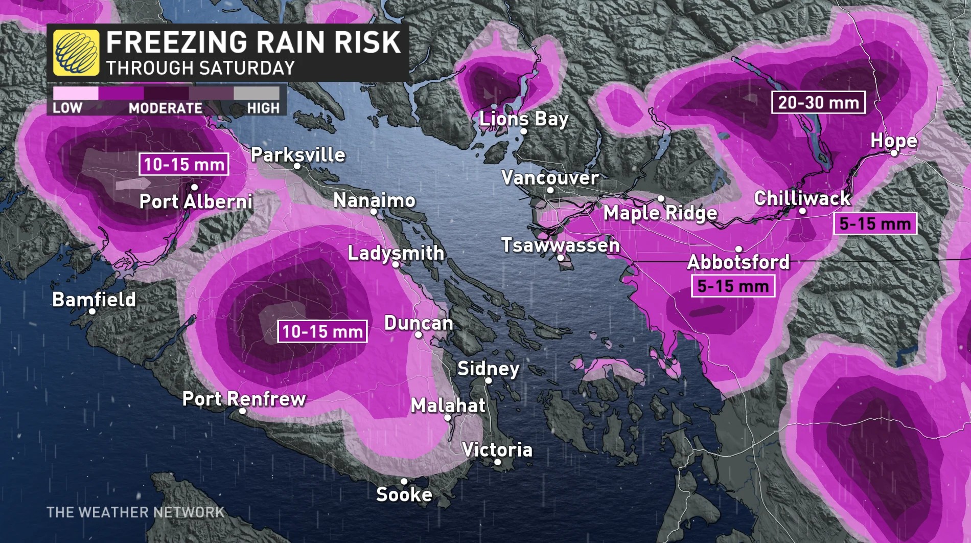
The ice accretion will likely cause problems for hydro infrastructure and roads, threatening possible power outages and difficult travel. Other areas of concern for freezing rain include up Howe Sound, where light outflow winds will persist the longest near Squamish.
By Saturday evening, most of that colder air will have been sufficiently flushed from valleys and inlets, transitioning the precipitation to rain, making for a rainy and gusty Christmas along the coast.
Boxing Day and beyond will feature an abundance of wet weather as a stormy pattern remains locked across the coast through the final days of 2022.
WATCH: Vancouver sees big increase in building fires as cold sets in
Check back for the latest on these multiple wintry threats across B.C.