Mid-summer check-in: Ghost of El Niño disrupts summer patterns in Canada

Wondering why our summer weather has taken a significant detour? La Niña hit the pause button
We have just passed the midpoint of meteorological summer, so it is time to check in on the good, the bad, and also the ugly of the 2024 Summer Forecast, and look ahead to what we expect for the second half of the season.
Our forecast for the months of June, July, and August called for warmer than normal temperatures across most of Canada, especially during the second half of the season. The one region that we thought would see more of a typical summer was across the westernmost parts of the country.
Below is our original temperature forecast.

The Weather Network's Summer Forecast temperature forecast published on May 29.
The graphic below shows the temperature anomalies across North America from June through July 15, with the various shades of orange highlighting warmer than normal temperatures, and the various shades of blue highlighting cooler than normal temperatures.
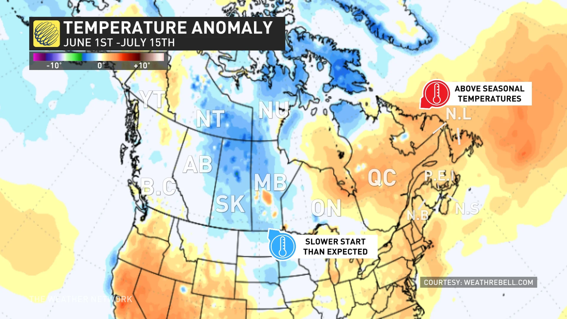
Courtesy of WeatherBELL
The warmer than normal temperatures across eastern Canada fit well with our forecast, as do the near normal temperatures across the Yukon, British Columbia and Alberta. However, summer got off to a slower start than expected across Saskatchewan, Manitoba, much of the Northwest Territories, and Nunavut.
However, the first half of July featured a pattern change.
Below are the temperature anomalies that we saw during the second week of July. Note the warmer than normal temperatures from coast to coast across southern Canada.
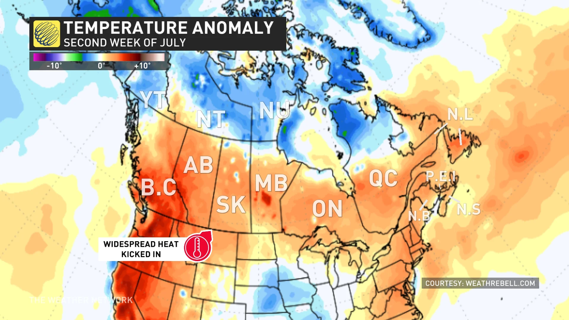
Courtesy of WeatherBELL
Summer trends hotter than expected across Western Canada
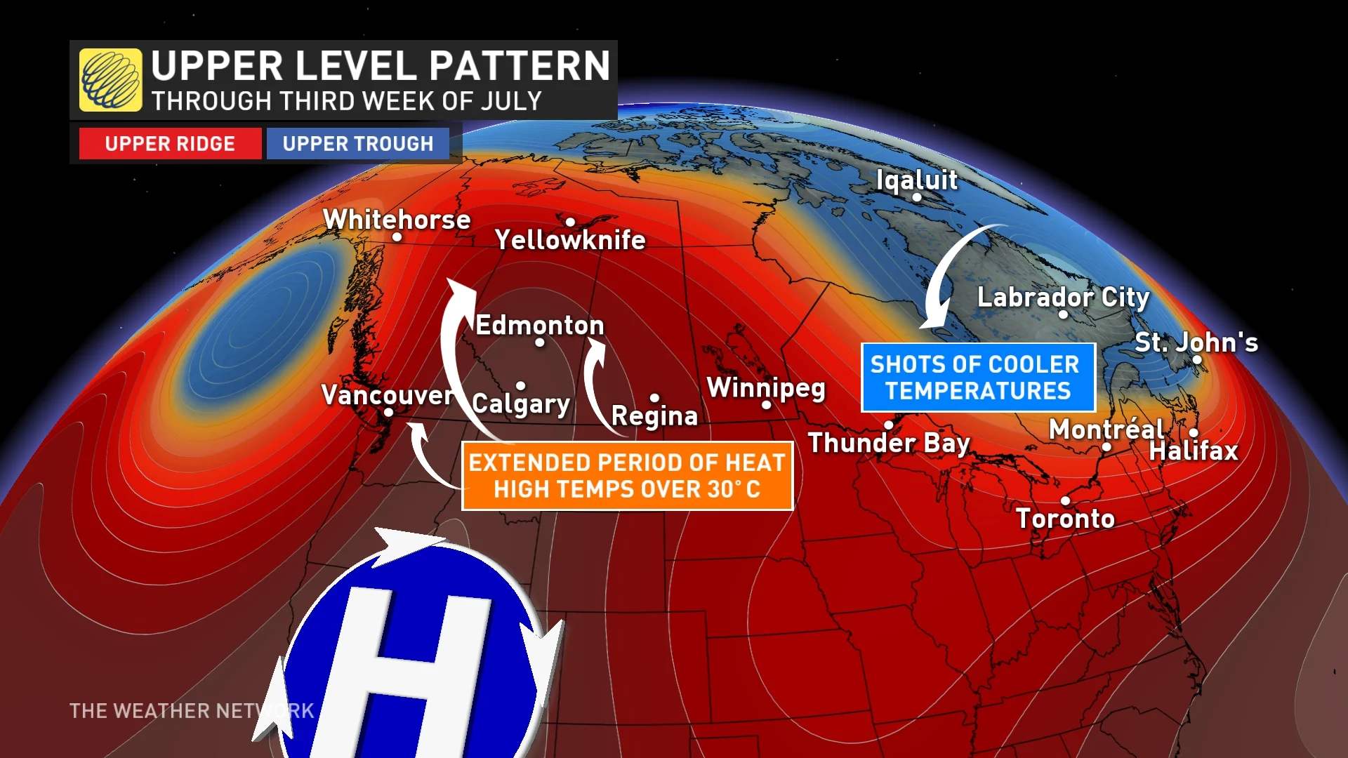
A period of widespread hot weather fits well with the Summer Forecast, but as we look ahead to the rest of July, it is evident that this summer is now trending hotter than initially expected across B.C. and Alberta.
RELATED: Unyielding heat keeps B.C. sizzling under stifling temperatures
The following is a model forecast, which roughly illustrates our current expectations for the second half of July. Note that the focus of the heat will be across the western Prairies.

Courtesy of WeatherBELL
Meanwhile, the second half of July will continue to bring shots of cooler weather into Ontario and Quebec. This region should still be warmer than normal for the summer as a whole, but the lack of heat during the hottest part of the summer was not expected.
We will look ahead to the month of August in a moment, but first, here is a look at why our summer weather has taken a significant detour.
MUST SEE: What happens when El Niño and La Niña disappear?
One of the keys to our 2024 Summer Forecast was the fact that the global pattern was in the midst of a rapid transition from El Niño to La Niña. By the end of May, ocean water temperatures were already running cooler than normal in the tropical Pacific to the west of South America, (see the region in the black box below) which is the signature of La Niña.
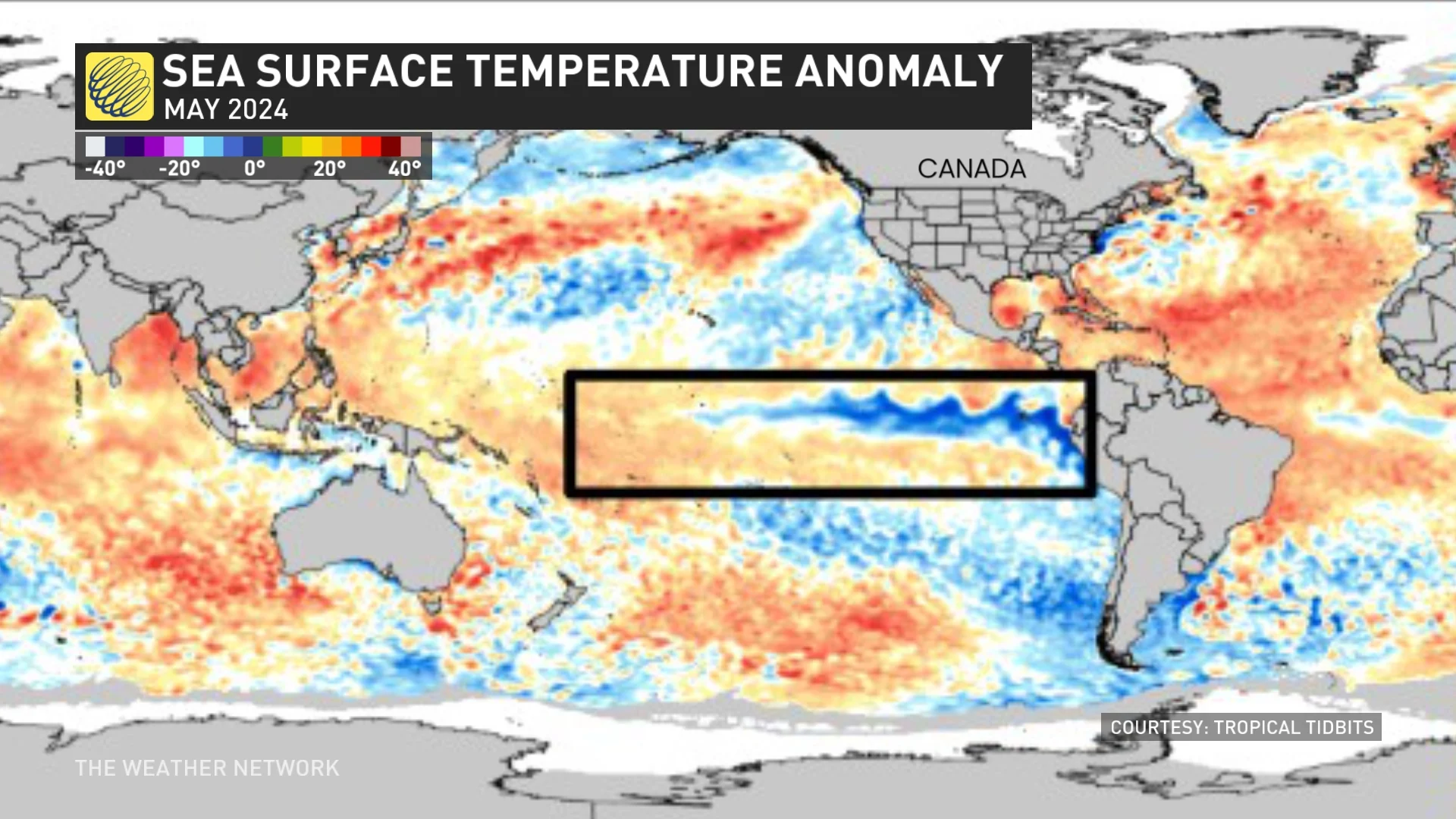
Every indication was that La Niña would continue to develop as we progressed through the summer.
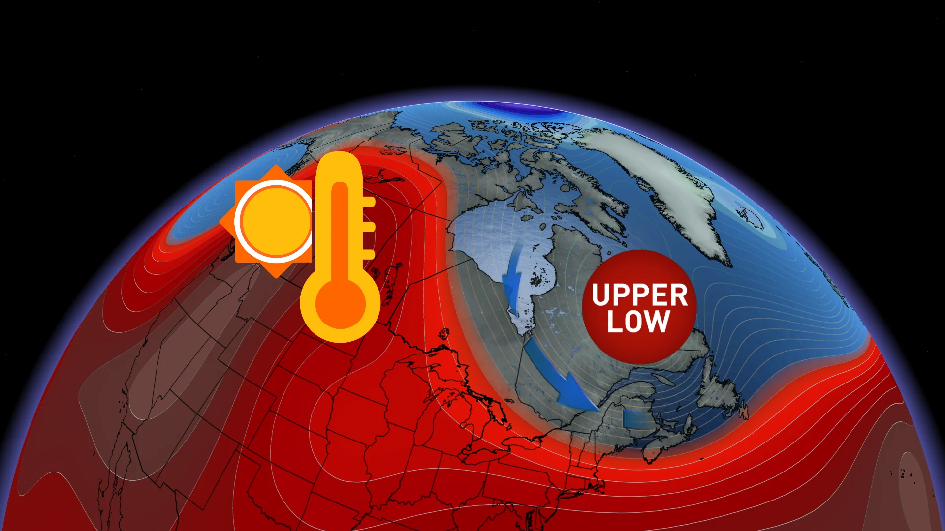
Ghost of El Niño disrupts initial Summer Forecast
Not only has La Niña hit the pause button, ocean water temperatures have actually trended warmer, instead of continuing to cool in the tropical Pacific. Note that we now have less blue in the box on the map below.
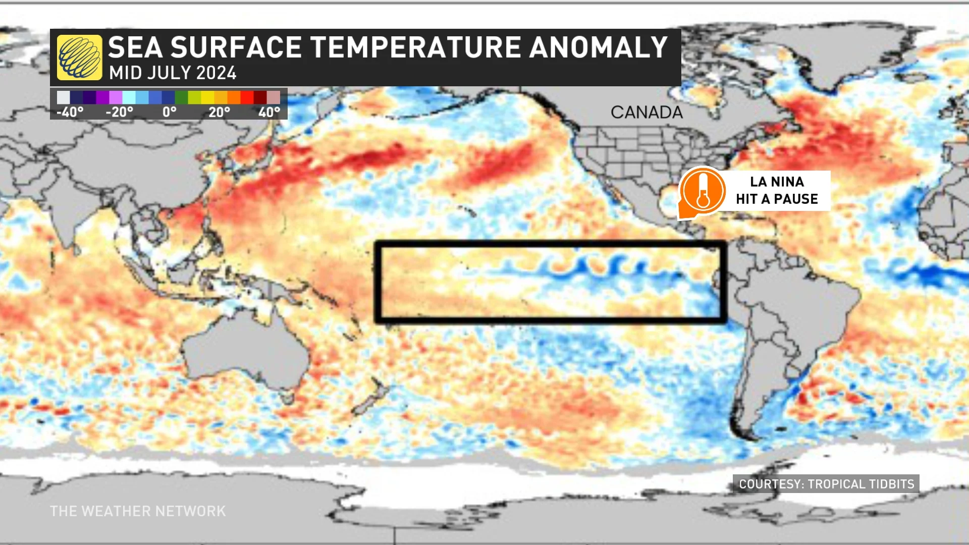
So why does that matter? Instead of having a global jet stream pattern that is consistent with a developing La Niña, it has reverted back to the pattern that we often see with El Niño, which is the pattern that we were in last summer.
During El Niño summers, we often see the heat focused across western Canada and periods of cooler weather across Ontario and into Quebec. That is what we expect to see most of the time for the rest of July.
DON'T MISS: The Weather Network's hub on all things El Niño and La Niña
A look ahead to August: Summer may finish strong (hot!)
As we look ahead to August, we expect a widespread warm pattern across most of Canada, but a cooler pattern across northern areas. Even if the ghost of El Niño lingers, history shows us that summers with a similar pattern have finished strong with more widespread hot weather.

If we start to trend back into La Niña again, however, that would result in even hotter conditions across the Great Lakes region and less heat across Western Canada.
Regardless, we will not see as much persistent heat as we initially expected across Ontario and Quebec for the summer as a whole.
But why all the rain?
If you live in Ontario and Quebec, no doubt you have noticed that this summer has been much wetter than expected.
One of the keys to the wet and stormy pattern has been the frequent clashes between the hot and very humid weather across eastern North America and the cooler weather, which dominated the first half of the season across the Prairies.
PHOTOS: Major flooding prompts road closures, power outages in Ontario
If hot weather had been more persistent, then Ontario and Quebec would have turned much drier, but the more changeable pattern has been conducive to a very active and stormy pattern.
The rest of July will continue to bring changeable conditions to Ontario and Quebec, so it is unlikely that we will flip to a truly dry pattern anytime soon. However, we expect that the rain and storms will be less frequent (with more periods of dry weather) during late July and August than what we saw during the first half of summer.
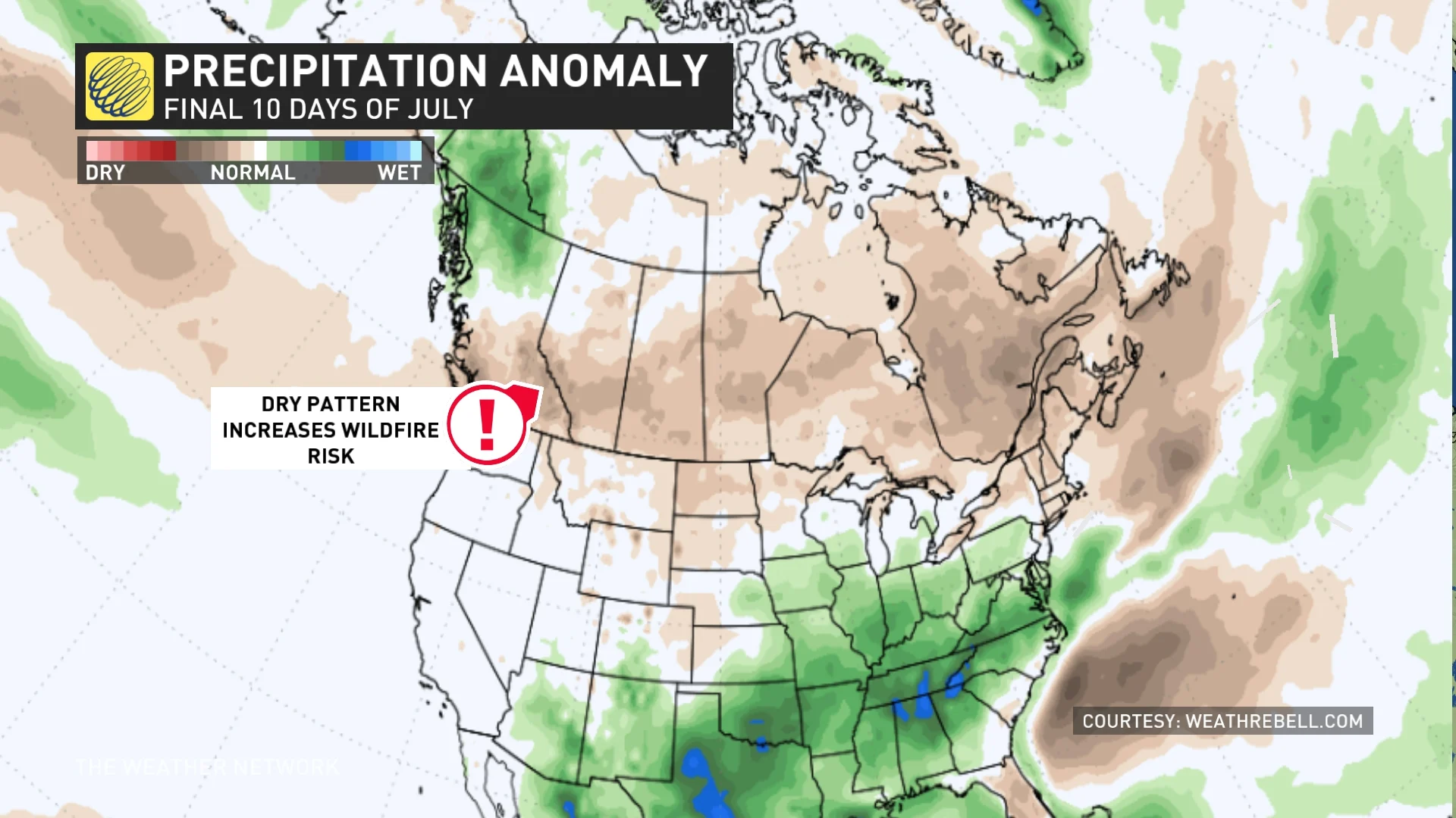
Unfortunately, we expect that much of central and western Canada will be much drier with an increasing risk for wildfires.
RELATED: Extreme heat sparks wildfire woes, worries across Western Canada
The graphic below is a model forecast for the final 10 days of July. The shades of green and blue highlight a forecast for wetter than normal conditions, and the shades of brown highlight a forecast for drier than normal conditions.
Courtesy of WeatherBELL
While the very wet and stormy pattern for the eastern U.S. could shift north into southern Ontario at times, much of Canada will see a drier pattern during late July and into the beginning of August.