Canada set to endure a warm, dry August ahead—with a few hiccups
Here’s a look at your monthly weather outlook across Canada
We’re on the cusp of fall as kids get ready to head back to school and folks embark on their final vacations of the season. What kind of conditions can we expect for these dog days of summer?
An early fall isn’t in the cards for the vast majority of Canadians this August as a warmer and drier-than-normal pattern looks to dominate the country throughout the month. However, there will be exceptions to the trend—and that could include your community.
Here’s a look at the monthly outlook for your August ahead.
August to bring warmer-than-normal conditions to most
Raging fires dominated headlines in July as a warm and dry pattern dominated the western half of Canada. Billowing smoke from hundreds of blazes across the region tinted skies from coast to coast to round out the month.
Several rounds of severe weather brought significant flooding to the Greater Toronto Area, with Pearson Airport recording one of its all-time wettest days on record back on July 16. Another round of storms produced a confirmed tornado near Montreal just a few days later.
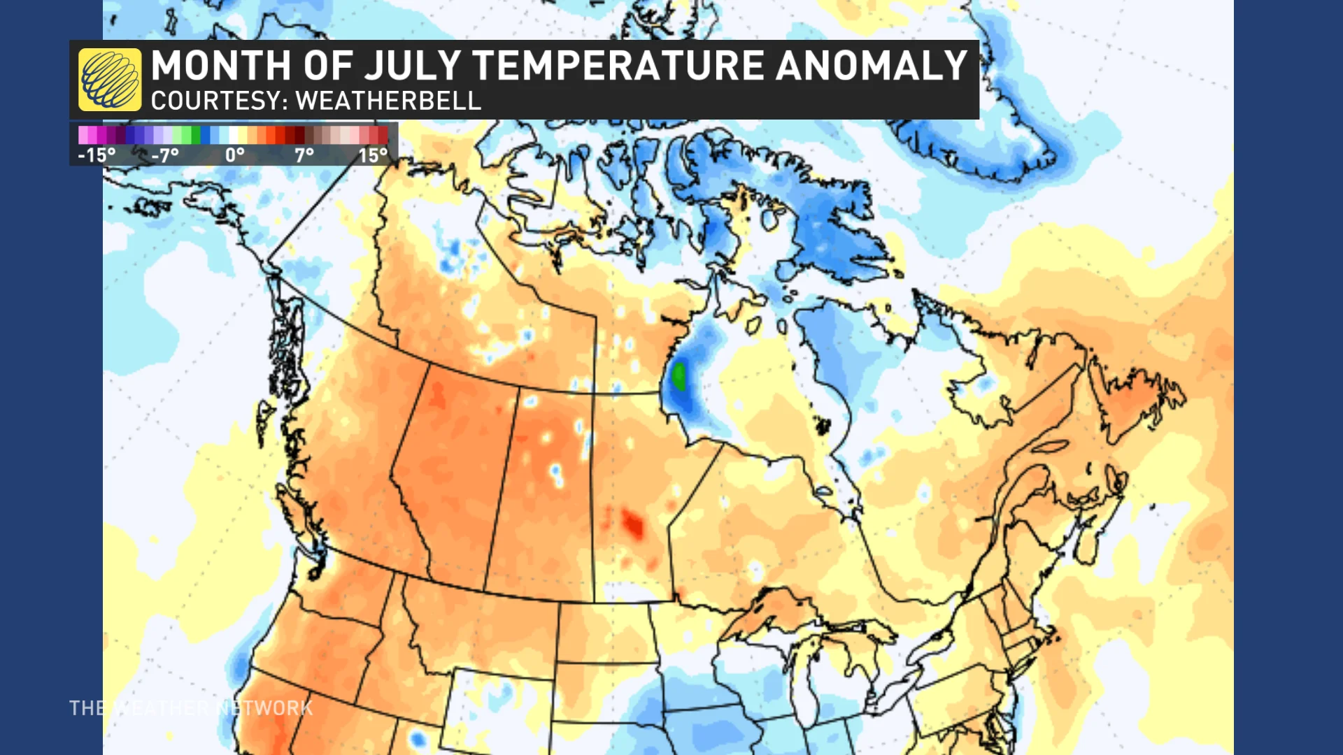
Temperature anomaly for July 2024. Various shades of orange highlight warmer than normal temperatures. (Courtesy: WeatherBELL)
DON’T MISS: Mid-summer check-in: Ghost of El Niño disrupts summer patterns in Canada
Will we see a repeat of July’s turbulent weather in August?
Just about all of Canada’s population centres are on track to deal with above-seasonal temperatures throughout the month ahead.
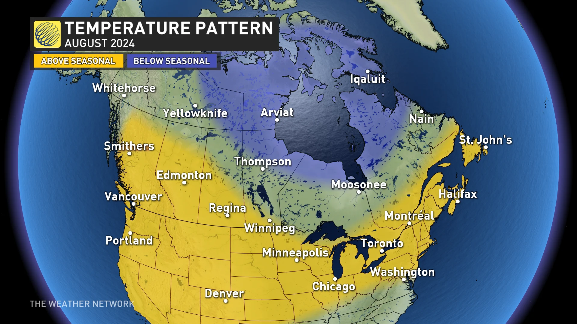
Only folks across the Far North will be spared the consistent heat, with below-seasonal temperatures on the way for places like the Yukon and Baffin Island.
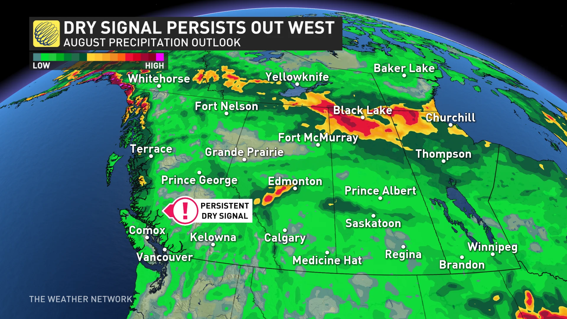
Western Canada stays dry overall
Above-seasonal temperatures and below-seasonal precipitation will dominate conditions across British Columbia and much of the Prairies, which is terrible news for both wildfires and agriculture throughout the region. Vancouver may sit right on the edge of the pattern between above-seasonal and near-seasonal conditions throughout the month.
However, folks across B.C.’s Interior and the Prairies will likely still see scattered thunderstorms with the risk for severe weather at times, so it’s possible to get localized torrential rains even in an overall dry pattern.
Eastern Canada stays muggy, watching the tropics
Don’t put those short-sleeve shirts away just yet if you’re in Halifax or St. John’s. Eastern Canada will have to contend with a hot and humid start to August—largely thanks to a pattern shift triggered by a typhoon that tore across the Pacific Ocean at the end of July.
A dose of cooler conditions is likely to arrive across the East after the long weekend, but that reprieve will give way to a return to muggy weather for the latter half of the month.
MUST SEE: What happens when El Niño and La Niña disappear?
Ontario and Quebec will likely find themselves caught in between the two patterns dominating either side of the country. Conditions will alternate back and forth between stretches of stormy weather interspersed with calmer and drier spells. Much like the Prairies, thunderstorms may bring occasional bouts of torrential rains to some communities.
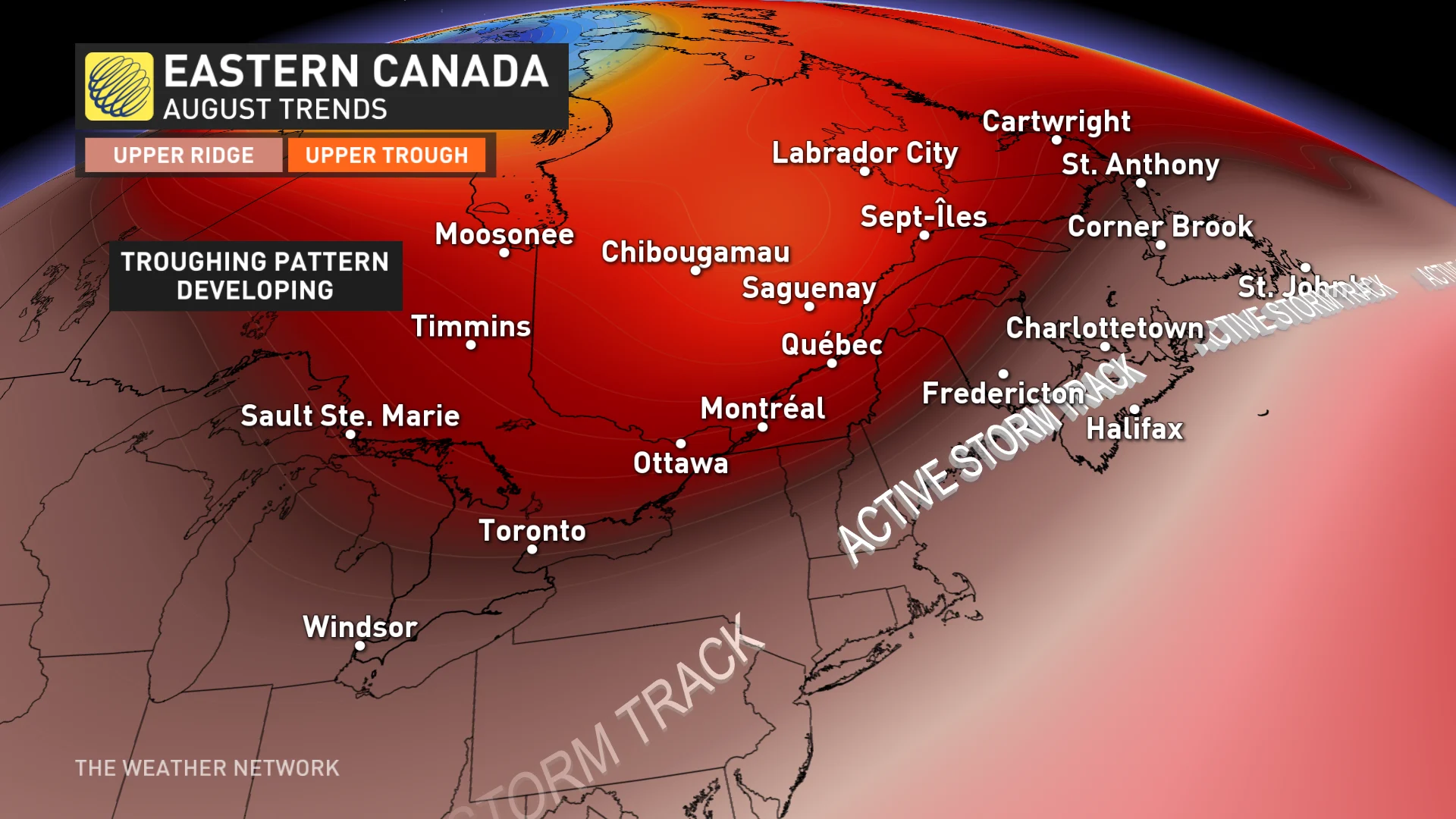
An active storm track appears to be shaping up across Atlantic Canada under a dominant southwest flow during the first half of the month. We’ll have to closely watch the tropics, though, as forecasters expect the Atlantic basin to become very active as we approach the peak of hurricane season through August.
While the primary area of concern for tropical activity will be the Gulf of Mexico and Florida, a couple of storms will turn north before reaching the U.S. and could threaten Atlantic Canada. If even just the remnants of storms pass through the Atlantic provinces, we could easily see above-normal precipitation across the region.