Big weather flip to hit the East Coast as temperatures tumble, snow moves in
From sun and 20°C daytime highs, to single-digit temperatures and signs of the first snowfall of the season. Get ready for quite the dramatic weather flip coming soon to Atlantic Canada
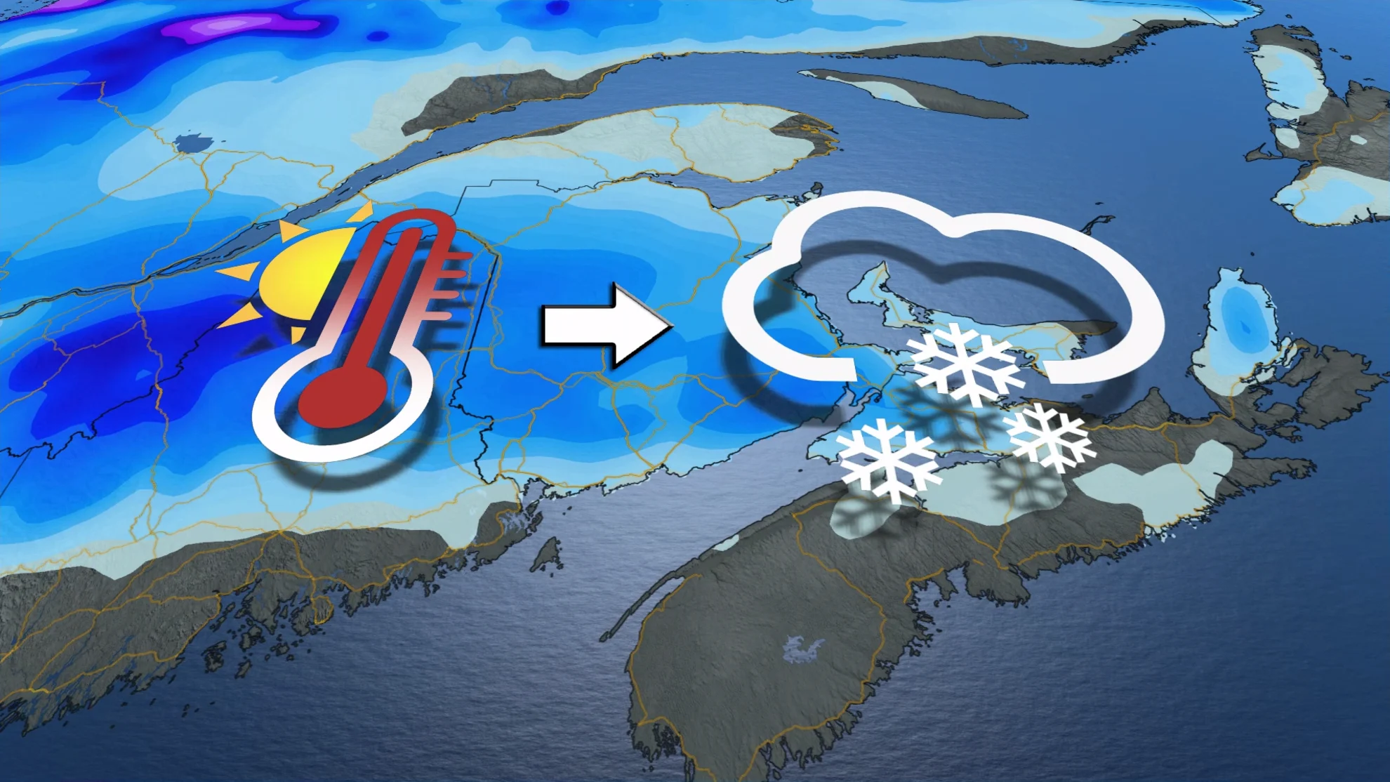
Atlantic Canada will feel some extraordinary October warmth this weekend as daytime highs soar into the 20s, likely setting new records for some communities. However, it will be quite a freefall into the winter season after that, with temperatures tumbling into the single digits by Sunday, and even the first signs of snow to start out next week.
The much colder weather will dominate next week, including Halloween on Tuesday. Cooler than seasonal temperatures are expected to continue well into the second week of November, as well.
__MUST SEE: Warm or wintry? Halloween weekend holds a mixed bag for Canada __
Major pattern flip this weekend after days of well above seasonal temperatures
Soak up the warmth and sunshine while you can! Temperatures will soar on Saturday, reaching a balmy 20°C for many in the Maritimes.

This won't last long however, as a sharp cold front will move through as soon as Sunday, dropping temperatures drastically. Some areas are forecast to see only single-digit highs.
Things get even frostier on Monday, as an active pattern sets up over Eastern Canada, setting the stage for some of the first snowfalls of the season.

A low pressure system will develop in the U.S. Northeast on Monday, and will track south of the Maritimes. Although cooler conditions will already be in place from the cold front on Sunday, a northeasterly wind will usher in even colder air to the northern Maritimes.
Temperatures will range from 0-3°C for New Brunswick on Monday, with a range of 5-10°C daytime highs for Nova Scotia. P.E.I. will land right in the middle of those ranges.

With these colder temperatures, it is possible for New Brunswick, and local parts of Nova Scotia and P.E.I., to see their first snowfall of the season. There is still uncertainty as to how much snow will fall and exactly where that will be, but with colder temperatures and the track of the system, central and northern New Brunswick have the greatest chances of seeing snow and even accumulations.
The southern Maritimes could see some flurries, but is more likely to see rain at this point in time.

We'll also be watching the potential for a significant storm for Atlantic Canada during the middle of next week, one that would bring more snow.
Be sure to check back for the latest weather updates across Atlantic Canada.