Beryl makes third and final landfall in Texas early Monday morning
A stretch of the Texas coast is now under hurricane and storm surge alerts as Beryl makes an early Monday morning landfall

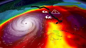
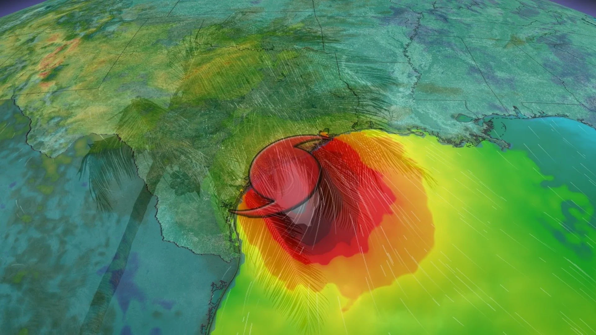
After carving a path of destruction, Hurricane Beryl has made a third and final landfall near Matagorda, Texas early Monday morning.
The storm hit as a Category 1 hurricane at 4:00 CDT with wind speeds up to 130 km/h. With tropical ocean waters no longer available to Beryl, the storm will continue to weaken as it continues inland.

A hurricane warning and a storm surge warning are both in effect for the Texas coast from Baffin Bay northward to Sargent. This includes the city of Corpus Christi. A tropical storm warning is in effect farther north, including the cities of Houston and Galveston.
Damaging winds, flooding rain that could reach up to 380 mm in localized spots and life-threatening storm surge flooding along the coast are possible as Beryl moves inland early this week. Tornadoes are also possible around the Houston metropolitan area as the storm makes landfall.
DON’T MISS: Canadian Red Cross launches appeal to help people impacted by Hurricane Beryl
After landfall, it’s likely that the ridge of high pressure over the southeastern U.S. will steer Beryl’s remnants over the region.
Recent model updates show that the remnants of Beryl are expected to remain fairly organized long after landfall, thanks to the upper-level trough.
Southern Ontario and Quebec will likely feel the impact of the remnants of Beryl as it tracks northwards and then northeastward towards the Great Lakes in the coming days, bringing heavy rainfall to the region.

Beryl’s historic run
Beryl is a historic storm. Over the past couple of days, the system has set records for:
the earliest Category 5 hurricane on record, beating 2005’s Hurricane Emily
the earliest Category 4 hurricane on record, beating 2005’s Hurricane Dennis
the earliest hurricane so far east in the tropical Atlantic on record
This is also the first time since 1966 we’ve seen a major hurricane before the July 4th holiday.

Experts largely agree that we’re in for a very active Atlantic hurricane season in the weeks and months to come. Sea surface temperatures throughout the Atlantic are running several degrees hotter than normal, closer to what you’d expect in September than the end of June.
MUST SEE: El Niño is over—but La Niña may arrive during peak hurricane season
These abnormally hot waters will combine with the lower wind shear brought on by a developing La Niña in the eastern Pacific to foster extremely favourable conditions for tropical cyclone development through the peak of the season this fall.
The latest seasonal outlooks call for as many as two-dozen named storms, which is far more than the 14 tropical storms we’d see during a typical Atlantic hurricane season.
Thumbnail courtesy of NOAA.
Stay with The Weather Network for all the latest on this busy hurricane season.