Relentless moisture fuels rainfall warnings, high avalanche danger in B.C.
Much of B.C.’s terrain faces a high avalanche danger as mild temperatures and relentless rain continue throughout the province.
The seemingly endless train of rainy systems drenching the West Coast will continue marching over the region through the end of the week, bringing some parts of British Columbia more than 100 mm of rain into the weekend.
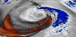
This latest wave of precipitation arrives courtesy of the same series of atmospheric rivers that’s plagued much of North America’s Pacific coast over the past couple of weeks.
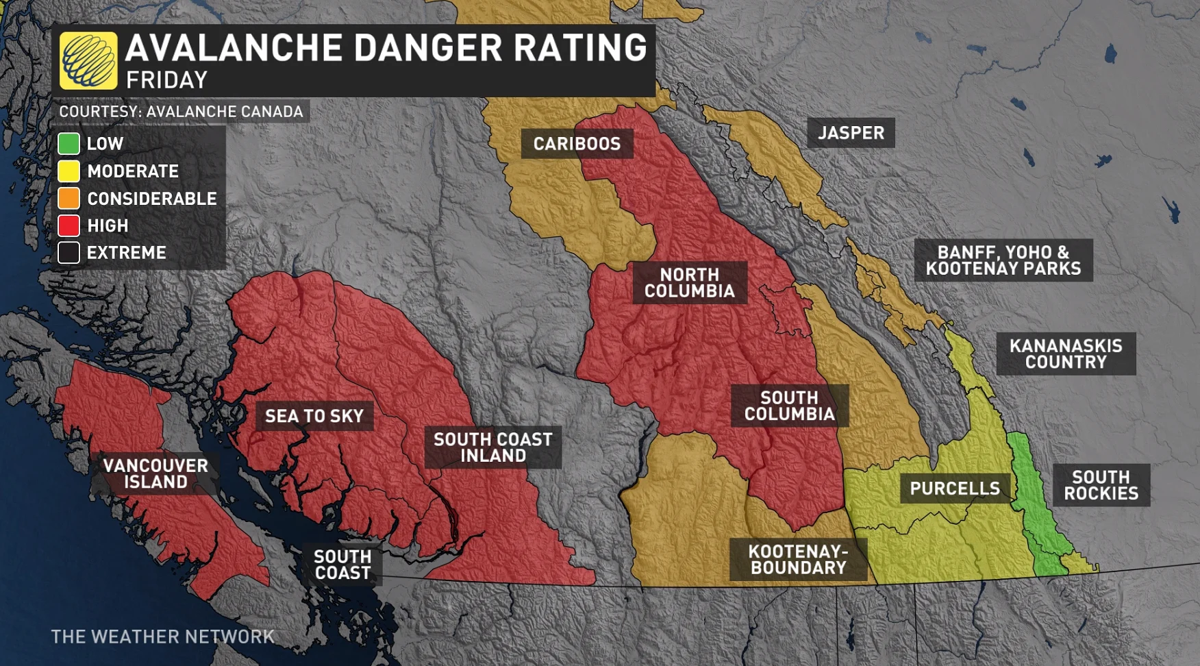
A ‘considerable’ to ‘high’ avalanche risk will build across much of B.C.’s terrain through the end of the week, as recent conditions have created a dangerously unstable snowpack across the province.
SEE ALSO: Snowpack a 'house of cards,' warns Avalanche Canada after fatality
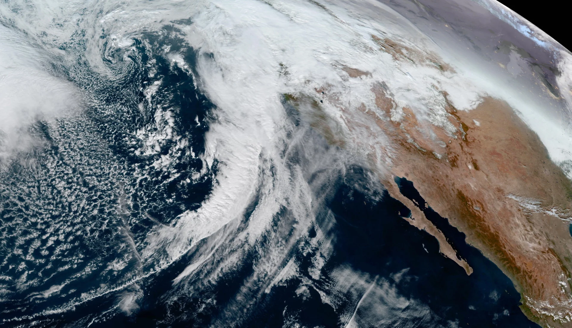
California is enduring the bulk of the gushing rains and heavy mountain snows. Many residents in Southern California were forced to evacuate from their homes due to increased risk of flooding and the potential for mudslides.
The vast low-pressure system bringing California all this excess moisture won’t move much heading into the weekend, leaving this broad storm in the perfect position to fling one round of moisture after another at an already-soaked B.C. coast.
DON'T MISS: Why March is so dangerous when it comes to avalanches
This is a long-duration rainfall event, with multiple waves of precipitation washing ashore over the next couple of days. Some communities will have endured 60 hours of rainfall by the time precipitation tapers to showers on Saturday.
Precipitation totals will amount to 150+ mm for some areas by this weekend, with totals varying widely as a result of elevation.
Locations along western Vancouver Island and north of the Fraser River could see high-end precipitation totals, while folks stuck in the rain shadow down around Victoria might only wring out about 15-30 mm of precipitation from this event.
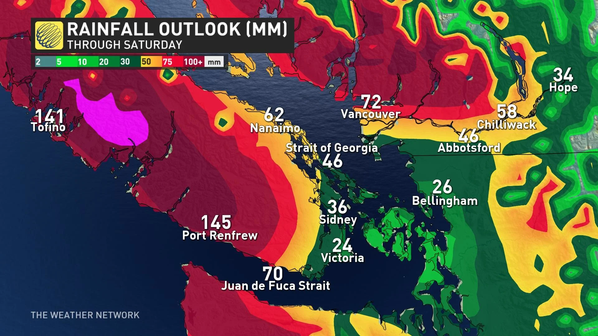
Widespread rainfall warnings are in effect through the overnight hours into Friday morning.
“Heavy downpours can cause flash floods and water pooling on roads,” Environment and Climate Change Canada (ECCC) said in its warning for Metro Vancouver. “Localized flooding in low-lying areas is possible. Watch for possible washouts near rivers, creeks and culverts.”
Pockets of cooler air near Whistler should keep the bulk of the precipitation as snow, especially above 1800 metres.
Meanwhile, heavy snow is expected for the alpine regions, so travellers can expect to see difficult road conditions.
Additional rounds of rain at lower elevations and heavy snow for higher elevations will exacerbate an already-dangerous avalanche threat across British Columbia.
The province’s unstable snowpack is a “house of cards,” as a senior forecaster for Avalanche Canada told CBC News earlier this week. An avalanche on Monday killed one police officer and critically injured another while they were skiing near Empire Cabin.
Much of B.C.’s terrain will face ‘considerable’ to ‘high’ avalanche danger by Thursday and Friday, according to the latest forecast issued by Avalanche Canada.
The agency pointed out that recent snows have buried the crust under 60-80 cm of fresh powder, leading to an unstable snowpack that’s “prime depth for human-triggering as well as large, consequential avalanches.”
Looking ahead, cooler temperatures arriving next week will allow for heavy snow for all ski areas, with freezing levels falling quite low by the end of the week. A reprieve from the wet weather should arrive for the South Coast by the last week of January, with wetter conditions building in for the North Coast.
WATCH: Major avalanche concerns for B.C. right now, here's what you should know
Contains files from CBC News.
Thumbnail image courtesy of NOAA.
Stay with The Weather Network for the latest on conditions across British Columbia.


