Atlantic: Chilly temperatures, flurries linger with another system en route

System brushes southern Maritimes with showers and rain/snow mix Friday, temperatures remain below seasonal
The latest system has started to impact the southern Maritimes with showers Friday morning and will push its way east through the day before making its way into Newfoundland with a messy mix in the overnight hours. Temperatures will remain on the cool side. More unsettled weather headed to the region next week. Details and timing, below.
WEATHER HIGHLIGHTS:
Showers move into Nova Scotia Friday, precipitation will change in the evening
Newfoundland to get wintry impacts overnight Friday
More unsettled weather next week
Keep up with the weather ALERTS in your area
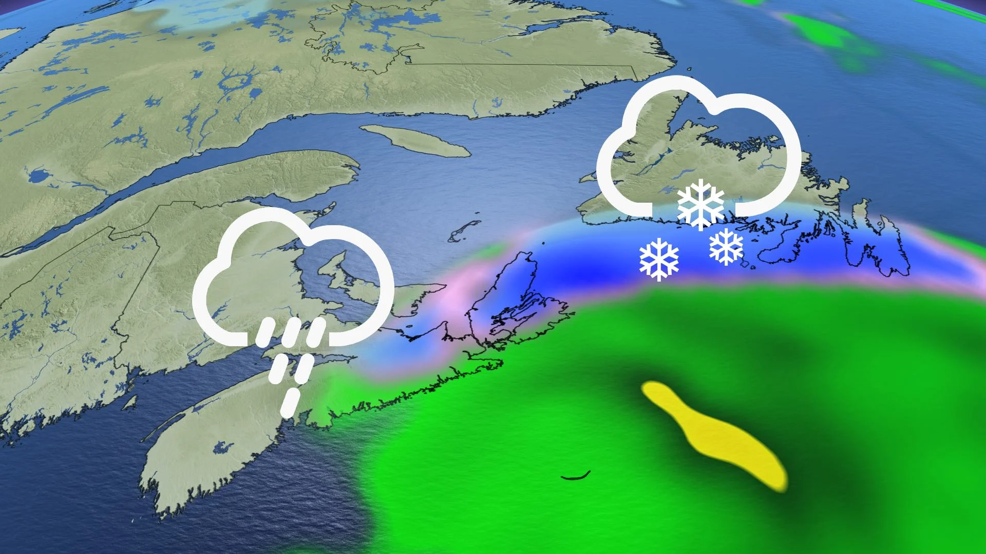
FRIDAY: LOW SKIMS SOUTHERN MARITIMES WITH SHOWERS
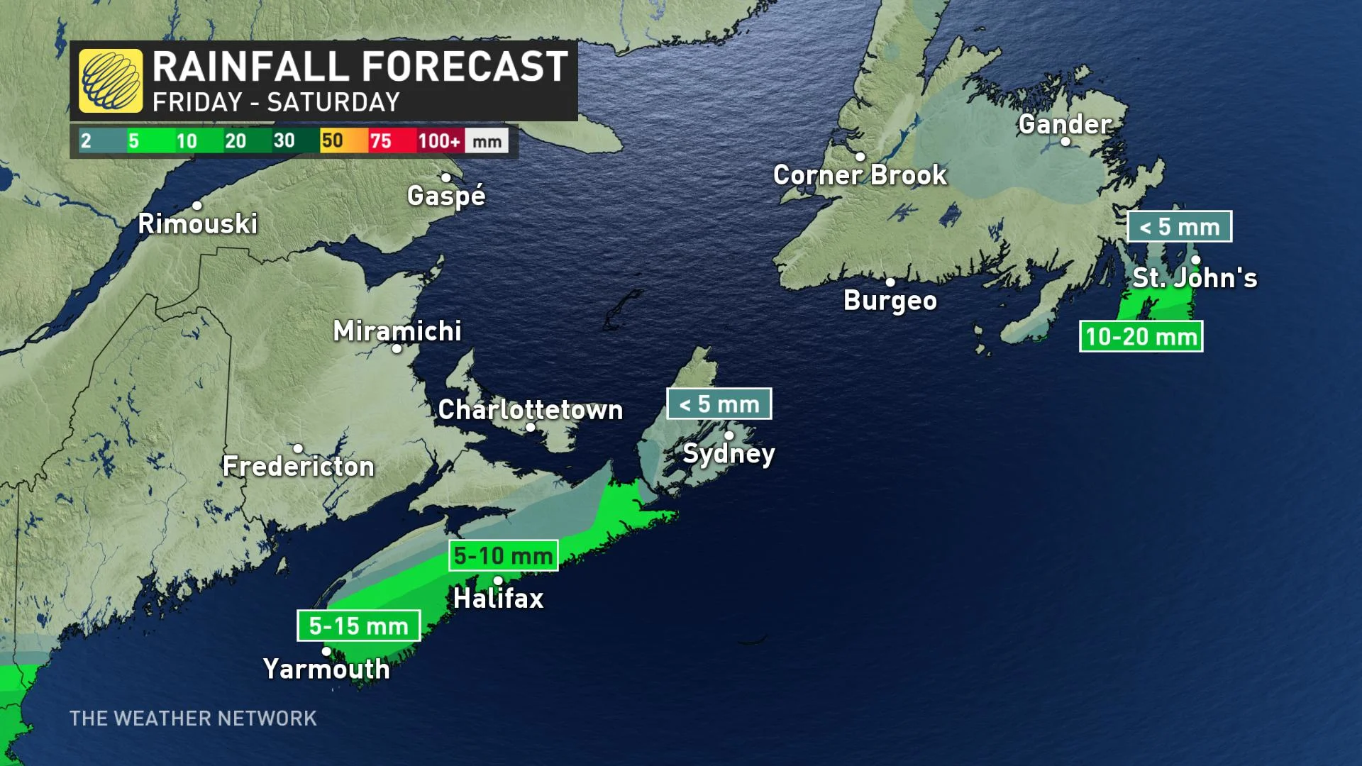
The low passing to the south of Nova Scotia Friday will continue pushing showers east across the province through the coastal areas of the province. P.E.I. and New Brunswick will be spared from the system's effects.
By the evening, precipitation will transition to a rain/snow mix for Nova Scotia, particularly eastern areas, with amounts down somewhat from previous forecasts.
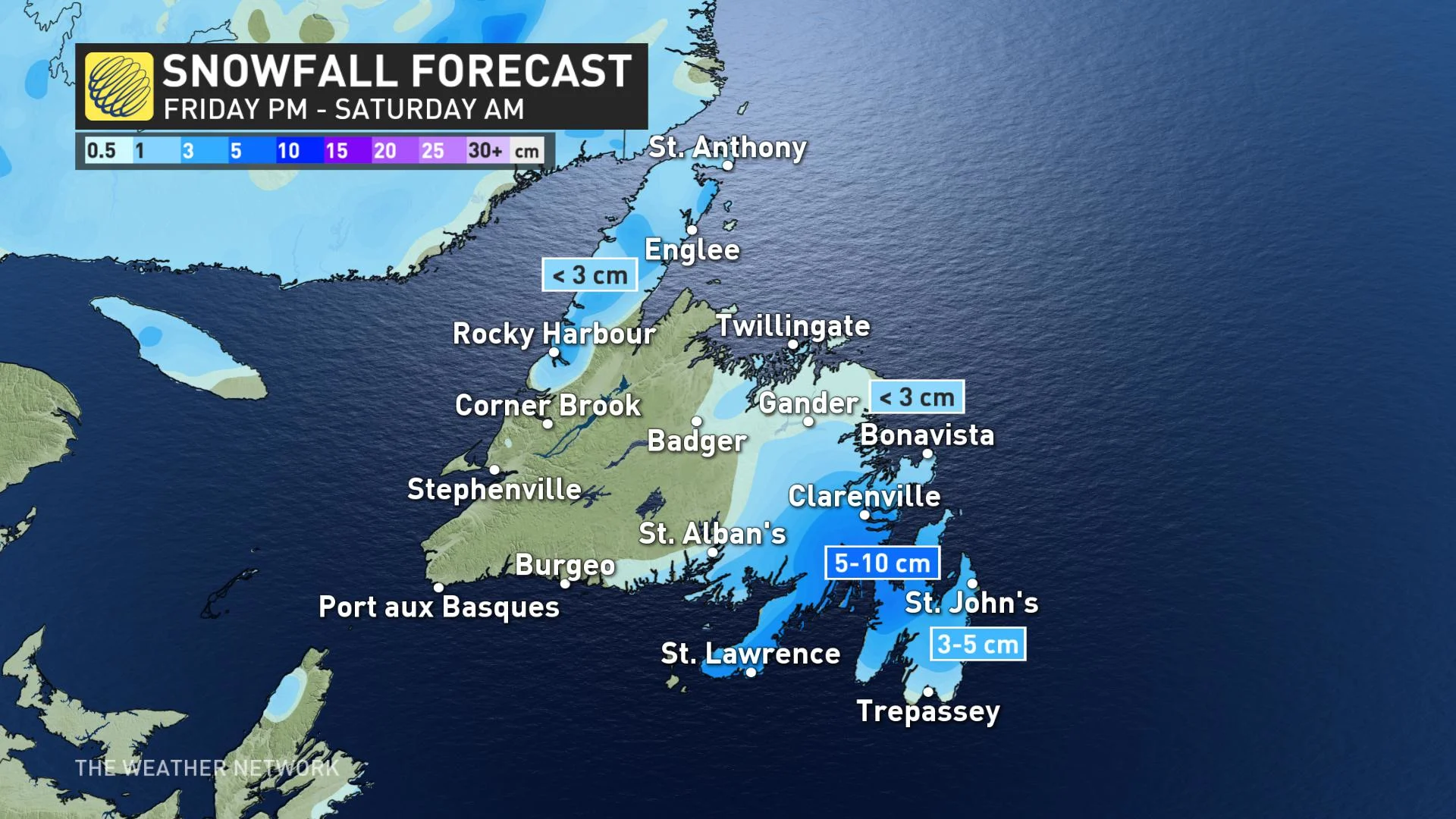
SATURDAY: WINTRY MIX MOVES INTO NEWFOUNDLAND
Across the Gulf, the low will push into Newfoundland in the overnight hours, starting as snow for the Avalon then changing to rain early Saturday morning. The heaviest snow will remain just west of the Avalon, but a tight gradient having western NL remaining dry. Precipitation will move out through the afternoon hours.
LOOK AHEAD: MORE UNSETTLED WEATHER NEXT WEEK
A second system will track into Atlantic Canada for early next week, bringing a wintry mix of wet snow and rain. There is still some uncertainty in the exact track, which could determine what precipitation the Avalon will see – heavy snow versus a messy mix of snow, ice and rain.
"Heavy snow is expected for parts of southern and eastern Newfoundland, especially from the Burin to the Bonavista area. 15-25 cm is likely where the precipitation falls primarily as snow," said Weather Network meteorologist Dr. Doug Gillham.
Temperatures are also expected to stay on the cooler side of seasonal for the remainder of the month.
Check back frequently as we continue to monitor the forecast.