Atlantic hurricane season awakens with back-to-back storms this week

The Atlantic hurricane season begins to roar back to life after a lull in the season throughout August
The Atlantic hurricane season officially hit its peak on September 10 this week, and despite a quieter season than predicted so far, all eyes are on the tropics with back-to-back storms now brewing.
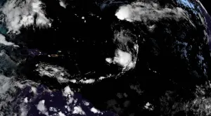
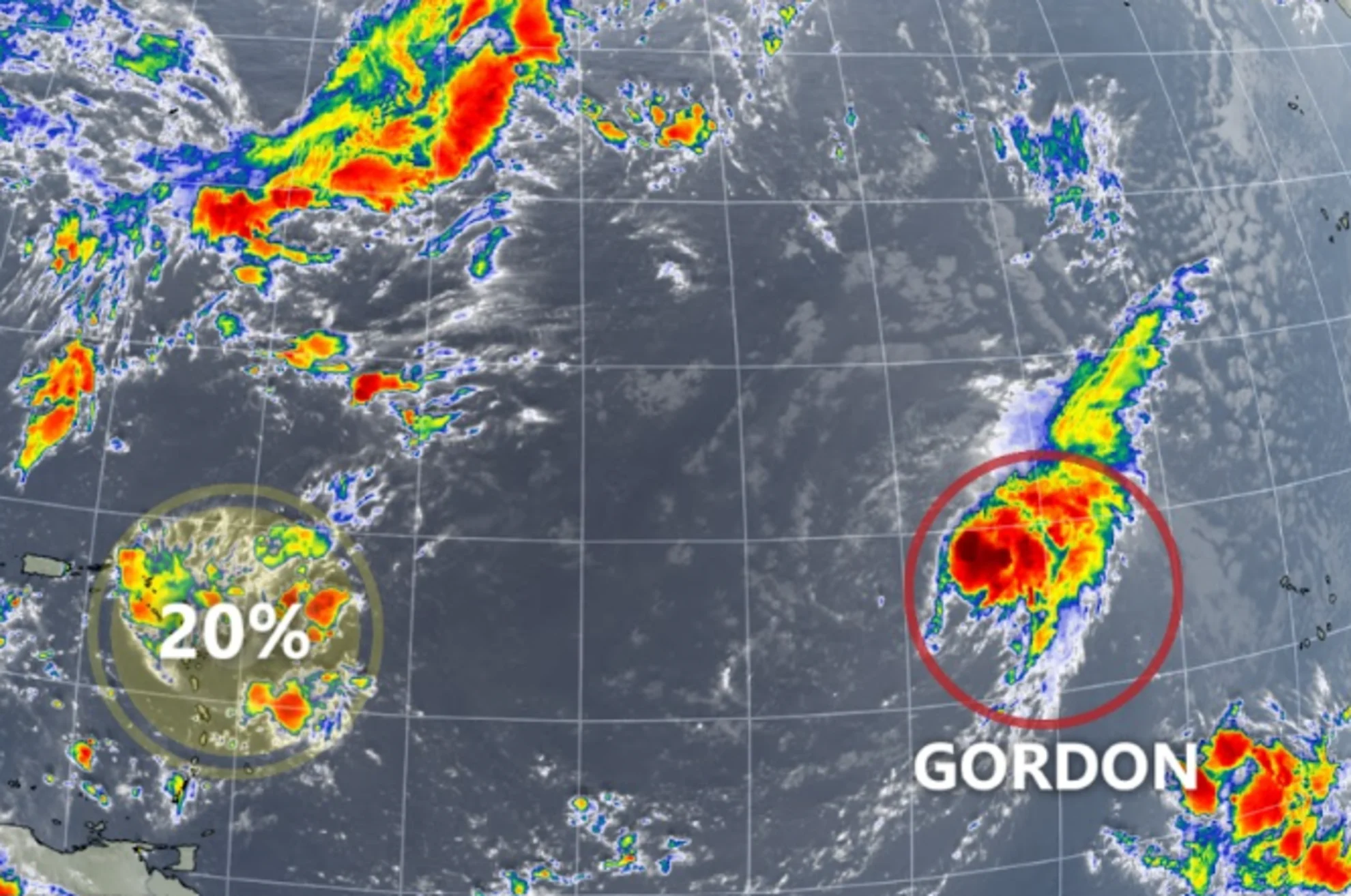
Tropical Storm Gordon was the latest to form Friday morning, swirling about 1590 km west northwest of the Cabo Verde Islands. According to the U.S. National Hurricane Center (NHC), slight strengthening is expected before a weakening trend begins on Saturday, though Gordon poses no threat to land, and there are no coastal watches or warnings in effect.
Visit The Weather Network's hurricane hub to keep up with the latest on tropical developments in Canada and around the world

In addition to Gordon, the NHC is issuing advisories on Tropical Depression Seven, located over the central tropical Atlantic Ocean. There's only a 20 percent chance to become a named storm, but regardless of development, locally heavy rains and gusty winds are forecast over the northern Leeward Islands on Friday.
"Remember, it doesn't take a named storm to have impacts," says Rachel Modestino, a meteorologist at The Weather Network.
RELATED: Storm Francine races across US South, slamming region with rain and wind
Earlier this week, Francine strengthened to tropical storm status under the influence of very warm waters in the western Gulf. After further strengthening, Francine made landfall as a Category 2 hurricane Wednesday evening near Cocodrie and Morgan City, in Terrebonne Parish, Louisiana.
WATCH: Francine slams Louisiana, leaving thousands in the dark
At the time of landfall, Francine packed winds of around 160 km/h, with heavy bands of rain flooding into New Orleans. During the height of the storm, more than 350,000 customers were without power in Louisiana.
Francine was the fourth hurricane of the season so far.
SEE ALSO: ‘ACE’ is the best way to measure a hurricane season’s ferocity
NOAA had predicted an above-normal 2024 Atlantic hurricane season, making the lack of activity in August feel strange. Unusual bouts of rain falling over the Sahara Desert however, are likely linked to the tropics falling unusually quiet. Dust from the Sahara desert in Africa could also be a factor, making the air drier, and discouraging storms from forming.
Since the peak of the season, the tropics have come back to life.
MUST SEE: Rare desert rains may have stifled Atlantic hurricanes—for now
"We expect that the second half of the season will be much more active, with a weather pattern that is conducive for tropical systems to have an impact on parts of Atlantic Canada, as well," noted The Weather Network's Dr. Doug Gillham in the release of the 2024 Fall Forecast.
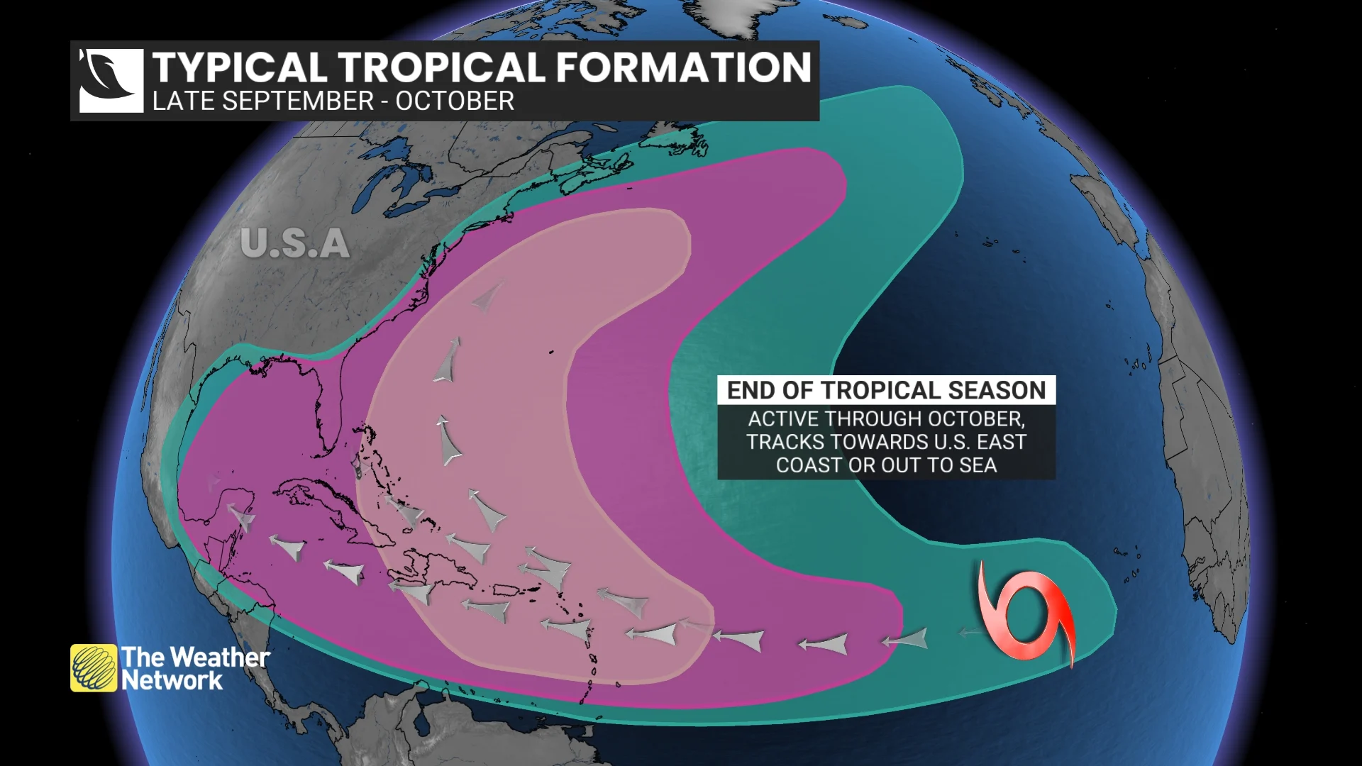
Historically speaking, more than half of all hurricane activity in the Atlantic basin occurs after Labour Day. The hurricane season runs until November 30.